
Anantapur district, officially Anantapuramu district, is one of the eight districts in the Rayalaseema region of the Indian state of Andhra Pradesh. The district headquarters is located in Anantapur city. It is one of the driest places in South India. In the year 2022, as part of re-organisation of districts, Sri Sathya Sai district was carved out.

Kadapa district is one of the twenty six districts in the Indian state of Andhra Pradesh. In 2022 reorganisation of Andhra Pradesh districts, the district boundary is largely restricted to Kadapa parliamentary constituency area. It is also one of the eight districts in the Rayalaseema region. Kadapa is the administrative headquarters for this district.

Nuzvid, natively spelled Nuzividu or Nuziveedu is a city in the Eluru district of the Indian state of Andhra Pradesh. It serves as the administrative headquarters for Nuzvid mandal and Nuzvid revenue division.

Proddatur (1915) is a city in the YSR Kadapa District of Andhra Pradesh, located on the banks of the Penna River. The city is a municipality, and also the mandal headquarters of Proddatur mandal. It is the second-largest town in former Kadapa District. It is the oldest municipality which formed before Independence.
Dommara Nandyal is a census town in Mylavaram Mandal, Kadapa district, Andhra Pradesh, India. Dommara Nandyal is under the constituency of Jammalamadugu. Dommara Nandyal is situated along the bank of the Penna River. Mylavaram dam is constructed just 3 km away from it, that supplies water for drinking. Dommara Nandyal is also famous for people making silk sarees with their own hands. Veparala and Moragudi, beside of Dommaranadyala, are also the handloom towns.
Pedana is a municipality and the headquarters of Pedana mandal under Machilipatnam revenue division of Krishna district of the Indian state of Andhra Pradesh. It is located at a distance of 8 km (5.0 mi) from the district headquarters, Machilipatnam.
Punganur is a Municipality city in Chittoor district of the Indian state of Andhra Pradesh. It is the headquarters of Punganur Mandel of Palamaner Revenue Division.
Rayachoti is a Municipality and District headquarters of Annamayya district which is formed after Rajampet of the Indian state of Andhra Pradesh. Also It is the headquarters of Rayachoti revenue division. It is one of the oldest towns in Andhra Pradesh.

Tadipatri or Tadpatri is a city in Anantapur district of the Indian state of Andhra Pradesh at the border of Nandyala district and Kadapa district. It is the mandal headquarters of Tadipatri mandal in Anantapur revenue division. The Chintala Venkataramana Temple is located on a five-acre site in Tadipatri. The Bugga Ramalingeswara Temple is located one kilometer from the town, overlooking the Penna River.

Yerraguntla is a town and Nagar Panchayat in YSR Kadapa District. It is an industrial area in YSR Kadapa district, Andhra Pradesh. It is located in Yerraguntla mandal of Kadapa revenue division.
Pulivendula is a town located in the YSR Kadapa district, Andhra Pradesh, India. It is a small town which became 3rd grade municipality in 2008 from nagar Panchayat.

Dhone or Dronachalam is a town in Nandyal district of the Indian state of Andhra Pradesh. It is a municipality located in Dhone mandal. And it is the head quarters of Dhone revenue division.
Atlur is a mandal in Kadapa district of the Indian state of Andhra Pradesh. It is located in the Badvel revenue division. It consists of 23 revenue villages and 12 gram panchayats.
Duvvur is a village in Kadapa district of the Indian state of Andhra Pradesh. It is located in Duvvur mandal of Jammalamadugu Revenue Division.
Khajipet Sunkesula is a village in Kadapa district of the Indian state of Andhra Pradesh. It is located in Khajipet mandal of Badvel revenue division.
Chennur is a village in YSR Kadapa district of the Indian state of Andhra Pradesh. It is located in Chennur mandal of Kadapa revenue divisions.
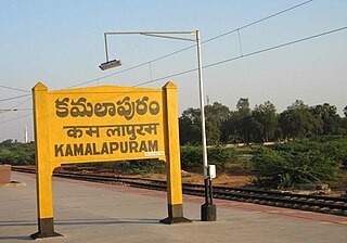
Kamalapuram is a Town in YSR Kadapa district of the Indian state of Andhra Pradesh. It is located in Kamalapuram mandal of Kadapa revenue division and is the Thaluka headquarter of Kamalapuram assembly constituency.

Kondapuram is a town in YSR Kadapa district of the Indian state of Andhra Pradesh. It is located in Kondapuram mandal of Jammalamadugu revenue division.
Rajupalem is a village in YSR Kadapa district of the Indian state of Andhra Pradesh. It is located in Rajupalem mandal of Jammalamadugu revenue division.
Kamalapuram mandal is one of the 50 mandals in Kadapa district of the Indian state of Andhra Pradesh. It is under the administration of Kadapa revenue division and the headquarters are located at Kamalapuram. The mandal is bounded by Yerraguntla, Proddutur, Chapad, Khajipet, Vallur, Pendlimarri and Veerapunayunipalle mandals.


