Jefferson, Greene County, Pennsylvania

Last updated
Jefferson, Greene County,
Pennsylvania
Monongahela College site with historical marker.jpg
Etymology: Thomas Jefferson
Greene County Pennsylvania Incorporated and Unincorporated areas Jefferson Highlighted.svg
Location of Jefferson in Greene County, Pennsylvania.
USA Pennsylvania location map.svg
Red pog.svg
Jefferson
Usa edcp location map.svg
Red pog.svg
Jefferson
Coordinates: 39°55′49″N80°3′32″W / 39.93028°N 80.05889°W / 39.93028; -80.05889
CountryUnited States
State Pennsylvania
County Greene
Established1795
Named for Thomas Jefferson
Government
  BodyJefferson Borough Council
  MayorDale E. Harshman (Democrat)
  Tax CollectorSigna Coneybeer (Democrat)
Area
[1]
  Total0.19 sq mi (0.49 km2)
  Land0.19 sq mi (0.49 km2)
  Water0.00 sq mi (0.00 km2)
Elevation
960 ft (290 m)
Population
 (2020) [2]
  Total253
  Density1,345.74/sq mi (519.98/km2)
Time zone UTC-4 (EST)
  Summer (DST) UTC-5 (EDT)
ZIP code
15344
Area code 724
FIPS code 42-37880

Jefferson is a borough in Greene County, Pennsylvania, United States. The population was 253 at the 2020 census, [3] a decline from the figure of 270 tabulated in 2010. [4] The borough was named after Thomas Jefferson. [5]

Contents

Geography

Jefferson is located in northeastern Greene County at 39°55′49″N80°3′32″W / 39.93028°N 80.05889°W / 39.93028; -80.05889 (39.930322, -80.058993). [6] It is surrounded by Jefferson Township, a separate municipality. Pennsylvania Route 188 (Jefferson Road) passes through the center of the borough, leading east 3 miles (5 km) to Dry Tavern and west 7 miles (11 km) to Waynesburg, the county seat.

According to the United States Census Bureau, the borough has a total area of 0.19 square miles (0.49 km2), all land. The South Fork of Tenmile Creek passes just north of the borough.

Demographics

Historical population
CensusPop.Note
1880 347
1890 327−5.8%
1900 311−4.9%
1910 35714.8%
1920 3929.8%
1930 52834.7%
1940 5575.5%
1950 5753.2%
1960 442−23.1%
1970 366−17.2%
1980 41312.8%
1990 355−14.0%
2000 337−5.1%
2010 270−19.9%
2020 253−6.3%
2021 (est.)248 [3] −2.0%
Sources: [7] [8] [9] [2]

As of the census [8] of 2000, there were 337 people, 139 households, and 97 families residing in the borough. The population density was 1,801.8 inhabitants per square mile (695.7/km2). There were 147 housing units at an average density of 786.0 per square mile (303.5/km2). The racial makeup of the borough was 99.41% White, 0.30% African American, and 0.30% from two or more races.

There were 139 households, out of which 30.2% had children under the age of 18 living with them, 52.5% were married couples living together, 11.5% had a female householder with no husband present, and 30.2% were non-families. 25.9% of all households were made up of individuals, and 14.4% had someone living alone who was 65 years of age or older. The average household size was 2.42 and the average family size was 2.91.

In the borough the population was spread out, with 25.2% under the age of 18, 4.7% from 18 to 24, 26.7% from 25 to 44, 22.8% from 45 to 64, and 20.5% who were 65 years of age or older. The median age was 41 years. For every 100 females there were 93.7 males. For every 100 females age 18 and over, there were 89.5 males.

The median income for a household in the borough was $33,750, and the median income for a family was $40,893. Males had a median income of $28,958 versus $14,219 for females. The per capita income for the borough was $15,294. About 8.9% of families and 7.8% of the population were below the poverty line, including 3.8% of those under age 18 and 16.7% of those age 65 or over.

Related Research Articles

<span class="mw-page-title-main">Biglerville, Pennsylvania</span> Borough in Pennsylvania, United States

Biglerville is a borough in Adams County, Pennsylvania, United States. The population was 1,225 at the 2020 census. The National Apple Museum is located on West Hanover St. in Biglerville. The borough is home to Biglerville High School.

<span class="mw-page-title-main">Manorville, Pennsylvania</span> Borough in Pennsylvania, United States

Manorville is a borough in Armstrong County, Pennsylvania, United States. The population was 382 at the 2020 census.

<span class="mw-page-title-main">Jefferson Township, Butler County, Pennsylvania</span> Township in Pennsylvania, United States

Jefferson Township is a township in Butler County, Pennsylvania, United States. The population was 5,209 at the 2020 census.

<span class="mw-page-title-main">Troutville, Pennsylvania</span> Borough in Pennsylvania, United States

Troutville is a borough in Clearfield County, Pennsylvania, United States. The population was 230 at the 2020 census.

<span class="mw-page-title-main">Carmichaels, Pennsylvania</span> Borough in Pennsylvania, United States

Carmichaels is a borough in Greene County, Pennsylvania, United States. The population was 434 at the 2020 census, a decline from the figure of 483 tabulated in 2010.

<span class="mw-page-title-main">Clarksville, Pennsylvania</span> Borough in Pennsylvania, United States

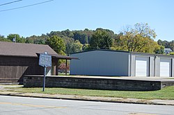
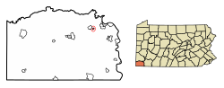
Clarksville is a borough in Greene County, Pennsylvania, United States. The population was 194 at the 2020 census.

<span class="mw-page-title-main">Cumberland Township, Greene County, Pennsylvania</span> Township in Pennsylvania, United States

Cumberland Township is a township in Greene County, Pennsylvania, United States. The population was 6,399 at the 2020 census.

<span class="mw-page-title-main">Franklin Township, Greene County, Pennsylvania</span> Township in Pennsylvania, United States

Franklin Township is a township in Greene County, Pennsylvania, United States. The population was 7,003 at the 2020 census, down from 7,280 at the 2010 census.

<span class="mw-page-title-main">Gilmore Township, Greene County, Pennsylvania</span> Township in Pennsylvania, United States

Gilmore Township is a township in Greene County, Pennsylvania, United States. The population was 240 at the 2020 census, down from 260 at the 2010 census.

<span class="mw-page-title-main">Gray Township, Greene County, Pennsylvania</span> Township in Pennsylvania, United States

Gray Township is a township in Greene County, Pennsylvania, United States. The population was 182 at the 2020 census.

<span class="mw-page-title-main">Jefferson Township, Greene County, Pennsylvania</span> Township in Pennsylvania, United States

Jefferson Township is a township that is located in Greene County, Pennsylvania, United States. The population was 2,359 at the time of the 2020 census, up from 2,352 at the 2010 census.

<span class="mw-page-title-main">Morris Township, Greene County, Pennsylvania</span> Township in Pennsylvania, United States

Morris Township is a township that is located in Greene County, Pennsylvania, United States. The population was 566 at the time of the 2020 census, a decline from the total of 818 that was tabulated during the 2010 census.

<span class="mw-page-title-main">Morrisville, Greene County, Pennsylvania</span> Census-designated place in Pennsylvania, United States

Morrisville is a census-designated place (CDP) in Franklin Township, Greene County, Pennsylvania, United States. The population was 1,265 at the 2010 census.

<span class="mw-page-title-main">Perry Township, Greene County, Pennsylvania</span> Township in Pennsylvania, United States

Perry Township is a township in Greene County, Pennsylvania, United States. The population was 1,406 at the 2020 census, down from 1,521 at the 2010 census.

<span class="mw-page-title-main">Rices Landing, Pennsylvania</span> Borough in Pennsylvania, United States

Rices Landing is a borough in Greene County, Pennsylvania, United States. The population was 426 at the 2020 census.

<span class="mw-page-title-main">Washington Township, Greene County, Pennsylvania</span> Township in Pennsylvania, United States

Washington Township is a township that is located in Greene County, Pennsylvania, United States. The population was 1,098 at the time of the 2010 census.

<span class="mw-page-title-main">Waynesburg, Pennsylvania</span> Borough in Pennsylvania, United States

Waynesburg is a borough in and the county seat of Greene County, Pennsylvania, United States, about 50 miles (80 km) south of Pittsburgh. Its population was 3,987 at the 2020 census.

<span class="mw-page-title-main">Whiteley Township, Pennsylvania</span> Township in Pennsylvania, United States

Whiteley Township is a township that is located in Greene County, Pennsylvania, United States. The population was 572 at the time of the 2020 census, which was a decreased from the total of 649 that was documented during the 2010 census.

<span class="mw-page-title-main">Ellsworth, Pennsylvania</span> Borough in Pennsylvania, United States

Ellsworth is a borough in Washington County, Pennsylvania, United States. The population was 947 at the 2020 census. The coal town was founded by James Ellsworth, who bought the land in 1890s, developed the Monongahela Railway, and sold the mines to Bethlehem Steel in the 1920s.

<span class="mw-page-title-main">Falls Creek, Pennsylvania</span> Borough in Pennsylvania, United States

Falls Creek is a borough located in Jefferson and Clearfield counties in Pennsylvania, United States. The population was 1,036 at the 2020 census. Of this, 994 were in Jefferson County, and 42 were in Clearfield County.

References

  1. "ArcGIS REST Services Directory". United States Census Bureau. Retrieved October 12, 2022.
  2. 1 2 "Census Population API". United States Census Bureau. Retrieved Oct 12, 2022.
  3. 1 2 Bureau, US Census. "City and Town Population Totals: 2020—2021". Census.gov. US Census Bureau. Retrieved July 24, 2022.
  4. "Geographic Identifiers: 2010 Demographic Profile Data (G001): Jefferson borough (Greene County), Pennsylvania". American Factfinder. U.S. Census Bureau. Retrieved January 27, 2017.[ dead link ]
  5. Ackerman, Jan (May 10, 1984). "Town names carry bit of history". Pittsburgh Post-Gazette. p. 1. Retrieved 31 October 2015.
  6. "US Gazetteer files: 2010, 2000, and 1990". United States Census Bureau. 2011-02-12. Retrieved 2011-04-23.
  7. "Census of Population and Housing". U.S. Census Bureau. Retrieved 11 December 2013.
  8. 1 2 "U.S. Census website". United States Census Bureau . Retrieved 2008-01-31.
  9. "Incorporated Places and Minor Civil Divisions Datasets: Subcounty Resident Population Estimates: April 1, 2010 to July 1, 2012". Population Estimates. U.S. Census Bureau. Archived from the original on 11 June 2013. Retrieved 11 December 2013.