This is a list of the extreme points of Ireland – the points that are farthest north, south, east or west in Ireland. It includes the Republic of Ireland and Northern Ireland.

The Neptune Range is a mountain range, 112 km (70 mi) long, lying WSW of Forrestal Range in the central part of the Pensacola Mountains in Antarctica. The range is composed of Washington Escarpment with its associated ridges, valleys and peaks, the Iroquois Plateau, and the Schmidt and Williams Hills. It was discovered and photographed on 13 January 1956 on a US Navy transcontinental plane flight from McMurdo Sound to Weddell Sea and return.
The Windsor-3 Representative District is a one-member state Representative district in the U.S. state of Vermont. It is one of the 108 one or two member districts into which the state was divided by the redistricting and reapportionment plan developed by the Vermont General Assembly following the 2000 U.S. Census. The plan applies to legislatures elected in 2002, 2004, 2006, 2008, and 2010. A new plan will be developed in 2012 following the 2010 U.S. Census.

Albendea is a municipality in Cuenca, Castile-La Mancha, Spain. It has a population of 169.

Fresno de Rodilla is a municipality located in the province of Burgos, Castile and León, Spain. According to the 2004 census (INE), the municipality has a population of 46 inhabitants.
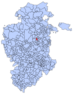
Quintanavides is a municipality and town located in the province of Burgos, Castile and León, Spain. According to the 2004 census (INE), the municipality has a population of 118 inhabitants.

Glassville is a community in the Canadian province of New Brunswick located mainly at the intersection of Route 107 and Route 580. It is situated in Aberdeen, a parish of Carleton County.

Kouka is a department or commune of Banwa Province in western Burkina Faso. Its capital lies at the town of Kouka. According to the 1996 census the department has a total population of 53,415.

Okrasin is a village in the administrative district of Gmina Radziłów, within Grajewo County, Podlaskie Voivodeship, in north-eastern Poland. It lies approximately 5 kilometres (3 mi) east of Radziłów, 26 km (16 mi) south of Grajewo, and 57 km (35 mi) north-west of the regional capital Białystok.
Mzurki is a village in the administrative district of Gmina Wola Krzysztoporska, within Piotrków County, Łódź Voivodeship, in central Poland. It lies approximately 11 kilometres (7 mi) north-west of Wola Krzysztoporska, 15 km (9 mi) west of Piotrków Trybunalski, and 41 km (25 mi) south of the regional capital Łódź.
Ruda Żelazna is a village in the administrative district of Gmina Tomaszów Lubelski, within Tomaszów Lubelski County, Lublin Voivodeship, in eastern Poland. It lies approximately 7 kilometres (4 mi) south-east of Tomaszów Lubelski and 113 km (70 mi) south-east of the regional capital Lublin.
Bolejny is a village in the administrative district of Gmina Nidzica, within Nidzica County, Warmian-Masurian Voivodeship, in northern Poland. It lies approximately 14 kilometres (9 mi) north of Nidzica and 34 km (21 mi) south of the regional capital Olsztyn. Until 1945 the village belonged to Germany and was named "Bolleinen".
Sooaluse is a village in Sõmeru Parish, Lääne-Viru County, in northeastern Estonia.
Whymper Spur is a rock spur rising to about 1,250 m eastward of Blanchard Hill in Pioneers Escarpment, Shackleton Range. Named by the United Kingdom Antarctic Place-Names Committee (UK-APC) in 1971 after English mountaineer and artist Edward Whymper (1840–1911), who made the first ascent of the Matterhorn, Switzerland, July 14, 1865; designer of the prototype of the Whymper tent, 1861–62.

Stewart Glacier is a glacier on the north side of Edward VII Peninsula, flowing northeast along the east side of Howard Heights into Sulzberger Ice Shelf mapped by United States Geological Survey (USGS) from surveys and U.S. Navy air photos, 1959–65. Named by Advisory Committee on Antarctic Names (US-ACAN) for Lieutenant Commander Wayne B. Stewart, U.S. Navy, co-pilot in LC-130F Hercules aircraft during Operation Deep Freeze 1968.
Dahmouni is a town and commune in Tiaret Province in northwestern Algeria.

Poljaci is a village in the municipality of Kruševac, Serbia. According to the 2002 census, the village has a population of 393 people.
Dogwood Valley is an unincorporated community in the Fraser Canyon region of British Columbia, Canada, approximately midway between the towns of Yale and Hope. It was named in 1972 in reference to the many flowering dogwood trees in the area.
Pteleum or Pteleon was a fortress town in the territory of Erythrae, in Ionia. Pliny the Elder mentions Pteleon, Helos, and Dorium as near Erythrae, but those places are confused by Pliny with the Triphylian towns in Homer's Catalogue of Ships in the Iliad.
