Kendallville, Indiana

Last updated

Kendallville, Indiana
Kendallville-indiana-downtown2.jpg
Downtown Kendallville in October 2005.
Noble County Indiana Incorporated and Unincorporated areas Kendallville Highlighted 1839402.svg
Location of Kendallville in Noble County, Indiana.
Coordinates: 41°26′36″N85°15′23″W / 41.44333°N 85.25639°W / 41.44333; -85.25639
Country United States
State Indiana
County Noble
Township Wayne
Government
   Mayor Lance L. Waters (R) [1]
Area
[2]
  Total6.34 sq mi (16.42 km2)
  Land6.12 sq mi (15.84 km2)
  Water0.22 sq mi (0.58 km2)
Elevation
[3]
988 ft (301 m)
Population
 (2020)
  Total10,271
  Density1,679.64/sq mi (648.47/km2)
Time zone UTC-5 (Eastern (EST))
  Summer (DST) UTC-4 (EDT)
ZIP code
46755
Area code 260
FIPS code 18-39402 [4]
GNIS feature ID2395505 [3]
Website http://www.kendallville-in.org

Kendallville is a city in Wayne Township, Noble County, in the U.S. state of Indiana. [3] The population was 10,205 at the 2021 census.

Contents

History

Kendallville was laid out in 1849. [5] The city was named for Amos Kendall, 8th United States Postmaster General. [6]

A post office has been in operation at Kendallville since 1837. [7]

The Iddings-Gilbert-Leader-Anderson Block and Kendallville Downtown Historic District are listed on the National Register of Historic Places. [8]

Geography

According to the 2010 census, Kendallville has a total area of 6.264 square miles (16.22 km2), of which 6.04 square miles (15.64 km2) (or 96.42%) is land and 0.224 square miles (0.58 km2) (or 3.58%) is water. [9]

Demographics

Historical population
CensusPop.Note
1870 2,164
1880 2,3739.7%
1890 2,96024.7%
1900 3,35413.3%
1910 4,98148.5%
1920 5,2735.9%
1930 5,4393.1%
1940 5,431−0.1%
1950 6,11912.7%
1960 6,76510.6%
1970 6,8381.1%
1980 7,2996.7%
1990 7,7736.5%
2000 9,61623.7%
2010 9,8622.6%
2020 10,2714.1%
U.S. Decennial Census [10]
Detail of Victorian facade downtown Kendallville-indiana-architectural-detail.jpg
Detail of Victorian facade downtown
City Hall Kendallville-indiana-city-hall.jpg
City Hall

2010 census

As of the census [11] of 2010, there were 9,862 people, 3,940 households, and 2,483 families living in the city. The population density was 1,630.1 inhabitants per square mile (629.4/km2). There were 4,382 housing units at an average density of 724.3 per square mile (279.7/km2). The racial makeup of the city was 94.1% White, 0.5% African American, 0.2% Native American, 0.5% Asian, 2.9% from other races, and 1.8% from two or more races. Hispanic or Latino of any race were 5.1% of the population.

There were 3,940 households, of which 36.1% had children under the age of 18 living with them, 42.2% were married couples living together, 14.4% had a female householder with no husband present, 6.4% had a male householder with no wife present, and 37.0% were non-families. 31.1% of all households were made up of individuals, and 11.9% had someone living alone who was 65 years of age or older. The average household size was 2.46 and the average family size was 3.06.

The median age in the city was 34.6 years. 27.4% of residents were under the age of 18; 8.9% were between the ages of 18 and 24; 27.3% were from 25 to 44; 23.5% were from 45 to 64; and 12.9% were 65 years of age or older. The gender makeup of the city was 48.2% male and 51.8% female.

2000 census

As of the census [4] of 2000, there were 9,616 people, 3,873 households, and 2,459 families living in the city. The population density was 1,890.0 inhabitants per square mile (729.7/km2). There were 4,172 housing units at an average density of 820.0 per square mile (316.6/km2). The racial makeup of the city was 96.66% White, 0.25% African American, 0.16% Native American, 0.59% Asian, 0.01% Pacific Islander, 1.37% from other races, and 0.96% from two or more races. Hispanic or Latino of any race were 3.16% of the population.

There were 3,873 households, out of which 35.9% had children under the age of 18 living with them, 46.0% were married couples living together, 13.3% had a female householder with no husband present, and 36.5% were non-families. 31.5% of all households were made up of individuals, and 12.7% had someone living alone who was 65 years of age or older. The average household size was 2.44 and the average family size was 3.07.

In the city, the population was spread out, with 28.0% under the age of 18, 10.3% from 18 to 24, 30.1% from 25 to 44, 17.7% from 45 to 64, and 13.8% who were 65 years of age or older. The median age was 32 years. For every 100 females, there were 89.1 males. For every 100 females age 18 and over, there were 86.2 males.

The median income for a household in the city was $33,899, and the median income for a family was $42,341. Males had a median income of $33,258 versus $23,851 for females. The per capita income for the city was $16,335. About 7.9% of families and 9.9% of the population were below the poverty line, including 10.7% of those under age 18 and 8.6% of those age 65 or over.

Annual cultural events

Education

Schools in the Kendallville area include:

The town has a lending library, the Kendallville Public Library. [13]

Media

The News Sun is the city's daily newspaper; and it also covers the rest of Noble and LaGrange counties. It is the successor of the Noble County Journal, a weekly founded c.1860, and is now owned by KPC Media Group, a chain of three dailies, three weeklies, and several monthly publications in northeastern Indiana. It has its headquarters on Main Street in Kendallville. [14]

The Kendallville Mall newspaper and KendallvilleTV on YouTube provide local news and videos. [15]

The Cinema Museum in London holds good home movies of Kendalville and the refrigerator factory in 1959. [16]

Notable people

Related Research Articles

<span class="mw-page-title-main">Alexandria, Indiana</span> City in Indiana, United States

Alexandria is a city in Monroe Township, Madison County, Indiana, United States. It is about 48 miles (77 km) northeast of Indianapolis. According to the 2020 census, its population was 5,149, nearly unchanged from 2010.

<span class="mw-page-title-main">Carroll County, Kentucky</span> County in Kentucky, United States

Carroll County is a county located in the northern part of the U.S. state of Kentucky. Its county seat is Carrollton. The county was formed in 1838 and named for Charles Carroll of Carrollton, the last living signer of the Declaration of Independence. It is located at the confluence of the Kentucky and Ohio Rivers.

<span class="mw-page-title-main">Royal Center, Indiana</span> Town in Indiana, United States

Royal Center is a town in Boone Township, Cass County, Indiana, United States. The population was 861 at the 2010 census.

<span class="mw-page-title-main">Utica, Indiana</span> Town in Indiana, United States

Utica is a town in Utica Township, Clark County, Indiana, United States. The population was 776 at the 2010 census.

<span class="mw-page-title-main">Michigantown, Indiana</span> Town in Indiana, United States

Michigantown is a town in Michigan Township, Clinton County, Indiana, United States. The population was 467 at the 2010 census. The town was named for the Michigan Road, an early thoroughfare through the area.

<span class="mw-page-title-main">Altona, Indiana</span> Town in Indiana, United States

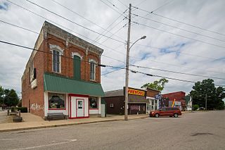
Altona is a town in Keyser Township, DeKalb County, Indiana, United States. The population was 197 at the 2010 census.

<span class="mw-page-title-main">Whiteland, Indiana</span> Town in Indiana, United States

Whiteland is a town in Pleasant, Franklin and Clark townships, Johnson County, Indiana, United States. The population was 4,599 at the 2020 census.

<span class="mw-page-title-main">Bicknell, Indiana</span> City in Indiana, United States

Bicknell is a city in Knox County, Indiana, United States. The population was 2,915 at the 2010 census.

<span class="mw-page-title-main">Silver Lake, Indiana</span> Town in Indiana, United States

Silver Lake is a town in Lake Township, Kosciusko County, in the U.S. state of Indiana. The population was 915 at the 2010 census.

<span class="mw-page-title-main">Syracuse, Indiana</span> Town in Indiana, United States

Syracuse is a town in Turkey Creek Township, Kosciusko County, in the U.S. state of Indiana. The population was 3,079 at the 2020 census. Syracuse is the location of Lake Syracuse and the nearby, larger Lake Wawasee, in addition to several other lakes in the region. The National Weather Service operates a Weather Forecast Office South of town, toward North Webster. It serves Northern Indiana.

<span class="mw-page-title-main">LaGrange, Indiana</span> Town in Indiana, United States

LaGrange is a town in and the county seat of LaGrange County, Indiana, United States. The population was 2,625 at the 2010 census.

<span class="mw-page-title-main">Wolcottville, Indiana</span> Town in Indiana, United States

Wolcottville is a town in Orange Township, Noble County and Johnson Township, LaGrange County in the U.S. state of Indiana. The population was 998 at the 2010 census.

<span class="mw-page-title-main">Kingsbury, Indiana</span> Town in Indiana, United States

Kingsbury is a town in Washington Township, LaPorte County, Indiana, just northwest of the intersection of U.S. Route 35 and U.S. Route 6. The town was founded in 1835 and incorporated on March 3, 1941. During 1940 - 1941, the Kingsbury Ordnance Plant (KOP) was built for use during World War II. The plant closed after the war but reopened during the Korean War, closing permanently in 1959. The population was 242 at the 2010 census. It is included in the Michigan City, Indiana-La Porte, Indiana Metropolitan Statistical Area. The town has its own fire department, KVFD, and a Greek revival style First Baptist church built in 1851 with its own graveyard and Winchell Cemetery.

<span class="mw-page-title-main">Ingalls, Indiana</span> Town in Indiana, United States

Ingalls is a town in Green Township, Madison County, Indiana, United States. It is part of the Indianapolis–Carmel–Anderson metropolitan statistical area. The population was 2,223 at the 2020 census.

<span class="mw-page-title-main">Brooklyn, Indiana</span> Town in Indiana, United States

Brooklyn is a town in Clay and Brown townships, Morgan County, Indiana, United States. The population was 2,511 at the 2020 census, up from 1,598 in 2010.

<span class="mw-page-title-main">Albion, Indiana</span> Town in Indiana, United States

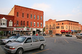
Albion is a town in Albion and Jefferson townships, Noble County, in the U.S. state of Indiana. The population was 2,349 at the 2010 census. The city is the county seat of Noble County.

<span class="mw-page-title-main">Cromwell, Indiana</span> Town in Indiana, United States

Cromwell is a town in Sparta Township, Noble County, in the U.S. state of Indiana. The population was 512 at the 2010 census.

<span class="mw-page-title-main">Ligonier, Indiana</span> City in Indiana, United States

Ligonier is a city in Perry Township, Noble County, in the U.S. state of Indiana. The population was 4,568 at the 2020 census.

<span class="mw-page-title-main">Rome City, Indiana</span> Town in Indiana, United States

Rome City is a town in Orange Township, Noble County, in the U.S. state of Indiana. The population was 1,361 at the 2010 census.

<span class="mw-page-title-main">Angola, Indiana</span> City in Indiana, United States

Angola is a city in Pleasant Township, Steuben County, Indiana, United States. The population was 8,612 at the 2010 census. The city is the county seat of Steuben County. Angola was founded by Thomas Gale and Cornelius Gilmore on June 28, 1838, and is home to Trine University. The town is served by I-69 and the Indiana Toll Road.

References

  1. https://www.kendallvillein.gov/departments/Mayor
  2. "2020 U.S. Gazetteer Files". United States Census Bureau. Retrieved March 16, 2022.
  3. 1 2 3 U.S. Geological Survey Geographic Names Information System: Kendallville, Indiana
  4. 1 2 "U.S. Census website". United States Census Bureau . Retrieved January 31, 2008.
  5. A Biographical History of Eminent and Self-made Men of the State of Indiana ... Western Biographical Publishing Company. 1880. p. 184.
  6. Counties of LaGrange and Noble, Indiana: Historical and Biographical. F.A. Battey & Company. 1882. p. 120.
  7. "Noble County". Jim Forte Postal History. Retrieved May 5, 2017.
  8. "National Register Information System". National Register of Historic Places . National Park Service. July 9, 2010.
  9. "G001 - Geographic Identifiers - 2010 Census Summary File 1". United States Census Bureau. Archived from the original on February 13, 2020. Retrieved July 28, 2015.
  10. "Census of Population and Housing". Census.gov. Retrieved June 4, 2015.
  11. "U.S. Census website". United States Census Bureau . Retrieved December 11, 2012.
  12. Winger, James. "Bluegrass in the Midwest by Northern Indiana Bluegrass". www.bluegrassusa.net.
  13. "Indiana public library directory" (PDF). Indiana State Library. Archived from the original (PDF) on February 18, 2017. Retrieved March 14, 2018.
  14. "KPCNews - Serving the Northeast Indiana Community". KPCNews. Retrieved January 5, 2021.
  15. "Kendallville TV - YouTube". www.youtube.com.
  16. "Cinema Museum Home Movie Database.xlsx". Google Docs. Retrieved October 3, 2023.