Kendrapara district

Last updated

Kendrapara district
Kanika Rajabaati 2.JPG
Harparbati Temple, Pattamundai.jpg
Sakhibata Kendrapara.JPG
Reptile Salt Water Crocodile P1110400 05.jpg
Starting Pointing of Pentha Beach Odisha 754225, India - panoramio.jpg
Clockwise from top-left: Kanika Rajbari, Haparbati Temple in Pattamundai, Crocodile in Bhitarkanika Mangroves, Pentha Beach, Fields in Sakhibata
India Odisha Kendrapara district.svg
Location in Odisha
Coordinates: 20°31′30″N86°28′30″E / 20.525°N 86.475°E / 20.525; 86.475
CountryFlag of India.svg  India
StateOrissa Flag(INDIA).png Odisha
Headquarter Kendrapara
Government
   Collector & District Magistrate Shri Amrit Ruturaj IAS
   Superintendent of Police Jugal Kishore Banoth, IPS
Area
  Total2,644 km2 (1,021 sq mi)
Population
 (2011)
  Total1,440,361
  Density492.38/km2 (1,275.3/sq mi)
Languages
  Official Odia, English
Time zone UTC+5:30 (IST)
PIN
754 xxx [1]
Vehicle registration OD-29
Sex ratio 1.006 /
Literacy85.93%
Lok Sabha constituency Kendrapara
Vidhan Sabha constituency5
 
Climate Aw (Köppen)
Precipitation 1,501.3 millimetres (59.11 in)
Website www.kendrapara.nic.in

Kendrapara District is an administrative district of Odisha state in eastern India. The town of Kendrapara is the district headquarters. Kendrapara District is situated in the eastern portion of the state, and is bounded on the north by Bhadrak district, on the east by the Bay of Bengal, on the south by Jagatsinghpur District, on the west by Cuttack District on the northwest by Jajpur District.

Contents

History

The formation of Kendrapara District took place on April 1, 1993, when a coastal area spanning 2,644 square kilometers was carved out from Cuttack district, with its own headquarter in town Kendrapara.

Geography

Kendrapara District lies in 20° 20’ N To 20° 37’ N Latitude and 86° 14’ E To 87° 01’ E Longitude and situated in central coastal plain zone of the Odisha. The Bay of Bengal lies in the eastern part of the district. The coastline covers 48 km stretching from Dhamra Muhan to Batighar. Kendrapara district headquarters is 55 km from Cuttack.

Kendrapara District lies in the river delta formed by the Brahmani and Baitarani and branch rivers of Mahanadi. The Bhitarkanika Mangroves, Bhitarkanika National Park, Gahirmatha Beach and Baladevjew Temple lie in the district. Other features in the district include Suka-Parikshita Ashram, Kudanagari, Landibata Mahapurusha Matha Chanpur, Pentha sea beach, PatharaKani Temple Gogua, Harihar Kshetra Mahala, Gadadhara Gosain Pitha, and Korua. This district has 9 blocks named as Aul, Derabish, Garadpur, Mahakalapada, Marshaghai, Kendrapara, Rajanagar, Rajkanika, Patamundai.

Divisions

There are 9 Tahasils and 9 blocks in Kendrapara district. [2] They are :

Tahasils

  1. Aul
  2. Kanika
  3. Kendrapara
  4. Marshaghai
  5. Pattamundai
  6. Rajnagar
  7. Mahakalpada
  8. Derabish
  9. Garadpur

Blocks

  1. Aul
  2. Derabish
  3. Garadpur
  4. Kendrapara
  5. Mahakalpada
  6. Marshaghai
  7. Pattamundai
  8. Rajkanika
  9. Rajnagar

Demographics

Historical population
YearPop.±%
1901459,224    
1911470,355+2.4%
1921457,135−2.8%
1931486,625+6.5%
1941509,546+4.7%
1951526,472+3.3%
1961649,457+23.4%
1971823,451+26.8%
1981981,219+19.2%
19911,149,501+17.2%
20011,302,005+13.3%
20111,440,361+10.6%
Source: Census of India [3]
Religions in Kendrapara district (2011) [4]
ReligionPercent
Hinduism
96.28%
Islam
3.49%
Other or not stated
0.23%

According to the 2011 census Kendrapara district has a population of 1,440,361, [5] roughly equal to the nation of Eswatini [6] or the US state of Hawaii. [7] This gives it a ranking of 344th in India (out of a total of 640). [5] The district has a population density of 545 inhabitants per square kilometre (1,410/sq mi). [5] Its population growth rate over the decade 2001–2011 was 10.59%. [5] Kendrapara has a sex ratio of 1006 females for every 1000 males, [5] and a literacy rate of 85.93%. 5.80% of the population lives in urban areas. Scheduled Castes and Scheduled Tribes make up 21.51% and 0.66% of the population respectively. [5]

Languages of Kendrapara district (2011) [8]

   Odia (91.47%)
   Bengali (4.76%)
   Urdu (3.31%)
  Others (0.46%)

At the time of the 2011 Census of India, 91.47% of the population in the district spoke Odia, 4.76% Bengali and 3.31% Urdu as their first language. [8]

Politics

Vidhan sabha constituencies

The following is the 5 Vidhan sabha constituencies [9] [10] of Kendrapara district and the elected members [11] of that area

No.ConstituencyReservationExtent of the Assembly Constituency (Blocks)Member of 14th AssemblyParty
96 Patkura NoneDerabish, Garadapur, Marshaghai (part)Sabitri Agrawal BJD
97 Kendrapara SCKendrapara (M), Kendrapara, Pattamundai (part)Shashi Bhusan Behera BJD
98 Aul None Aul, RajkanikaShri Pratap Keshari Dev BJD
99 Rajanagar None Pattamundai (NAC), Rajanagar, Pattamundai (part)Dhruba Charan Sahoo BJD
100 Mahakalapada NoneMahakalapada, Marshaghai (part) Atanu Sabyasachi Nayak BJD

Related Research Articles

<span class="mw-page-title-main">Odisha</span> State in Eastern India

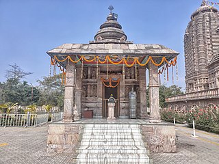
Odisha, formerly Orissa, is an Indian state located in Eastern India. It is the eighth-largest state by area, and the eleventh-largest by population, with over 41 million inhabitants. The state also has the third-largest population of Scheduled Tribes in India. It neighbours the states of Jharkhand and West Bengal to the north, Chhattisgarh to the west, and Andhra Pradesh and Telangana to the south. Odisha has a coastline of 485 kilometres (301 mi) along the Bay of Bengal in Indian Ocean. The region is also known as Utkaḷa and is mentioned by this name in India's national anthem, Jana Gana Mana. The language of Odisha is Odia, which is one of the Classical languages of India.

<span class="mw-page-title-main">Cuttack district</span> District in Odisha, India

Cuttack district is one of the 30 districts of Odisha state in India. It is located in the coastal part of the state and its administrative headquarters are located in the city of Cuttack. As of 2011 Census, after Ganjam, it is the second most populous district of Odisha, with a population of 2,624,470. The name is an anglicized form of Kataka or Katak meaning Fort – referring to the Barabati Fort. The district is bisected by the river Mahanadi and its numerous distributaries and occupies a large portion of the river's delta. It is bounded by the Angul, Dhenkanal, Nayagarh and Khurda districts to the west while its southern and eastern boundaries touch Puri, Jagatsinghpur, Kendrapara and Jajpur districts.

<span class="mw-page-title-main">Angul district</span> District of Odisha in India

Angul district; also known as Anugul, is one of the thirty districts of Odisha in eastern India. The city of Angul is the district headquarters of Angul district. A major industrial hub of the state, the district hosts numerous industries relating to coal, bauxite and steel apart from extensive forests including the Satkosia Tiger Reserve.

<span class="mw-page-title-main">Puri district</span> District of Odisha in India

Puri district is a coastal district of the Odisha state of India. It has one sub-division, 11 tahasils and 11 blocks and comprises 1722 revenue villages. Puri is the only municipality of the district. Konark, Pipili, Satyabadi, Gop, Kakatpur and Nimapada are the NACs in this district while Brahmagiri being a semi-urban town.

<span class="mw-page-title-main">Jajpur district</span> District in Odisha, India

Jajpur is a district of Odisha state in eastern India. The Odisha Government carried out a re-organisation of districts of Odisha in 1993. The erstwhile Cuttack district was split into multiple districts with Jajpur being one of them. The district came into being on 1 April 1993.

<span class="mw-page-title-main">Balasore district</span> District of Odisha in India

Balasore District, also known as Baleswar District, is an administrative district of Odisha state, in eastern India. Balasore is one of the coastal districts of Odisha and lies on the northernmost part of the state.

Kendrapara is a Town and a municipality in the Kendrapara district of the Indian state of Odisha. It is the headquarters of Kendrapara district.

Chhatrapur (ଛତ୍ରପୁର) is a town and a Municipality in Ganjam district in the state of Odisha, India.

Pattamundai is a town and a municipality in Kendrapara district in the Indian state of Odisha, located on the centre of SH-9A from Cuttack to Chandbali along the south end of Brahmani River. It is also the headquarter of Pattamundai Block.

Kendrapara Lok Sabha Constituency is one of the 21 Lok Sabha (Parliamentary) Constituencies in Odisha state in Eastern India.

<span class="mw-page-title-main">Lakhmi Varaha Temple</span> Hindu temple in Odisha, India

Sri Lakshmi Varaha Swamy Temple is a 500-year-old Indian temple dedicated to Varaha, the boar incarnation of Vishnu.

Karilopatna (Karilo patna, Karilo patana, is a village near Patkura in Kendrapara district in the Indian state of Odisha.

Rajkanika is a town and block of Kendrapara district in the Indian state of Odisha.

Kujang is a large village in Odisha, India. It is known as the gateway to the Paradip industrial area. The literacy rate of Kujang is around 90.48%, which is above the national average of 74.04%. Correspondingly, the "Bana Bihari High School", a prominent local school which was founded in 1901, is located in Kujang.

<span class="mw-page-title-main">Patkura Assembly constituency</span> Constituency of the Odisha legislative assembly in India

Patkura is a Vidhan Sabha constituency of Kendrapara district, Odisha.

<span class="mw-page-title-main">Aul Assembly constituency</span> Constituency of the Odisha legislative assembly in India

Aul is a Vidhan Sabha constituency of Kendrapara district, Odisha.

Manmatha Nath High School better known as M.N High School, is a co-ed senior secondary Odiah medium school located in Pattamundai in District of Kendrapara, Odisha, India. The courses at high school levels are affiliated to the Board of Secondary Education, Odisha.

Aul is a town and the headquarters of Aul CD Block and Aul Tehsil in Kendrapara district in the Indian state of Odisha. It is 17 km from Chandabali. Aul is surrounded by the river Kharasrota and Brahmani on north and south respectively. To its east is Bhitarkanika National Park.

Rajnagar Block is a block in Kendrapara district of the Indian state of Odisha.

References

  1. "PinCode: Kendrapara, Orissa, India, All Post Office Addresses Data, Pincode.net.in". pincode.net.in. Retrieved 11 January 2013. KENDRAPARA 754211
  2. h http://orissa.gov.in/e-magazine/orissaannualreference/ORA-2005/pdf/list_of_districts.pdf
  3. "Decadal Variation In Population Since 1901".
  4. "Table C-01 Population by Religious Community: Odisha". Census of India, 2011. Registrar General and Census Commissioner of India.
  5. 1 2 3 4 5 6 "District Census Handbook 2011 - Kendrapara" (PDF). Census of India . Registrar General and Census Commissioner of India.
  6. US Directorate of Intelligence. "Country Comparison:Population". Archived from the original on 13 June 2007. Retrieved 1 October 2011. Swaziland 1,370,424
  7. "2010 Resident Population Data". U. S. Census Bureau. Archived from the original on 19 October 2013. Retrieved 30 September 2011. Hawaii 1,360,301
  8. 1 2 "Table C-16 Population by Mother Tongue: Odisha". Census of India 2011. Registrar General and Census Commissioner of India.
  9. Assembly Constituencies and their EXtent
  10. Seats of Odisha
  11. "List of Member in Fourteenth Assembly". ws.ori.nic.in. Archived from the original on 2 May 2007. Retrieved 19 February 2013. MEMBER NAME