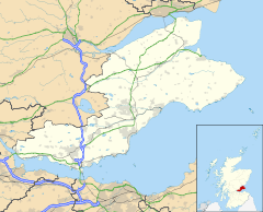
Fife is a council area, historic county, registration county and lieutenancy area of Scotland. It is situated between the Firth of Tay and the Firth of Forth, with inland boundaries with Perth and Kinross and Clackmannanshire. By custom it is widely held to have been one of the major Pictish kingdoms, known as Fib, and is still commonly known as the Kingdom of Fife within Scotland. A person from Fife is known as a Fifer. In older documents the county was very occasionally known by the anglicisation Fifeshire.

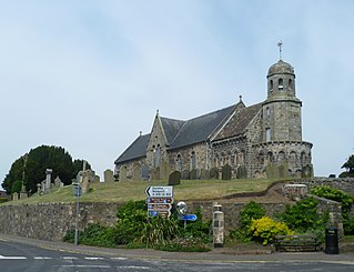
Crail ; Scottish Gaelic: Cathair Aile) is a former royal burgh, parish and community council area in the East Neuk of Fife, Scotland.

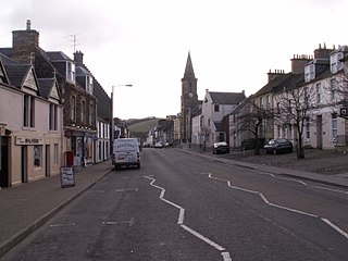
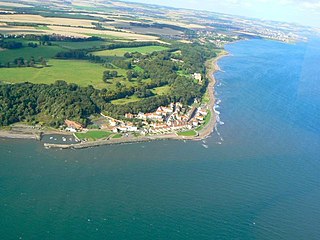
Kinghorn is a town and parish in Fife, Scotland. A seaside resort with two beaches, Kinghorn Beach and Pettycur Bay, plus a fishing port, it stands on the north shore of the Firth of Forth, opposite Edinburgh. According to the 2008 population estimate, the town has a population of 2,930.
Leuchars is a small town and parish near the north-east coast of Fife in Scotland.

Anstruther is a small coastal resort town in Fife, Scotland, situated on the north-shore of the Firth of Forth and 9 mi (14 km) south-southeast of St Andrews. The town comprises two settlements, Anstruther Easter and Anstruther Wester, which are divided by a stream, the Dreel Burn. With a population of 3,500, it is the largest community on the Firth of Forth's north-shore coastline known as the East Neuk. To the east, it merges with the village of Cellardyke.
Newburgh is a royal burgh and parish in Fife, Scotland, at the south shore of the Firth of Tay. The town has a population of 2,171, which constitutes a 10% increase since 1901 when the population was counted at 1,904 persons.
East Fife was a county constituency represented in the House of Commons of the Parliament of the United Kingdom from 1885 to 1983. Along with West Fife, it was formed by splitting the old Fife constituency.
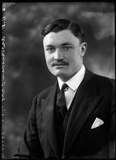
William John St Clair Anstruther-Gray, Baron Kilmany, MC PC was a Scottish Unionist Party politician.

Elie and Earlsferry is a coastal town and former royal burgh in Fife, and parish, Scotland, situated within the East Neuk beside Chapel Ness on the north coast of the Firth of Forth, eight miles east of Leven. The burgh comprised the linked villages of Elie to the east and to the west Earlsferry, which were formally merged in 1930 by the Local Government (Scotland) Act 1929. To the north is the village of Kilconquhar and Kilconquhar Loch.

Markinch (, is both a village and a parish in the heart of Fife, Scotland. According to an estimate taken in 2008, the village has a population of 2,420. The civil parish had a population of 16,530. Markinch is east of Fife's administrative centre, Glenrothes and preceded Cupar as Fife's place of warranty and justice prior to the 13th century.

Dunino is a village and parish in the East Neuk of Fife. It is 10 km from the nearest town, St Andrews, and 8 km from the fishing village of Anstruther. It is a small village with no local shops or services. It had one primary school which was closed down in 2014.

Carnock is a village and parish of Fife, Scotland, 4+1⁄4 miles west of Dunfermline. It is 1+1⁄4 miles east of Oakley, Fife. The name of the village derives from Scottish Gaelic, from ceàrn ("corner"), with a suffix denoting a toponym, thus giving "[the] corner place". Carnock is known to have had military significance in antiquity. The civil parish had a population of 5,927 as of 2011.
Scoonie is a settlement and parish in Fife, Scotland, the parish contains the town of Leven. It is bordered on the north by the parishes of Kettle and Ceres, on the east by the parish of Largo, on the south by the parishes of Markinch and Wemyss, and on the west by the parishes of Markinch and Kennoway. It extends about 4+1⁄2 miles north to south. Its width varies between 5⁄8 and 2+3⁄4 mi . The parish is on the coast of the Firth of Forth, with a coastline of about 1+1⁄2 mi (2.4 km) The area of the parish is 4,107 acres.
Largo is a parish in Fife, Scotland containing the villages of Upper Largo or Kirkton of Largo, Lower Largo and Lundin Links. It is bounded on the west by the parish of Scoonie, on the north by Ceres and on the east by the parishes of Newburn and Kilconquhar. It has a coastline of 2¾ miles along Largo bay. Inland it extends 3-4 ½ miles north from the south coast of Fife. Area 7,378 acres.
Moonzie is a small parish in Fife, Scotland, about 3 miles north-west of Cupar. It is bounded on the west by Creich, on the north by Kilmany, on the south-east by Cupar and on the south-west by Monimail.

Abdie is a parish in north-west Fife, Scotland, lying on the south shore of the Firth of Tay on the eastern outskirts of Newburgh, extending about 3 miles eastwards to the boundary of Dunbog parish, with which it is now united ecclesiastically and for the Community Council. It is also bounded by Collessie on the south and has a small border with the parish of Moonzie in the south-east.

Cameron is a parish in east Fife, Scotland, 3½ miles south-west of St Andrews.
Logie is a parish and village in east Fife, Scotland, 5 miles north-east of Cupar.
Wemyss is a civil parish on the south coast of Fife, Scotland, lying on the Firth of Forth. It is bounded on the north-east by the parish of Scoonie and the south-west by the parish of Kirkcaldy and Dysart and its length from south-west to north-east is about 6 miles. Inland it is bounded by Markinch and its greatest breadth is 2+1⁄4 miles.

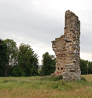
St Fort is a rural area, largely in Forgan parish, Fife. The current form of the name is late eighteenth century, the origin being a sandy ford on the Motray Water, in all likelihood the ford earlier known as Adnectan or Nechtan's ford. St Fort Hill lies immediately to the south of Newport-on-Tay and William Burn’s St Fort House, a large baronial mansion, demolished in 1953, lay on its southern slopes. The Home Farm, to its west, survives.