
Argyll and Bute is one of 32 unitary council areas in Scotland and a lieutenancy area. The current lord-lieutenant for Argyll and Bute is Jane Margaret MacLeod. The administrative centre for the council area is in Lochgilphead at Kilmory Castle, a 19th-century Gothic Revival building and estate. The current council leader is Robin Currie, a councillor for Kintyre and the Islands.

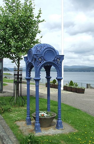
Dunoon is the main town on the Cowal peninsula in the south of Argyll and Bute, Scotland. It is located on the western shore of the upper Firth of Clyde, to the south of the Holy Loch and to the north of Innellan. As well as forming part of the council area of Argyll and Bute, Dunoon also has its own community council. Dunoon was a burgh until 1976.

Argyll, sometimes called Argyllshire, is a historic county and registration county of western Scotland.

Cowal is a rugged peninsula in Argyll and Bute, on the west coast of Scotland. It is bounded on the west by Loch Fyne and on the east by Loch Long and the Firth of Clyde. The Kyles of Bute separate it from the Isle of Bute to the south.

The Holy Loch is a sea loch, a part of the Cowal peninsula coast of the Firth of Clyde, in Argyll and Bute, Scotland.

Loch Long is a body of water in the council area of Argyll and Bute, Scotland. The Sea Loch extends from the Firth of Clyde at its southwestern end. It measures approximately 20 miles in length, with a width of between one and two miles. The loch also has an arm, Loch Goil, on its western side.

Loch Etive is a 30 km sea loch in Argyll and Bute, Scotland. It reaches the sea at Connel, 5 km north of Oban. It measures 31.6 km long and from 1.2 km to 1.6 km (1 mi) wide. Its depth varies greatly, up to a maximum of 150 m (490 ft).

Tarbert is a village in the west of Scotland, in the Argyll and Bute council area. It is built around East Loch Tarbert, an inlet of Loch Fyne, and extends over the isthmus which links the peninsula of Kintyre to Knapdale and West Loch Tarbert. Tarbert had a recorded population of 1,338 in the 2001 Census.
Kirn is a village in Argyll and Bute in the Scottish Highlands on the west shore of the Firth of Clyde on the Cowal peninsula. It now forms part of the continuous habitation between Dunoon and Hunters Quay, where the Holy Loch joins the Firth of Clyde. It originally had its own pier, with buildings designed by Harry Edward Clifford in 1895, and was a regular stop for the Clyde steamer services, bringing holidaymakers to the town, mostly from the Glasgow area.

Colintraive is a village in Argyll and Bute, Scotland. Once the site where cattle were swum across the narrows to the Isle of Bute, the MV Loch Dunvegan — a ferry operated by Caledonian MacBrayne — now provides a link to the island.

Strachur and Strathlachlan are united parishes located on the Cowal peninsula, in Argyll and Bute, Scotland. Strachur is a small village on the eastern coast of Loch Fyne.

Ardnadam is a village on the Holy Loch on the Cowal peninsula, Argyll and Bute, Scotland. It is located northwest of Hunters Quay and east of Sandbank, and sits across the loch from Kilmun.
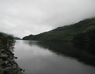
Loch Eck is a freshwater loch located on the Cowal peninsula, north of Dunoon, Argyll and Bute, Scotland. It is seven miles long. It is oriented in a north-south direction. Its main inflow, at the northern end, is the River Cur, and its main outflow, at the southern end, is the River Eachaig, which meanders somewhat within the confines of the broad strath before flowing into the head of Holy Loch, about 5 km further south.

Glendaruel is a glen in the Cowal peninsula in Argyll and Bute, Scotland.
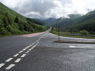
The A815 is a major road located in Argyll and Bute, Scotland. It runs for about 37 miles (60 km) from the A83, near Cairndow, in the north to Toward in the south. It passes beside three lochs, while its final stretch is along the Firth of Clyde.
Auchenbreck Castle is located in Argyll and Bute, Scotland. Its remains are situated in Kilmodan parish, near the south of Glendaruel, 9 kilometres (5.6 mi) north of Tighnabruaich on the Cowal peninsula. Little remains of the castle, other than a flat rectangular platform, around 35 by 18 metres, between Auchenbreck farmhouse and the Auchenbreck Burn. This is partially bounded by a revetment wall up to 2.2 metres high.

Built in 1783 Kilmodan Church, is in the Clachan of Glendaruel in the Kilmodan parish of the Cowal peninsula, Argyll and Bute, West of Scotland. It is constructed to a Georgian T-plan design and a category B listed building. The walls are inset with shields from the previous church on the site and one is inscribed and dated 'SDC/1610.' There is also a memorial to Rev John Maclaurin and his notable sons. It has a rendered front and both the ends and rear are harled. The building underwent complete restoration in 1983.

Loch Tarsan; is a freshwater loch and impounding reservoir located 13 kilometres Northwest of Dunoon, on the Cowal peninsula in Argyll and Bute, Scotland. This three-armed Reservoir extends into both Glen Tarsan and Glen Lean. It supplies water to the Striven Hydro-Electric Scheme. The larger of the two dams is 17.6 metres high and was completed in 1953. The water that is collected in the loch is piped to the hydro-electric generating station, located at Ardtaraig, at the head of Loch Striven.
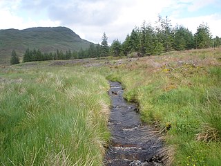
The River Cur is a river in the Cowal peninsula, Argyll and Bute, western Scotland. The position of its source is uncertain, as it is formed from a large number of small burns; for example, one of these rises on the slopes of Cruach nam Mult, at grid reference NN165056 and an elevation of about 2,000 feet (600 m). The river flows south-west until it reaches the head of a glacial valley near Strachur, Loch Fyne. The river does not enter Loch Fyne, but instead turns south-east. At that point it has reached an elevation of only about 160 feet (50 m), and it continues along the valley, losing altitude much more slowly, until it reaches the head of Loch Eck. Before reaching Loch Eck, it passes near the tiny settlements of Balliemore and Invernoaden and Glenbranter.
