Kiowa, Oklahoma

Last updated

Kiowa, Oklahoma
OKMap-doton-Kiowa.PNG
Location of Kiowa, Oklahoma
Coordinates: 34°43′22″N95°54′09″W / 34.72278°N 95.90250°W / 34.72278; -95.90250
Country United States
State Oklahoma
County Pittsburg
Area
[1]
  Total1.25 sq mi (3.24 km2)
  Land1.24 sq mi (3.22 km2)
  Water0.01 sq mi (0.02 km2)
Elevation
[2]
738 ft (225 m)
Population
 (2020)
  Total595
  Density478.68/sq mi (184.89/km2)
Time zone UTC-6 (Central (CST))
  Summer (DST) UTC-5 (CDT)
ZIP code
74553
Area code(s) 539/918
FIPS code 40-40000 [3]
GNIS feature ID2412839 [2]

Kiowa is a town in Pittsburg County, Oklahoma, United States. The population was 731 at the 2010 census.

Contents

History

At the time of its founding, Kiowa was located in Jacksfork County, Choctaw Nation, in the Indian Territory. [4] Its location is placed by some maps as in Tobucksy County, which included McAlester; the boundary was very near. [5]

A post office was established at Kiowa, Indian Territory on May 6, 1881. It took its name from nearby Kiowa Hill. [6]

Geography

According to the United States Census Bureau, the town has a total area of 1.3 square miles (3.4 km2), all land.

Demographics

Historical population
CensusPop.Note
1910 1,021
1920 1,28726.1%
1930 689−46.5%
1940 80216.4%
1950 8020.0%
1960 607−24.3%
1970 75424.2%
1980 86614.9%
1990 718−17.1%
2000 693−3.5%
2010 7315.5%
2020 595−18.6%
U.S. Decennial Census [7]

As of the census [3] of 2000, there were 693 people, 293 households, and 200 families residing in the town. The population density was 538.3 inhabitants per square mile (207.8/km2). There were 335 housing units at an average density of 260.2 per square mile (100.5/km2). The racial makeup of the town was 75.1% White, 14.2% Native American, and 6.8% from two or more races, 0.3% African American. Hispanic or Latino of any race were 3.6% of the population.

There were 293 households, out of which 28.7% had children under the age of 18 living with them, 56.0% were married couples living together, 8.2% had a female householder with no husband present, and 31.4% were non-families. 28.7% of all households were made up of individuals, and 15.4% had someone living alone who was 65 years of age or older. The average household size was 2.37 and the average family size was 2.92.

In the town, the population was spread out, with 25.0% under the age of 18, 6.8% from 18 to 24, 26.6% from 25 to 44, 23.4% from 45 to 64, and 18.3% who were 65 years of age or older. The median age was 38 years. For every 100 females, there were 90.4 males. For every 100 females age 18 and over, there were 93.3 males.

The median income for a household in the town was $22,614, and the median income for a family was $33,125. Males had a median income of $22,188 versus $20,000 for females. The per capita income for the town was $17,948. About 16.6% of families and 20.1% of the population were below the poverty line, including 22.2% of those under age 18 and 20.0% of those age 65 or over.

Notable people

Related Research Articles

<span class="mw-page-title-main">Tillman County, Oklahoma</span> County in Oklahoma, United States

Tillman County is a county located in the southwestern part of Oklahoma, United States. As of the 2020 census, the population was 6,968. The county seat is Frederick.

<span class="mw-page-title-main">Kiowa County, Oklahoma</span> County in Oklahoma, United States

Kiowa County is a county located in the southwestern part of the U.S. state of Oklahoma. As of the 2020 census, the population was 8,509. Its county seat is Hobart. The county was created in 1901 as part of Oklahoma Territory. It was named for the Kiowa people.

<span class="mw-page-title-main">Kiowa, Kansas</span> City in Kiowa County, Kansas

Kiowa is a city in Barber County, Kansas, United States. As of the 2020 census, the population of the city was 902. It is located 1 mile north of the Kansas / Oklahoma state border.

<span class="mw-page-title-main">Bokchito, Oklahoma</span> Town in Oklahoma, United States

Bokchito is a town in Bryan County, Oklahoma, United States. The population was 632 at the 2010 census, an increase of 12.1 percent over the figure of 564 recorded in 2000. In the Choctaw language, "bok" means river, and "chito" means big or large, literally translating into "big creek".

<span class="mw-page-title-main">Cement, Oklahoma</span> Town in Oklahoma, United States

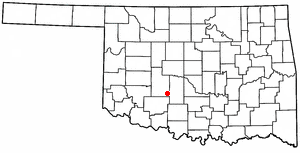
Cement is a town in Caddo County, Oklahoma, United States. The population was 436 as of the 2020 United States census.

<span class="mw-page-title-main">Randlett, Oklahoma</span> Town in Oklahoma, United States

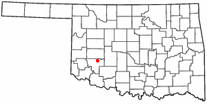
Randlett is a town in Cotton County, Oklahoma, United States. The population was 289 as of the 2020 United States census. Randlett is located about 22 driving miles south-southwest of the county seat of Walters, and is at the corner where US Route 277 and US Route 281 join US Route 70.

<span class="mw-page-title-main">Maysville, Oklahoma</span> Town in Oklahoma, United States

Maysville is a town in Garvin and McClain counties, Oklahoma, United States. The population was 1,232 at the 2010 census, down from 1,313 in 2000.

<span class="mw-page-title-main">Verden, Oklahoma</span> Town in Oklahoma, United States

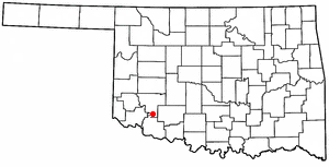
Verden is a town in western Grady County, Oklahoma, United States. It abuts the Caddo County line, and is probably best known as the site of the 1865 Camp Napoleon Council. The population was 580 at the 2020 census, a decline from 530 in 2010.

Hastings is a town in Jefferson County, Oklahoma, United States. The population was 143 at the 2010 census, a decline of 7.8 percent from the figure of 155 in 2000.

<span class="mw-page-title-main">Cooperton, Oklahoma</span> Town in Oklahoma, United States

Cooperton is a town in Kiowa County, Oklahoma, United States. The population was 16 at the 2010 census, a decline of 20 percent from the total of 20 in 2000.

<span class="mw-page-title-main">Gotebo, Oklahoma</span> Town in Oklahoma, United States

Gotebo is a town in Kiowa County, Oklahoma, United States. The population was 174 at the 2020 Census.

<span class="mw-page-title-main">Hobart, Oklahoma</span> City in Oklahoma, United States

Hobart is a city in, and the county seat of, Kiowa County, Oklahoma, United States. It is west-southwest of Oklahoma City, and northwest of Lawton. It was named for Garret Hobart, the 24th Vice President of the United States. The population was 3,413 at the 2020 Census. It is served by Hobart Regional Airport. It also has two museums: the General Tommy Franks Museum and the Kiowa County Museum.

<span class="mw-page-title-main">Lone Wolf, Oklahoma</span> Town in Oklahoma, United States

Lone Wolf is a town in Kiowa County, Oklahoma, United States. The population was 438 at the 2010 census, a decline of 12.4 percent from 500 in 2000. The town was named for Chief Lone Wolf (1843–1923), a warrior chief of the Kiowa who fought to preserve his people's autonomy and way of life.

<span class="mw-page-title-main">Mountain View, Oklahoma</span> Town in Oklahoma, United States

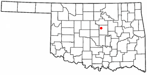
Mountain View is a town in Kiowa County, Oklahoma, United States. Its population was 740 as of the 2020 United States census. It is situated about 23 miles east of the county seat of Hobart, at the intersection of Oklahoma State Highway 9 and Oklahoma State Highway 115.

<span class="mw-page-title-main">Roosevelt, Oklahoma</span> Town in Oklahoma, United States

Roosevelt is a town in Kiowa County, Oklahoma, United States. The population was 248 at the 2010 census, a decline of 11.4 percent from 283 in 2000. The town was named for President Theodore Roosevelt.

<span class="mw-page-title-main">Snyder, Oklahoma</span> City in Oklahoma, United States

Snyder is a city in Kiowa County, Oklahoma, United States. The population was 1,394 at the 2010 census. This figure represented a decline of 7.6 percent from 1,509 persons in 2000.

<span class="mw-page-title-main">Carney, Oklahoma</span> Town in Oklahoma, United States

Carney is a town in Lincoln County, Oklahoma, United States. As of the 2020 census, the population of the town was 545.

<span class="mw-page-title-main">Davenport, Oklahoma</span> Town in Oklahoma, United States

Davenport is a town in Lincoln County, Oklahoma, United States. The population was 814 at the 2010 census.

Pittsburg is a town in Pittsburg County, Oklahoma, United States. The population was 280 at the 2000 census.

<span class="mw-page-title-main">Quinton, Oklahoma</span> Town in Oklahoma, United States

Quinton is a town in Pittsburg County, Oklahoma, United States. The population was 1,051 at the 2010 census. The town was named for Elizabeth Quinton, who lived to be 116 years old. Her family still resides in and around the town of Quinton. Web address https://townofquinton.com/

References

  1. "ArcGIS REST Services Directory". United States Census Bureau. Retrieved September 20, 2022.
  2. 1 2 U.S. Geological Survey Geographic Names Information System: Kiowa, Oklahoma
  3. 1 2 "U.S. Census website". United States Census Bureau . Retrieved January 31, 2008.
  4. John W. Morris, Historical Atlas of Oklahoma, Plate 38.
  5. “Map of the Indian and Oklahoma Territories.” Rand McNally and Company, 1892.
  6. George H. Shirk, Oklahoma Place Names (Norman: University of Oklahoma Press, 1965), p. 118.
  7. "Census of Population and Housing". Census.gov. Retrieved June 4, 2015.