Knik-Fairview, Alaska

Last updated

Knik-Fairview, Alaska
CDP
Matanuska-Susitna Borough Alaska incorporated and unincorporated areas Knik-Fairview highlighted.svg
Location of Knik-Fairview in Matanuska-Susitna Borough and the state of Alaska
USA Alaska location map.svg
Red pog.svg
Knik-Fairview, Alaska
Location within the state of Alaska
Coordinates: 61°31′39″N149°35′53″W / 61.52750°N 149.59806°W / 61.52750; -149.59806
CountryUnited States
State Alaska
Borough Matanuska-Susitna
Government
  Borough mayor Edna DeVries
   State senators Shelley Hughes (R)
Mike Shower (R)
David Wilson (R)
   State reps. David Eastman (R)
Kevin McCabe (R)
Cathy Tilton (R)
Area
[1]
  Total74.55 sq mi (193.08 km2)
  Land73.53 sq mi (190.45 km2)
  Water1.01 sq mi (2.62 km2)
Population
 (2020)
  Total19,297
  Rank ranked 4th
  Density262.42/sq mi (101.32/km2)
Time zone UTC-9 (Alaska (AKST))
  Summer (DST) UTC-8 (AKDT)
Area code 907
FIPS code 02-40645

Knik-Fairview is a census-designated place (CDP) in Matanuska-Susitna Borough, Alaska, United States. It is part of the Anchorage, Alaska Metropolitan Statistical Area. At the 2020 census the population was 19,297, up from 14,923 in 2010. It is the most populated CDP in Alaska. [2]

Contents

Geography

Knik-Fairview is located at 61°31′39″N149°35′53″W / 61.527579°N 149.597947°W / 61.527579; -149.597947 . [3] 17.5 miles (28.2 km) northeast of Anchorage on the west bank of the Knik Arm of Cook Inlet; 13 miles south of Wasilla.

According to the United States Census Bureau, the CDP has a total area of 180 km2 (69 sq mi). Two percent, or 1 square mile (2.6 km2), of it is water.

Demographics

Historical population
CensusPop.Note
1910 118
1920 40−66.1%
1930 34−15.0%
1940 4017.6%
1980 10
1990 2722,620.0%
2000 7,0492,491.5%
2010 14,923111.7%
2020 19,29729.3%
U.S. Decennial Census [4]

Knik-Fairview first appeared on the 1910 U.S. Census as the unincorporated village of Knik. [5] It appeared again from 1920–40. Knik did not appear again until 1980, when it was classified as a native village with just 10 residents. [6] In 1990, it was reclassified as a census-designated place (CDP). In 2000, it was renamed Knik-Fairview (CDP).

As of the 2000 census, there were 7,050 people, 2,380 households, and 1,800 families residing in the CDP. The population density was 39/km2 (100/sq mi). There were 2,590 housing units at an average density of 37/sq mi (14/km2). The racial makeup of the CDP was 88% white, 6% Native American, and 4% from two or more races. 3% of the population were Hispanic or Latino of any race. Blacks, Asians, and Pacific Islanders all have less than 1%. 1% are from other races.

There were 2,380 households, out of which 45% had children under the age of 18 living with them, 64% were married couples living together, 7% had a female householder with no husband present, and 24% were non-families. 18% of all households were made up of individuals, and 3% had someone living alone who was 65 years of age or older. The average household size was 3.0 and the average family size was 3.4.

In the CDP, the population was spread out, with 34% under the age of 18, 6% from 18 to 24, 33% from 25 to 44, 23% from 45 to 64, and 5% who were 65 years of age or older. The median age was 33 years. For every 100 females, there were 108 males. For every 100 females age 18 and over, there were 107 males.

The median income for a household in the CDP was $52,100, and the median income for a family was $60,100. Males had a median income of $46,300 versus $29,800 for females. The per capita income for the CDP was $20,900. 11% of the population and 9% of families were below the poverty line. 13% of those under the age of 18 and 4% of those 65 and older were living below the poverty line.

Related Research Articles

<span class="mw-page-title-main">Matanuska-Susitna Borough, Alaska</span> Borough in Alaska, United States

Matanuska-Susitna Borough is a borough located in the U.S. state of Alaska. Its borough seat is Palmer, and the largest community is the census-designated place of Knik-Fairview. As of the 2020 census, the borough's population was 107,801.

<span class="mw-page-title-main">Bear Creek, Alaska</span> Census-designated place in Alaska, United States

Bear Creek is a census-designated place (CDP) in Kenai Peninsula Borough, Alaska, United States. At the 2020 census the population was 2,129 up from 1,956 in 2010. Bear Creek is a few miles north of Seward near the stream of the same name and its source, Bear Lake.

<span class="mw-page-title-main">Moose Pass, Alaska</span> Census-designated place in Alaska, United States

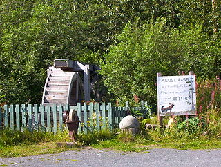
Moose Pass is a census-designated place (CDP) in Kenai Peninsula Borough, Alaska, United States. The population was 219 at the 2010 census, up from 206 in 2000.

<span class="mw-page-title-main">Big Lake, Alaska</span> CDP in Alaska, United States

Big Lake is a census-designated place (CDP) in Matanuska-Susitna Borough, Alaska, United States. It is part of the Anchorage, Alaska Metropolitan Statistical Area. The population was 3,833 at the 2020 census, up from 3,350 in 2010.

<span class="mw-page-title-main">Buffalo Soapstone, Alaska</span> CDP in Alaska, United States

Buffalo Soapstone is a census-designated place (CDP) in Matanuska-Susitna Borough, Alaska, United States. It is part of the Anchorage, Alaska Metropolitan Statistical Area. The population was 1,021 at the 2020 census, up from 855 in 2010.

<span class="mw-page-title-main">Butte, Alaska</span> CDP in Alaska, United States

Butte is a census-designated place (CDP) in Matanuska-Susitna Borough, Alaska, United States. It is part of the Anchorage, Alaska Metropolitan Statistical Area. At the 2020 census, the population was 3,589, up from 3,246 in 2010. Butte is located between the Matanuska River and the Knik River, approximately 5 miles (8 km) southeast of Palmer. It is accessible via the Old Glenn Highway.

<span class="mw-page-title-main">Chickaloon, Alaska</span> Census-designated place in Matanuska-Susitna Borough, Alaska, United States

Chickaloon is a census-designated place (CDP) in Matanuska-Susitna Borough, Alaska, United States. It is part of the Anchorage, Alaska Metropolitan Statistical Area. The population was 254 at the 2020 census, down from 272 in 2010.

<span class="mw-page-title-main">Farm Loop, Alaska</span> CDP in Alaska, United States

Farm Loop is a census-designated place (CDP) in Matanuska-Susitna Borough, Alaska, United States. It is part of the Anchorage, Alaska Metropolitan Statistical Area. At the 2020 census the population was 2,747, up from 1,028 in 2010.

<span class="mw-page-title-main">Fishhook, Alaska</span> CDP in Alaska, United States

Fishhook is a census-designated place (CDP) in Matanuska-Susitna Borough, Alaska, United States. It is part of the Anchorage, Alaska Metropolitan Statistical Area. At the 2020 census the population was 5,048, up from 4,679 in 2010.

<span class="mw-page-title-main">Gateway, Alaska</span> CDP in Alaska, United States

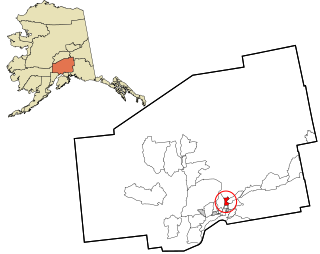
Gateway is a census-designated place (CDP) in Matanuska-Susitna Borough, Alaska, United States. It is part of the Anchorage, Alaska Metropolitan Statistical Area. The population was 5,748 at the 2020 census, up from 5,552 in 2010. Gateway is the fifth-most populated CDP in the borough.

<span class="mw-page-title-main">Glacier View, Alaska</span> Census-designated place in Alaska, United States

Glacier View is a census-designated place (CDP) in Matanuska-Susitna Borough, Alaska, United States. It is part of the Anchorage Metropolitan Area. At the 2020 census the population was 375, up from 234 in 2010. The terminus of Matanuska Glacier is located approximately three miles southwest of Glacier View.

<span class="mw-page-title-main">Knik River, Alaska</span> CDP in Alaska, United States

Knik River is a census-designated place (CDP) in Matanuska-Susitna Borough in the U.S. state of Alaska. Located 15 miles southeast from Palmer along the Knik River, it is part of the Anchorage, Alaska Metropolitan Statistical Area. The population was 792 at the 2020 census, up from 744 in 2010.

<span class="mw-page-title-main">Lakes, Alaska</span> CDP in Alaska, United States

Lakes was a census-designated place (CDP) in Matanuska-Susitna Borough, Alaska, United States. It was split in two CDPs for 2020 Census purposes: North Lakes and South Lakes. The area is part of the Anchorage, Alaska Metropolitan Statistical Area. At the 2010 census the population was 8,364, up from 6,706 in 2000.

<span class="mw-page-title-main">Lazy Mountain, Alaska</span> CDP in Alaska, United States

Lazy Mountain is a census-designated place (CDP) in Matanuska-Susitna Borough, Alaska, United States. Located east of Palmer along the Matanuska River. At the 2020 census the population was 1,506, up from 1,479 in 2010.

<span class="mw-page-title-main">Meadow Lakes, Alaska</span> CDP in Alaska, United States

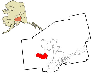
Meadow Lakes is a census-designated place (CDP) in Matanuska-Susitna Borough, Alaska, United States. Located west of Wasilla, it is part of the Anchorage, Alaska Metropolitan Statistical Area. As of the 2020 census, the population was 9,197, up from 7,570 in 2010. It is the fifth-most populated CDP in Alaska and the third largest community in the borough.

<span class="mw-page-title-main">Point MacKenzie, Alaska</span> CDP in Alaska, United States

Point MacKenzie is a census-designated place (CDP) in Matanuska-Susitna Borough, Alaska, United States. It is part of the Anchorage, Alaska Metropolitan Statistical Area. At the 2020 census the population was 1,852, up from 529 in 2010.

<span class="mw-page-title-main">Skwentna, Alaska</span> CDP in Alaska, United States

Skwentna is a census-designated place (CDP) on Iditarod Trail in Matanuska-Susitna Borough, Alaska, United States. Located 61 miles northwest of Wasilla along the Skwentna River, it is part of the Anchorage, Alaska Metropolitan Statistical Area. At the 2020 census the population was 62, up from 37 in 2010. The town is served by Skwentna Airport.

<span class="mw-page-title-main">Tanaina, Alaska</span> CDP in Alaska, United States

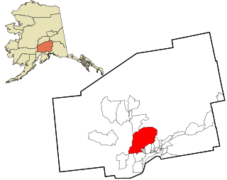
Tanaina is a census-designated place (CDP) in the Matanuska-Susitna Borough in the U.S. state of Alaska. Located 4 miles north from Wasilla, it is part of the Anchorage, Alaska Metropolitan Statistical Area. At the 2020 census the population was 8,817, up from 8,197 in 2010. Tanaina is the sixth-most populated CDP in Alaska.

<span class="mw-page-title-main">Willow, Alaska</span> CDP in Alaska, United States

Willow is a census-designated place (CDP) in the Matanuska-Susitna Borough in the U.S. state of Alaska. Located 26 miles northwest from Wasilla along the George Parks Highway, it is part of the Anchorage, Alaska Metropolitan Statistical Area. At the 2020 census the population was 2,196, up from 2,102 in 2010.

<span class="mw-page-title-main">Badger, Alaska</span> CDP in Alaska, United States

Badger is a census-designated place (CDP) in the Fairbanks North Star Borough of Alaska. It was one of the CDPs created in 2010 out of small suburbs and outskirts of Fairbanks. It has an area of 66.71 sq. mi, 65.63 of land and 1.08 of water.

References

  1. "2020 U.S. Gazetteer Files". United States Census Bureau. Retrieved October 29, 2021.
  2. "2020 Census Data - Cities and Census Designated Places" (Web). State of Alaska, Department of Labor and Workforce Development. Retrieved October 31, 2021.
  3. "US Gazetteer files: 2010, 2000, and 1990". United States Census Bureau. February 12, 2011. Archived from the original on May 27, 2002. Retrieved April 23, 2011.
  4. "U.S. Decennial Census". Census.gov. Retrieved October 16, 2021.
  5. "Geological Survey Professional Paper". 1949.
  6. "Characteristics of the Populations - Number of Inhabitants - Alaska" (PDF). United States Census Bureau. May 1982.