Lake Norman of Catawba, North Carolina

Last updated
Lake Norman of Catawba
USA North Carolina location map.svg
Red pog.svg
Lake Norman
of Catawba
Location within the state of North Carolina
Coordinates: 35°35′58″N80°59′02″W / 35.59944°N 80.98389°W / 35.59944; -80.98389
Country United States
State North Carolina
County Catawba
Area
[1]
  Total18.75 sq mi (48.56 km2)
  Land10.09 sq mi (26.14 km2)
  Water8.66 sq mi (22.42 km2)
Elevation
[2]
860 ft (260 m)
Population
 (2020)
  Total11,395
  Density1,128.89/sq mi (435.88/km2)
Time zone UTC-5 (Eastern (EST))
  Summer (DST) UTC-4 (EDT)
FIPS code 37-36511 [3]
GNIS feature ID2403201 [2]

Lake Norman of Catawba is a census-designated place (CDP) in Catawba County, North Carolina, United States. The population was 11,395 at the 2020 census up from 7,411 at the 2010 census. [4] It is part of the Hickory-Lenoir-Morganton Metropolitan Statistical Area.

Contents

Geography

Lake Norman of Catawba is located in the southeast corner of Catawba County. It consists of several residential developments that occupy the western shore of Lake Norman, a large reservoir on the Catawba River, as well as the shores of numerous inlets on the western side of the lake. The CDP is bounded on the east by the center of the Catawba River, forming the Catawba County/Iredell County line; on the south by the Lincoln County line; and on the west and north by several rural roads, extending as far north as Long Island Road. The CDP includes the unincorporated communities of Terrell, Sherrills Ford, Monbo, and Long Island.

North Carolina Highway 150 crosses the southern part of the CDP, passing through the center of Terrell and leading east 11 miles (18 km) to Mooresville and west 17 miles (27 km) to Lincolnton.

The Marshall Steam Station, a coal power plant operated by Duke Energy, is located in the CDP just northeast of downtown Terrell. On December 11, 2014, Duke Energy, to repair a rusted, leaking pipe, received approval from North Carolina to dump Coal Ash (containing arsenic, lead, thallium and mercury, among other heavy metals) from the Marshall Steam Station into Lake Norman. [5]

On October 3, 2015, Duke reported that a sinkhole had formed at the base of the Marshall Steam Station dam north of Charlotte on Lake Norman. The Department of Environmental Quality (DEQ) says Duke placed a liner in the hole and filled it with crushed stone. [6]

According to the United States Census Bureau, the CDP has a total area of 32.4 square miles (83.8 km2), of which 23.8 square miles (61.7 km2) is land and 8.5 square miles (22.1 km2), or 26.35%, is water. [4]

Demographics

Historical population
CensusPop.Note
2020 11,395
U.S. Decennial Census [7]

As of the census [3] of 2000, there were 4,744 people, 1,988 households, and 1,455 families residing in the CDP. The population density was 248.0 inhabitants per square mile (95.8/km2). There were 2,776 housing units at an average density of 145.1 per square mile (56.0/km2). The racial makeup of the CDP was 97.39% White, 1.31% African American, 0.40% Native American, 0.19% Asian, 0.04% Pacific Islander, 0.23% from other races, and 0.44% from two or more races. Hispanic or Latino of any race were 0.70% of the population.

There were 1,988 households, out of which 25.7% had children under the age of 18 living with them, 64.7% were married couples living together, 5.7% had a female householder with no husband present, and 26.8% were non-families. 21.3% of all households were made up of individuals, and 6.2% had someone living alone who was 65 years of age or older. The average household size was 2.39 and the average family size was 2.77.

In the CDP, the population was spread out, with 19.6% under the age of 18, 5.8% from 18 to 24, 29.8% from 25 to 44, 32.6% from 45 to 64, and 12.2% who were 65 years of age or older. The median age was 42 years. For every 100 females, there were 103.0 males. For every 100 females age 18 and over, there were 101.8 males.

The median income for a household in the CDP was $50,367, and the median income for a family was $55,192. Males had a median income of $40,250 versus $28,650 for females. The per capita income for the CDP was $27,278. About 5.6% of families and 7.1% of the population were below the poverty line, including 12.0% of those under age 18 and 5.5% of those age 65 or over.

Related Research Articles

<span class="mw-page-title-main">York County, South Carolina</span> County in South Carolina, United States

York County is a county on the north central border in the U.S. state of South Carolina. As of the 2020 census, the population was 282,090, making it the seventh most populous county in the state. Its county seat is the city of York, and its largest city is Rock Hill. The county is served by one interstate highway, Interstate 77.

<span class="mw-page-title-main">Lancaster County, South Carolina</span> County in South Carolina, United States

Lancaster County is a county located in the U.S. state of South Carolina. As of the 2020 census, its population was 96,016, Its county seat is Lancaster, which has an urban population of 23,979. The county was created in 1785.

<span class="mw-page-title-main">Catawba County, North Carolina</span> County in North Carolina, United States

Catawba County is a county in the U.S. state of North Carolina. As of the 2020 census, the population was 160,610. Its county seat is Newton, and its largest city is Hickory.

<span class="mw-page-title-main">Bethlehem, Alexander County, North Carolina</span> Census-designated place in North Carolina, United States

Bethlehem is a census-designated place (CDP) in Alexander County, North Carolina, United States. The population was 4,214 at the 2010 census. It is part of the Hickory–Lenoir–Morganton Metropolitan Statistical Area.

Northlakes is a census-designated place (CDP) in Caldwell County, North Carolina, United States. It is part of the Hickory–Lenoir–Morganton Metropolitan Statistical Area.

<span class="mw-page-title-main">Catawba, North Carolina</span> Town in North Carolina, United States

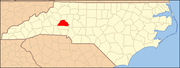
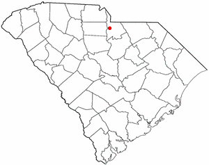
Catawba is a town in Catawba County, North Carolina, United States. The population was 603 at the 2010 census. It is part of the Hickory–Lenoir–Morganton Metropolitan Statistical Area. As with the county, the name recalls the Catawba people, the indigenous people who once inhabited the area.

<span class="mw-page-title-main">Mountain View, North Carolina</span> Census-designated place in North Carolina, United States

Mountain View is a census-designated place (CDP) in Catawba County, North Carolina, United States. The population was 3,552 at the 2010 census. It is part of the Hickory–Lenoir–Morganton Metropolitan Statistical Area.

<span class="mw-page-title-main">Sherrills Ford, North Carolina</span> Unincorporated community in North Carolina, United States

Sherrills Ford is an unincorporated community and former census-designated place (CDP) in Catawba County, North Carolina, United States. The population was 941 at the 2000 census. For the 2010 census it was included within the Lake Norman of Catawba CDP. It is part of the Hickory-Lenoir-Morganton Metropolitan Statistical Area.

<span class="mw-page-title-main">St. Stephens, North Carolina</span> Census-designated place in North Carolina, United States

St. Stephens is a census-designated place (CDP) in Catawba County, North Carolina, United States. The population was 8,759 at the 2010 census, down from 9,439 in 2000. It is part of the Hickory–Lenoir–Morganton Metropolitan Statistical Area.

<span class="mw-page-title-main">Buies Creek, North Carolina</span> Census-designated place in North Carolina, United States

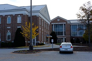
Buies Creek is a census-designated place (CDP) located in the Neills Creek Township of Harnett County, North Carolina, United States. It is the home of Campbell University. The population was 3,253 at the 2020 census, up from 2,942 in 2010. Buies Creek is a part of the Dunn Micropolitan Area, which is also a part of the greater Raleigh–Durham–Cary Combined Statistical Area (CSA) as defined by the United States Census Bureau.

<span class="mw-page-title-main">Mooresville, North Carolina</span> Town in North Carolina, United States

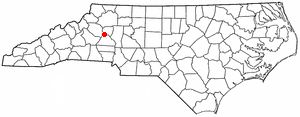
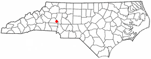
Mooresville is a town located in the southwestern section of Iredell County, North Carolina, United States, and is a part of the fast-growing Charlotte metropolitan area. The population was 50,193 at the 2020 United States Census, making it the largest municipality in Iredell County. It is located approximately 25 miles (40 km) north of Charlotte.

<span class="mw-page-title-main">Lowesville, North Carolina</span> Census-designated place in North Carolina, United States

Lowesville is a census-designated place (CDP) in Lincoln County, North Carolina, United States. The population was 2,945 at the 2010 census, up from 1,440 in 2000.

<span class="mw-page-title-main">Westport, North Carolina</span> Census-designated place in North Carolina, United States

Westport is an unincorporated community and census-designated place (CDP) located in Lincoln County, North Carolina, United States. The population of the CDP was 4,026 at the 2010 census, up from 2,006 at the 2000 census. The community's name comes from its location on the west side of Lake Norman.

Elgin is an unincorporated community and census-designated place (CDP) in Lancaster County, South Carolina, United States. The population was 2,607 at the 2010 census.

<span class="mw-page-title-main">Irwin, South Carolina</span> Census-designated place in South Carolina, United States

Irwin is an unincorporated community and census-designated place (CDP) in Lancaster County, South Carolina, United States. The population was 1,405 at the 2010 census.

Springdale is an unincorporated community and census-designated place (CDP) in Lancaster County, South Carolina, United States. The population was 2,574 at the 2010 census, down from 2,864 at the 2000 census.

<span class="mw-page-title-main">Red Bank, South Carolina</span> Census-designated place in South Carolina, United States

Red Bank is an unincorporated community and census-designated place (CDP) in Lexington County, South Carolina, United States. The population was 9,617 at the 2010 census, up from 8,811 at the 2000 census. It is part of the Columbia, South Carolina Metropolitan Statistical Area.

<span class="mw-page-title-main">Lake Wylie, South Carolina</span> CDP in South Carolina, United States

Lake Wylie is a census-designated place (CDP) in York County, South Carolina, United States. The population was 8,841 at the 2010 census. Lake Wylie is located on a peninsula along the shore of Lake Wylie, a reservoir that was named for Dr. W. Gil Wylie in 1960. It is a suburb of Charlotte, North Carolina.

<span class="mw-page-title-main">Riverview, South Carolina</span> CDP in South Carolina, United States

Riverview is a census-designated place (CDP) in York County, South Carolina, United States, located southwest of Fort Mill along the Catawba River. The population was 708 at the 2000 census.

Lake Royale is a census-designated place (CDP) in southeastern Franklin County, North Carolina, United States. The population was 3,392 at the 2020 census.

References

  1. "ArcGIS REST Services Directory". United States Census Bureau. Retrieved September 20, 2022.
  2. 1 2 U.S. Geological Survey Geographic Names Information System: Lake Norman of Catawba, North Carolina
  3. 1 2 "U.S. Census website". United States Census Bureau . Retrieved 2008-01-31.
  4. 1 2 "Geographic Identifiers: 2010 Demographic Profile Data (G001): Lake Norman of Catawba CDP, North Carolina". U.S. Census Bureau, American Factfinder. Archived from the original on February 12, 2020. Retrieved December 29, 2014.
  5. Michael Biesecker. "Duke to repair leaky pipe at coal ash dump in Catawba County". Hickoryrecord.com. Retrieved 24 November 2021.
  6. "Weekend storm impacts dams at Duke Energy coal plants". Bizjournals.com. Retrieved November 24, 2021.
  7. "Census of Population and Housing". Census.gov. Retrieved June 4, 2016.