Laoang

Last updated
Laoang
Municipality of Laoang
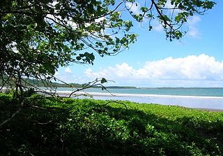
Laoang Sunset.jpg
Sunset at Laoang shoreline
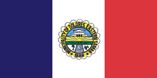
Flag of Laoang, Northern Samar.png
Ph locator northern samar laoang.png
Map of Northern Samar with Laoang highlighted
OpenStreetMap
Laoang
Philippines location map (square).svg
Red pog.svg
Laoang
Location within the Philippines
Coordinates: 12°34′N125°01′E / 12.57°N 125.02°E / 12.57; 125.02
Country Philippines
Region Eastern Visayas
Province Northern Samar
District 2nd district
Founded 1768
Barangays 56 (see Barangays)
Government
[1]
  Type Sangguniang Bayan
   Mayor Harris Christopher M. Ongchuan
   Vice Mayor Miguel L. Sarmiento
   Representative Jose L. Ong Jr.
  Councilors
List
   Electorate 38,574 voters (2022)
Area
[2]
  Total246.94 km2 (95.34 sq mi)
Elevation
7.0 m (23.0 ft)
Highest elevation
69 m (226 ft)
Lowest elevation
0 m (0 ft)
Population
 (2020 census) [3]
  Total60,607
  Density250/km2 (640/sq mi)
   Households
13,339
Demonym Laoangnon
Economy
   Income class 2nd municipal income class
   Poverty incidence
39.81
% (2018) [4]
   Revenue 232.8 million (2020)
   Assets 742.8 million (2020)
   Expenditure 134.1 million (2020)
   Liabilities 132.6 million (2020)
Service provider
  ElectricityNorthern Samar Electric Cooperative (NORSAMELCO)
Time zone UTC+8 (PST)
ZIP code
6411
PSGC
IDD : area code +63(0)55
Native languages Waray
Tagalog

Laoang, officially the Municipality of Laoang (Waray : Bungto han Laoang; Tagalog : Bayan ng Laoang), is a 2nd class municipality in the province of Northern Samar, Philippines. According to the 2020 census, it has a population of 61,607 people. [3]

Contents

It is the economic, educational, socio-cultural and government center of the 2nd district of the province.

History

Pre-Spanish Time

Written by: Rev.Msgr. Gaspar D. Balerite, H.P.S.Th.D., Vicar General-Diocese of Catarman [5]

In the pre-Hispanic times, the poblacion of Laoang was a settlement called Makarato [6] while the whole island was called Lawang which later on evolved into Laoang. According to Fr. Ignatius Alzina in his book Historia de las Islas y Indios de Bisayas, the settlement was ruled by a monarch called Dato Karagrag, whose consort Bingi had an irresistible beauty that captivated other neighbouring kings, especially the dato from Albay. (Fr. Alzina lived as missionary in Samar and Leyte for 38 years, from 1634 to 1674, working mostly in Palapag.) Contrary to the popular legend that the word “Laoang” is an evolution of the word “lawag”, Laoang as “Lawang” in 1800s maps may have its origin from early Indonesian settlers of the island. In Sumatra Island (now part of Indonesia), there is a village known Bukitlawang in the vicinity of Lake Toba; Samareños are fond of abbreviations and contractions, hence the current name

Then, describing the place of the settlement, Fr. Alzina in his visit to the place in 1640 says, “On the opposite side of Rawis, on the Lawang Island, which is a sandbar there is a solid ridge of rock. It is fashioned by nature itself and it is so steep that it looks like a façade of a wall… It was a natural fortification, due to its great height of massive rock; it was also secured as if by a moat which encircled its three sides. The fourth side was blocked by a palisade of strong logs. Then too, nature also formed on one side of this rock something like a small cove with its little beach.”

Historian William Henry Scott wrote that a “Samar datu by the name of Iberein was rowed out to a Spanish vessel anchored in his harbor in 1543 by oarsmen collared in gold; while wearing on his own person earrings and chains.” In the local epic called siday entitled Bingi of Lawan as written in the article of Scott, Lawan is a prosperous Lakanate in Samar. Datu Hadi Iberein came from the Lakanate of Lawan [7]

Christianization (Spanish Era)

The Christianisation of Laoang was as early as the evangelisation of the whole island, and began when Jesuit missionaries arrived in Tinago (now Dapdap in Tarangnan, Samar), on October 15, 1596. Soon after, the missionaries traversed the north-west of the island over the Gandara River and reached Ibabao in the north-east. They founded a mission station in Catubig (originally in Binongtoan, Las Navas). In 1605 the Catubig mission established other mission stations: in Rawis, Batac (Batag Island), Laoang, and Palapag. In 1606, the center of the Ibabao mission was moved from Catubig to Palapag. The mission center of Palapag was called Residencia de Cabo del Espritu Santo. In the 1650s Laoang became one of ten mission-stations covered by the Palapag Residencia which comprised stations from Bobon to Borongan.

On February 27, 1767, Charles III of Spain expelled the Society of Jesus from the Spanish Empire and all its territories including the Philippines. The order then left the colony in batches between August 1769 and January 1770, and were replaced by the Franciscans who arrived in Catbalogan on September 25, 1768. Rev. José Anda, SJ was the last Jesuit to minister in Laoang and Rev. Antonio Toledo, OFM took over administration of Laoang, with the titular St. Michael the Archangel upon his arrival in November 1768. In the same year, Pambujan was founded as a visita of Laoang (visita was the 17th-century ecclesiastical term for a village with a non-resident priest, similar to chapelries in Britain).

To prevent raids by Moro invaders, the Governor-General proposed in 1814 the construction of defensive plans. Rev. José Mata, parish priest of both Laoang and Palapag, was cited for being the first to have launched a construction of muralla in Laoang at his own expense. To ease the constant shuttling of the parish priest from Palapag to Laoang, the townspeople of Laoang petitioned for a permanent minister. During the tenure of Rev. Manuel Lozano in the 1840s, an earthquake damaged the parish church, which was renovated between 1848 and 1852 by Rev Sebastian Almonacid. He had the attached rectory fixed as well, and he directed the construction of the tribunal and schoolhouse using stone and wood.

On August 4, 1863, Pambujan seceded from Laoang. In 1869 a great fire broke out in the town and besides many other buildings, it consumed the entire roof and wooden materials of the church, belfry and convent. Five years later the church complex was reconstructed. By 1890, Laoang had the population of 5,384 in the población and a total of 2,754 in four visitas and eight barrios. The last Spanish parish priest of Laoang was Rev. Telesforo Acereda, after which the entire Philippine Islands were ceded by Spain to the United States of America in 1898.

In 1930s, a controversy broke out between the Catholic Church and civil authorities (by then separated by the American colonial government) when an organisation called "Dugo ni Rizal" insisted on erecting a statue of Dr. José Rizal on the plaza, land which the Church claimed. The case was brought to the court with Msgr. Sofronio Hacbang, Bishop of Samar and Leyte, acting as applicant-appellant. The Supreme Court en banc issued a decision on July 31, 1935, which confirmed that the lots presently occupied by the church, convent, auditorium, and plaza were ecclesiastical property. The presence of José Rizal's statue caused the plaza to be erroneously called “Plaza Rizal” for years, even though it had been called Plaza María since Spanish times. It is now called “Plaza Inmaculada Concepción” in honour of the Immaculate Conception, whose statue stands on the square's western side. In the 1970s, recognising the Church's ownership of the plaza, the civil government moved the statue of Rizal from the centre of the square to its present location on the eastern side.

When the Diocese of Catarman was formally created on March 11, 1975, Laoang became the center of the Vicariate of St. Thérèse of Child Jesus which comprised the other towns of Palapag, Catubig, Las Navas, Pambujan, and San Roque. When the diocese celebrated its 25th anniversary, two mission centers were created: Salvacion which covered all the barrios of Batag Island including Barangay Cahayagan; and Rawis which comprised all the surrounding barangays bordering on barrios on the right banks of the river going to Catubig.

The religiosity of Laoang is graced when one of its parish priests was proclaimed “Blessed” by Pope Benedict XVI on October 12, 2007. He was Fr. Angel Ranera, OFM, the parish priest of Laoang from 1924 till his return to Spain in 1929. [During the Spanish Civil War, he faced the firing squad of the rebels with two other priests on August 16, 1936.] The first council of the Knights of Columbus in Northern Samar was installed in Laoang in 1949, the Msgr. Diasnes Council. Since 1957 only in Laoang that a communitarian devotion to Mary, Barangay sang Birhen, is still being practiced without interruption. Immediately after the creation of the Diocese of Catarman one of the initial acts of the first diocesan bishop, Angel T. Hobayon, was to petition the Pope to grant a papal honor to the parish priest of Laoang with the title “Domestic Prelate,” to Potenciano Ortega. When the North of Samar celebrated its 400th year of Christianity, the Bishop again petitioned the Pope to grand Papal Honors with the title “Honorary Prelates” to three priests, two of them from Laoang: Msgr. Gaspar Balerite and Msgr. Romeo Infante. Of all the parishes in the whole island of Samar, Laoang has the most number of native priests: as of this writing, 37 priests in all. [8] [9] [10] [11] [12] [13] [14]

Geography

The municipality lies on the eastern side of the province. Bordering Pambujan in the west, Palapag facing east and the municipality of Catubig as its southern neighbor while the Philippine Sea stretches in the north.

Laoang is geographically divided into three distinct areas. The first is the lowlands of the mainland of Samar Island along the mouth of the Catubig River. The second is Laoang Island itself where the poblacion is situated, and the third is the Batag Island which forms as a natural barrier from the waters of the Pacific Ocean.

Climate

Climate data for Laoang, Northern Samar
MonthJanFebMarAprMayJunJulAugSepOctNovDecYear
Mean daily maximum °C (°F)27
(81)
27
(81)
28
(82)
29
(84)
30
(86)
30
(86)
30
(86)
30
(86)
29
(84)
29
(84)
28
(82)
27
(81)
29
(84)
Mean daily minimum °C (°F)23
(73)
22
(72)
22
(72)
23
(73)
24
(75)
24
(75)
24
(75)
24
(75)
24
(75)
24
(75)
24
(75)
23
(73)
23
(74)
Average precipitation mm (inches)105
(4.1)
67
(2.6)
65
(2.6)
53
(2.1)
86
(3.4)
129
(5.1)
135
(5.3)
113
(4.4)
131
(5.2)
163
(6.4)
167
(6.6)
162
(6.4)
1,376
(54.2)
Average rainy days17.613.215.514.919.624.326.625.424.925.422.920.9251.2
Source: Meteoblue [15]

Barangays

Laoang is politically subdivided into 56 barangays. Each barangay consists of puroks and some have sitios.

  • Abaton
  • Aguadahan
  • Aroganga
  • Atipolo
  • Bawang
  • Baybay (Poblacion)
  • Binatiklan
  • Bobolosan
  • Bongliw
  • Burabud (San Isidro)
  • Cabadiangan
  • Cabagngan
  • Cabago-an
  • Cabulaloan
  • Cagaasan
  • Cagdara-o
  • Cahayagan
  • Calomotan
  • Candawid
  • Cangcahipos
  • Canyomanao
  • Catigbian
  • E. J. Dulay
  • G. B. Tan
  • Gibatangan
  • Guilaoangi (Poblacion)
  • Inamlan (Gapas-gapas)
  • La Perla
  • Langob
  • Lawaan
  • Little Venice (Poblacion)
  • Magsaysay
  • Marubay
  • Mualbual
  • Napotiocan (Salvacion)
  • Oleras
  • Onay (Doña Luisa)
  • Palmera
  • Pangdan
  • Rawis (Agno)
  • Rombang
  • San Antonio (Son-og)
  • San Miguel Heights (Poblacion)
  • Sangcol
  • Sibunot
  • Simora
  • Santo Niño (Calintaan) Pob.
  • Suba
  • Tan-awan
  • Tarusan
  • Tinoblan
  • Tumaguingting (Poblacion)
  • Vigo
  • Yabyaban (San Vicente)
  • Yapas
  • Talisay

Demographics

Population census of Laoang
YearPop.±% p.a.
1903 8,636    
1918 11,508+1.93%
1939 19,736+2.60%
1948 29,748+4.66%
1960 41,158+2.74%
1970 37,382−0.96%
1975 42,498+2.61%
1980 46,545+1.84%
1990 42,048−1.01%
1995 47,438+2.29%
2000 54,523+3.03%
2007 56,196+0.42%
2010 58,037+1.18%
2015 61,359+1.07%
2020 60,607−0.24%
Source: Philippine Statistics Authority [16] [17] [18] [19]

Religion

Majority of the populace are Roman Catholic and is very religious. It has the most number (37) of ordained presbyters (including five monsignors) of the Roman Catholic Church in the whole region with the exception of the municipality of Villareal, Samar.

Economy

Laoang serves as the economic center of the Northeastern Pacific region.

Education

The municipality boasts for having three elementary school districts (two in the poblacion area), 13 secondary schools including one private-sectarian high school (Colegio de Santa Teresita) and a laboratory high school. The University of Eastern Philippines maintains one satellite branch.

Culture

Several festivities are celebrated throughout the year. In the 4th Sunday of January, they celebrate the feast of Santo Niño or the Child Jesus.

Flores De Mayo, like any other Philippine town, is also done in May and the town's fiesta is on September 28–29 in honor of its patron St. Michael the Archangel.

Its people shares its rich oral/written literature such as surumatanons and is handed down from the earliest inhabitants to the new generation.

Also popular are the kundimans in Waray version, sidays and individual compositions. One of this is the "Laoang Sunset" or "Sidsid San Adlaw Sa Laoang" composed by Bernardino Muncada which portrays the beauty of the town.

Tourism

Notable personalities

Notes

  1. Municipality of Laoang | (DILG)
  2. "2015 Census of Population, Report No. 3 – Population, Land Area, and Population Density" (PDF). Philippine Statistics Authority. Quezon City, Philippines. August 2016. ISSN   0117-1453. Archived (PDF) from the original on May 25, 2021. Retrieved July 16, 2021.
  3. 1 2 Census of Population (2020). "Region VIII (Eastern Visayas)". Total Population by Province, City, Municipality and Barangay. Philippine Statistics Authority . Retrieved 8 July 2021.
  4. "PSA Releases the 2018 Municipal and City Level Poverty Estimates". Philippine Statistics Authority. 15 December 2021. Retrieved 22 January 2022.
  5. A SHORT HISTORY OF LAOANG PARISH By Msgr. Gaspar D. Balerite, H.P., S.Th.D.://www.facebook.com/notes/laoang-tourism/a-short-history-of-laoang-parish-by-msgr-gaspar-d-balerite-hp-sthd/336397973141663/s
  6. Kobak, Cantius (2002). Historical Sketches of the Pueblos of Samar and Leyte: 1580-1900. Milwaukee, Wisconsin: Unpublished. pp. 445–477.
  7. Scott, William Henry (1985). Cracks in the parchment curtain and other essays in Philippine history. New Day Publishers. p.  93. ISBN   978-971-10-0073-8.
  8. Balerite, H.P., S.Th.D., Msgr. Gaspar D. (1996). "The History of the Church in the North of Samar (1596-2006)." North of Samar: 400 years of Christianization. Catarman.{{cite book}}: CS1 maint: location missing publisher (link) CS1 maint: multiple names: authors list (link)
  9. Balerite, J. (1990). History of Laoang 1600 - 1972. Laoang.{{cite book}}: CS1 maint: location missing publisher (link)
  10. Cruikshank, Bruce (1985). Quezon City: Historical Conservation Society.{{cite book}}: Missing or empty |title= (help)CS1 maint: location missing publisher (link)
  11. Guitay, J. F. (2011). The Franciscans in Samar: 1768-1898." Diocese of Calbayog:100 Years, The History of Local Church. Diocese of Calbayog, Samar. pp. 31–51.{{cite book}}: CS1 maint: location missing publisher (link)
  12. Nachura, R. Implantation of the Faith. 100 Years. Diocese of Calbayog. pp. 3–29.
  13. Pastrana, A. The Franciscans and the Evangelization of the Philippines (1578-1900). Boletin Ecclesiastico de Filipinas. Vol. XXXIX, No. 435. pp. 20–113.
  14. Schumacher, J. (1987). Reading in Philippine History. Quezon City: Loyola School of Theology.{{cite book}}: CS1 maint: location missing publisher (link)
  15. "Laoang, Northern Samar : Average Temperatures and Rainfall". Meteoblue. Retrieved 6 January 2019.
  16. Census of Population (2015). "Region VIII (Eastern Visayas)". Total Population by Province, City, Municipality and Barangay. Philippine Statistics Authority . Retrieved 20 June 2016.
  17. Census of Population and Housing (2010). "Region VIII (Eastern Visayas)" (PDF). Total Population by Province, City, Municipality and Barangay. National Statistics Office . Retrieved 29 June 2016.
  18. Censuses of Population (1903–2007). "Region VIII (Eastern Visayas)". Table 1. Population Enumerated in Various Censuses by Province/Highly Urbanized City: 1903 to 2007. National Statistics Office.{{cite encyclopedia}}: CS1 maint: numeric names: authors list (link)
  19. "Province of Northern Samar". Municipality Population Data. Local Water Utilities Administration Research Division. Retrieved 17 December 2016.
  20. "Poverty incidence (PI):". Philippine Statistics Authority. Retrieved December 28, 2020.
  21. "Estimation of Local Poverty in the Philippines" (PDF). Philippine Statistics Authority. 29 November 2005.
  22. "2003 City and Municipal Level Poverty Estimates" (PDF). Philippine Statistics Authority. 23 March 2009.
  23. "City and Municipal Level Poverty Estimates; 2006 and 2009" (PDF). Philippine Statistics Authority. 3 August 2012.
  24. "2012 Municipal and City Level Poverty Estimates" (PDF). Philippine Statistics Authority. 31 May 2016.
  25. "Municipal and City Level Small Area Poverty Estimates; 2009, 2012 and 2015". Philippine Statistics Authority. 10 July 2019.
  26. "PSA Releases the 2018 Municipal and City Level Poverty Estimates". Philippine Statistics Authority. 15 December 2021. Retrieved 22 January 2022.
  27. Sugbo, Victor, ed. (1995). Tinipigan: An Anthology of Waray Literature. Manila, Philippines: National Commission for Culture and the Arts. p. 272. OCLC   645852700 . Retrieved 27 September 2019.

Related Research Articles

<span class="mw-page-title-main">Northern Samar</span> Province in Eastern Visayas, Philippines

Northern Samar, officially the Province of Northern Samar, is a province in the Philippines located in the Eastern Visayas region. Its capital is Catarman and is located at the northern portion of the island of Samar. Bordering the province to the south are the provinces of Samar and Eastern Samar. To the northwest, across the San Bernardino Strait is Sorsogon; to the east is the Philippine Sea of the Pacific Ocean and to the west is Samar Sea.

<span class="mw-page-title-main">Samar (province)</span> Province in Eastern Visayas, Philippines

Samar, officially the Province of Samar, formerly named Western Samar, is a province in the Philippines located in the Eastern Visayas region. Its capital is the city of Catbalogan. It is bordered by Northern Samar, Eastern Samar, Leyte and Leyte Gulf, and includes several islands in the Samar Sea. Samar is connected to the island of Leyte via the San Juanico Bridge.

<span class="mw-page-title-main">San Julian, Eastern Samar</span> Municipality in Eastern Samar, Philippines

San Julian, officially the Municipality of San Julian, is a 5th class municipality in the province of Eastern Samar, Philippines. According to the 2020 census, it has a population of 14,800 people.

<span class="mw-page-title-main">Catarman, Northern Samar</span> Capital of Northern Samar, Philippines

Catarman, officially the Municipality of Catarman, is a 1st class municipality and capital of the province of Northern Samar, Philippines. According to the 2020 census, it has a population of 97,879 people.

<span class="mw-page-title-main">Zumarraga, Samar</span> Municipality in Samar, Philippines

Zumarraga, officially the Municipality of Zumarraga, is a 5th class island municipality in the province of Samar, Philippines. According to the 2020 census, it has a population of 16,279 people.

<span class="mw-page-title-main">Capul</span> Municipality in Northern Samar, Philippines

Capul, officially the Municipality of Capul, is a 5th class island municipality in the province of Northern Samar, Philippines. According to the 2020 census, it has a population of 12,323 people.

<span class="mw-page-title-main">Catubig</span> Municipality in Northern Samar, Philippines

Catubig, officially the Municipality of Catubig, is a 3rd class municipality in the province of Northern Samar, Philippines. According to the 2020 census, it has a population of 32,174 people.

<span class="mw-page-title-main">Gamay, Northern Samar</span> Municipality in Northern Samar, Philippines

Gamay, officially the Municipality of Gamay, is a 4th class municipality in the province of Northern Samar, Philippines. According to the 2020 census, it has a population of 23,367 people.

<span class="mw-page-title-main">Las Navas</span> Municipality in Northern Samar, Philippines

Las Navas, officially the Municipality of Las Navas, is a 4th class municipality in the province of Northern Samar, Philippines. According to the 2020 census, it has a population of 36,621 people.

<span class="mw-page-title-main">Lavezares</span> Municipality in Northern Samar, Philippines

Lavezares, officially the Municipality of Lavezares, is a 4th class municipality in the province of Northern Samar, Philippines. According to the 2020 census, it has a population of 29,390 people.

<span class="mw-page-title-main">Lope de Vega, Northern Samar</span> Municipality in Northern Samar, Philippines

Lope de Vega, officially the Municipality of Lope de Vega, is a 4th class municipality in the province of Northern Samar, Philippines. According to the 2020 census, it has a population of 14,690 people.

<span class="mw-page-title-main">Palapag</span> Municipality in Northern Samar, Philippines

Palapag, officially the Municipality of Palapag, is a 3rd class municipality in the province of Northern Samar, Philippines. According to the 2020 census, it has a population of 34,034 people.

<span class="mw-page-title-main">Pambujan</span> Municipality in Northern Samar, Philippines

Pambujan, officially the Municipality of Pambujan, is a 4th class municipality in the province of Northern Samar, Philippines. According to the 2020 census, it has a population of 35,532 people.

<span class="mw-page-title-main">San Antonio, Northern Samar</span> Municipality in Northern Samar, Philippines

San Antonio, officially the Municipality of San Antonio, is a 5th class municipality in the province of Northern Samar, Philippines. According to the 2020 census, it has a population of 8,882 people.

<span class="mw-page-title-main">Borongan</span> Capital of Eastern Samar, Philippines

Borongan, officially the City of Borongan, is a 1st class component city and capital of the province of Eastern Samar, Philippines. According to the 2020 census, it has a population of 71,961 people.

<span class="mw-page-title-main">Can-avid</span> Municipality in Eastern Samar, Philippines

Can-avid, officially the Municipality of Can-avid, is a 4th class municipality in the province of Eastern Samar, Philippines. According to the 2020 census, it has a population of 21,682 people.

<span class="mw-page-title-main">Dolores, Eastern Samar</span> Municipality in Eastern Samar, Philippines

Dolores, officially the Municipality of Dolores, is a 3rd class municipality in the province of Eastern Samar, Philippines. According to the 2020 census, it has a population of 44,626 people.

<span class="mw-page-title-main">Giporlos</span> Municipality in Eastern Samar, Philippines

Giporlos, officially the Municipality of Giporlos, is a 5th class municipality in the province of Eastern Samar, Philippines. According to the 2020 census, it has a population of 13,117 people.

<span class="mw-page-title-main">Palompon</span> Municipality in Leyte, Philippines

Palompon, officially the Municipality of Palompon, is a 2nd class municipality in the province of Leyte, Philippines. According to the 2020 census, it has a population of 58,313 people.

<span class="mw-page-title-main">Catbalogan</span> Capital of Samar, Philippines

Catbalogan, officially the City of Catbalogan, is a 5th class component city and capital city of the province of Samar, Philippines. According to the 2020 census, it has a population of 106,440 people.