
Robe is a town and fishing port located in the Limestone Coast of South Australia. The town's distinctive combination of historical buildings, ocean, fishing fleets, lakes and dense bush is widely appreciated. Robe lies on the southern shore of Guichen Bay, just off the Princes Highway. At the 2016 census, Robe had a population of 998. Robe is the main town in the District Council of Robe local government area. It is in the state electorate of MacKillop and the federal Division of Barker.
Taperoo is a suburb in the Australian state of South Australia located on the LeFevre Peninsula in the west of Adelaide about 18 kilometres (11 mi) north-west of the Adelaide city centre.

Enfield is a suburb in Adelaide, Australia. The suburb is about a 10-minute drive north from Adelaide's Central Business District. The suburb is bordered by Gepps Cross, Blair Athol and Clearview at the Northern end, and Prospect, Sefton Park and Broadview at the Southern end.

Kilburn is a suburb in the inner north of Adelaide, South Australia. The suburb borders Blair Athol, Gepps Cross, Wingfield, Regency Park and Prospect. Kilburn has the same postcode (5084) as Blair Athol and was previously known as 'Little Chicago' before its name was changed during the 20th century.
Regency Park is an inner-northern suburb of Adelaide, 6 km from the City Centre, in the state of South Australia, Australia. It is located in the City of Port Adelaide Enfield, and is adjacent to Wingfield, Angle Park, Ferryden Park, Kilburn, Prospect, Dudley Park and Croydon Park. It is bounded to the north by Grand Junction Road, east by the Gawler railway line, south by Regency Road and to the west by Days and South Roads. The postcode for Regency Park is 5010.

Port Noarlunga is a suburb in the City of Onkaparinga, South Australia. It is a small sea-side suburb, population 2,918, about 30 kilometres to the south of the Adelaide city centre and was originally created as a sea port. This area is now popular as a holiday destination or for permanent residents wishing to commute to Adelaide or work locally. There is a jetty that connects to a 1.6 kilometres long natural reef that is exposed at low tide. The beach is large and very long and has reasonable surfing in the South Port area whose name is taken from its location - "South of the Port".
Outer Harbor is a suburb in the Australian state of South Australia located at the northern tip of the Lefevre Peninsula about 22 kilometres (14 mi) north-west of the Adelaide city centre.

Semaphore is a northwestern suburb of Adelaide in the Australian state of South Australia. It is located on the Gulf St Vincent coastline of the Lefevre Peninsula about 14 kilometres (8.7 mi) from the Adelaide city centre.
Largs North is a suburb in the Australian state of South Australia located on the Lefevre Peninsula in the west of Adelaide about 17 kilometres (11 mi) northwest of the Adelaide city centre.
Peterhead is a north-western suburb of Adelaide 15 km from the CBD, on the LeFevre Peninsula, in the state of South Australia, Australia and falls under the City of Port Adelaide Enfield. It is adjacent to Largs Bay and Birkenhead. The postcode for Peterhead is 5016. It is bounded to the north by Wills Street, to the south by Hargrave Street and in the west and east by the Outer Harbor railway line and the Port River respectively.
Birkenhead is a north-western suburb of Adelaide 14 km from the CBD, on the Lefevre Peninsula, in South Australia, and lies within the City of Port Adelaide Enfield. It is adjacent to Peterhead, Exeter and Glanville. It is bounded to the south by the Gawler Reach of the Port River, to the north by Hargrave Street and in the west and east by the Outer Harbor railway line and the Port River respectively.

Exeter is a north-western suburb of Adelaide 14 km from the CBD, on the LeFevre Peninsula, in the state of South Australia, Australia and falls under the City of Port Adelaide Enfield. It is adjacent to Semaphore, Birkenhead, Largs Bay and Glanville. It is bounded to the south by Exmouth Road, to the north by Hargrave Street and in the east and west by the Outer Harbor railway line and Woolnough Road respectively.

For Pennshaw in the UK, see Penshaw

Mile End is an inner western suburb of Adelaide, located in the City of West Torrens, around 2 kilometres from the Adelaide city centre. It has a census area population of 4,413 people (2011). Much of the suburb is residential, but there are small commercial areas along Henley Beach Road and South Road.

Beachport is a small coastal town in the Australian state of South Australia about 311 kilometres (193 mi) south-east of the state capital of Adelaide and about 34 kilometres (21 mi) north-west of the municipal seat in Millicent, located at the northern end of Rivoli Bay. Beachport has a large crayfishing fleet, and is known for its 772-metre (2,533 ft)-long jetty, the second-longest in South Australia after the one at Port Germein.

Emu Bay is a locality in the Australian state of South Australia on the north coast of Kangaroo Island located about 124 kilometres (77 mi) south-west of the state capital of Adelaide and about located about 13 kilometres (8.1 mi) west of the municipal seat of Kingscote.
Queenstown is a north-western suburb of Adelaide about 10.5 km from the CBD, in the state of South Australia, Australia and the city council area of Port Adelaide Enfield.

Milang is a town and locality located in the Australian state of South Australia on the west coast of Lake Alexandrina about 71 kilometres (44 mi) south-east of the state capital of Adelaide and about 20 kilometres (12 mi) north-east of the municipal seat of Goolwa.

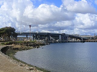
Torrens Island is a locality in the Australian state of South Australia located in the Adelaide metropolitan area within the estuary of the Port River about 16 kilometres north-west of the Adelaide city centre.

New Port is a north-western suburb of Adelaide.

