Leominster nunnery

Last updated

Coordinates: 52°13′47″N2°44′10″W / 52.229861°N 2.736134°W / 52.229861; -2.736134

Geographic coordinate system Coordinate system

A geographic coordinate system is a coordinate system that enables every location on Earth to be specified by a set of numbers, letters or symbols. The coordinates are often chosen such that one of the numbers represents a vertical position and two or three of the numbers represent a horizontal position; alternatively, a geographic position may be expressed in a combined three-dimensional Cartesian vector. A common choice of coordinates is latitude, longitude and elevation. To specify a location on a plane requires a map projection.

The (current) Priory Church building at Leominster Priory Church Leominster.JPG
The (current) Priory Church building at Leominster

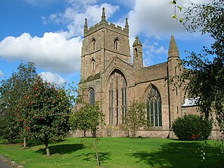
Leominster nunnery was an Anglo-Saxon nunnery at Leominster, Herefordshire, England. Founded in the ninth century, the nunnery is known to have been active in the eleventh century. [1] The exact location of the nunnery is not known, but it may have been the site later occupied by Leominster Priory, a twelfth-century foundation.

Leominster town in Herefordshire, England

Leominster is a market town in Herefordshire, England, at the confluence of the River Lugg and its tributary the River Kenwater 12 miles (19 km) north of Hereford and 7 miles south of Ludlow in Shropshire. With a population of 11,700, Leominster is the largest of the five towns in the county.

Herefordshire County of England

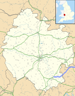
Herefordshire is a county in the West Midlands of England, governed by Herefordshire Council. It borders Shropshire to the north, Worcestershire to the east, Gloucestershire to the south-east, and the Welsh counties of Monmouthshire and Powys to the west.

England Country in north-west Europe, part of the United Kingdom

England is a country that is part of the United Kingdom. It shares land borders with Wales to the west and Scotland to the north-northwest. The Irish Sea lies west of England and the Celtic Sea lies to the southwest. England is separated from continental Europe by the North Sea to the east and the English Channel to the south. The country covers five-eighths of the island of Great Britain, which lies in the North Atlantic, and includes over 100 smaller islands, such as the Isles of Scilly and the Isle of Wight.

Related Research Articles

Malvern Hills District Non-metropolitan district in England

Malvern Hills is a local government district in Worcestershire, England. Its council is based in the town of Malvern, and its area covers most of the western half of the county, including the small towns of Tenbury and Upton. It was originally formed in 1974 and was subject to a significant boundary reform in 1998. In the 2011 census the population of the Malvern Hills district was 74,631.

Leominster (district) local government district in England

Leominster (district) was a local government district in England from 1 April 1974 to 1 April 1998 with its administrative seat in the town of Leominster.

Leominster (UK Parliament constituency) former UK Parliament constituency

Leominster was a parliamentary constituency represented until 1707 in the House of Commons of England, then until 1801 in that of Great Britain, and finally until 2010, when it disappeared in boundary changes, in the Parliament of the United Kingdom.

North Herefordshire (UK Parliament constituency) Parliamentary constituency in the United Kingdom

North Herefordshire is a constituency represented in the House of Commons of the UK Parliament since its 2010 creation by Bill Wiggin, a Conservative.

Orleton village in United Kingdom

Orleton is a small village in northern Herefordshire, England, at grid reference SO493672. The population of the civil parish at the 2011 census was 794.

Trumpet, Herefordshire village in United Kingdom

Trumpet or The Trumpet is a village in Herefordshire, England. The village is named after the timber-framed Trumpet Inn.

Mortimers Cross Water Mill

Mortimer's Cross Water Mill is an 18th-century watermill located on the River Lugg, 11 km (7 mi) northwest of Leominster, Herefordshire, England. It is owned by English Heritage and is in partial working order.

Priory Church, Leominster Church

The Priory Church is an Anglican parish church in Leominster, Herefordshire, England, dedicated to Saint Peter and Saint Paul. The building was constructed for a Benedictine Priory in about the 13th century, although there had been an Anglo-Saxon monastery in Leominster, possibly on the same site. In 1539 the east end of the church was destroyed along with most of the monastic buildings, but the main body of the church was preserved.

Leominster Abbey Medieval monastery and convent in Leominster, England

Leominster abbey was an Anglo-Saxon monastery established at Leominster in the county of Hereford, England. The name of the town refers to its minster, a settlement of clergy living a communal life.

Hatfield, Herefordshire village in United Kingdom

Hatfield is a small village near Leominster in Herefordshire, England. The Fair View caravan site in the village.

Croft Ambrey hillfort in Herefordshire

Croft Ambrey is a British Iron Age hill fort in northern Herefordshire, 10 kilometres (6 mi) north of Leominster close to the present day county border with South Shropshire.

Titley village in the United Kingdom

Titley is a village and civil parish in Herefordshire, England. It lies on the B4355 between Kington and Presteigne.

Lucton is a village near the town of Leominster in the county of Herefordshire, England. It is best known for being the location of Lucton School, an independent, mixed-gender day and boarding school.

Ivington Camp is an Iron Age hill fort located at Brierley, 3 km south of Leominster, Herefordshire.

Kingsland, Herefordshire village in the United Kingdom

Kingsland is a small village and civil parish in the English county of Herefordshire. It is located 5 kilometres (3 mi) north-west of Leominster. The population of the civil parish at the 2011 census was 986.

Grange Court former market hall, in Leominster, England

Grange Court is a former market hall in Leominster, Herefordshire, England. It was built in 1633 by John Abel, and moved to its present location in 1859. It was then used as a private house until the 1930s, and is now once again a civic building.

Pinsley Mill, also known as Etnam Street Mill, is a former watermill in Leominster, Herefordshire, England.

Leominster Museum Independent museum in Herefordshire, England

Leominster Museum, formerly known as Leominster Folk Museum, is an independent, volunteer-run, museum in Leominster, Herefordshire, England.

Eaton Hall is a two-storey building in Leominster in Herefordshire, 1 mile to the south-east of the village church. It was historically sited in the parish of Leominster Out. It was recorded in 1934 as being two-storey, with stone and timber-framed walls and slate and tile rooves. It is Grade II listed.

References

  1. "Herefordshire through time" . Retrieved June 1, 2012.