Lincoln Charter Township, Michigan

Last updated
Lincoln Charter Township, Michigan
Lincoln Township Seal.png
Lincoln Charter Township (Berrien), MI location.png
Location within Berrien County (red) and the administered village of Stevensville (pink)
USA Michigan location map.svg
Red pog.svg
Lincoln Township
Location within the state of Michigan
Coordinates: 42°01′27″N86°30′21″W / 42.02417°N 86.50583°W / 42.02417; -86.50583
Country United States
State Michigan
County Berrien
Area
  Total18.2 sq mi (47.2 km2)
  Land17.9 sq mi (46.4 km2)
  Water0.3 sq mi (0.8 km2)
Elevation
636 ft (194 m)
Population
 (2020)
  Total14,929
Time zone UTC-5 (Eastern (EST))
  Summer (DST) UTC-4 (EDT)
ZIP code(s)
49085, 49101, 49127
Area code 269
FIPS code 26-47600 [1]
GNIS feature ID1626619 [2]
Website Official website

Lincoln Charter Township is a charter township of Berrien County in the U.S. state of Michigan. The population was 14,929 at the 2020 census. [3]

Contents

Lincoln Charter Township is located in the west-central portion of Berrien County, with Lake Michigan to the west. The village of Shoreham and St. Joseph Charter Township are to the north, Royalton Township to the east, Baroda Township to the southeast and south, and Lake Charter Township to the south and southwest.

Communities

Geography

According to the United States Census Bureau, the township has a total area of 47.2 square miles (122 km2), of which 46.4 square miles (120 km2) is land and 0.8 square miles (2.1 km2), or 1.67%, is water. [5]

Interstate 94 passes through the western portion of the township. Grand Mere State Park is centered on the three Grand Mere Lakes and is home to sand dunes that range from 3,000 to 10,000 years old. The park lies between Stevensville and Lake Michigan.

Demographics

Historical population
CensusPop.Note
2000 13,952
2010 14,6915.3%
2020 14,9291.6%
Sources: [1] [5] [3]

As of the census [1] of 2000, there were 13,952 people, 5,486 households, and 3,999 families residing in the township. The population density was 778.2 inhabitants per square mile (300.5/km2). There were 5,992 housing units at an average density of 334.2 per square mile (129.0/km2). The racial makeup of the township was 95.62% White, 1.06% African American, 0.32% Native American, 1.39% Asian, 0.02% Pacific Islander, 0.59% from other races, and 1.00% from two or more races. Hispanic or Latino of any race were 1.30% of the population.

There were 5,486 households, out of which 34.2% had children under the age of 18 living with them, 62.8% were married couples living together, 7.7% had a female householder with no husband present, and 27.1% were non-families. 24.0% of all households were made up of individuals, and 9.6% had someone living alone who was 65 years of age or older. The average household size was 2.52 and the average family size was 3.00.

In the township the population was spread out, with 26.1% under the age of 18, 5.9% from 18 to 24, 28.2% from 25 to 44, 26.7% from 45 to 64, and 13.2% who were 65 years of age or older. The median age was 39 years. For every 100 females, there were 95.0 males. For every 100 females age 18 and over, there were 91.5 males.

The median income for a household in the township was $53,718, and the median income for a family was $64,211. Males had a median income of $48,571 versus $26,984 for females. The per capita income for the township was $27,559. About 1.3% of families and 2.7% of the population were below the poverty line, including 1.9% of those under age 18 and 5.0% of those age 65 or over.

Related Research Articles

Rutland Charter Township is a charter township of Barry County in the U.S. state of Michigan. The population was 4,136 at the 2020 census.

<span class="mw-page-title-main">Bainbridge Township, Michigan</span> Civil township in Michigan, United States

Bainbridge Township is a civil township of Berrien County in the U.S. state of Michigan. As of the 2010 census, the township population was 2,850. It was organized in 1837. The name is a transfer from Bainbridge, New York.

<span class="mw-page-title-main">Baroda Township, Michigan</span> Civil township in Michigan, United States

Baroda Township is a civil township of Berrien County in the U.S. state of Michigan. As of the 2010 census, the township population was 2,801.

<span class="mw-page-title-main">Berrien Township, Michigan</span> Civil township in Michigan, United States

Berrien Township is a civil township of Berrien County in the U.S. state of Michigan. As of the 2010 census, the township population was 5,084.

<span class="mw-page-title-main">Berrien Springs, Michigan</span> Village in Michigan, United States

Berrien Springs is a village in Berrien County in the U.S. state of Michigan. The population was 1,910 at the time of the 2020 census. The village is located within Oronoko Charter Township.

<span class="mw-page-title-main">Buchanan Township, Michigan</span> Civil township in Michigan, United States

Buchanan Township is a civil township of Berrien County in the U.S. state of Michigan. As of the 2010 census, the township population was 3,523. The city of Buchanan is located in the southeast portion of the township.

<span class="mw-page-title-main">Chikaming Township, Michigan</span> Civil township in Michigan, United States

Chikaming Township is a civil township of Berrien County in the U.S. state of Michigan. As of the 2010 census, the township population was 3,100. The township is located in the west central portion of the county. Lake Michigan lies to the northwest, Lake Township is to the north and northeast, Weesaw Township is to the east, Three Oaks Township is to the south, and New Buffalo Township is to the southwest.

<span class="mw-page-title-main">Coloma Charter Township, Michigan</span> Charter township in Michigan, United States

Coloma Charter Township is a charter township of Berrien County in the U.S. state of Michigan. The population was 5,051 at the 2020 census. The city of Coloma lies within the township.

<span class="mw-page-title-main">Eau Claire, Michigan</span> Village in Michigan, United States

Eau Claire is a village located in east central Berrien County in the U.S. state of Michigan. The population was 552 at the 2020 census.

<span class="mw-page-title-main">Fair Plain, Michigan</span> Census-designated place & unincorporated community in Michigan, United States

Fair Plain is an unincorporated community in Berrien County in the U.S. state of Michigan. It is a census-designated place (CDP) for statistical purposes and has no legal status as a municipality. The population was 7,631 at the 2010 census.

<span class="mw-page-title-main">Hagar Township, Michigan</span> Civil township in Michigan, United States

Hagar Township is a civil township of Berrien County in the U.S. state of Michigan. As of the 2010 census, the township population was 3,671.

<span class="mw-page-title-main">Lake Charter Township, Michigan</span> Charter township in Michigan, United States

Lake Charter Township is a charter township of Berrien County in the U.S. state of Michigan. The population was 3,316 at the 2020 census.

<span class="mw-page-title-main">Niles Charter Township, Michigan</span> Charter township in Michigan, United States

Niles Charter Township is a charter township of Berrien County in the U.S. state of Michigan. The population was 14,164 at the 2010 census.

<span class="mw-page-title-main">Oronoko Charter Township, Michigan</span> Charter township in Michigan, United States

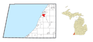
Oronoko Charter Township is a charter township of Berrien County in the U.S. state of Michigan. The population was 9,193 at the 2010 census.

<span class="mw-page-title-main">Royalton Township, Michigan</span> Civil township in Michigan, United States

Royalton Township is a civil township of Berrien County in the U.S. state of Michigan, a few miles southeast of the city of St. Joseph. The population was 4,766 at the 2010 census, up from 3,888 at the 2000 census. There are no incorporated municipalities in the township, but portions are considered to be part of the Benton Harbor/St. Joseph urban area. The unincorporated communities of Hollywood, Scottdale, Arden, and Buckhorn are within the township.

<span class="mw-page-title-main">St. Joseph Charter Township, Michigan</span> Charter township in Michigan, United States

St. Joseph Charter Township is a charter township of Berrien County in the U.S. state of Michigan. The population was 10,028 at the 2010 census. The township is on the shores of Lake Michigan in the west central portion of the county, south of and adjacent to the city of St. Joseph. The village of Shoreham, on Lake Michigan south of St. Joseph city, is the only incorporated community within the boundaries of the township. Both the village and township are bedroom communities for the city of St. Joseph.

<span class="mw-page-title-main">Stevensville, Michigan</span> Village in Michigan, United States

Stevensville is a village in Berrien County in the U.S. state of Michigan. The village lies within Lincoln Township. The population was 1,147 at the 2020 census.

<span class="mw-page-title-main">Weesaw Township, Michigan</span> Civil township in Michigan, United States

Weesaw Township is a civil township of Berrien County in the U.S. state of Michigan. The population was 1,936 at the 2010 census. The township was organized in 1837, and was named after Weesaw, a local Potawatomi chief.

<span class="mw-page-title-main">Georgetown Township, Michigan</span> Charter township in Michigan, United States

Georgetown Charter Township is a charter township of Ottawa County in the U.S. state of Michigan. The population was 46,985 at the time of the 2010 census. The city of Hudsonville is adjacent to the township and the unincorporated community of Jenison is within the township, which includes about half the township's population.

<span class="mw-page-title-main">Columbia Township, Van Buren County, Michigan</span> Township in Michigan, United States

Columbia Township is a civil township of Van Buren County in the U.S. state of Michigan. The population was 2,714 at the 2000 census, down to 2,588 at the 2010 census.

References

Notes

  1. 1 2 3 "U.S. Census website". United States Census Bureau . Retrieved 2008-01-31.
  2. U.S. Geological Survey Geographic Names Information System: Lincoln Charter Township, Michigan
  3. 1 2 "Lincoln charter township, Berrien County, Michigan - Census Bureau Profile". United States Census Bureau. Retrieved 8 March 2024.
  4. Romig 1986, p. 226.
  5. 1 2 "Geographic Identifiers: 2010 Demographic Profile Data (G001): Lincoln charter township, Berrien County, Michigan". U.S. Census Bureau, American Factfinder. Archived from the original on February 12, 2020. Retrieved January 8, 2014.

Sources