
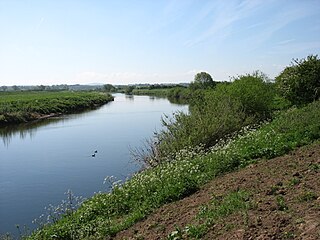
Carlisle is a city in Cumbria, England of which it is the county town and the administrative centre of the City of Carlisle district. Carlisle is located 8 miles (13 km) south of the Scottish border of which it is commonly referred to as a "border city ". The city is located at the confluence of the rivers Eden, Caldew and Petteril. It is the largest settlement in the county of Cumbria and serves as the administrative centre for both Carlisle City Council and Cumbria County Council. Carlisle is also in the historic county of Cumberland. At the time of the 2001 census, the population of Carlisle was 71,773, with 100,734 living in the wider city. In the 2011 census, the city's population had risen to 75,306, with 107,524 in the wider city.
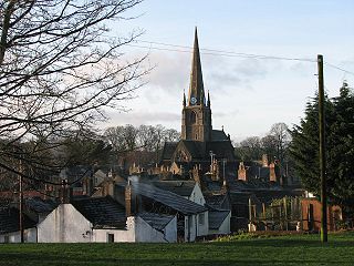
Cockermouth is a market town and civil parish in the Borough of Allerdale in Cumbria, England, so named because it is at the confluence of the River Cocker as it flows into the River Derwent. The mid-2010 census estimates state that Cockermouth has a population of 8,204, increasing to 8,761 at the 2011 Census.

Penrith is a market town and civil parish in the county of Cumbria, England, less than 3 miles (5 km) outside the Lake District National Park. It had a population of 15,181 at the 2011 Census. Historically in Cumberland, Penrith's local authority is currently Eden District Council, which is based in the town, as were the defunct Penrith Urban and Rural District councils. From 1974 to 2015, it was an unparished area with no local council. A civil parish was reintroduced as Penrith Town Council and first elected on 7 May 2015.
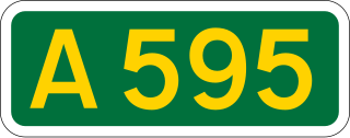
The A595 is a primary route in Cumbria, in Northern England that starts in Carlisle, passes through Whitehaven and goes close to Workington, Cockermouth and Wigton. It passes Sellafield and Ravenglass before ending at the Dalton-in-Furness by-pass, in southern Cumbria, where it joins the A590 trunk road. The road is mostly single carriageway, apart from in central Carlisle, where it passes the castle as a busy dual carriageway road named Castle Way, and prior to that as Bridge Street and Church Street, where it passes close to the McVitie's or Carr's biscuit factory. The Lillyhall bypass is also dual carriageway.

Haltwhistle is a market town and civil parish in Northumberland, England, 10 miles (16 km) east of Brampton. It had a population of 3,811 at the 2011 Census.
Orton is a village and civil parish in Cumbria, England. It lies 15 miles (24 km) south of Penrith, 8 miles (13 km) from Appleby-in-Westmorland and 1.5 miles (2.4 km) from the M6 motorway. The village is in the upper Lune Valley, at the foot of Orton Scar in the Orton Fells. The Lake District is nearby. The parish includes a wide area outside the village, and had a population of 594 in 2001, decreasing to 588 at the 2011 Census.

Hayton is a small village and civil parish in Cumbria, England, roughly 8 miles (13 km) east of Carlisle, and 10 miles (16 km) from the England/Scotland border. The population of the parish taken at the 2011 census was 2,222.

Hesket is a large civil parish in the Eden District of Cumbria, England, on the main A6 between Carlisle and Penrith. At the 2001 census it had a population of 2,363, increasing to 2,588 at the 2011 census, and estimated at 2,774 in 2019. The parish formed in 1894 with the passing of the Local Government Act 1894 and grew to embrace the parish of Plumpton Wall by a County Review Order in 1934. Hesket is part of the historic royal hunting ground of Inglewood Forest. Settlement hereabouts dates back to the Roman occupation.
Stanwix is a district of Carlisle, Cumbria in North West England. The ward population had a population taken at the 2011 census of 5,934. It is located on the north side of River Eden, across from Carlisle city centre. Although long counted as a suburb it did not officially become part of the city until 1912 when part of the civil parish of Stanwix became part of the parish, city and municipal borough of Carlisle. Further areas were added to the city, which was by then a county borough, in 1934 and 1951. The remaining part of the parish was eventually renamed Stanwix Rural in 1966.

Stanwix Rural is a civil parish in the City of Carlisle district of Cumbria, England, immediately to the north east of Carlisle itself – parts of the Carlisle urban area are in the parish boundaries.

Melmerby is a village and civil parish in the Eden district, in the county of Cumbria, England. It is a small village with a population of around 200. The village is 9 miles to the east of Penrith, a thriving community with immediate access to Junction 40 of the M6 motorway and a main line railway station serving London, Manchester, Edinburgh and Glasgow. Surrounded by countryside it sits between the North Pennines with its highest point, Cross Fell to the east and the World Heritage Lake District National Park 10 miles to the west. The River Eden is bridged about 4 miles (6.4 km) away at Langwathby, and Long Meg and Her Daughters, the 3,500-year-old stone circle – the second largest in the country – is nearby at Little Salkeld. In 1931 the parish had a population of 175.
Thursby is a village in the Allerdale borough of Cumbria, England. It is near to the city of Carlisle in North West England. Thurlby was historically part of Cumberland.
Park Broom is a hamlet in the civil parish of Stanwix Rural, in the Carlisle district, in the county of Cumbria, England. It is a few miles away from the small city of Carlisle and near the River Eden. It was formerly in the township of Linstock.

Whiteclosegate is a hamlet in the Carlisle district of the county of Cumbria, England.

Brunstock is a hamlet in the civil parish of Stanwix Rural, in the Carlisle district, in the county of Cumbria, England. Circa 1870, the township had a population of 84 as recorded in the Imperial Gazetteer of England and Wales.

Tarraby is a hamlet in the Carlisle district, in the county of Cumbria, England. Circa 1870, it had a population of 106 as recorded in the Imperial Gazetteer of England and Wales.

Johnby is a hamlet in the Eden District, in the English county of Cumbria. It is about 6 miles (9.7 km) from the large town of Penrith and about 1 mile (1.6 km) from the village of Greystoke. The B5305 road, the B5288 road, the A66 road and the M6 motorway are all nearby. Circa 1870, it had a population of 92 as recorded in the Imperial Gazetteer of England and Wales.

Nether Denton is a scattered settlement and civil parish in rural Cumbria, England, situated about 12 miles (19 km) north-east of Carlisle, by the A69 road. The population of the parish taken at the 2011 census was 415. Nether Denton is a couple of miles south-west of the village of Upper Denton. The parish contains the village of Low Row.

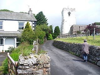
Scaleby is a village and civil parish in the English county of Cumbria. It is bounded on the north by Kirklinton and Irthington; whilst to the south lie Stanwix and Crosby-on-Eden. Scaleby is located six miles north-east of the city of Carlisle, and has a population of 349, falling slightly to 346 at the 2011 Census. Scaleby is located close to the M6 motorway making it relatively accessible to anyone interested in its two main attractions; Scaleby Castle and the Church of All Saints, the former having many links with notable names in history.
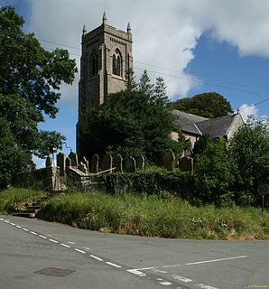
Stanwix Rural is a civil parish in the Carlisle district of Cumbria, England. It contains 63 listed buildings that are recorded in the National Heritage List for England. Of these, three are listed at Grade II*, the middle of the three grades, and the others are at Grade II, the lowest grade. The parish is to the northeast of the city of Carlisle, and contains the villages of Houghton, Low Crosby, High Crosby, Brunstock, Linstock, Tarraby, and Rickerby, and the surrounding countryside. The oldest two listed buildings originated as tower houses, and have since been extended and altered. Most of the listed buildings are country houses and smaller houses, some with associated structures, farmhouses and farm buildings. The other listed buildings include churches, milestones, a public house, schools, a war memorial, and an isolated tower.


