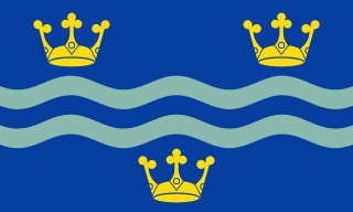
Cambridgeshire is a county in the East of England, bordering Lincolnshire to the north, Norfolk to the north-east, Suffolk to the east, Essex and Hertfordshire to the south, and Bedfordshire and Northamptonshire to the west. The city of Cambridge is the county town. Following the Local Government Act 1972 restructuring, modern Cambridgeshire was formed in 1974 through the amalgamation of two administrative counties: Cambridgeshire and Isle of Ely, comprising the historic county of Cambridgeshire ; and Huntingdon and Peterborough, comprising the historic county of Huntingdonshire and the Soke of Peterborough, historically part of Northamptonshire. Cambridgeshire contains most of the region known as Silicon Fen.

The historic counties of England are areas that were established for administration by the Normans, in many cases based on earlier kingdoms and shires created by the Angles, Saxons, Jutes, Celts and others. They are alternatively known as ancient counties, traditional counties, former counties or simply as counties. In the centuries that followed their establishment, as well as their administrative function, the counties also helped define local culture and identity. This role continued even after the counties ceased to be used for administration after the creation of administrative counties in 1889, which were themselves amended by further local government reforms in the years following.
The counties and areas for the purposes of the lieutenancies, also referred to as the lieutenancy areas of England and informally known as ceremonial counties, are areas of England to which lords-lieutenant are appointed. Legally, the areas in England, as well as in Wales and Scotland, are defined by the Lieutenancies Act 1997 as "counties and areas for the purposes of the lieutenancies in Great Britain", in contrast to the areas used for local government. They are also informally known as "geographic counties", to distinguish them from other types of counties of England.

Huntingdon and Peterborough was a short-lived administrative and geographical county in East Anglia in the United Kingdom. It existed from 1965 to 1974, when it became part of Cambridgeshire.

The Kent Downs is an Area of Outstanding Natural Beauty (AONB) in Kent, England. They are the eastern half of the North Downs and stretch from the London/Surrey borders to the White Cliffs of Dover, including a small section of the London Borough of Bromley. The AONB also includes the Greensand Ridge, a prominent sandstone escarpment which lies south of the chalk escarpment of the North Downs.

Stanground is a residential area in the city of Peterborough, Cambridgeshire in the United Kingdom. For electoral purposes it comprises Stanground South and Fletton & Stanground wards in North West Cambridgeshire constituency.
Metropolitan and non-metropolitan counties are one of the four levels of subdivisions of England used for the purposes of local government outside Greater London and the Isles of Scilly. As originally constituted, the metropolitan and non-metropolitan counties each consisted of multiple districts, had a county council and were also the counties for the purposes of Lieutenancies. Later changes in legislation during the 1980s and 1990s have resulted in counties with no county council and 'unitary authority' counties with no districts. Counties for the purposes of Lieutenancies are now defined separately, based on the metropolitan and non-metropolitan counties.

Covington is a village and civil parish in Cambridgeshire, England. Covington lies approximately 10 miles (16 km) west of Huntingdon near to Catworth and close to the county borders with both Bedfordshire and Northamptonshire. Covington is situated within Huntingdonshire which is a non-metropolitan district of Cambridgeshire as well as being a historic county of England. Covington. The civil parish covers an area of 1,294 acres. At the 2011 Census the population of the village was found to be less than 100 and was included in the civil parish of Tilbrook.
England is divided by a number of different regional schemes for various purposes. Since the creation of the Government Office Regions in 1994 and their adoption for statistical purposes in 1999, some historical regional schemes have become obsolete. However, many alternative regional designations also exist and continue to be widely used.

Wothorpe is a village and civil parish in the Peterborough unitary authority of Cambridgeshire, England. It is in the far north-west of the district, and to the south of Stamford. The parish borders Northamptonshire to the west.

The mountains and hills of the British Isles are categorised into various lists based on different combinations of elevation, prominence, and other criteria such as isolation. These lists are used for peak bagging, whereby hillwalkers attempt to reach all the summits on a given list, the oldest being the 282 Munros in Scotland, created in 1891.
The Pevsner Architectural Guides are a series of guide books to the architecture of Great Britain and Ireland. Begun in the 1940s by the art historian Sir Nikolaus Pevsner, the 46 volumes of the original Buildings of England series were published between 1951 and 1974. The series was then extended to Scotland, Wales and Ireland in the late 1970s. Most of the English volumes have had subsequent revised and expanded editions, chiefly by other authors.

Administrative counties were subnational divisions of England used for local government from 1889 to 1974. They were created by the Local Government Act 1888, which established an elected county council for each area. Some geographically large historic counties were divided into several administrative counties, each with its own county council. The administrative counties operated until 1974, when they were replaced by a system of metropolitan and non-metropolitan counties under the Local Government Act 1972.

Ely is a cathedral city in the East Cambridgeshire district of Cambridgeshire, England, about 14 miles (23 km) north-northeast of Cambridge and 80 miles (130 km) from London.
Provincial Grand Lodges are administrative subdivisions of a Grand Lodge. Under the jurisdiction of the United Grand Lodge of England they are the regional governing bodies of Freemasonry in England, Wales, the Isle of Man, and the Channel Islands.

