This is a list of rivers of Newfoundland and Labrador , Canada, divided by watershed. Nearly all watersheds in the province ultimately drain into the Atlantic Ocean.
In order from East to West:
Rivers listed from West to East:
In order from North to South:
In order from North to South:
Western Bay Brook Echre Pit Brook
Northern Bay BrookRivers listed from North to South

The Bay of Islands is an extensive inlet located on the west coast of the island of Newfoundland, in Canada. It is a sub-basin of the Gulf of St. Lawrence, consisting of many inlets such as Humber Arm and Goose Arm.

Division 1, Newfoundland and Labrador is a census division covering the entire Avalon Peninsula including the Isthmus of Avalon of the Canadian province of Newfoundland and Labrador. Like all census divisions in Newfoundland and Labrador, but unlike the census divisions of some other provinces, the division exists only as a statistical division for census data, and is not a political entity.

Grand Bank is a defunct provincial electoral district for the House of Assembly of Newfoundland and Labrador, Canada. Prior to the 1974 redistribution, the district was called Burin. The district was abolished in 2015 and replaced by Burin-Grand Bank.

Baie Verte-Green Bay is a provincial electoral district for the House of Assembly of Newfoundland and Labrador, Canada. As of 2011 it has 8,067 eligible voters. The district was redistributed in 2015.
The Straits – White Bay North is a defunct provincial electoral district for the House of Assembly of Newfoundland and Labrador, Canada. The district was known as Strait of Belle Isle prior to the 1996 election. In the 2007 redistribution, it added five per cent of St. Barbe. As of 2011, there are 6,851 eligible voters living within the district.
A barachois is a term used in Atlantic Canada, Saint Pierre and Miquelon, Réunion and Mauritius to describe a coastal lagoon partially or totally separated from the ocean by a sand or shingle bar. Sometimes the bar is constructed of boulders, as is the case at Freshwater Bay near St. John’s, Newfoundland. Salt water may enter the barachois during high tide.
St. George's Bay - informally referred to as Bay St. George due to its French translation Baie St-George - is a large bay in the province of Newfoundland and Labrador, Canada. It is located on the west coast of the island of Newfoundland and comprises a sub-basin of the Gulf of St. Lawrence.

Area code 709 is the telephone area code in the North American Numbering Plan (NANP) for the entire Canadian province of Newfoundland and Labrador.
The Burin Peninsula is a peninsula located on the south coast of the island of Newfoundland in the province of Newfoundland and Labrador. Marystown is the largest population centre on the peninsula.
The House of Assembly Channel is a cable television channel broadcast throughout much of Newfoundland and Labrador, exclusively on cable. The channel first signed on the air on November 17, 2001.
Nova Central School District was a school district headquartered in Gander in the Canadian province of Newfoundland and Labrador. The district had 66 schools located in 50 different communities, and served about 13,000 students, including a significant rural population. The District was formed by the merger of the Lewisporte-Gander and Baie Verte-Central-Connaigre school boards in 2004. The largest school in the district was Gander Academy. The district was replaced by the Newfoundland and Labrador English School District upon provincial amalgamation in 2013.
The East Coast Trail (ECT) is a long-distance coastal footpath located in the Canadian province of Newfoundland and Labrador. It is a developed trail over 336 kilometres (209 mi) long, creation of which began in 1994. It is made up of 25 linked wilderness paths and passes through more than 30 communities. It was named one of the best adventure destinations by National Geographic in 2012 and is extended and improved yearly.
St. Mary's Bay is one of many bays in Newfoundland, Canada, where bay is taken as a regional subdivision, somewhat along the lines of county divisions. It is the most southern and eastern of Newfoundland's major bays.

The Cape Shore is a region on the southwestern portion of the Avalon Peninsula on the island of Newfoundland, Canada.
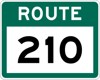
Route 210, also known as the Burin Peninsula Highway and Heritage Run, is a highway that extends through the Burin Peninsula from Goobies to Grand Bank, Newfoundland and Labrador. The maximum speed limit is 90 km/h except through communities and settlements where the speed limit is reduced to 50 km/h. Just after exiting Swift Current, until a few kilometres north of Marystown, much of the landscape is barren, with very few trees prevalent. After entering Marystown, motorists approach a junction where they could turn right to continue their journey on Route 210 until arriving at Grand Bank, or going straight onto Route 220 towards Burin and St. Lawrence. Marystown is the most populous community along the route.

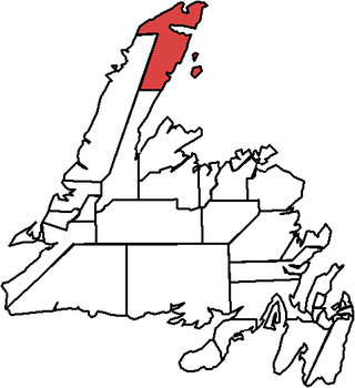
Route 430 is a 413-kilometre-long (257 mi) paved highway that traverses the Great Northern Peninsula of Newfoundland in the Canadian province of Newfoundland and Labrador. The route begins at the intersection of Route 1 in Deer Lake and ends in St. Anthony. Officially known as the Great Northern Peninsula Highway, it has been designated as the Viking Trail since it is the main auto route to L'Anse aux Meadows, the only proven Viking era settlement in North America. It is the primary travel route in the Great Northern Peninsula and the only improved highway between Deer Lake and St. Anthony. It is the main access route to the Labrador Ferry terminal in St. Barbe.
Division No. 1, Subdivision B is an unorganized subdivision on the Avalon Peninsula in Newfoundland and Labrador, Canada. It is in Division 1 and contains the unorganized communities of Iona, Little Barasway, Placentia Junction, Point Verde and Ship Harbour.