List of sovereign states and dependent territories in the Indian Ocean
Last updated
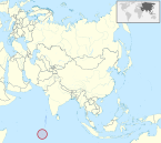
This list of sovereign states and dependent territories in the Indian Ocean consists of 38 countries, with 13 in Africa, 22 in Asia, and 1 in Oceania that either border on or are in the Indian Ocean, as well as 2 European countries which administer several dependencies or overseas territories in the region.
The entity listed below has declared itself to be a sovereign state and exercises control over some territory but has limited or no recognition from other states and is not a member state of the United Nations.
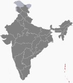
English: Andaman and Nicobar Islands — Union Territory of the Andaman and Nicobar Islands
Hindi: अंडमान व निकोबार द्वीप समूह — केंद्र शासित प्रदेश अंडमान और निकोबार द्वीप समूह (Andamaan Aur Nikobaar Dveep Samooh — Kendr Shaasit Pradesh Andamaan Aur Nikobaar Dveep Samooh)
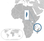
Djibouti is a country in the Horn of Africa bordered by Somaliland to the east, Eritrea to west and the Red Sea to the north, Ethiopia to the west and south, and the Gulf of Aden to the east.
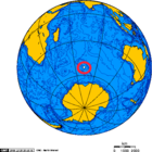
The Southern Hemisphere is the half (hemisphere) of Earth that is south of the Equator. It contains all or parts of five continents and four oceans, as well as New Zealand and most of the Pacific Islands in Oceania. Its surface is 80.9% water, compared with 60.7% water in the Northern Hemisphere, and it contains 32.7% of Earth's land.
This gallery of sovereign state flags shows the national or state flags of sovereign states that appear on the list of sovereign states. For flags of other entities, please see gallery of flags of dependent territories. Each flag is depicted as if the flagpole is positioned on the left of the flag, except for those of Iran, Iraq and Saudi Arabia which are depicted with the hoist to the right.
Greater Somalia sometimes called Greater Somaliland is the geographical location comprising the regions in the Horn of Africa in which ethnic Somalis live and have historically inhabited.
The Organisation of African, Caribbean and Pacific States is a group of countries in Africa, the Caribbean, and the Pacific that was created by the Georgetown Agreement in 1975. Formerly known as African, Caribbean and Pacific Group of States (ACP), the organisation's main objectives are sustainable development and poverty reduction within its member states, as well as their greater integration into the world's economy. All of the member states, except Cuba, are signatories to the Cotonou Agreement with the European Union.
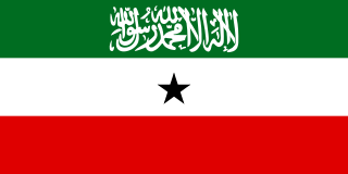
Foreign relations of the Republic of Somaliland are the responsibility of the Ministry of Foreign Affairs of the Republic of Somaliland. The region's self-declaration of independence remains unrecognised by the international community.
Somaliland, officially the State of Somaliland, was a short-lived independent country in the territory of the present-day unilaterally declared Republic of Somaliland, which regards itself as its legal successor. It existed on the territory of former British Somaliland for five days between 26 June 1960 and 1 July 1960, when it merged with the formerly Italian administered Trust Territory of Somaliland to form the Somali Republic.
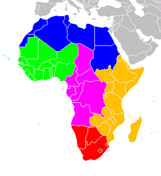
The following is an alphabetical list of subregions in the United Nations geoscheme for Africa, used by the United Nations and maintained by the UNSD department for statistical purposes.
This is a list of articles holding galleries of maps of present-day countries and dependencies. The list includes all countries listed in the List of countries, the French overseas departments, the Spanish and Portuguese overseas regions and inhabited overseas dependencies.
The following outline is provided as an overview and topical guide to Somaliland:
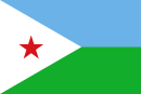
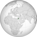
Djibouti, officially the Republic of Djibouti, is a country in the Horn of Africa, bordered by Somalia to the south, Ethiopia to the southwest, Eritrea in the north, and the Red Sea and the Gulf of Aden to the east. The country has an area of 23,200 km2 (8,958 sq mi).
Visa requirements for Afghan citizens are administrative entry restrictions by the authorities of other states placed on citizens of Afghanistan.
References
↑ "The Somali Republic shall have the following boundaries. (a) North; Gulf of Aden. (b) North West; Djibouti. (c) West; Ethiopia. (d) South south-west; Kenya. (e) East; Indian Ocean."
↑ Lacey, Marc (5 June 2006). The Signs Say Somaliland, but the World Says Somalia Archived 2011-05-30 at WebCite. The New York Times. Retrieved 2010-05-25.
↑ "UN in Action: Reforming Somaliland's Judiciary" (PDF). Archived (PDF) from the original on 2012-01-21. Retrieved 2012-05-29.
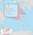
↑ The main station on the Îles Éparses is on Tromelin. The headquarters of the district chief, however, is Saint-Pierre, in Réunion.
↑ "French Southern and Antarctic Lands". Archived from the original on 2007-08-14. Retrieved 5 October 2014.
↑ TAAF Collectivity. "Présentation des territoires". taaf.fr (in French). Retrieved 19 October 2019.
↑ MWACHANG`A, DEVOTA (23 May 2014). "Kikwete to grace launch of 2012 statistics report". IPP Media.
This page is based on this Wikipedia article Text is available under the CC BY-SA 4.0 license; additional terms may apply. Images, videos and audio are available under their respective licenses.
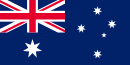
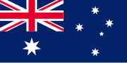
 Australia
  Bahrain
  Bangladesh
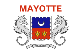
  Comoros
  Djibouti
  Egypt
Egypt  Eritrea
  France
  India
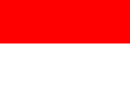
India  Indonesia
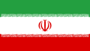
  Iran
Iran  Iraq
Iraq  Israel
  Jordan
  Kenya
Kenya  Kuwait
  Madagascar
  Malaysia
  Maldives
  Mauritius
  Mozambique
  Myanmar
  Oman
Oman  Pakistan
  Qatar
Qatar  Saudi Arabia
  Seychelles
  Singapore
  Somalia
  South Africa
  Sri Lanka
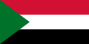
  Sudan
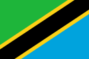
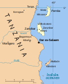
Sudan  Tanzania
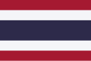
  Thailand
  Timor-Leste
  United Arab Emirates
  United Kingdom
  Yemen
Yemen