 | |
|---|---|
 |
This is a list of streets in San Francisco, California. They are grouped by type: arterial thoroughfares, commercial corridors, and other streets.
| | |
|---|---|
| |
This is a list of streets in San Francisco, California. They are grouped by type: arterial thoroughfares, commercial corridors, and other streets.

The Richmond District is a neighborhood in the northwest corner of San Francisco, California, developed initially in the late 19th century. It is sometimes confused with the city of Richmond, which is 20 miles (32 km) northeast of San Francisco.

Lombard Street is an east–west street in San Francisco, California that is famous for a steep, one-block section with eight hairpin turns. Stretching from The Presidio east to The Embarcadero, most of the street's western segment is a major thoroughfare designated as part of U.S. Route 101. The famous one-block section, claimed to be "the crookedest street in the world", is located along the eastern segment in the Russian Hill neighborhood. It is a major tourist attraction, receiving around two million visitors per year and up to 17,000 per day on busy summer weekends, as of 2015.

The Central Freeway is a roughly one-mile (1.5 km) elevated freeway in San Francisco, California, United States, connecting the Bayshore/James Lick Freeway with the Hayes Valley neighborhood. Most of the freeway is part of US 101, which exits at Mission Street on the way to the Golden Gate Bridge. The freeway once extended north to Turk Street, and initially formed part of a loop around downtown, but was damaged along with the Embarcadero in the 1989 Loma Prieta earthquake; both highways have since been replaced with the surface-level Octavia Boulevard and Embarcadero, respectively.

Hayes Valley is a neighborhood in the Western Addition district of San Francisco, California. It is located between the historical districts of Alamo Square and the Civic Center. Victorian, Queen Anne, and Edwardian townhouses are mixed with high-end boutiques, restaurants, and public housing complexes. The neighborhood gets its name from Hayes Street, which was named for Thomas Hayes, San Francisco's county clerk from 1853 to 1856 who also started the first Market Street Railway franchise.
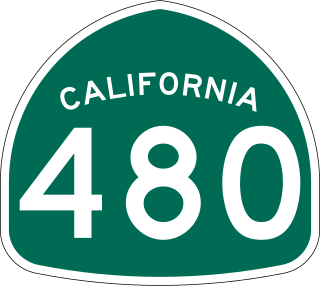
State Route 480 was a state highway in San Francisco, California, United States, consisting of the elevated double-decker Embarcadero Freeway, the partly elevated Doyle Drive approach to the Golden Gate Bridge and the proposed and unbuilt section in between. The unbuilt section from Doyle Drive to Van Ness Avenue was to have been called the Golden Gate Freeway and the Embarcadero Freeway as originally planned would have extended from Van Ness along the north side of Bay Street and then along the Embarcadero to the San Francisco-Oakland Bay Bridge.

Geary Boulevard is a major east–west 5.8-mile-long (9 km) thoroughfare in San Francisco, California, United States, beginning downtown at Market Street near Market Street's intersection with Kearny Street, and running westbound through downtown, the Civic Center area, the Western Addition, and running for most of its length through the predominantly residential Richmond District. Geary Boulevard terminates near Sutro Heights Park at 48th Avenue, close to the Cliff House above Ocean Beach at the Pacific Ocean. At 42nd Avenue, Geary intersects with Point Lobos Avenue, which takes through traffic to the Cliff House, Ocean Beach and the Great Highway. It is a major commercial artery through the Richmond District; it is lined with stores and restaurants, many of them catering to the various immigrant groups who live in the area. The boulevard borders Japantown between Fillmore and Laguna Streets.

The Fillmore West was a historic rock and roll music venue in San Francisco, California, US which became famous under the direction of concert promoter Bill Graham from 1968 to 1971. Named after The Fillmore at the intersection of Fillmore Street and Geary Boulevard, it stood at the southwest corner of Market Street and South Van Ness Avenue in the Civic Center district. In June 2018, the top two floors of the building reopened as SVN West, a new concert and corporate event venue.

Octavia Boulevard is a major street in San Francisco, California, that replaced the Hayes Valley portion of the damaged two-level Central Freeway. Once a portion of Octavia Street alongside shadowy, fenced-off land beneath the elevated U.S. Route 101 roadway, Octavia Boulevard was redeveloped and redesigned upon the suggestion of Mark Jolles of San Francisco.

People in the San Francisco Bay Area rely on a complex multimodal transportation infrastructure consisting of roads, bridges, highways, rail, tunnels, airports, seaports, and bike and pedestrian paths. The development, maintenance, and operation of these different modes of transportation are overseen by various agencies, including the California Department of Transportation (Caltrans), the Association of Bay Area Governments, San Francisco Municipal Transportation Agency, and the Metropolitan Transportation Commission. These and other organizations collectively manage several interstate highways and state routes, eight passenger rail networks, eight trans-bay bridges, transbay ferry service, local and transbay bus service, three international airports, and an extensive network of roads, tunnels, and bike paths.
U.S. Route 101 (US 101) is a major north–south United States Numbered Highway, stretching from Los Angeles, California, to Tumwater, Washington. The California portion of US 101 is one of the last remaining and longest U.S. Routes still active in the state, and the longest highway of any kind in California. US 101 was also one of the original national routes established in 1926. Significant portions of US 101 between the Los Angeles area and the San Francisco Bay Area follow El Camino Real, the commemorative route connecting the former Alta California's 21 missions.
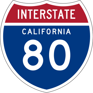
Interstate 80 (I-80) is a transcontinental Interstate Highway in the United States, stretching from San Francisco, California, to Teaneck, New Jersey. The segment of I-80 in California runs east from San Francisco across the San Francisco–Oakland Bay Bridge to Oakland, where it turns north and crosses the Carquinez Bridge before turning back northeast through the Sacramento Valley. I-80 then traverses the Sierra Nevada, cresting at Donner Summit, before crossing into the state of Nevada within the Truckee River Canyon. The speed limit is at most 65 mph (105 km/h) along the entire route instead of the state's maximum of 70 mph (110 km/h) as most of the route is in either urban areas or mountainous terrain. I-80 has portions designated as the Eastshore Freeway and Alan S. Hart Freeway.
The 49-Mile Scenic Drive is a designated scenic road tour highlighting much of San Francisco, California. It was created in 1938 by the San Francisco Down Town Association to showcase the city's major attractions and natural beauty during the 1939 Golden Gate International Exposition.

Lower Pacific Heights, also known as Upper Fillmore, is a neighborhood in San Francisco, California, between Pacific Heights, the Fillmore District, Laurel Heights, and Japantown. The neighborhood is centered on the commercial corridor of Fillmore Street between California and Post streets, with California Street to the north, Geary Boulevard to the south, Presidio Avenue to the west, and Van Ness Avenue to the east.

Van Ness Bus Rapid Transit is a bus rapid transit (BRT) corridor on Van Ness Avenue in San Francisco, California, United States. The 1.96-mile (3.15 km) line, which runs between Mission Street and Lombard Street, has dedicated center bus lanes and nine stations. It was built as part of the $346 million Van Ness Improvement Project, which also included utility replacement and pedestrian safety features. Van Ness Bus Rapid Transit is used by several San Francisco Municipal Railway (Muni) lines including the 49 Van Ness–Mission, as well as three Golden Gate Transit routes.
Park Presidio Boulevard is a road and park in San Francisco, California which connects Golden Gate Park to the Presidio of San Francisco. It carries California State Route 1 along its entire route.
The Geary Subway is a proposed rail tunnel underneath Geary Boulevard in San Francisco, California. Several plans have been put forward as early as the 1930s to add a grade separated route along the corridor for transit. San Francisco Municipal Railway bus routes on the street served 52,900 daily riders in 2019, the most of any corridor in the city.
| Numbered streets |  | |
|---|---|---|
| North–south streets |
| |
| East–west streets | ||
| Diagonal streets | ||
| Alleyways | ||