Little Charity Island

Last updated
Little Charity Island
USA Michigan location map.svg
Red pog.svg
Little Charity Island
Geography
Location Saginaw Bay
Coordinates 44°00′09″N83°27′58″W / 44.00250°N 83.46611°W / 44.00250; -83.46611 Coordinates: 44°00′09″N83°27′58″W / 44.00250°N 83.46611°W / 44.00250; -83.46611
Area5.4 acres (2.2 ha)
Administration
State Michigan
County Arenac County
Township Sims Township
Demographics
PopulationUninhabited

Little Charity Island is a small island in Saginaw Bay, Lake Huron. The 5.4-acre (0.02 km2) island is located in Sims Township, Arenac County in the U.S. state of Michigan. Acquired by the U.S. Fish and Wildlife Service in 1999, it is administered by staff from the Seney National Wildlife Refuge as a unit of the Michigan Islands National Wildlife Refuge.

Island Any piece of sub-continental land that is surrounded by water

An island or isle is any piece of sub-continental land that is surrounded by water. Very small islands such as emergent land features on atolls can be called islets, skerries, cays or keys. An island in a river or a lake island may be called an eyot or ait, and a small island off the coast may be called a holm. A grouping of geographically or geologically related islands is called an archipelago, such as the Philippines.

Saginaw Bay bay within Lake Huron in eastern Michigan

Saginaw Bay is a bay within Lake Huron located on the eastern side of the U.S. state of Michigan. It forms the space between Michigan's Thumb region and the rest of the Lower Peninsula of Michigan. Saginaw Bay is 1,143 square miles (2,960 km2) in area. It is located in parts of five Michigan counties: Arenac, Bay, Huron, Iosco, and Tuscola.

Lake Huron one of the Great Lakes of North America

Lake Huron is one of the five Great Lakes of North America. Hydrologically, it comprises the easterly portion of Lake Michigan–Huron, having the same surface elevation as its westerly counterpart, to which it is connected by the 5-mile-wide (8.0 km), 20-fathom-deep Straits of Mackinac. It is shared on the north and east by the Canadian province of Ontario and on the south and west by the state of Michigan in the United States. The name of the lake is derived from early French explorers who named it for the Huron people inhabiting the region. The Huronian glaciation was named due to evidence collected from Lake Huron region. The northern parts of the lake include the North Channel and Georgian Bay. Across the lake to the southwest is Saginaw Bay. The main inlet is the St. Marys River, and the main outlet is the St. Clair River.

Little Charity Island is located in the middle of the bay, inland from its larger neighbor, Big Charity Island. It rises approximately halfway between "Point Lookout" to the northwest and "Sand Point" to the southeast. The island is home to some riparian tree life, and is home to colonial-nesting waterbirds, including double-crested cormorants. Many bay fishermen use the island as a navigation point.

Charity Island (Michigan) island in the United States of America

Charity Island, sometimes called Big Charity Island, is the largest island in Saginaw Bay, in the Michigan waters of Lake Huron. The island is 222 acres (0.90 km2) in area and has about 3 miles (4.8 km) of shoreline. It is part of Whitney Township, in Arenac County.

Double-crested cormorant species of bird

The double-crested cormorant is a member of the cormorant family of seabirds. Its habitat is near rivers and lakes as well as in coastal areas, and is widely distributed across North America, from the Aleutian Islands in Alaska down to Florida and Mexico. Measuring 70–90 cm (28–35 in) in length, it is an all-black bird which gains a small double crest of black and white feathers in breeding season. It has a bare patch of orange-yellow facial skin. Five subspecies are recognized. It mainly eats fish and hunts by swimming and diving. Its feathers, like those of all cormorants, are not waterproof and it must spend time drying them out after spending time in the water. Once threatened by the use of DDT, the numbers of this bird have increased markedly in recent years.

Navigation The process of monitoring and controlling the movement of a craft or vehicle from one place to another

Navigation is a field of study that focuses on the process of monitoring and controlling the movement of a craft or vehicle from one place to another. The field of navigation includes four general categories: land navigation, marine navigation, aeronautic navigation, and space navigation.

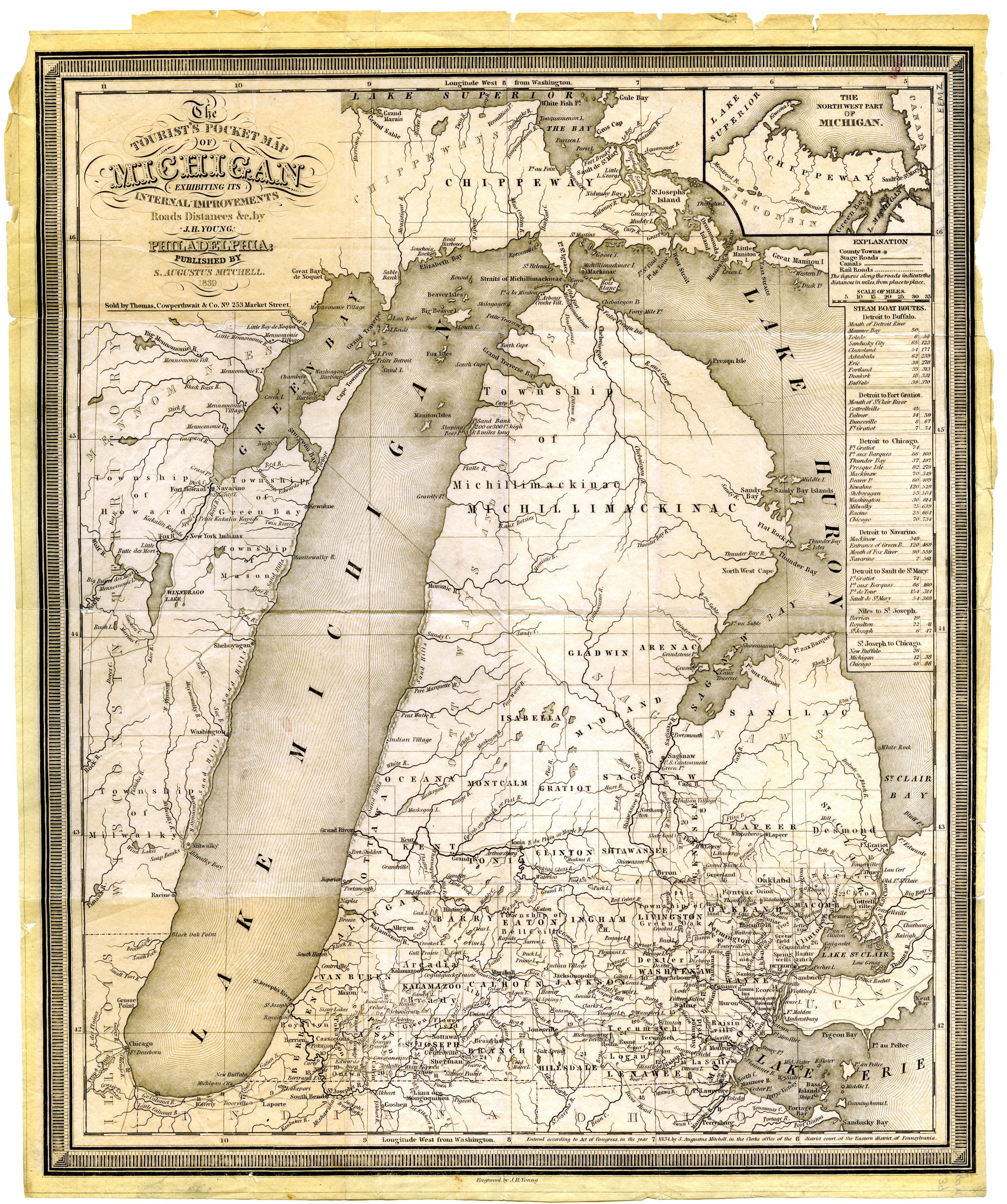
Little Charity Island was once called Ile de Traverse, according to an 1839 map of Michigan. [1] In the 19th century and early 20th century Little Charity was owned by Bay Port Fish Company, a commercial fishing company in Saginaw Bay, for its riparian water rights. After the 1940s, when Michigan law changed, the island was sold as were other islands in the bay.[ citation needed ]

Riparian water rights is a system for allocating water among those who possess land along its path. It has its origins in English common law. Riparian water rights exist in many jurisdictions with a common law heritage, such as Canada, Australia, and states in the eastern United States.

Related Research Articles

Shiawassee National Wildlife Refuge

The Shiawassee National Wildlife Refuge is a 9,870.35 acres (39.9439 km2) National Wildlife Refuge in Saginaw County managed by the United States Fish and Wildlife Service. It is located in the central portion of the lower peninsula of the U.S. state of Michigan, approximately 25 miles (40 km) south of the Saginaw Bay in Lake Huron and five miles (8 km) south of the city of Saginaw in the county's Spaulding and James townships. It was established in 1953 to provide habitat for migratory waterfowl.

Detroit River International Wildlife Refuge the only international wildlife refuge in North America, jointly administered by US and Canadian federal authorities

The Detroit River International Wildlife Refuge is the only international wildlife refuge in North America. It was established in 2001 and is managed jointly by the United States Fish and Wildlife Service and the Canadian Wildlife Service. It is situated in the heart of a major metropolitan area. Detroit River International Wildlife Refuge is one of over 540 National Wildlife Refuges managed by the U.S. Fish and Wildlife Service within the Department of the Interior. It occupies 7.88 square miles (20.42 km2) of scattered property but has drawn boundaries for further expansion.

Don Edwards San Francisco Bay National Wildlife Refuge United States National Wildlife Refuge

Don Edwards San Francisco Bay National Wildlife Refuge (DESFBNWR) is a United States National Wildlife Refuge located in the southern part of San Francisco Bay, California. The Refuge headquarters and visitor center is located in the Baylands district of Fremont, next to Coyote Hills Regional Park, in Alameda County. The visitor center is on Marshlands Rd, off Thornton Ave.

Back Bay National Wildlife Refuge Wildlife reserve in Virginia, US

Back Bay National Wildlife Refuge in southeastern Virginia is located in the independent city of Virginia Beach. Established in 1938 in an isolated portion of the former Princess Anne County, it is managed by the U.S. Fish & Wildlife Service. The administrative office is located on Sandbridge Road at Sigma between Lago Mar and Sandbridge Beach. The Visitor Contact Center is accessed via Sandpiper Road from the Sandbridge area of Virginia Beach, which is the southernmost area of development on the Atlantic Coast of Virginia.

Michigan Islands National Wildlife Refuge

The Michigan Islands National Wildlife Refuge is a designation for eight Michigan islands in the North American Great Lakes. Owned by the United States federal government, they were set aside for ecosystem protection purposes by President Franklin D. Roosevelt 1943.

Seal Beach National Wildlife Refuge

The Seal Beach National Wildlife Refuge is a wildlife refuge encompassing 965 acres (3.91 km2) located in the California coastal community of Seal Beach. Although it is located in Orange County it is included as part of the San Diego National Wildlife Refuge Complex. It was established in 1972.

The Oregon Coast National Wildlife Refuge Complex consists of six National Wildlife Refuges along the Oregon Coast. It provides wilderness protection to thousands of small islands, rocks, reefs, headlands, marshes, and bays totaling 371 acres spanning 320 miles (515 km) of Oregon's coastline. The areas are all managed by the United States Fish and Wildlife Service.

Bandon Marsh National Wildlife Refuge

Bandon Marsh National Wildlife Refuge is a U.S. National Wildlife Refuge on Oregon's coast. It is one of six National Wildlife Refuges comprising the Oregon Coast National Wildlife Refuge Complex and is renowned among bird watchers for being able to view rare shorebirds including ruff, Hudsonian godwit, and Mongolian plover. The refuge was last expanded in 1999, it now has 889 acres (3.60 km2) in two units: Bandon Marsh and Ni-les'tun.

Siletz Bay National Wildlife Refuge

Siletz Bay National Wildlife Refuge is a U.S. National Wildlife Refuge on Oregon's coast. It is one of six National Wildlife Refuges (NWRs) comprising the Oregon Coast National Wildlife Refuge Complex. The refuge consists of several discontinuous tracts north and south of the Siletz River where it enters Siletz Bay south of Lincoln City. Previously closed to public use, excluding viewing from outside the refuge boundaries and during special events, the refuge now has a boat launch offering access to non-motorized boats. Alder Island Nature Trail caters to visitors on foot, opened in 2017, and is 0.85 miles (1.37 km) round trip.

Harbor Island National Wildlife Refuge

The Harbor Island National Wildlife Refuge is a 695-acre (281 ha) horseshoe-shaped island and National Wildlife Refuge in Potagannissing Bay north of Drummond Island in the U.S. state of Michigan. The island was acquired in 1983 by the United States Fish and Wildlife Service from its previous owner, the Nature Conservancy, and set aside as a refuge. It is located in Drummond Township, in Chippewa County.

Sachuest Point National Wildlife Refuge

Occupying a peninsula between the Sakonnet River and Rhode Island Sound, the 242-acre (0.98 km2) Sachuest Point National Wildlife Refuge is a very popular site for the over 65,000 annual visitors each year. It is located in the southeasternmost part of the Town of Middletown.

Franz Lake National Wildlife Refuge

Franz Lake National Wildlife Refuge is located in southwest Washington State, within the Columbia River Gorge National Scenic Area. The refuge provides a variety of habitats including riparian wetlands, Columbia River riparian corridor blocks, transitional woodlands from lower elevation willows, and cottonwoods to mid-elevation old-growth fir and cedar with associated native understory shrubs, open meadows, and numerous streams and seeps.

McNary National Wildlife Refuge

McNary National Wildlife Refuge is a wildlife preserve, one of the national wildlife refuges operated by the United States Fish and Wildlife Service. Extending along the east bank of the Columbia River in southeastern Washington, from the confluence of the Snake River to the mouth of the Walla Walla River, and downstream into Oregon, McNary NWR is located in rural Burbank, but very close to the rapid development of the Tri-Cities. In fact, the refuge meets the definition of an "urban refuge." Few areas in North America support waterfowl populations in the extraordinary numbers found here. Visitors enjoy spectacular concentrations of Canada geese, mallards, and other waterfowl. More than half the mallards in the Pacific Flyway overwinter at some time in this portion of the Columbia River Basin.

Green Bay National Wildlife Refuge

Green Bay National Wildlife Refuge is a National Wildlife Refuge of the United States located in the state of Wisconsin. It includes three islands in Lake Michigan: Hog Island, Plum Island, and Pilot Island. The islands are near Washington Island off the tip of the Door Peninsula of Wisconsin.

Sacramento River National Wildlife Refuge

Sacramento River National Wildlife Refuge is located along the Sacramento River in the Sacramento Valley of California. Landscape is very flat, bordered by the Sierra and Coast ranges, with intensive agriculture. This riparian community is one of the most important wildlife habitats in California and North America.

Long Island National Wildlife Refuge Complex is a National Wildlife Refuge complex in the state of New York. All of the component refuges are located on Long Island.

Wisconsin Islands Wilderness

The Wisconsin Islands Wilderness is a 29-acre (12 ha) wilderness area located in Door County in northeastern Wisconsin. It is one of the smallest wilderness areas in the United States. Managed by the U.S. Fish & Wildlife Service, the wilderness area is composed of three islands in Lake Michigan.

References