The North Shore is one of the major geographical regions of Auckland, the largest city in New Zealand. The area is defined as the northern shores of the Waitematā Harbour as far north as the Ōkura River.

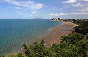
East Coast Bays is a string of small suburbs that form the northernmost part of the North Shore, part of the contiguous Auckland metropolitan area in New Zealand. The suburbs line the north-east coast of the city along the shore of the Hauraki Gulf and Rangitoto Channel. They include, from north to south, Long Bay, Torbay, Waiake Bay, Browns Bay, Rothesay Bay, Murrays Bay, Mairangi Bay, Campbells Bay and Castor Bay. Most of the East Coast Bays are covered under the East Coast Bays subdivision of the Hibiscus and Bays local board area.
Torbay is a northern suburb of Auckland, New Zealand. It is located in the upper East Coast Bays of the city's North Shore, and is governed by Auckland Council.

Mechanics Bay is a reclaimed bay on the Waitematā Harbour in Auckland, New Zealand. It is also the name of the area of the former bay that is now mainly occupied by commercial and port facilities. Sometimes the bay formed between Tāmaki Drive and the western reclamation edge of Fergusson Container Terminal is also referred to as Mechanics Bay.

The Hibiscus Coast is a populated area on a stretch of the Hauraki Gulf coast in New Zealand's Auckland Region. It has a population of 63,400, making it the 10th most populous urban area in New Zealand, and the second most populous in the Auckland Region, behind Auckland itself.

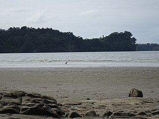
The Ōkura River, also known as the Ōkura Estuary, is a river in the north of the Auckland Region in the North Island of New Zealand. The river rises in the low hills to the south of Silverdale and flows into Karepiro Bay on the Hauraki Gulf / Tīkapa Moana. The river is extremely tidal with only a narrow channel being navigable by small craft at low tide. The area is popular for horse riding, riders wait till low tide and then ford the boating channel to ride the estuary and beaches on the northern side.
Ōkura is a northern suburb of the North Shore, part of the contiguous metropolitan area in Auckland, New Zealand. It is under the local governance of the Auckland Council. The official name is spelled with a macron.

Tāwharanui Peninsula is a finger of land projecting into the Hauraki Gulf from the east coast of the much larger North Auckland Peninsula of New Zealand. It separates Ōmaha Bay to the north from Kawau Bay and Kawau Island to the south. The nearest sizable town is Warkworth.

Long Bay is one of the northernmost suburbs of the North Shore, part of the contiguous Auckland metropolitan area located in New Zealand.

Long Bay Regional Park is a regional park in Long Bay located in Auckland, New Zealand. It is located in the Hibiscus and Bays in the northern part of the city and is operated by Auckland Council.

Motumānawa / Pollen Island is an island in the Waitematā Harbour, very near the northern end of Rosebank Peninsula, in Auckland, New Zealand. It is one of two islands surrounded by the Motu Manawa Marine Reserve, the other being Traherne Island. The 500 hectares (1.9 sq mi) marine reserve was established in 1995. The official name of the island was changed from Pollen Island and gazetted as Motumānawa / Pollen Island on 12 November 2015.

North Shore City Council v Auckland Regional Council was a case in the Environment Court of New Zealand concerning the proper interpretation of section five of the Resource Management Act 1991 by planning bodies.

Waiake is one of the northernmost suburbs of the North Shore, in Auckland, New Zealand. It is located in the East Coast Bays between the suburbs of Browns Bay to the south and Torbay to the north. It has a beach, which looks out to the Tor, a presque-isle at the north end of the beach that becomes an island at high tide. Waiake is under the local governance of the Auckland Council.
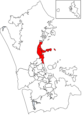
Hibiscus and Bays is a local government area in Auckland, in New Zealand's Auckland Region, governed by the Hibiscus and Bays Local Board and Auckland Council. It currently aligns with the council's Albany Ward.
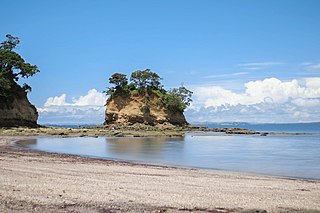
Pōhutukawa Bay is a beach north of Long Bay, located on the North Shore of Auckland. It is situated northeast of Ōkura, close to Piripiri Point. Directly south of Pōhutukawa Bay Beach is Granny's Bay Beach, and a little further south is Long Bay Regional Park. The beach is accessible only at low tide, and it is among one of Auckland's most popular naturist beaches. Public nudity is technically legal on any New Zealand beach where it is "known to occur". Getting to the beach requires going through the coastal track, a 6 km (3.7 mi) walk that starts from the beach carparks, and ends at the Okura River.

Te Matuku Marine Reserve is a marine reserve administered by the New Zealand Department of Conservation. It includes Te Matuku Bay, one of the largest and least disturbed estuaries on Waiheke Island, as well as a surrounding area of sea. It covers an area of 690 ha and was established in 2003.
Tāwharanui Marine Reserve is a marine reserve covering an area of 394 hectares in the Hauraki Gulf, offshore from the Tāwharanui Peninsula in the Auckland Region of New Zealand's North Island. It was established in 2011 and is administered by the Department of Conservation.

Te Paepae o Aotea Marine Reserve is a marine reserve covering an area of 1,267 hectares in the Bay of Plenty of New Zealand's North Island. It includes an area around Te Paepae o Aotea, 55 kilometres (34 mi) north-northwest of Whakatāne and 5 kilometres (3.1 mi) northwest of Whakaari/White Island.
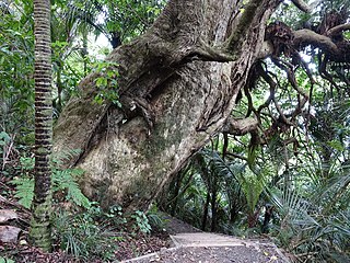
The Okura Bush Scenic Reserve is a protected forested area on the Hibiscus Coast in the Auckland Region, New Zealand. It is the location of the Okura Bush Track.
Karepiro Bay is a bay of the Hauraki Gulf / Tīkapa Moana in the Auckland Region, New Zealand. It found between the Whangaparāoa Peninsula and North Shore, and is the mouth of the Weiti River and Ōkura River.