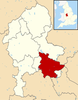
Lichfield is a local government district in Staffordshire, England. It is administered by Lichfield District Council, based in Lichfield.
Alrewas(awl-ree-was) is a village and civil parish in the Lichfield District of Staffordshire, England.

Edingale is a village and civil parish in Lichfield District, Staffordshire, England. It lies on the River Mease, around 7 miles (11 km) north of Tamworth. Historically, the village is shared with Derbyshire. In 2001 the parish had a population of 598, increasing to 632 at the 2011 census.

Whittington is a village and civil parish which lies approximately 3 miles south east of Lichfield in the Lichfield district of Staffordshire, England. According to the 2001 census it had a population of 2,591, increasing to 2,603 at the 2011 Census. The parish council is a joint one with Fisherwick. The Coventry Canal borders the village to the north and east.
Adbaston is a village and a civil parish in the English county of Staffordshire.
Armitage with Handsacre is a civil parish in the Lichfield district of Staffordshire, England. It includes the villages of Armitage and Handsacre, and in 2001 had a population of 5,181, rising to 5,335 at the 2011 Census.

Beckbury is a village and civil parish in Shropshire, England. Beckbury had a population of 327 according to the 2001 census, increasing to 340 at the 2011 Census, The village is 8 miles (13 km) south-east of Telford and is close to the Staffordshire border. The small rural parish of Beckbury lies on the Shropshire–Staffordshire border 3.7 miles (6 km) south of Shifnal. It has a pub – the Seven Stars, a Church of England school, a village hall, and a parish church dedicated to St Milburga.

Brocton is a village and civil parish in the English county of Staffordshire. It is within the borough of Stafford. The village describes itself as the Gateway to Cannock Chase, an Area of Outstanding Natural Beauty and a Site of Special Scientific Interest.
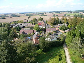
Fradley is a village in the Lichfield District, in the county of Staffordshire, England. It is in the civil parish of Fradley and Streethay whose population at the 2011 census was 3,753.

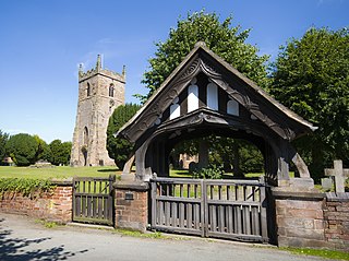
Hints is a small village and civil parish between Lichfield and Tamworth in Staffordshire, within Lichfield local government district. The village is on the line of Watling Street, which was formerly the A5, but the A5 now runs in a cutting north of the village. The name of the parish council is Hints with Canwell. The parish church is dedicated to St Bartholomew.

Hammerwich is a small village and civil parish in Lichfield District, Staffordshire, England, south-east of Burntwood.

For the village in South Yorkshire, site of violence during the 1984 miners strike, see Orgreave, South Yorkshire
Weston is a village and civil parish. within the English county of Staffordshire. The parish is in the Local Authority of Stafford.
Clifton Campville is a village and civil parish in Staffordshire, England. It lies on the River Mease, about 10 miles (16 km) east of the City of Lichfield, 6 miles (10 km) west of Measham and 7 miles (11 km) north of Tamworth. The village lies very close to Staffordshire's borders with Derbyshire, Leicestershire and Warwickshire. In 2001 the parish had a population of 764, increasing to 912 at the 2011 census.

Fisherwick is a civil parish in Lichfield District, Staffordshire, England. Located about 4 miles (6 km) east of the City of Lichfield, the parish does not include a village, just a scattered collection of farms and houses. The ancient settlement, dating back to the 12th century, and the manor of Fisherwick Park no longer exist. The parish council is a joint one with Whittington.

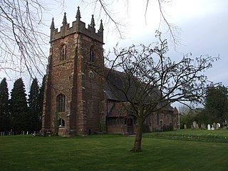
Harlaston is a village and civil parish in Staffordshire, England. It lies on the River Mease, about 5 miles (8 km) north of Tamworth. There is an Early English church, dedicated to St Matthew, and a public house, the White Lion.

Thorpe Constantine is a small village and civil parish in Staffordshire, England. It lies about 6 miles (10 km) north-east of Tamworth and 6 miles south-west of Measham. The nucleus of the parish is the Thorpe estate.

Upper Longdon is a village within the civil parish of Longdon and is in the District of Lichfield of the English county of Staffordshire.

Gentleshaw is a village and hamlet in Staffordshire located about 5.8 miles (9.3 km) from Lichfield and about 6.3 miles (10.1 km) from Rugeley, and about 2.3 miles (3.7 km) north of Burntwood. Although it is now part of Longdon civil parish, it has a Parish Church and a primary school. Population details as taken at the 2011 census can be found under Longdon.
Kingstone is a village and civil parish within the English county of Staffordshire.

