
According to the 2022 census, the population of South Africa is about 62 million people of diverse origins, cultures, languages, and religions. The South African National Census of 2022 was the most recent census held; the next will be in 2032.

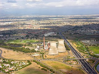
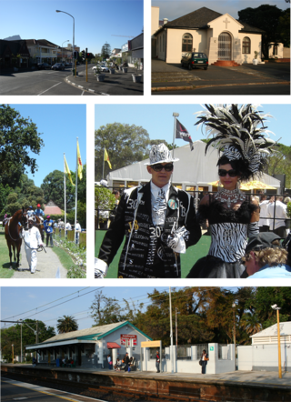
The Cape Flats is an expansive, low-lying, flat area situated to the southeast of the central business district of Cape Town. The Cape Flats is also the name of an administrative region of the City of Cape Town, which lies within the larger geographical area.

Coloureds refers to members of multiracial ethnic communities in South Africa who may have ancestry from African, European, and Asian people. The intermixing of different races began in the Cape province of South Africa, with Dutch settlers, Bantu, and Malay slaves intermixing with the indigenous Khoi tribes of that region. Later various other European nationals also contributed to the growing mixed race people, who would later be officially classified as coloured by the apartheid government in the 1950s.

The Western Cape is a province of South Africa, situated on the south-western coast of the country. It is the fourth largest of the nine provinces with an area of 129,449 square kilometres (49,981 sq mi), and the third most populous, with an estimated 7 million inhabitants in 2020. About two-thirds of these inhabitants live in the metropolitan area of Cape Town, which is also the provincial capital. The Western Cape was created in 1994 from part of the former Cape Province. The two largest cities are Cape Town and George.

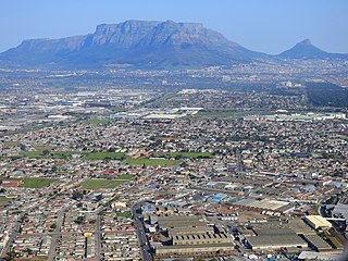
Rondebosch is one of the Southern Suburbs of Cape Town, South Africa. It is primarily a residential suburb, with shopping and business districts as well as the main campus of the University of Cape Town. The area is noted for its beautiful views of Table Mountain, its convent location to the rest of the city of Cape Town, and its proximity to the University of Cape Town.

Stellenbosch Municipality is the local municipality that governs the towns of Stellenbosch, Franschhoek and Pniel, and the surrounding rural areas, in the Western Cape province of South Africa. It covers an area of 831 square kilometres (321 sq mi), and as of 2011 had a population of 155,733 people in 43,420 households. It falls within the Cape Winelands District Municipality.

Drakenstein Municipality is a local municipality located within the Cape Winelands District Municipality, in the Western Cape province of South Africa. As of 2011, it had a population of 251,262. Its municipality code is WC023.

Breede Valley Municipality is a local municipality located within the Cape Winelands District Municipality, in the Western Cape province of South Africa. As of 2007, it had a population of 166,825. Its municipality code is WC025.
Bergvliet is a suburb of Cape Town, South Africa. Bergvliet, which means "Mountain Streamlet" in Afrikaans, is bordered by Retreat, Meadowridge, Tokai, and Heathfield.
The Sarah Baartman District Municipality, formerly the Cacadu District Municipality, is situated in the western part of the Eastern Cape province of South Africa, covering an area of 58,242 square kilometres. The area of the district municipality includes seven local municipalities. The seat is the city of Gqeberha, although Gqeberha is not itself in the district. As of 2011, the languages most spoken among the 388,201 inhabitants were Xhosa and Afrikaans. The district code is DC10.
Athlone is a suburb of Cape Town located to the east of the city centre on the Cape Flats, south of the N2 highway. Two of the suburb's main landmarks are Athlone Stadium and the decommissioned coal-burning Athlone Power Station. Athlone is mainly residential and is served by a railway station of the same name. It however includes industrial and commercial zones. There are many "sub-areas" within Athlone, including Gatesville, Rylands, Belgravia Estate, Bridgetown and Hazendal. Colloquially other areas around Athlone are also often included in the greater Athlone area even though the City of Cape Town might classify them as separate neighborhoods such as Rondebosch East, Crawford, and Manenberg.

Wynberg is a southern suburb of the City of Cape Town in Western Cape, South Africa. It is situated between Plumstead and Kenilworth, and is a main transport hub for the Southern Suburbs of Cape Town.
Eerste River is a town in the Western Cape, South Africa and a suburb of the City of Cape Town. It forms part of the Eastern Suburbs zone of the city situated behind the Stellenbosch/Vlaeberg Hills on the eastern outskirts of the city..
Elsie's River is a suburb of Cape Town, South Africa.

Rosebank is one of the Southern Suburbs of Cape Town, South Africa, located between the suburbs of Mowbray and Rondebosch.
Kenilworth is a suburb in Cape Town, South Africa.
White Africans of European ancestry refers to citizens or residents in Africa who can trace full or partial ancestry to Europe. They are distinguished from indigenous North African people who are sometimes identified as white but not European. In 1989, there were an estimated 4.6 million white people with European ancestry on the African continent.

Afrikaners are a Southern African ethnic group descended from predominantly Dutch settlers first arriving at the Cape of Good Hope in 1652. Until 1994, they dominated South Africa's politics as well as the country's commercial agricultural sector.
Maitland is a suburb of Cape Town, South Africa.

Racial groups in South Africa have a variety of origins. The racial categories introduced by Apartheid remain ingrained in South African society with South Africans and the governing party of South Africa continuing to classify themselves, and each other, as belonging to one of the four defined race groups. Statistics South Africa asks people to describe themselves in the census in terms of five racial population groups. The 2022 estimates were 81.4% Black or Indigenous South African, 7.3% White South African, 8.2% Coloured South African, and 2.7% Indian South African.

