Lowell Airport (Indiana)

Last updated
Lowell Airport
Summary
Airport type Public use
Owner Donald E. Bailey
Serves Lowell, Indiana
Opened August 1980 (1980-08) [1]
Elevation  AMSL 675 ft / 206 m
Coordinates 41°13′48″N087°30′28″W / 41.23000°N 87.50778°W / 41.23000; -87.50778 Coordinates: 41°13′48″N087°30′28″W / 41.23000°N 87.50778°W / 41.23000; -87.50778
Map
USA Indiana location map.svg
Airplane silhouette.svg
C97
Location of airport in Indiana
Runways
Direction Length Surface
ft m
18/36 3,041 927 Turf
Statistics (2008)
Aircraft operations 4,176
Based aircraft 11

Lowell Airport( FAA LID : C97) is a privately owned, public use airport located five  nautical miles (9  km) southwest of the central business district of Lowell, a town in Lake County, Indiana, United States. [2]

Federal Aviation Administration United States Government agency dedicated to civil aviation matters

The Federal Aviation Administration (FAA) is a governmental body of the United States with powers to regulate all aspects of civil aviation in that nation as well as over its surrounding international waters. Its powers include the construction and operation of airports, air traffic management, the certification of personnel and aircraft, and the protection of U.S. assets during the launch or re-entry of commercial space vehicles. Powers over neighboring international waters were delegated to the FAA by authority of the International Civil Aviation Organization.

A location identifier is a symbolic representation for the name and the location of an airport, navigation aid, or weather station, and is used for manned air traffic control facilities in air traffic control, telecommunications, computer programming, weather reports, and related services.

Airport location where aircraft take off and land

An airport is an aerodrome with extended facilities, mostly for commercial air transport. Airports often have facilities to store and maintain aircraft, and a control tower. An airport consists of a landing area, which comprises an aerially accessible open space including at least one operationally active surface such as a runway for a plane to take off or a helipad, and often includes adjacent utility buildings such as control towers, hangars and terminals. Larger airports may have airport aprons, taxiway bridges, air traffic control centres, passenger facilities such as restaurants and lounges, and emergency services. In some countries, the US in particular, they also typically have one or more fixed-base operators, serving general aviation.

Contents

Facilities and aircraft

Lowell Airport covers an area of 19 acres (8 ha) at an elevation of 675 feet (206 m) above mean sea level. It has one runway designated 18/36 with a turf surface measuring 3,041 by 100 feet (927 x 30 m). [2]

Acre unit of area

The acre is a unit of land area used in the imperial and US customary systems. It is traditionally defined as the area of one chain by one furlong, which is exactly equal to 10 square chains, ​1640 of a square mile, or 43,560 square feet, and approximately 4,047 m2, or about 40% of a hectare. Based upon the International yard and pound agreement of 1959, an acre may be declared as exactly 4,046.8564224 square metres. The acre is a statute measure in the United States and was formerly one in the United Kingdom and almost all countries of the former British Empire, although informal use continues.

Hectare metric unit of area

The hectare is an SI accepted metric system unit of area equal to a square with 100-metre sides, or 10,000 m2, and is primarily used in the measurement of land. There are 100 hectares in one square kilometre. An acre is about 0.405 hectare and one hectare contains about 2.47 acres.

Elevation Height of a geographic location above a fixed reference point

The elevation of a geographic location is its height above or below a fixed reference point, most commonly a reference geoid, a mathematical model of the Earth's sea level as an equipotential gravitational surface . The term elevation is mainly used when referring to points on the Earth's surface, while altitude or geopotential height is used for points above the surface, such as an aircraft in flight or a spacecraft in orbit, and depth is used for points below the surface.

For the 12-month period ending December 31, 2008, the airport had 4,176 general aviation aircraft operations, an average of 11 per day. At that time there were 11 single-engine aircraft based at this airport. [2]

General aviation civil use of aircraft excluding commercial transportation

General Aviation (GA) represents the 'private transport' and recreational flying component of aviation.

Aircraft engine Engine designed for use in powered aircraft

An aircraft engine is a component of the propulsion system for an aircraft that generates mechanical power. Aircraft engines are almost always either lightweight piston engines or gas turbines, except for small multicopter UAVs which are almost always electric aircraft.

See also

Related Research Articles

Fulton County Airport (Indiana) airport in Indiana, United States of America

Fulton County Airport is two miles east of Rochester, in Fulton County, Indiana. It is owned by the Fulton County Airport Authority.

Griffith-Merrillville Airport airport in Indiana, United States of America

Griffith-Merrillville Airport is a public-use airport two miles east of Griffith, in Lake County, Indiana, United States. It is privately owned by Griffith Aviation, Inc.

Porter County Regional Airport airport in Indiana, United States of America

Porter County Regional Airport is a public use airport one nautical mile (1.8 km) southeast of the central business district of Valparaiso, a city in Porter County, Indiana, United States. The Porter County Municipal Airport Authority owns the airport.

Michigan City Municipal Airport airport in Indiana, United States of America

Michigan City Municipal Airport is a public use airport located three nautical miles east of the central business district of Michigan City, in LaPorte County, Indiana, United States. The airport is publicly owned by the Michigan City Board of Aviation Commissioners.

Greensburg Municipal Airport airport in Indiana, United States of America

Greensburg Municipal Airport is a public use airport located two nautical miles (4 km) southwest of the central business district of Greensburg, a city in Decatur County, Indiana, United States. Owned by the Greensburg-Decatur County Board of Aviation Commissioners, it was formerly known as Greensburg-Decatur County Airport. It is included in the National Plan of Integrated Airport Systems for 2011–2015, which categorized it as a general aviation facility.

Delaware County Regional Airport airport in Indiana, United States of America

Delaware County Regional Airport is in Delaware County, Indiana three miles northwest of Muncie. Owned by the Delaware County Airport Authority, it was formerly Delaware County Airport and Johnson Field. The National Plan of Integrated Airport Systems for 2011–2015 categorized it as a general aviation facility.

Sullivan County Airport airport in Indiana, United States of America

Sullivan County Airport is a county-owned public-use airport located three nautical miles northwest of the central business district of Sullivan, a city in Sullivan County, Indiana, United States. It is included in the FAA's National Plan of Integrated Airport Systems for 2011–2015, which categorized it as a general aviation facility.

Virgil I. Grissom Municipal Airport airport in Indiana, United States of America

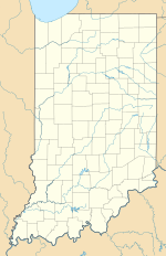
Virgil I. Grissom Municipal Airport is a public use airport located three nautical miles southeast of the central business district of Bedford, a city in Lawrence County, Indiana, United States.

Jasper County Airport (Indiana) airport in Indiana, United States of America

Jasper County Airport is located one mile northwest of Rensselaer, in Jasper County, Indiana, United States.

Magnolia Municipal Airport airport in Arkansas, United States of America

Magnolia Municipal Airport is three miles southeast of Magnolia, in Columbia County, Arkansas.

Kokomo Municipal Airport airport in Indiana, United States of America

Kokomo Municipal Airport is five miles northeast of Kokomo, in Howard County, Indiana. It is owned by the Kokomo Board of Aviation Commissioners. The FAA's National Plan of Integrated Airport Systems for 2009–2013 categorized it as a general aviation facility.

Ephraim–Gibraltar Airport airport in Door County, United States of America

Ephraim–Gibraltar Airport is a public use airport located one nautical mile (2 km) southwest of the central business district of Ephraim, a village in Door County, Wisconsin, United States. The airport is owned by the Village of Ephraim and the Town of Gibraltar. It was formerly known as Ephraim-Fish Creek Airport.

Mettel Field airport in Indiana, United States of America

Mettel Field is a public airport three miles north of Connersville, in Fayette County, Indiana. It is owned by the Connersville Board of Aviation Commissioners. The National Plan of Integrated Airport Systems for 2011–2015 categorized it as a general aviation facility.

Goshen Municipal Airport airport in Indiana, United States of America

Goshen Municipal Airport is a public use airport located three nautical miles (6 km) southeast of the central business district of Goshen, a city in Elkhart County, Indiana, United States. It is owned by the Goshen Board of Aviation Commissioners. This airport is included in the National Plan of Integrated Airport Systems for 2011–2015, which categorized it as a general aviation facility.

Richmond Municipal Airport airport in Indiana, United States of America

Richmond Municipal Airport is six miles southeast of Richmond, in Wayne County, Indiana. It is owned by the Richmond Board of Aviation Commissioners. The National Plan of Integrated Airport Systems for 2011–2015 called it a general aviation facility.

Plymouth Municipal Airport (Indiana) airport in Indiana, United States of America

Plymouth Municipal Airport is a public use airport located two nautical miles (4 km) north of the central business district of Plymouth, a city in Marshall County, Indiana, United States. It is owned by the Plymouth Board of Aviation of Commissioners. This airport is included in the National Plan of Integrated Airport Systems for 2011–2015, which categorized it as a general aviation facility.

Wheeler Airport airport in Indiana, United States of America

Wheeler Airport is a private use airport in Starke County, Indiana, United States. It is located six nautical miles (11 km) south of the central business district of Knox, Indiana, and was previously a public use airport.

Kentland Municipal Airport airport in Indiana, United States of America

Kentland Municipal Airport is a public use airport located one nautical mile (2 km) southeast of the central business district of Kentland, in Newton County, Indiana, United States. It is owned by the Kentland Board of Aviation Commissioners. This airport included in the National Plan of Integrated Airport Systems for 2011–2015, which categorized it as a general aviation facility.

Crawfordsville Regional Airport Airport in Crawfordsville, Indiana

Crawfordsville Regional Airport is a public use airport located 4 miles (6.4 km) south of the central business district of Crawfordsville, a city in Montgomery County, Indiana, United States. The airport was founded in June 1945 and is owned by the city. It is included in the Federal Aviation Administration (FAA) National Plan of Integrated Airport Systems for 2019–2023, in which it is categorized as a local general aviation facility.

Reedsburg Municipal Airport airport in Sauk County, United States of America

Reedsburg Municipal Airport, is a city owned public use airport located 1 mile (2 km) east of the central business district of Reedsburg, Wisconsin, a city in Sauk County, Wisconsin, United States. It is included in the Federal Aviation Administration (FAA) National Plan of Integrated Airport Systems for 2019–2023, in which it is categorized as a local general aviation facility.

References

  1. "Lowell Airport". AirNav, LLC. Retrieved 2016-10-18.
  2. 1 2 3 4 FAA Airport Master Record for C97 ( Form 5010 PDF ). Federal Aviation Administration. Effective November 15, 2012.
The National Map

The National Map is a collaborative effort of the United States Geological Survey (USGS) and other federal, state, and local agencies to improve and deliver topographic information for the United States. The purpose of the effort is to provide "...a seamless, continuously maintained set of public domain geographic base information that will serve as a foundation for integrating, sharing, and using other data easily and consistently".