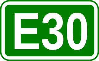
European route E30 is an A-Class European route from the port of Cork in Ireland in the west to the Russian city of Omsk, near the border with Kazakhstan in the east. For much of the Russian stretch, it follows the Trans-Siberian Highway and, east of the Ural Mountains, with AH6 of the Asian Highway Network, which continues to Busan, South Korea. The total length is 6,530 km (4,060 mi)—3,300 km (2,100 mi) from Cork to Moscow, and 3,230 km (2,010 mi) from Moscow to Omsk. The naming is by the United Nations Economic Commission for Europe (UNECE).

Volokolamsk is a town and the administrative center of Volokolamsky District in Moscow Oblast, Russia, located on the Gorodenka River, not far from its confluence with the Lama River, 129 kilometers (80 mi) northwest of Moscow. Population: 26,398 (2021 Census); 23,433 (2010 Census); 16,656 (2002 Census); 18,226 (1989 Census).
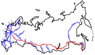
The Trans-Siberian Highway is the unofficial name for a network of federal highways that span the width of Russia from the Baltic Sea of the Atlantic Ocean to the Sea of Japan. In the Asian Highway Network, the route is known as AH6. It stretches over 11,000 kilometres from St. Petersburg to Vladivostok. The road disputes the title of the longest national highway in the world with Australia's Highway 1. The highway became fully paved on 12 August 2015.

The Moscow Automobile Ring Road, or MKAD (МКАД), is a ring road running predominantly on the city border of Moscow with a length of 108.9 km (67.7 mi) and 35 exits. It was completed in 1962. The speed limit is 100 km/h.

The M10 "Russia" is a federal highway in Russia connecting the country's two largest cities, Moscow and Saint Petersburg. Other than in the vicinity of Moscow and Saint Petersburg, the M10 is basically a two-lane highway, with an occasional third centre lane to allow overtaking or for left-turning traffic at intersections.
Yuzhnoye Izmaylovo is an area located in the eastern part of Moscow, Russia, just north of the Shosse Entuziastov Route and west of the Moscow Ring Highway (МКАД). It borders Izmaylovo District in the south and Izmaylovsky Park in the north and west. In 1960, it became a part of Moscow, after all territories inside Moscow Ring Highway were annexed by Moscow City proper.

M01 is a Ukraine international highway (M-highway) that stretches from the state capital, Kyiv, to the northern border with Belarus.

The Russian route M1 is a major trunk road that runs from Moscow through Smolensk before reaching the border with Belarus. The length is 440 kilometers (270 mi). The highway runs south of Odintsovo, Kubinka, Mozhaysk, Gagarin, north of Vyazma, through Safonovo and Yartsevo. After crossing the border with Belarus, the highway continues to Minsk, Brest, and Warsaw. The entire route is part of European route E30 and AH6.

The Russian route M2 is a major trunk road that connects Moscow to Crimea. It is part of the European route E105. It is 720 kilometers long.
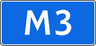
The Russian route M3 is a major trunk road that runs across a distance of about 490 kilometres from Moscow to Russia's border with Ukraine.

The Russian route M5 is a major trunk road running across a distance of 1879 km from Moscow to the Ural Mountains. It is part of the European route E30 and the Trans-Siberian Highway. The section from Yekaterinburg to Chelyabinsk is also part of AH7, and the section from Chelyabinsk to Moscow is also part of AH6.

The Russian route M8 "Kholmogory" or Yaroslavl highway, is a major trunk road that links Moscow to the Russian North in general and the sea harbour of Arkhangelsk in particular. The road runs north of Moscow across a distance of 1271 kilometres through Mytishchi, Pushkino, Sergiyev Posad, Pereslavl-Zalessky, Rostov the Great, Yaroslavl, Danilov, Gryazovets, Vologda, Kadnikov, Velsk, Kholmogory, and Arkhangelsk, ending up in the city of Severodvinsk. It passes Moscow, Vladimir, Yaroslavl, Vologda, and Arkhangelsk Oblasts.

The Vladimir Highway, familiarly known as the Vladimirka (Влади́мирка), was a road leading east from Moscow to Vladimir and Nizhny Novgorod. Its length was about 190 kilometers.

Leninsky Avenue is a major avenue in Moscow, Russia, that runs in the south-western direction between Kaluzhskaya Square in the central part of the city through Gagarin Square to the Moscow Ring Road. It is a part of the M3 highway which continues from Moscow to Kaluga and Bryansk to the border with Ukraine, and used to provide connections with Kyiv and Odesa. It is also a part of the European route E101 connecting Moscow and Kyiv.
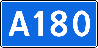
Russian Route A180, also known as Narva Highway is a Russian federal highway that runs from Saint Petersburg through Ivangorod up to the border with Estonia by the Narva River, with the Estonian city of Narva on the opposite bank, which explains the name of the highway. It is part of European route E20, making its easternmost stretch.

Kashirskoye Highway or Kashira Highway is a major street in Moscow, Russia, continued as a highway beyond the city into Moscow Oblast as a backup route for highway M4. It was named in the 19th century after the old Kashira Road, which led to the town of Kashira. It was one of the sites of the Russian apartment bombings of 1999. Along the road, major landmarks include the Saburovo Church and the Orekhovo-Borisovo Cathedral.

Highway M02 is a Ukraine international highway (M-highway) connecting the M01 near Kipti with Bachivsk on the border with Russia, where it continues as the M3 to Moscow. The entire route is part of European route E101 and the section from Hlukhiv to the Russian border is part of European route E391.

Volokolamsk Highway is a novel written by Alexandr Bek, published in Russian in 1944, with later translations into English, Hebrew, Spanish, Chinese, German and many other languages during the 1940s and '50s. The novel, based on real events in October, 1941, during the Battle of Moscow, describes defensive fighting over several days by a single battalion of the 316th Rifle Division against elements of German Army Group Center. Both for its realism and for its practical advice on infantry tactics in modern war, Volokolamsk Highway became standard reading for junior officers in the Red Army and later Soviet Army, the forces of the arising State of Israel, and most socialist and revolutionary movements during the latter part of the 20th century. The novel has been out of print in English for several decades.

Kommunarka is a Moscow Metro station on the Sokolnicheskaya line. It was opened on 20 June 2019, along with Filatov Lug, Prokshino, and Olkhovaya. and became the southwestern terminus of the line, after Olkhovaya station. Kommunarka became the 232nd station of the Moscow Metro.

Olkhovaya is a Moscow Metro station on the Sokolnicheskaya line. It was opened on 20 June 2019, as part of an extension that included Kommunarka, Prokshino, and Filatov Lug.