
Porur is a neighbourhood of Chennai, India. It is situated in the Maduravoyal taluk of Chennai district in the southern part of the city. Since 2011, it has been a part of the Chennai Corporation and included in zone number 11.
Thiruneermalai is a suburb located south of Chennai, India. It lies in Kanchipuram district, Tamil Nadu, India. Originally a town panchayat, Thiruneermalai is now a part of Pammal Zone under Tambaram Municipal Corporation. It is also a nagar panchayat in Kovur.

Khetri Nagar is the town in Neem Ka Thana district of Rajasthan in India. It is a part of the Shekhawati region. Khetri consists of two towns, "Khetri Town" founded by Raja Khet Singhji Nirwan and "Khetri Nagar" which is about 10 km away from Khetri. Khetri Nagar, well known for its Copper Project, was built by and is under the control of Hindustan Copper Limited, a public sector undertaking under the Government of India. Khetri Nagar is also known as 'Copper'. There are many attached villages near Khetri Nagar like Manota Khurd, the people of this village was employed in mines. Khetri is full of heritage and diversity. People of various religions live with mutual cooperation and harmony here. Today this adorable part of India is the backward region due to lack of development. Khetri is the town and Tehsil in Jhunjhunu district of Rajasthan state in India. Total number of villages in this Tehsil is 106. Khetri Tehsil sex ratio is 914 females per 1000 of males. Average literacy rate of Khetri Tehsil in 2011 were 72.51%, in which male and female literacy were 85.58% and 58.39% respectively.
Perungudi is a neighbourhood of Chennai in the state of Tamil Nadu, India. It is situated about 10 kilometres (6.2 mi) south of Adyar. It is bordered on two sides by the Old Mahabalipuram Road and the Perungudi lake. It is situated on the Old Mahabalipuram IT Expressway right in middle of an Information Technology (IT) Estate. It is between Taramani and Thoraipakkam and parallel to Kottivakkam and Palavakkam in the East Coast Road.
Puzhuthivakkam, commonly known as Ullagaram or Ullagaram–Puzhuthivakkam, is a southern neighbourhood of Chennai in Tamil Nadu, India. Puzhuthivakkam loosely translates to dust neighborhood. The neighbourhood is part of the Greater Chennai Corporation, following Chennai's expansion into Kanchipuram district. Puzhuthivakkam is located between the neighborhoods of Madipakkam, Adambakkam, Velachery, Pallikaranai, and Nanganallur. Puzhuthivakkam was initially developed in the late 1960s and early 1970s. Upon completion of the MRTS extension line, the neighborhood will be served by Puzhuthivakkam railway station. As of 2011, the town had a population of 53,322.

Poonamallee is town and suburb of Chennai, India under the Chennai Metropolitan Area. It was historically called Pushpagirimangalam, later renamed in Tamil as Poovirundhavalli, and now colloquially called as Poondhamalli. It is the headquarters of the Poonamallee taluk of the Tiruvallur district in the Indian state of Tamil Nadu. The nearest Railway station is at Avadi. It acts as the gateway to the city from its western side. It is a town with rich cultural heritage and also a fast-growing areas in the city. As of 2011, the town had a population of 57,224. There are plans to merge the areas under Poonamallee Municipality with Avadi Municipal Corporation.
Chinnasekkadu is a neighbourhood of Chennai in Chennai district in the state of Tamil Nadu, India. Chinnasekkadu used to be a town panchayat in Thiruvallur district. In 2011, Chinnasekkadu town panchayat was merged with Chennai Corporation. Chinnasekkadu comes under ward 29 in Zone 3(Madhavaram) of Chennai Corporation.
Jaladianpet is a census town in Chennai district in the Indian state of Tamil Nadu.
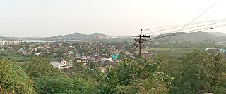
Marakkanam is a coastal panchayat town & Taluk in Viluppuram district in the Indian state of Tamil Nadu. It is well connected to the state capital Chennai and the nearby union territory of Puducherry by the East Coast Road. To the west, Marakkanam is connected to the town of Tindivanam by the SH-134. Marakkanam is situated on the declared National Waterways NW-4. On materialisation of National Waterways NW-4, Marakkanam will be connected to two states Andhra Pradesh (Kakinada) and Puducherry through north and south of Buckingham Canal.
Meerpet–Jillelguda is a satellite city of Hyderabad and a municipal corporation in Rangareddy district of the Indian state of Telangana. The municipal corporation was formed after merging municipality of Meerpet and Jillelguda.
Minjur is a town located in the outskirts of North Chennai, India. It is located in the Thiruvallur district in the Indian state of Tamil Nadu. Minjur is called 'Vada Kanchi' meaning North Kanchipuram. The town has two famous temples for Shiva and Vishnu, similar to Kanchipuram. The neighbourhood is served by Minjur railway station of the Chennai Suburban Railway Network.
Moovarasanpattu is a census town in Metro city Chennai. It is a rapidly-growing locality in the South suburbs of the Metropolitan city Chennai.which is comes under Chengalpattu district in the Indian state of Tamil Nadu.
Neelangarai is a census town and is a locality in the south of Chennai. it is situated in Chennai district in the Indian state of Tamil Nadu about seven kilometers south of Adyar, Chennai. The former name of the city was Thiruneelakandapuram, named after the Thiruneelakandeshwarar temple. Neelankarai is located with Palavakkam in the north, Vettuvankeni in the south, Thoraipakkam in the west and the Bay of Bengal in the east. Over the years Neelankarai has developed tremendously and has made a significant name for itself in popularity for various reasons.
Palavakam is a locality in the south of Chennai and census town in Chennai district in the Indian state of Tamil Nadu. It is located on the East Coast Road about 6 km south of Adyar.

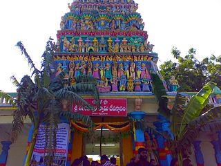
Perungalathur is a southern residential neighborhood of the Chennai Metropolitan Area,served by Perungalathur Railway Station of the Chennai Suburban Railway Network. Formerly a Town Panchayat,it was merged into the Tambaram City Municipal Corporation in November 2021.Ancient Shiva Temple, located in Perungulathur is about 800 years old. The Kamatchi Amman Temple and Aadhi Karaneeswarar Temple are also popular.
Pulhal is a Northwestern residential town in Chennai district in the Indian state of Tamil Nadu. Pulhal is located on the banks of Pulhal Lake. The town is known for Pulhal Central Prison.

Singaperumal Koil is a satellite town city of Chennai located between Chengalpattu and Maraimalai Nagar in Chengalpattu district in the Indian state of Tamil Nadu. It is a part of the area Chennai Metropolitan Development Authority (CMDA) and a vital locality in Chennai Metropolitan Area.
Maraimalai Nagar is a municipality town in Chengalpattu district, Tamil Nadu, India. Lying in the southern part of the Chennai metropolitan area, it is a satellite town of Chennai, the state capital, around 50 km from Downtown Chennai (Egmore) and about 15 km from Vandalur. It was developed by the CMDA in 1980. Many heavy industries are located in Maraimalai Nagar. The Ford India and BMW car factories are located within a mile from Maraimalai Nagar and the Indian software giant Infosys also has an office within eight kilometers of Maraimalai Nagar. SRM University has its main campus in the neighboring Potheri. As of 2011, Maraimalai Nagar had a population of 81,872.
Nerkundram or Nerkunram is a census town located in Chennai City, Chennai district in the Indian state of Tamil Nadu. It falls under Maduravoyal constituency in Tiruvallur district in the Indian state of Tamil Nadu. It consists of a portion of Ambattur taluk and part of Chennai Corporation. It falls under Sriperumbudur.

Kovilambakkam is a southern suburb of Chennai, India. It is located in Chengalpattu district in the state of Tamil Nadu, about 26 km from Chennai city center and 12 km from Tambaram. The neighbourhood spans the areas of Sunnambu Kolathur, Chinna Kovilambakkam and Periya Kovilambakkam.


