Maineville, Ohio

Last updated

Maineville, Ohio
Maineville Road houses.jpg
Houses on Maineville Road
OHMap-doton-Maineville.png
Location of Maineville, Ohio
Map of Warren County Ohio Highlighting Maineville Village.png
Location of Maineville in Warren County
Coordinates: 39°18′24″N84°11′59″W / 39.30667°N 84.19972°W / 39.30667; -84.19972
Country United States
State Ohio
County Warren
Government
  TypeStatutory government
  MayorBob Beebe[ citation needed ]
Area
[1]
  Total1.59 sq mi (4.11 km2)
  Land1.59 sq mi (4.11 km2)
  Water0.00 sq mi (0.00 km2)
Elevation
[2]
797 ft (243 m)
Population
 (2020)
  Total1,405
  Density884.76/sq mi (341.51/km2)
Time zone UTC-5 (Eastern (EST))
  Summer (DST) UTC-4 (EDT)
ZIP code
45039
Area code 513
FIPS code 39-46872 [3]
GNIS feature ID2399227 [2]
Website http://www.mainevilleoh.com

Maineville is a village in Warren County, Ohio, United States. The population was 1,405 at the 2020 census.

Contents

History

Maineville was incorporated as a village on March 23, 1850. [4] The village derives its name from Maine, the native state of a large share of its first settlers.The settlers came mostly from the Maine town of Phillips; and some from nearby Farmington. Originally, the relocation of these people involved nearly one hundred families (the relocation took 30 to 60 days). The town was called "Yankeetown" and "Maineville", and in 1850 it was incorporated as "Maineville". A village flag was designed and created by John Michael, later to become Mayor of Maineville. The flag includes Ohio and Maine, the state seals and a connecting reference to the two areas. The flag was adopted unanimously by the Maineville Council in 1994. [5] A post office was established at Maineville in 1854. [6]

Geography

According to the United States Census Bureau, the village has a total area of 1.37 square miles (3.55 km2), all land. [7]

Demographics

Historical population
CensusPop.Note
1870 290
1880 32411.7%
1890 256−21.0%
1900 28812.5%
1910 245−14.9%
1920 2699.8%
1930 30413.0%
1940 278−8.6%
1950 31212.2%
1960 3439.9%
1970 333−2.9%
1980 307−7.8%
1990 35916.9%
2000 885146.5%
2010 97510.2%
2020 1,40544.1%
U.S. Decennial Census [8]

2010 census

As of the census [9] of 2010, there were 995 people, 401 households, and 266 families living in the village. The population density was 711.7 inhabitants per square mile (274.8/km2). There were 422 housing units at an average density of 308.0 per square mile (118.9/km2). The racial makeup of the village was 97.6% White, 0.5% African American, 0.1% Native American, 0.4% Asian, 0.2% from other races, and 1.1% from two or more races. Hispanic or Latino of any race were 0.8% of the population.

There were 401 households, of which 31.9% had children under the age of 18 living with them, 51.1% were married couples living together, 8.5% had a female householder with no husband present, 6.7% had a male householder with no wife present, and 33.7% were non-families. 30.7% of all households were made up of individuals, and 13.5% had someone living alone who was 65 years of age or older. The average household size was 2.43 and the average family size was 3.04.

The median age in the village was 38.4 years. 24.9% of residents were under the age of 18; 5.5% were between the ages of 18 and 24; 28% were from 25 to 44; 28.6% were from 45 to 64; and 13.1% were 65 years of age or older. The gender makeup of the village was 50.5% male and 49.5% female.

2000 census

As of the census [3] of 2000, there were 359 people, 164 households, and 158 families living in the village. The population density was 3,637.1 inhabitants per square mile (1,404.3/km2). There were 390 housing units at an average density of 1,602.8 per square mile (618.8/km2). The racial makeup of the village was 98.64% White, 0.23% African American, 0.11% Asian, 0.34% from other races, and 0.68% from two or more races. Hispanic or Latino of any race were 0.90% of the population.

There were 164 households, out of which 30.8% had children under the age of 18 living with them, 60.2% were married couples living together, 7.1% had a female householder with no husband present, and 29.1% were non-families. 26.1% of all households were made up of individuals, and 17.3% had someone living alone who was 65 years of age or older. The average household size was 2.43 and the average family size was 2.94.

In the village, the population was spread out, with 22.3% under the age of 18, 6.7% from 18 to 24, 34.9% from 25 to 44, 21.5% from 45 to 64, and 14.7% who were 65 years of age or older. The median age was 38 years. For every 100 females there were 88.3 males. For every 100 females age 18 and over, there were 80.1 males.

The median income for a household in the village was $55,714, and the median income for a family was $65,089. Males had a median income of $43,828 versus $28,636 for females. The per capita income for the village was $24,054. About 2.0% of families and 3.2% of the population were below the poverty line, including 1.0% of those under age 18 and 6.8% of those age 65 or over.

Notable people

Related Research Articles

<span class="mw-page-title-main">Grand Isle, Maine</span> Town in the state of Maine, United States

Grand Isle is a town in Aroostook County, Maine, United States. The population was 366 at the 2020 census. The village of Grand Isle is in the northwestern part of the town.

<span class="mw-page-title-main">Hartford, Maine</span> Town in the state of Maine, United States

Hartford is a town in Oxford County, Maine, United States. Hartford is included in the Lewiston-Auburn, Maine metropolitan New England City and Town Area. The population was 1,203 at the 2020 census.

Woodstock is a town in Oxford County, Maine, United States. Woodstock is included in the Lewiston-Auburn, Maine metropolitan New England city and town area. The population was 1,352 at the 2020 census. The village of Bryant Pond, on State Route 26 in the northern part of Woodstock, is the town's urban center and largest settlement.

<span class="mw-page-title-main">Jacksonville, Ohio</span> Village in Ohio, United States

Jacksonville is a village in Athens County, Ohio, United States. The population was 400 at the 2020 census.

<span class="mw-page-title-main">Brookside, Ohio</span> Village in Ohio, United States

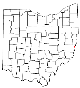
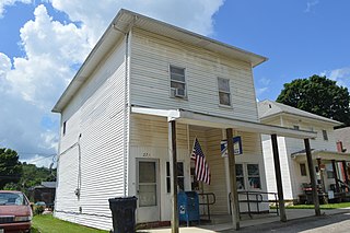
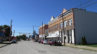
Brookside is a village in eastern Belmont County, Ohio, United States. The population was 538 at the 2020 census. It is part of the Wheeling metropolitan area.

<span class="mw-page-title-main">Castine, Ohio</span> Village in Ohio, United States

Castine is a village in Darke County, Ohio, United States. The population was 110 at the 2020 census.

<span class="mw-page-title-main">Cleves, Ohio</span> City in Ohio, United States

Cleves is a village in Miami Township, Hamilton County, Ohio, United States. Located along the Ohio River, it is a western suburb of Cincinnati. The population was 3,414 at the 2020 census.

<span class="mw-page-title-main">Evendale, Ohio</span> Village in Ohio, United States

Evendale is a village in Hamilton County, Ohio, United States, within the Cincinnati metropolitan area. The population was 2,669 at the 2020 census.

<span class="mw-page-title-main">Mowrystown, Ohio</span> Village in Ohio, United States

Mowrystown is a village in Highland County, Ohio, United States. The population was 385 at the 2020 census.

<span class="mw-page-title-main">Hanover, Ohio</span> Village in Ohio, United States

Hanover is a village in Licking County, Ohio, United States. The population was 1,270 at the 2020 census. The village lies along Ohio State Route 16.

<span class="mw-page-title-main">St. Louisville, Ohio</span> Village in Ohio, United States

St. Louisville or Saint Louisville is a village in Licking County, Ohio, United States, along the North Fork of the Licking River. The population was 352 at the 2020 census.

<span class="mw-page-title-main">Spencer, Ohio</span> Village in Ohio, United States

Spencer is a village in Spencer Township located in Medina County, Ohio, United States. The population was 684 at the 2020 census.

<span class="mw-page-title-main">Laura, Ohio</span> Village in Ohio, United States

Laura is a village in Miami County, Ohio, United States. The population was 398 at the 2020 census. It is part of the Dayton Metropolitan Statistical Area.

<span class="mw-page-title-main">Cloverdale, Ohio</span> Village in Ohio, United States

Cloverdale is a village in Perry Township, Putnam County, Ohio, United States. The population was 170 at the 2020 census.

<span class="mw-page-title-main">East Sparta, Ohio</span> Village in Ohio, United States

East Sparta is a village in southern Stark County, Ohio, United States. The population was 749 at the 2020 census. It is part of the Canton–Massillon metropolitan area.

<span class="mw-page-title-main">Navarre, Ohio</span> Village in Ohio, United States

Navarre is a village in southwestern Stark County, Ohio, United States. The population was 1,846 at the 2020 census. It is part of the Canton–Massillon metropolitan area.

<span class="mw-page-title-main">Newcomerstown, Ohio</span> Village in Ohio, United States

Newcomerstown is a village in Tuscarawas County, Ohio, United States, 85 miles (137 km) east-northeast of Columbus. The population was 3,702 at the 2020 census.

<span class="mw-page-title-main">Strasburg, Ohio</span> Village in Ohio, United States

Strasburg is a village in Tuscarawas County, Ohio, United States. The population was 2,735 at the 2020 census.

<span class="mw-page-title-main">Risingsun, Ohio</span> Village in Ohio, United States

Risingsun is a village in Wood County, Ohio, United States. The population was 541 at the 2020 census.

<span class="mw-page-title-main">New Holland, Ohio</span> Village in Ohio, United States

New Holland is a village in Fayette and Pickaway counties in Ohio, United States. The population was 804 at the 2020 census.

References

  1. "ArcGIS REST Services Directory". United States Census Bureau. Retrieved September 20, 2022.
  2. 1 2 U.S. Geological Survey Geographic Names Information System: Maineville, Ohio
  3. 1 2 "U.S. Census website". United States Census Bureau . Retrieved January 31, 2008.
  4. The History of Warren County, Ohio: Containing a History of the County ; Its Townships, Towns. W.H. Beers & Company. 1882. p. 621.
  5. "Maine Pioneers Founded Ohio Town Of Maineville". Lewiston Evening Journal. October 5, 1974. pp. 4A. Retrieved July 17, 2015.
  6. "Warren County". Jim Forte Postal History. Retrieved March 2, 2015.
  7. "US Gazetteer files 2010". United States Census Bureau. Archived from the original on January 25, 2012. Retrieved January 6, 2013.
  8. "Census of Population and Housing". Census.gov. Retrieved June 4, 2015.
  9. "U.S. Census website". United States Census Bureau . Retrieved January 6, 2013.
  10. "W. BUTTERWORTH DIES; CHAIRMAN OF DEERE & CO.." Chicago Daily Tribune . June 1, 1936. Start page: 18. Retrieved on February 12, 2009.