
Palawan, officially the Province of Palawan, is an archipelagic province of the Philippines that is located in the region of Mimaropa. It is the largest province in the country in terms of total area of 14,649.73 km2 (5,656.29 sq mi). The capital and largest city is Puerto Princesa wherein it is geographically grouped but administered independently from the province. Palawan is known as the Philippines' Last Frontier and as the Philippines' Best Island.

Tawi-Tawi, officially the Province of Tawi-Tawi, is an island province in the Philippines located in the Bangsamoro Autonomous Region in Muslim Mindanao (BARMM). The capital of Tawi-Tawi is Bongao.

The Sultanate of Sulu was a Muslim state that ruled the Sulu Archipelago, costal areas of Zamboanga City and certain portions of Palawan in the today's Philippines, alongside parts of present-day Sabah, North and East Kalimantan in north-eastern Borneo.
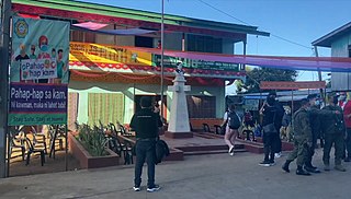
Mapun, officially the Municipality of Mapun, is a 4th class municipality in the province of Tawi-Tawi, Philippines. According to the 2020 census, it has a population of 30,038 people.

Turtle Islands, officially the Municipality of Turtle Islands, is a 5th class municipality in the province of Tawi-Tawi, Philippines. According to the 2020 census, it has a population of 5,683 people.

Balabac, officially the Municipality of Balabac, is a 2nd class municipality in the province of Palawan, Philippines. According to the 2020 census, it has a population of 42,527 people.

Kalayaan, officially the Municipality of Kalayaan, is a 5th class municipality in the South China Sea under the jurisdiction of the province of Palawan, Philippines. According to the 2020 census, it has a population of 193 people making it the least populated town in the Philippines.

The North Borneo dispute, also known as the Sabah dispute, is the territorial dispute between Malaysia and the Philippines over much of the eastern part of the state of Sabah. Sabah was previously known as North Borneo prior to the formation of the Malaysian federation.

This article covers the history of the Philippines from the recognition of independence in 1946 to the end of the presidency of Diosdado Macapagal that covered much of the Third Republic of the Philippines, which ended on January 17, 1973, with the ratification of the 1973 Constitution of the Republic of the Philippines.

The Balabac Strait is one of the straits that connects the South China Sea with the Sulu Sea. It separates Balabac Island, Philippines, from Balambangan and the Banggi Islands north of Borneo that are a part of Malaysia's Sabah state.

Balabac Island is the southernmost island of the Palawan province, and therefore the westernmost undisputed island in the Philippines, only about 50 kilometers (31 mi) north from Sabah, Malaysia, across the Balabac Strait.
The Philippines has claimed many territories throughout its history. These territories include the Spratly Islands, portions of North Borneo, and the Scarborough Shoal.

The Madrid Protocol of 1885 was an agreement between the United Kingdom, German Empire and Spain to recognize the sovereignty of Spain over the Sulu Archipelago as well as the limit of Spanish influence in the region. Under the agreement, Spain relinquishes all claim to Borneo.
The Spanish Government renounces, as far as regards the British Government, all claims of sovereignty over the
territories of the continent of Borneo, which belong, or which have belonged in the past to the Sultan of Sulu (Jolo), and which comprise the neighbouring islands of Balambangan, Banguey, and Malawali, as well as all those comprised within
a zone of three maritime leagues from the coast, and which form part of the territories administered by the Company styled the "British North Borneo Company".
The Malaysia–Philippines border is a maritime boundary located in the South China, Sulu and Celebes Seas. It separates the Malaysian state of Sabah, which is on the island of Borneo, and the Sulu Islands of the southern Philippines.

The history of Sabah can be traced back to about 23–30,000 years ago when evidence suggests the earliest human settlement in the region existed. The history is interwoven with the history of Brunei and the history of Malaysia, which Sabah was previously part of and is currently part of respectively. The earliest recorded history of Sabah being part of any organised civilisation began in the early 15th century during the thriving era of the Sultanate of Brunei. Prior to this, early inhabitants of the land lived in predominantly tribal societies, although such tribal societies had continued to exist until the 1900s. The eastern part of Sabah was ceded to the Sultan of Sulu by the Sultan of Brunei in 1658 for the former helping a victory over Brunei enemies, but many sources stated it had not been ceded at all. By the late 19th century, both territories previously owned by Sultan of Brunei and Sultan of Sulu was granted to British syndicate and later emerged as British North Borneo under the management of the North Borneo Chartered Company. Sabah became a protectorate of the United Kingdom in 1888 and subsequently became a Crown colony from 1946 until 1963, during which time it was known as Crown Colony of North Borneo. On 16 September 1963, Sabah merged with Malaya, Sarawak and Singapore to form Malaysia.

The Cape Melville Lighthouse is a historic lighthouse located in the island of Balabac, the southernmost point of the province of Palawan in the Philippines. It is also the southwest corner of the archipelago. The first-order light was constructed by the Spaniards to light Balabac Strait, the treacherous body of water that separates the Philippines from the neighboring country of Malaysia.
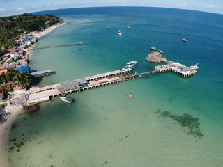
Taganak Island is a small tropical island surrounded by the Sulu Sea in the province of Tawi-Tawi, Philippines. The island is the largest of the seven Philippine Turtle Islands.

The Crown Colony of North Borneo was a Crown colony on the island of Borneo established in 1946 shortly after the dissolution of the British Military Administration. The Crown Colony of Labuan joined the new Crown Colony during its formation. It was succeeded as the state of Sabah through the formation of the Federation of Malaysia on 16 September 1963.
Little Bakkungaan Island is a tiny, flat, tropical island surrounded by the Sulu Sea in the state of Sabah, Malaysia. The island is the largest of the three Malaysian Turtle Islands that together comprise the Turtle Islands National Park. It covers a land area of 8.5 hectares. It is at the very edge of the international treaty limits separating Malaysia from the Republic of the Philippines. Indeed, the island itself is referred to in the international border treaty concluded in 1930 between the United States and the United Kingdom. That treaty sets the international frontier as running in a straight line between Little Bakkungaan Island and Great Bakkungaan Island. Great Bakkungaan Island is one of the Philippine Turtle Islands and less than 2km of water separate the two islands. This makes Little Bakkungaan Island the internationally recognised Malaysian territory that is closest to Philippine territory. The island hosts a turtle hatchery. The island is administered by Sabah Parks. There are several buildings on the island used by park rangers as well as a peer. Much of the island is surrounded by beach.
Great Bakkungaan Island is a small tropical island surrounded by the Sulu Sea in the province of Tawi-Tawi, Philippines. The island is one of the seven Philippine Turtle Islands.

