Marsfield, New South Wales

Last updated

Marsfield
Sydney,  New South Wales
Curzon0134.jpg
Curzon Hall on Agincourt Road, built in 1898
Marsfield, New South Wales
Population13,297 (2016 census) [1]
 • Density3,445/km2 (8,922/sq mi)
Postcode(s) 2122
Elevation86 m (282 ft)
Area3.86 km2 (1.5 sq mi)
Location16 km (10 mi) north-west of Sydney CBD
LGA(s) City of Ryde
State electorate(s) Ryde
Federal division(s) Bennelong
Suburbs around Marsfield:
North Epping
Epping
South Turramurra Macquarie Park
West Pymble
Eastwood Marsfield North Ryde
Denistone East Ryde Ryde

Marsfield is a suburb in the Northern Sydney region of Sydney, in the state of New South Wales, Australia. Marsfield is located 16 kilometres north-west of the Sydney central business district in the local government area of the City of Ryde. [2] [3]

Contents

The suburb is noted for its proximity to a number of leading scientific and tertiary educational institutions such as CSIRO, Macquarie University, the Macquarie Park Business Park and Macquarie University Hospital.

History

The suburb's name is derived from Field of Mars, the original name in the early days of British colonisation of Australia, [4] given to the area by Governor Arthur Phillip in 1792.

Aboriginal culture

The whole area between the Parramatta and Lane Cove Rivers was originally known by its Aboriginal name Wallumatta. The aboriginal name survives in a local park, the Wallumatta Nature Reserve, located at the corner of Twin and Cressy Roads, North Ryde.

European settlement

In 1792 Governor Phillip began the granting of parcels of lands to Royal Marines, and the area was referred to on Phillip's maps as the Field of Mars, named after the Roman Field of Mars probably because of the military link. The area was later part of the suburb of North Ryde, and many[ who? ] consider that Marsfield is still a part of the greater North Ryde area. Field of Mars was also the name for the parish proclaimed in 1835. [4]

In 1874, following extensive debate including a Parliamentary Select Committee, the government resumed the Common for sale and settlement by small farmers, using the money to fund bridges across the Parramatta River at Gladesville and Iron Cove. The land was subdivided into small farms of between 0.4 and 1.6 ha (1–4 acres), and released for sale in stages, starting in 1885. [5]

Many of the streets in Marsfield and bordering suburbs, mainly Eastwood and Macquarie Park, are named after famous historical conflicts or battles, such as Abuklea Road, Agincourt Road, Alma Road, Balaclava Road, Bannockburn Road (West Pymble), Blenheim Road (North Ryde), Buffalo Road (Gladesville), Busaco Road, Corunna Road, Cressy Road (East Ryde), Crimea Road, Culloden Road, Fontenoy Road, Khartoum Road, Nile Close, Plassey Road, Talavera Road, Taranto Road, Torrington Road, Trafalgar Place, Vimiera Road, Waterloo Road.

In 1894, the "Municipality of Marsfield" formed its own local government, splitting from Ryde Municipality. [5]

Stately, historical Curzon Hall was built in the 1890s by Harry Smith and named after his wife Isabella Curzon-Smith. The house was bought in 1921 by the Society of Saint Vincent de Paul which established St Joseph's Seminary on the premises. [6] It now serves as a function centre.

Until the 1950s, substantial parts of the North Ryde/Marsfield area were part of the "Green Belt" which prevented building houses on lots of less than 2 ha (5 acres). The Marsfield-North Ryde Green Belt boundaries were revised and in December 1959, 688 ha (1,700 acres) of land was rezoned. The last Green Belt land was released in September 1969 to build Macquarie Shopping Centre and Macquarie University. [5]

Boundaries

Marsfield is bounded by the Lane Cove River, Macquarie University Sports Fields, Talavera Road, Culloden Road, Waterloo Road, Vimiera Road, Marsfield Park and Culloden Road in the north, Epping Road, Shrimptons Creek, Kent Road, Ruse Street and Shrimptons Creek in the east, Bridge Road and Abuklea Road in the south and Terrys Creek in the west.

Landmarks and institutions

St Anthony's Catholic Church, Agincourt Road Wiki0137.jpg
St Anthony's Catholic Church, Agincourt Road

Marsfield is home to:

Housing

Accommodation for Macquarie University students Marsfield student accommodation.jpg
Accommodation for Macquarie University students

This green suburb features large, modern homes on the higher parts with city views, and townhouses/units in the parts of the suburb that border South Turramurra and Epping. A large number of the residents are students of Macquarie University.

At the 2016 census, 45.6% of occupied private dwellings were semi-detached (townhouses etc.), 32.2% were separate houses and 21.0% were flats, units or apartments. 64.0% were family households, 26.6% were single person households and 9.5% were group households. The average household size was 2.6 people. The tenure was split between 38.7% of properties that were rented, 29.3% owned outright and 26.1% owned with a mortgage. [1]

Public transport

A number of bus routes service Marsfield. The 292/293 routes run from the city through Lane Cove and terminate in Busaco Road, while many other routes e.g. 288/291 travel along Epping Road to Epping station.

Macquarie University railway station is located on Herring Road between the university and Macquarie shopping centre.

Demographics

The larger of two radio dishes at the Marsfield headquarters of the CSIRO Department of Radio Physics. CSIRO Radio Physics Marsfield 2014-04-29.JPG
The larger of two radio dishes at the Marsfield headquarters of the CSIRO Department of Radio Physics.

At the 2016 census, Marsfield recorded a population of 13,297. Of these: [1]

Age distribution
The residents of Marsfield were slightly younger than the country as a whole, with fewer children. Marsfield residents' median age was 35 years, compared to the national median of 38. Children aged 0–14 years made up 13.8% of the population (national average is 18.7%) and people aged 65 years and over made up 17.4% of the population (national average is 15.8%).
Ethnic diversity
39.0% of people were born in Australia. The most common non-Australian countries of birth were China 20.1%, Hong Kong 3.7%, India 3.1%, South Korea 3.0% and Indonesia 1.9%. However, only 12.1% identify their ethnic ancestry as Australian; the other common self-identified ancestries were Chinese 28.7%, English 13.5%, Irish 4.8% and Italian 4.0%. 40.6% of people only spoke English at home. Other languages spoken at home included Mandarin 20.1%, Cantonese 9.3%, Korean 3.6%, Italian 2.0% and Indonesian 1.7%.
Religion
The most common responses for religion were No Religion 36.7% and Catholic 20.5%.
Income
The median weekly household income was $1,641, somewhat above the national median of $1,438.

Related Research Articles

<span class="mw-page-title-main">Ryde, New South Wales</span> Suburb of Sydney, New South Wales, Australia

Ryde is a suburb of Sydney, New South Wales, Australia. Ryde is located 13 km north-west of the Sydney central business district and 8 km east of Parramatta. Ryde is the administrative centre of the local government area of the City of Ryde and part of the Northern Sydney region. It lies on the north bank of the Parramatta River. People from Ryde are colloquially known as Ryders, Rydiens or Rydemen.

<span class="mw-page-title-main">Lane Cove River</span> River in Sydney, Australia

The Lane Cove River, a northern tributary of the Parramatta River, is a tide-dominated, drowned valley estuary west of Sydney Harbour, located in Sydney, New South Wales, Australia. The river is a tributary of the Parramatta River, winding through a bushland valley. It joins Parramatta River at Greenwich and Woolwich, where together they form an arm of Sydney Harbour, and serves as a border along with Middle Harbour separating Sydney's North Shore.

<span class="mw-page-title-main">Epping, New South Wales</span> Suburb of Sydney, New South Wales, Australia

Epping is a suburb of Sydney, in the Australian state of New South Wales, 18 kilometres north-west of the Sydney central business district in the local government area of the City of Parramatta. Epping is in the Northern Sydney region. The suburb is the most north-eastern area of the City of Parramatta. North Epping is a separate suburb to the north and under a different council, Hornsby Shire.

<span class="mw-page-title-main">Wynyard railway station, Sydney</span> Heritage-listed railway station in Sydney, New South Wales, Australia

Wynyard railway station is a heritage-listed underground commuter rail station located in the north-west precinct of the Sydney central business district, in New South Wales, Australia. The station opened on 28 February 1932 to coincide with the opening of the Sydney Harbour Bridge.

<span class="mw-page-title-main">North Epping, New South Wales</span> Suburb of Sydney, New South Wales, Australia

North Epping is a suburb of Sydney, in the state of New South Wales, Australia 19 kilometres north-west of the Sydney central business district in the local government area of Hornsby Shire. North Epping is in the Northern Sydney region, and is often referred to as part of the "North-West" or North Shore. Epping is a separate suburb to the south and under the Parramatta City Council, which shares the postcode of 2121.

The Field of Mars Reserve is a protected nature reserve located on the northern suburbs of Sydney, in the state of New South Wales, Australia. The 50 Hectare reserve is a remnant of bushland situated between the Lane Cove and Parramatta rivers within the suburb of East Ryde and near Gladesville, Hunters Hill and Ryde.

<span class="mw-page-title-main">Eastwood, New South Wales</span> Suburb of Sydney, New South Wales, Australia

Eastwood is a suburb of Sydney, Australia. Eastwood is located 17 kilometres north-west of the Sydney central business district in the local government areas of the City of Ryde and the City of Parramatta. Eastwood is in the Northern Sydney region and is on the Sydney Trains Northern Line (Sydney). despite it being partially in the City of Parramatta. The area is best known for being an ethnic enclave for immigrant populations in Sydney, mainly of East Asian origin but the suburb also has a significant number of other immigrant populations, such as Italian and Anglo-Saxon people. Eastwood was originally its own town but due to the expansion of Sydney, was eventually absorbed.

<span class="mw-page-title-main">North Ryde, New South Wales</span> Suburb of Sydney, New South Wales, Australia

North Ryde is a suburb located in the Northern Sydney region of Sydney, New South Wales, Australia. North Ryde is located 15 kilometres north-west of the Sydney central business district, in the local government area of the City of Ryde.

<span class="mw-page-title-main">Macquarie Park, New South Wales</span> Suburb of Sydney, New South Wales, Australia

Macquarie Park is a suburb in the Northern Sydney region of Sydney, New South Wales, Australia. Macquarie Park is located 13 kilometres north-west of the Sydney central business district in the local government area of the City of Ryde.

<span class="mw-page-title-main">East Ryde, New South Wales</span> Suburb of Sydney, New South Wales, Australia

East Ryde is a suburb of Sydney in the state of New South Wales, Australia. East Ryde is in the Northern Sydney region and is located 12 kilometers north-west of the Sydney central business district, in the local government area of the City of Ryde. East Ryde sits on the western bank of the Lane Cove River. East Ryde shares the postcode of 2113 with the adjacent suburb of North Ryde, though it does not have a post office of its own.

<span class="mw-page-title-main">TG Millner Field</span>

TG Millner Field is in the North West Sydney suburb of Marsfield, New South Wales, Australia, and is currently the home ground of Eastwood Rugby Club, a rugby union Club that competes in the Shute Shield competition.

<span class="mw-page-title-main">Gladesville</span> Suburb of Sydney, New South Wales, Australia

Gladesville is a suburb in the Lower North Shore of Sydney, in the state of New South Wales, Australia. Gladesville is located 10 kilometres north-west of the Sydney central business district, in the local government area of the City of Ryde and the Municipality of Hunter's Hill. Gladesville is part of the federal electorates of North Sydney and Bennelong.

<span class="mw-page-title-main">City of Ryde</span> Local government area in New South Wales, Australia

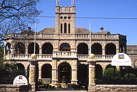
The City of Ryde is a local government area in the Northern Sydney region, in New South Wales, Australia. It was first established as the Municipal District of Ryde in 1870, became a municipality in 1906 and was proclaimed as the City of Ryde in 1992.

<span class="mw-page-title-main">South Turramurra</span> Suburb of Sydney, New South Wales, Australia

South Turramurra is a suburb on the Upper North Shore of Sydney in the state of New South Wales, Australia 18 kilometres (11 mi) north-west of the Sydney central business district, in the local government area of Ku-ring-gai Council. Turramurra and North Turramurra are separate suburbs.

<span class="mw-page-title-main">M2 Hills Motorway</span> Motorway in Sydney, Australia

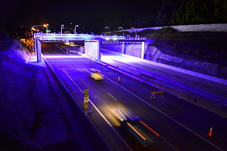
M2 Hills Motorway is a 19.3-kilometre (12.0 mi) tolled urban motorway in Sydney, New South Wales that is part of the Sydney Orbital Network and the National Highway west of Pennant Hills Road. Owned by toll road operator Transurban, it forms majority of Sydney's M2 route, with the Lane Cove Tunnel constituting the rest of the M2 route.

Epping Road is a 10-kilometre-long (6.2 mi) is a major arterial road linking the lower North Shore and Sydney central business district to the north western suburbs of the upper North Shore and Hills District of Sydney, New South Wales, Australia, being a major access road to the commercial, industrial and university areas of North Ryde and Macquarie Park.

<span class="mw-page-title-main">Northern Sydney</span> Region of Sydney in New South Wales, Australia

Northern Sydney is a large metropolitan area in Greater Sydney, New South Wales, Australia on the north shore of Sydney Harbour and Parramatta River. The region embraces suburbs in Sydney's north-east, north and inner north west. Northern Sydney is divided into distinctive regions such as the North Shore, Northern Beaches and Forest District.

<span class="mw-page-title-main">North & Western Bus Lines</span> Defunct Australian bus operator

North & Western Bus Lines was an Australian bus company operating route bus services and charter coaches in Sydney.

<span class="mw-page-title-main">Peter Board High School</span> School in Australia

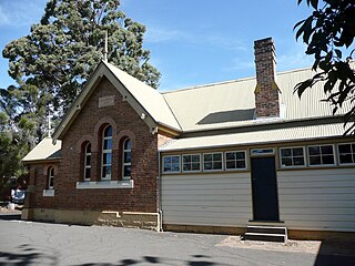
Peter Board High School, known from 1962 to 1985 as North Ryde High School, was a government-funded co-educational comprehensive secondary day school, that was located in North Ryde, a northern suburb of Sydney, New South Wales, Australia. The school opened in 1962 and closed in 1998.

References

  1. 1 2 3 Australian Bureau of Statistics (27 June 2017). "Marsfield (State Suburb)". 2016 Census QuickStats. Retrieved 3 September 2017. OOjs UI icon edit-ltr-progressive.svg
  2. "Realestate.com.au". Realestate.com.au. Retrieved 22 September 2021.
  3. https://www.planning.nsw.gov.au/-/media/Files/DPE/Reports/strategic-employment-review-macquarie-park-2015-12.pdf [ bare URL PDF ]
  4. 1 2 Phippen, Angela (2008). "Marsfield". Dictionary of Sydney. Dictionary of Sydney Trust. Retrieved 21 September 2014.
  5. 1 2 3 4 "Curzon Hall - Federation free style mansion". environment.nsw.gov.au. NSW Office of Environment & Heritage. Retrieved 11 September 2016.
  6. The Book of Sydney Suburbs, Frances Pollon, Angus and Robertson, 1990

33°46′47″S151°06′09″E / 33.77963°S 151.10253°E / -33.77963; 151.10253