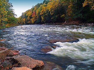
The Daniel Boone National Forest is a national forest in Kentucky. Established in 1937, it includes 708,000 acres (287,000 ha) of federally owned land within a 2,100,000 acres (850,000 ha) proclamation boundary. The name of the forest was changed in 1966 in honor of the explorer Daniel Boone.

The Ochoco National Forest is located in the Ochoco Mountains in Central Oregon in the United States, north and east of the city of Prineville, location of the national forest headquarters. It encompasses 850,000 acres (3,440 km2) of rimrock, canyons, geologic oddities, dense pine forests, and high desert terrain, as well as the headwaters of the North Fork Crooked River. A 1993 Forest Service study estimated that the extent of old growth in the forest was 95,000 acres (38,000 ha).

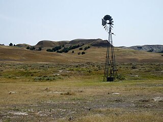
The Oglala National Grassland is a United States National Grassland in the northwest corner of Nebraska. It is in northern Sioux and northwestern Dawes counties, on the borders with South Dakota and Wyoming. It is 94,520 acres (38,250 ha) in size and is one of the small handful of National Grasslands administered by the US Department of Agriculture's Forest Service. It is managed by the U.S. Forest Service together with the Nebraska and Samuel R. McKelvie National Forests and the Buffalo Gap and Fort Pierre National Grasslands from common offices in Chadron, Nebraska.

Butte Valley National Grassland is a 18,425-acre (7,456 ha) United States National Grassland located in northern California. Administered by the United States Forest Service, Klamath National Forest, it is located in northern Siskiyou County, near the Oregon border, between the communities of Dorris and Macdoel along U.S. Highway 97. It was dedicated in July 1991 as the nation's 20th National Grassland. It is administered as part of the Klamath National Forest, and is the sole National Grassland in California and in Region 5 of the Forest Service. Administrative offices are located in Macdoel, California.

The Midewin National Tallgrass Prairie (MNTP) is a tallgrass prairie reserve and United States National Grassland operated by the United States Forest Service. The first national tallgrass prairie ever designated in the U.S. and the largest conservation site in the Chicago Wilderness region, it is located on the site of the former Joliet Army Ammunition Plant between the towns of Elwood, Manhattan and Wilmington in northeastern Illinois. Since 2015, it has hosted a conservation herd of American bison to study their interaction with prairie restoration and conservation.

The Cibola National Forest is a 1,633,783 acre United States National Forest in New Mexico, USA. The name Cibola is thought to be the original Zuni Indian name for their pueblos or tribal lands. The name was later interpreted by the Spanish to mean "buffalo." The forest is disjointed with lands spread across central and northern New Mexico, west Texas and Oklahoma. The Cibola National Forest is divided into four Ranger Districts: the Sandia, Mountainair, Mt. Taylor, and Magdalena. The Forest includes the San Mateo, Magdalena, Datil, Bear, Gallina, Manzano, Sandia, Mt. Taylor, and Zuni Mountains of west-central New Mexico. The Forest also manages four National Grasslands that stretch from northeastern New Mexico eastward into the Texas Panhandle and western Oklahoma. The Cibola National Forest and Grassland is administered by Region 3 of the United States Forest Service from offices in Albuquerque, New Mexico. Elevation ranges from 5,000 ft to 11,301 ft. The descending order of Cibola National Forest acres by county are: Socorro, Cibola, McKinley, Catron, Torrance, Bernalillo, Sandoval County, New Mexico, Lincoln, Sierra, and Valencia counties in New Mexico. The Cibola National Forest currently has 137,701 acres designated as Wilderness. In addition to these acres, it has 246,000 acres classified as Inventoried Roadless Areas pursuant to the Roadless Area Conservation Rule.

The Nebraska National Forest is a United States National Forest located within the U.S. state of Nebraska. The total area of the national forest is 141,864 acres, or 222 sq miles. The forest is managed by the U.S. Forest Service's Nebraska Forests and Grasslands Supervisor's Office in Chadron, Nebraska. The national forest includes two ranger districts, the Bessey Ranger District and the Pine Ridge Ranger District. In descending order of land, the forest lies in parts of Thomas, Dawes, Blaine, and Sioux counties.

Comanche National Grassland is a National Grassland located in southeastern Colorado, United States. It is the sister grassland of Cimarron National Grassland and contains both prairie grasslands and canyons. It is separated into two sections, each operated by a local ranger district, one of which is in Springfield and the other of which is in La Junta. The grassland is administered by the Forest Service together with the Pike and San Isabel National Forests, and the Cimarron National Grassland, from common headquarters located in Pueblo, Colorado.
Buffalo Gap National Grassland is a National Grassland located primarily in southwestern South Dakota, United States. It is also the second largest National Grassland, after Little Missouri National Grassland in North Dakota. Characteristics of the grasslands include mixed prairie and chalky badlands. The grassland is managed by the U.S. Forest Service and is a division of Nebraska National Forest. In descending order of land area it is located in parts of Fall River, Pennington, Jackson, and Custer counties.

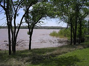
Caddo National Grassland is a national grassland in the southern Great Plains, consisting of two separate sections located in northeastern and southeastern Fannin County, Texas, United States. It is a 17,873-acre (7,233 ha) protected area that was purchased in the 1930s. The goal of the park when purchased was to restore the eroded soil. Two developed recreation areas are around Lake Davy Crockett, which is 388 acres (157 ha) in size. The grassland is divided into two units: Bois d'Arc Creek and Ladonia.

Fort Pierre National Grassland is a United States National Grassland in central South Dakota, south of the capital city Pierre and its neighbor Fort Pierre. The national grassland is primarily a short grass prairie and has a land area of 115,890 acres (46,900 ha). In descending order of area it lies in parts of Lyman, Stanley, and Jones counties. Part of the movie Dances with Wolves was filmed there. It is managed by the U.S. Forest Service together with the Nebraska and Samuel R. McKelvie National Forests and the Buffalo Gap and Oglala National Grasslands from common offices in Chadron, Nebraska. There is a local ranger district office located in Pierre.
Kiowa National Grassland is a National Grassland, located in northeastern New Mexico. The southwestern Great Plains grassland includes prairie and part of the Canadian River Canyon.
Rita Blanca National Grassland is a National Grassland on the Great Plains near the community of Texline in northwest Dallam County, Texas, in the Texas Panhandle, and in southern Cimarron County, Oklahoma, in the western Oklahoma Panhandle. The principal city in the area is Dalhart, Texas, which houses the XIT Museum.

Sheyenne National Grassland is a National Grassland located in southeastern North Dakota in the United States, comprising 70,446 acres (28,508 ha) of public land amid 64,769 acres (26,211 ha) of privately owned land in a region of sandy soils in the vicinity of the Sheyenne River in Ransom and Richland Counties. It is the only National Grassland in the tallgrass prairie region of the U.S. The grassland provides habitat for the largest population of greater prairie chickens in North Dakota, as well as the Dakota skipper butterfly, the western prairie fringed orchid, and numerous ferns, as well as grazing land for approximately 83 cattle ranchers.
Loyalsock State Forest is a Pennsylvania state forest in Pennsylvania Bureau of Forestry District #20. The forest spans across the northern tier's "Endless Mountains" and is a total of 114,552 acres (46,358 ha). The Loyalsock is a “working forest” and is managed for pure water, recreation, plant and animal habitats, sustainable timber, and natural gas.

The Sam Houston National Forest, one of four National Forests in Texas, is located 50 miles north of Houston. The forest is administered together with the other three United States National Forests and two National Grasslands located entirely in Texas, from common offices in Lufkin, Texas. The units include Angelina, Davy Crockett, Sabine, and Sam Houston National Forests, plus Caddo National Grassland and Lyndon B. Johnson National Grassland. There are local ranger district offices located in New Waverly. It is located in portions of three Texas counties including Montgomery, San Jacinto, and Walker.
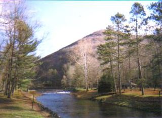
Ole Bull State Park is a 132-acre (53 ha) Pennsylvania state park in Stewardson Township, Potter County, Pennsylvania in the United States. The park is located on Pennsylvania Route 144, 26 miles (42 km) north of Renovo and 18 miles (29 km) south of Galeton. Ole Bull State Park is in the Kettle Creek Valley, and is surrounded by Susquehannock State Forest. The woods surrounding the park are called the Black Forest because of its once dense tree cover.

The Yolla Bolly–Middle Eel Wilderness is a federally designated wilderness area in the Yolla Bolly Range of the southern Klamath Mountains and the Inner Northern California Coast Ranges, in Northern California.

The Black Kettle National Grassland, in Roger Mills County, Oklahoma and Hemphill County, Texas, contains 31,286 acres (12,661 ha) of which 30,710 acres (12,430 ha) are in Oklahoma.

Manzano Mountain Wilderness is a designated Wilderness Area within the Cibola National Forest, located about 50 miles (80 km) south-southeast of Albuquerque. It is located in western Torrance County and eastern Valencia County. The Wilderness area includes 36,875 acres (14,923 ha) with elevations ranging from 6,100 feet (1,900 m) to 10,098 feet (3,078 m) at Manzano Peak.