Mersey and Irwell Navigation

Last updated

Mersey and Irwell Navigation
Stickings-lock.jpg
Stickings Lock on the River Irwell, c. 1850
Specifications
Statusmostly destroyed
History
Date of act1721
Date completed1734
Date closed1880s
Geography
Start pointSalford
End pointWidnes
Mersey and Irwell Navigation (1850)
BSicon uexSTR.svg
River Irwell
BSicon uWHRF.svg
Salford wharfs
BSicon uFABZgl+l.svg
BSicon uSTRq.svg
Manchester and Salford Junction Canal
BSicon uSTRq.svg
BSicon uFABZgr+r.svg
Manchester Bolton & Bury Canal
BSicon uFABZgl+l.svg
BSicon uSTRq.svg
Branch to Bridgewater Canal
BSicon uFGATEu.svg
Throstles Nest Lock
BSicon uFGATEu.svg
Mode Wheel Lock
BSicon uSTRl.svg
BSicon uSTR+r.svg
BSicon uFGATEu.svg
Barton lock
BSicon uSTRq.svg
BSicon uKRZu.svg
Barton aqueduct, Bridgewater Canal
BSicon uexSTR+l.svg
BSicon ueABZgr.svg
BSicon uexSTR+l.svg
BSicon uexSTRr.svg
BSicon uFGATEu.svg
Stickings lock
BSicon uexSTRl.svg
BSicon uexSTRq.svg
BSicon ueABZg+r.svg
BSicon uFGATEu.svg
Holmes Bridge Lock
BSicon uFGATEu.svg
Calamanco Lock
BSicon uKMW.svg
River Irwell
BSicon uSTR.svg
BSicon uexSTR+l.svg
River Mersey
BSicon uSTR+l.svg
BSicon uSTR+r.svg
BSicon uSTRl.svg
BSicon uxABZg+r.svg
BSicon uSTR.svg
BSicon uxABZgl.svg
BSicon uFGATEr.svg
BSicon uxABZgr.svg
Sandywarps lock
BSicon uSTR.svg
BSicon uexSTRl.svg
BSicon uexSTRq.svg
BSicon uexSTRr.svg
BSicon uFGATEu.svg
Millbank Lock
BSicon ueABZg+l.svg
BSicon uexSTRq.svg
BSicon uexSTRq.svg
River Bollin
BSicon ueABZgl.svg
BSicon uexABZq+r.svg
BSicon uexSTRq.svg
BSicon uexSTR+r.svg
Rixton
BSicon uFGATEu.svg
BSicon uexFGATEu.svg
BSicon uexSTR.svg
double locks / Old lock
BSicon ueABZg+l.svg
BSicon uexABZqr.svg
BSicon uexSTRq.svg
BSicon POINTERg@f.svg
BSicon uexSTRr.svg
Lymm loop
BSicon ueABZgl.svg
BSicon uexSTRq.svg
BSicon uexABZq+r.svg
BSicon POINTERf@g.svg
BSicon uexSTR+r.svg
River
BSicon uFGATEu.svg
BSicon uexSTR.svg
BSicon uexSTR.svg
Woolston Lock
BSicon uSTR.svg
BSicon uexFGATEu.svg
BSicon uexSTR.svg
Powder Mill Lock
BSicon ueTEEnl.svg
BSicon uexSTR+r.svg
BSicon uexSTR.svg
BSicon uexSTR.svg
Woolston New Cut / Old Cut
BSicon uFGATEu.svg
BSicon uexSTR.svg
BSicon uexABZg+l.svg
BSicon uexSTRr.svg
Paddington Lock
BSicon ueABZg+l.svg
BSicon uexKRZo.svg
BSicon uexSTRr.svg
Wooden Bridge (aqueduct)
BSicon uSTR.svg
BSicon uexSTRl.svg
BSicon uexSTRq.svg
BSicon uexSTR+r.svg
BSicon uABZgl.svg
BSicon uFGATEr.svg
BSicon uSTR+r.svg
BSicon uexSTR.svg
Latchford Lock
BSicon ueABZgl.svg
BSicon uexSTR+r.svg
BSicon ueTEEnl.svg
BSicon uexSTRr.svg
Feeder from Woolston Cut
BSicon uFGATEu.svg
BSicon uexSTR.svg
BSicon uSTR.svg
Howley lock
BSicon ueABZg+l.svg
BSicon uexSTRr.svg
BSicon uSTR.svg
BSicon uSTRl.svg
BSicon uSTR+r.svg
BSicon uKMW.svg
Runcorn and Latchford Canal
BSicon uexABZq+r.svg
BSicon uexSTR+r.svg
BSicon uSTR.svg
BSicon uSTR.svg
Sankey Canal
BSicon uexSTR.svg
BSicon ugFGATEu.svg
BSicon uSTR.svg
BSicon uSTR.svg
Sankey Lock
BSicon uexSTR.svg
BSicon uexSTRl.svg
BSicon uFABZgr+r.svg
BSicon uSTR.svg
Sankey Brook
BSicon uFABZgl+l.svg
BSicon uFGATEl.svg
BSicon uFABZgr+r.svg
BSicon uSTR.svg
Fiddlers Ferry lock
BSicon uexSTR.svg
BSicon uSTR.svg
BSicon uFGATEu.svg
Old Quay locks
BSicon uSTRl.svg
BSicon uFGATEl.svg
BSicon uFKRZ.svg
BSicon uSTRr.svg
Widnes lock, Sankey Canal
BSicon uSTR.svg
River Mersey

The Mersey and Irwell Navigation was a river navigation in North West England, which provided a navigable route from the Mersey estuary to Salford and Manchester, by improving the course of the River Irwell and the River Mersey. Eight locks were constructed between 1724 and 1734, and the rivers were improved by the construction of new cuts several times subsequently. Use of the navigation declined from the 1870s, and it was ultimately superseded by the Manchester Ship Canal, the construction of which destroyed most of the Irwell section of the navigation and the long cut between Latchford and Runcorn.

Contents

History

Rivers Mercy and Irwell Navigation Act 1720
Act of Parliament
Coat of Arms of Great Britain (1714-1801).svg
Long title An Act for making the Rivers Mercy and Irwell navigable, from Liverpoole to Manchester, in the County Palatine of Lancaster.
Citation 7 Geo. 1. St. 1 c. 15
Dates
Royal assent 7 June 1721

The idea that the Rivers Mersey and Irwell should be made navigable from the Mersey Estuary in the west to Manchester in the east was first proposed in 1660, and revived in 1712 by Thomas Steers. [1] In 1720 the necessary bills were tabled. The Act of Parliament (7 Geo. 1. St. 1 c. 15) for the navigation was received in 1721. [2] [3] The construction work was undertaken by the Mersey & Irwell Navigation Company. [1] Work began in 1724, and by 1734 boats "of moderate size" could make the journey from quays in Water Street, Manchester, 53°28′46″N2°15′23″W / 53.4794°N 2.2564°W / 53.4794; -2.2564 to the Irish Sea. [4] The navigation was suitable only for small ships, and during periods of drought, or when strong easterly winds held back the tide in the estuary, there was not always sufficient draft for a fully laden boat. [5]

Eight weirs were constructed along the length of the route, and some shortcuts were made around shallower parts of the river, with locks, to enable the passage of boats. [3] Some difficult turns along the river were also removed.

The navigation was modified and improved on a number of occasions. A canal section known as the Runcorn and Latchford Canal was added in 1804, [6] to bypass part of the lower reaches. In 1740 the company built quays and warehouses along Water Street in Manchester. [3]

In 1779 a group of businessmen from Manchester and Liverpool purchased the navigation, and began making improvements. A difficult section below Howley lock was cut out by the building of the Runcorn to Latchford Canal, and at Runcorn a basin was built for boats to wait for the tide. [7]

An aqueduct was built from Woolston Cut, to replace water lost from the locks that were used to raise boats into the new canal section. [7]

The completion of the Bridgewater Canal in 1776, followed in 1830 by the opening of the Liverpool & Manchester Railway, meant increasing competition for the carriage of goods, and in 1844 the navigation was purchased on behalf of the Bridgewater Canal Company, for £550,800. In 1846 ownership was transferred to the canal company. [7] [lower-alpha 1]

The company in charge of the navigation was known by several names. These include "The Old Navigation", "Old Quay Company", and "Old Quay Canal". [8]

Decline

In 1872, the navigation was sold to the newly formed [9] Bridgewater Navigation Company for £1,112,000, [5] but it had by then fallen into disrepair. In 1882 it was described as being "hopelessly choked with silt and filth", [10] and was open to 50-ton boats for only 47 out of 311 working days. [10]

Economic conditions deteriorated during the mid-1870s, in what has been called the Long Depression. [11] The dues charged by the Port of Liverpool, and the railway charges from there to Manchester, were perceived to be excessive; it was often cheaper to import goods via Hull, on the other side of England, than it was to use Liverpool, about 35 miles (56 km) away. [12] A ship canal was proposed as a way to reverse Manchester's economic decline by giving the city direct access to the sea for its imports and exports of manufactured goods.

Closure

The construction of the Manchester Ship Canal obliterated large parts of the earlier navigation, including almost the whole of the Irwell part of the course (except for a short length upstream of Pomona Docks, which is the only surviving part of the navigation today).

A short way downstream of the confluence with the Mersey, the ship canal followed a more southerly course than the old navigation, which remained in use as late as 1950 from Rixton Junction downstream.

The lower reaches of the ship canal from Eastham to Latchford obliterated a large section of the Runcorn to Latchford Canal, leaving just a short stub joining the navigation to the canal near Stockton Heath. The Woolston New Cut, excavated in 1821, [13] is still visible although completely dry. Woolston Old Cut, built in 1755, still exists although the lock is gone.

Design and construction

Locks

There were originally eight locks along the navigation. [8] Each lock chamber was 13 feet wide by 65 feet long. [7]

Throstles Nest Lock was the highest on the navigation. [14] It was followed by Mode Wheel lock. Lock 3 was at Barton-upon-Irwell, next to James Brindley's original Barton Aqueduct. The remains of the lock island appear to be situated in the same location as the island presently used for the swing aqueduct. Stickins Lock followed, in a 600-yard (550 m) cut. [14] There were further locks named Holmes Bridge, Calamanco, Holmes Bridge and finally Howley Tidal.

Further locks were added throughout the route's history. These include a new Stickins Lock, Sandywarps Lock in a cut located close to the confluence of the Irwell and Mersey, Butchersfield Locks (located on a short cut known as the Butchersfield Canal), Woolston New (located at the upper end of Woolston New Cut), Paddington Lock (lower end of Woolston New Cut), Woolston Old Lock, Latchford, and Old Quay Sea Locks.

See also

Related Research Articles

<span class="mw-page-title-main">Trent and Mersey Canal</span> Canal in England

The Trent and Mersey Canal is a 93+12-mile (150 km) canal in Derbyshire, Staffordshire and Cheshire in north-central England. It is a "narrow canal" for the vast majority of its length, but at the extremities to the east of Burton upon Trent and north of Middlewich, it is a wide canal.

<span class="mw-page-title-main">Manchester Bolton & Bury Canal</span> Canal in Greater Manchester, England

<span class="mw-page-title-main">River Mersey</span> Major river emptying into Liverpool Bay

The River Mersey is a major river in North West England. Its name derives from Old English and means "boundary river", possibly referring to its having been a border between the ancient kingdoms of Mercia and Northumbria. For centuries it has formed part of the boundary between the historic counties of Lancashire and Cheshire.

<span class="mw-page-title-main">History of the British canal system</span> Building, use, decline and restoration of artificial waterways in the United Kingdom

The canal network of the United Kingdom played a vital role in the Industrial Revolution. The UK was the first country to develop a nationwide canal network which, at its peak, expanded to nearly 4,000 miles in length. The canals allowed raw materials to be transported to a place of manufacture, and finished goods to be transported to consumers, more quickly and cheaply than by a land based route. The canal network was extensive and included feats of civil engineering such as the Anderton Boat Lift, the Manchester Ship Canal, the Worsley Navigable Levels and the Pontcysyllte Aqueduct.

<span class="mw-page-title-main">Manchester Ship Canal</span> UK canal linking Manchester to the coast

<span class="mw-page-title-main">Bridgewater Canal</span> Canal in northwest England

The Bridgewater Canal connects Runcorn, Manchester and Leigh, in North West England. It was commissioned by Francis Egerton, 3rd Duke of Bridgewater, to transport coal from his mines in Worsley to Manchester. It was opened in 1761 from Worsley to Manchester, and later extended from Manchester to Runcorn, and then from Worsley to Leigh.

<span class="mw-page-title-main">Castlefield</span> Human settlement in England

Castlefield is an inner-city conservation area in Manchester, North West England. The conservation area which bears its name is bounded by the River Irwell, Quay Street, Deansgate and Chester Road. It was the site of the Roman era fort of Mamucium or Mancunium which gave its name to Manchester. It was the terminus of the Bridgewater Canal, the world's first industrial canal, built in 1764; the oldest canal warehouse opened in 1779. The world's first passenger railway terminated here in 1830, at Liverpool Road railway station and the first railway warehouse opened here in 1831.

<span class="mw-page-title-main">River Weaver</span> River in Cheshire, England

The River Weaver is a river, navigable in its lower reaches, running in a curving route anti-clockwise across west Cheshire, northern England. Improvements to the river to make it navigable were authorised in 1720 and the work, which included eleven locks, was completed in 1732. An unusual clause in the enabling Act of Parliament stipulated that profits should be given to the County of Cheshire for the improvement of roads and bridges, but the navigation was not initially profitable, and it was 1775 before the first payments were made. Trade continued to rise, and by 1845, over £500,000 had been given to the county.

<span class="mw-page-title-main">Sankey Canal</span> Canal in England

The Sankey Canal in North West England, initially known as the Sankey Brook Navigation and later the St Helens Canal, is a former industrial canal, which when opened in 1757 was England's first of the Industrial revolution, and the first modern canal.

<span class="mw-page-title-main">River Irwell</span> River in Lancashire, United Kingdom

The River Irwell is a tributary of the River Mersey in north west England. It rises at Irwell Springs on Deerplay Moor, approximately 1+12 miles north of Bacup and flows southwards for 39 mi (63 km) to meet the Mersey near Irlam. The Irwell marks the boundary between Manchester and Salford, and its lower reaches have been canalised and now form part of the Manchester Ship Canal.

<span class="mw-page-title-main">Canals of the United Kingdom</span> Network of inland waterways

The canals of the United Kingdom are a major part of the network of inland waterways in the United Kingdom. They have a varied history, from use for irrigation and transport, through becoming the focus of the Industrial Revolution, to today's role of recreational boating. Despite a period of abandonment, today the canal system in the United Kingdom is again increasing in use, with abandoned and derelict canals being reopened, and the construction of some new routes. Canals in England and Wales are maintained by navigation authorities. The biggest navigation authorities are the Canal & River Trust and the Environment Agency, but other canals are managed by companies, local authorities or charitable trusts.

<span class="mw-page-title-main">Runcorn Docks</span> Inland port in Cheshire, England

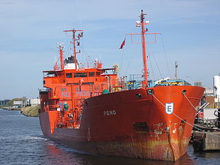
Runcorn Docks, originally the Bridgewater Docks, is an inland port on the Manchester Ship Canal in the town of Runcorn, Cheshire, England. It is operated by Peel Ports and handles bulk and project cargo.

<span class="mw-page-title-main">Rochdale Canal</span> Trans-Pennine navigable channel in northern England

The Rochdale Canal is in Northern England, between Manchester and Sowerby Bridge, part of the connected system of the canals of Great Britain. Its name refers to the town of Rochdale through which it passes.

<span class="mw-page-title-main">Canals in Cheshire</span>

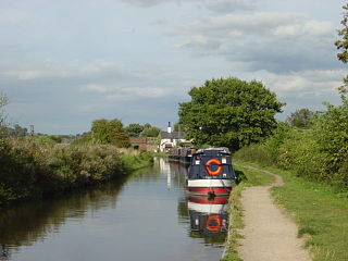
A large number of canals were built in Cheshire, England, during the early phases of the Industrial Revolution to transport goods and raw materials. This resulted in a significant canal network which is now enjoyed by holiday-makers, anglers, walkers, and others.

<span class="mw-page-title-main">Manchester and Salford Junction Canal</span>

The Manchester and Salford Junction Canal was a canal in the city of Manchester. It was originally built to provide a direct waterway between the Mersey and Irwell Navigation and the Rochdale Canal. The canal opened in 1839 and was abandoned in 1922.

<span class="mw-page-title-main">North Pennine Ring</span>

The North Pennine Ring is a canal ring which crosses the Pennines between Manchester, Leeds and Castleford. It follows parts of five canals, and shares much of its route with the Outer Pennine Ring, which uses a different route for the southern crossing of the Pennines.

<span class="mw-page-title-main">The Towers (Manchester)</span> Building in Manchester, United Kingdom

The Towers is a research establishment for new technologies in cotton production. The Shirley Institute was established in 1920 at a cost of £10,000 to accommodate the newly formed British Cotton Industry Research Association. It is a Grade II* listed building in the suburb of Didsbury, located 6 miles (10 km) south of the centre of Manchester, England.

<span class="mw-page-title-main">Runcorn and Weston Canal</span> Canal in Cheshire, England

The Runcorn and Weston Canal was a short canal near Runcorn in Cheshire, England, constructed to link the Weston Canal, which is part of the River Weaver Navigation, to the Bridgewater Canal and Runcorn Docks. It was completed in 1859, but was little used. Around half of it became the Arnold Dock in 1876, when it was made wider and deeper, and linked to Fenton Dock by a ship lock. The dock section and some of the remaining canal were filled in during the 1960s, and the remainder is in a derelict state.

<span class="mw-page-title-main">Runcorn to Latchford Canal</span> Canal in North West England

The Runcorn to Latchford Canal was a man-made canal that ran from Runcorn, to the Latchford area of Warrington. It connected the Mersey and Irwell Navigation to the River Mersey at Runcorn.

<span class="mw-page-title-main">Hulme Locks Branch Canal</span> Canal in Manchester, England

The Hulme Locks Branch Canal is a canal in the city of Manchester. It is 200m in length and was built to provide a direct waterway between the Mersey and Irwell Navigation and the Bridgewater Canal. The canal opened in 1838 and was superseded in 1995 by a new lock at Pomona Dock 3. As both of its locks remain closed, the canal is now overgrown.

References

Notes

  1. The Bridgewater Canal and the Manchester Ship Canal are thus now owned by the same company.

Citations

  1. 1 2 Gray (1997), p. 5
  2. Albert (2007), p. 200
  3. 1 2 3 Owen (1988), p. 10
  4. Owen (1983), pp. 3–4.
  5. 1 2 Owen (1983), p. 7
  6. Canal Archive:Bridging the Years, The Transport Archive, archived from the original on 3 March 2016, retrieved 13 August 2008
  7. 1 2 3 4 Owen (1988), p. 11
  8. 1 2 "Mersey and Irwell Navigation". Peter J Whitehead. 2003. Archived from the original on 28 August 2008. Retrieved 13 August 2008.
  9. Hadfield & Biddle 1970, p. 362.
  10. 1 2 Owen (1983), p. 16
  11. Harford (1994), p. 41
  12. Owen (1983), p. 27
  13. Wong, M. H. (2004), Wetlands Ecosystems in Asia, Elsevier, p. 132, ISBN   978-0-444-51691-6
  14. 1 2 Owen (1988), pp. 15–16

Bibliography