
Gipping Rural District was a rural district in the county of East Suffolk, England. It was created in 1934 by the merger of the disbanded Bosmere and Claydon Rural District and the disbanded East Stow Rural District, under a County Review Order. It was named after the River Gipping and administered from Needham Market.

Mendlesham is a village in Suffolk with 1,407 inhabitants at the 2011 census. It lies 5 miles (8 km) north east of Stowmarket and 73.135 miles (117.699 km) from London.

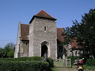
Troston is a village and civil parish in Suffolk, England, five miles north-east of Bury St Edmunds. Its parish church contains rare mediaeval wall paintings, including dragon-slaying and the Martyrdom of St Edmund.

Brockley(not to be confused with Brockley Green, 8 miles southwest in Hundon parish) is a village and civil parish in the West Suffolk district of Suffolk, England. Brockley parish includes the hamlets of Pound Green and Gulling Green. According to the 2001 Census parish population was 281, and increased to 312 at the 2011 Census.
Culpho is a hamlet and civil parish in the East Suffolk district of Suffolk, about 4 miles (6.4 km) northeast of the centre of Ipswich and 3+1⁄2 miles (5.6 km) west of Woodbridge.

Farnham is a village and civil parish about 3 miles (4.8 km) south-west of Saxmundham in the English county of Suffolk on the A12 road. Farnham is located west of Friday Street, south of Benhall Low Street and north-east of Stratford St Andrew.

Heveningham is a village and civil parish in the East Suffolk district of Suffolk in eastern England. Located four miles south-west of Halesworth, in 2005 it had a population of 120.

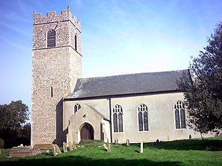
Sotherton is a dispersed village and civil parish in the East Suffolk district, in the English county of Suffolk. It is located approximately 7 miles (11 km) south of Beccles and 3+3⁄4 miles (6.0 km) north-east of Halesworth. The A145 road passes through the east of the parish area. The mid-2005 population estimate for Sotherton parish was 80. Uggeshall is located just to the north-east, Byford to the south and Blythburgh to the south-east. Latitude Festival takes place a couple of miles east.
Stoven is a village and former civil parish now in the parish of Brampton with Stoven, in the East Suffolk district of the English county of Suffolk. It is located approximately 4.5 miles (7.2 km) north east of Halesworth and 5.5 miles (8.9 km) south of Beccles. In 1961 the parish had a population of 110. On 1 April 1987 the parish was abolished and merged with Brampton to form "Brampton with Stoven" and the population of the expanded parish was 427 at the 2011 United Kingdom census. Brampton is located just to the west, Uggeshall to the south and Sotterley to the north.

Flowton is a village and civil parish in the Mid Suffolk district of Suffolk in eastern England, with a population of 117 people. The name 'Flowton' originally derives from the word 'Flocctun', meaning a flock of sheep or a sheep farm. The parish is located around six miles north west of Ipswich, which is the county town of Suffolk. Flowton contains the hamlet of Flowton Brook, and consists of rural farmland accompanied by scattered farm houses and a few newer builds situated nearby the parish church of 'St Mary's'. In the 1870s, Flowton was described as:

Stonham Aspal is a village and civil parish in the Mid Suffolk district of Suffolk in eastern England, some five miles (8 km) east of the town of Stowmarket. Nearby villages include Mickfield, Little Stonham and Pettaugh. Its population in 2011 was 601. The village has a primary school. It is set in farmland, but has a busy main road, A1120, running through.

Euston is a village and civil parish in the West Suffolk district of Suffolk in eastern England. Located on the A1088 around two miles south of Thetford, in 2005 its population was 130.
Ashby is a former civil parish, now in the parish of Somerleyton, Ashby and Herringfleet, in the East Suffolk district, in the north of the English county of Suffolk. It is 5+1⁄2 miles (8.9 km) north-west of Lowestoft.

Nowton is a small village and civil parish in the West Suffolk district of Suffolk in eastern England. Located on the southern edge of Bury St Edmunds, in 2005 its population was estimated to be 140. At the 2011 census 163 people were recorded as living in the village.

Denham is a village and civil parish in the West Suffolk district of Suffolk in eastern England. Located around five miles west of Bury St Edmunds, in 2005 its population was 170, increasing to 171 at the 2011 Census. The parish also includes the hamlet of Denham End, as well as the remains of Denham Castle, a motte-and-bailey structure. The parish council is shared with neighbouring Barrow.
Hawkedon is a village and civil parish in the West Suffolk district of Suffolk in eastern England. Located around 7 miles (11 km) south-south-west of Bury St Edmunds, the parish also contains the hamlet of Thurston End, and in 2005 had a population of 120. The majority of the village is classed as a conservation area.

Freston is a small village and civil parish in the Babergh district, in the county of Suffolk, England, located on the Shotley Peninsula, 4 miles south-east of Ipswich. In 2001 the parish had a population of 122, reducing slightly to 120 at the 2011 Census.

Swilland is a village and civil parish, in the East Suffolk district, in the English county of Suffolk. It is north of the large town of Ipswich. Swilland has a church called St Mary's Church and a pub called The Moon & Mushroom Inn which has been awarded Suffolk Pub of The Year on two occasions by the Evening Star. Swilland shares a parish council with Witnesham called "Swilland and Witnesham Grouped Parish Council".
Chediston is a village and a civil parish on the B1123 road, in the East Suffolk district, in the English county of Suffolk. It is located 2 miles west of Halesworth, its post town. The population of the civil parish as of the 2011 census was 195 and in 2018 it was estimated to be 234.
Linstead Parva is a small village and civil parish in the East Suffolk district of Suffolk in eastern England. It has a small but notable 13th-century parish church, still in regular use. The village pub, The Greyhound, was already established and trading when referenced in 1874, but it closed permanently in March 1955, and is now a private dwelling.

