Related Research Articles

Whittier is a neighborhood within the Powderhorn community in the U.S. city of Minneapolis, Minnesota, bounded by Franklin Avenue on the north, Interstate 35W on the east, Lake Street on the south, and Lyndale Avenue on the west. It is known for its many diverse restaurants, coffee shops and Asian markets, especially along Nicollet Avenue. The neighborhood is home to the Minneapolis Institute of Art, the Minneapolis College of Art and Design, and the Children's Theatre Company.
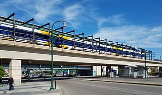
Lake Street/Midtown station, also referred locally as just Midtown station, is a Blue Line light rail station in Minneapolis, Minnesota, United States.

Lake Street is a major east-west thoroughfare in Minneapolis, Minnesota which is located between 29th and 31st Streets in south Minneapolis. It was named such because it runs through the Chain of Lakes area on the west side of town and passes over a small channel linking Bde Maka Ska and Lake of the Isles.

The Midtown Greenway is a 5.7-mile (9.2 km) rail trail in Minneapolis, Minnesota. It is considered under segregated cycle facilities.
The Southwest LRT is an under–construction 14.5-mile (23.3 km) light rail transit corridor in Hennepin County, Minnesota, with service between Minneapolis and Eden Prairie. The estimated one-way travel time from Southwest Station in Eden Prairie to Target Field Station in Minneapolis is 32 minutes. The Southwest LRT will extend through St. Louis Park, Hopkins and Minnetonka along the route. Major locations on the line will include Bde Maka Ska, Cedar Lake, the Walker Art Center, the Minneapolis Sculpture Garden and Target Field in downtown Minneapolis. On November 15, 2018, the council accepted an $800 million construction bid by Lunda Construction and C.S. McCrossan, with early construction starting in December 2018.

The Midtown Exchange is a large commercial building located in the Midtown Phillips neighborhood, in Minneapolis, Minnesota, United States. It is the second-largest building in Minnesota in terms of leasable space, after the Mall of America. It was built in 1928 as a retail and mail-order catalog facility for Sears, which occupied it until 1994. It lay vacant until 2005, when it was transformed into multipurpose commercial space.
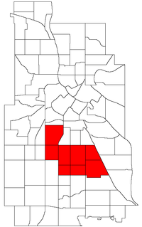
Phillips is a community in Minneapolis, just south of downtown. Phillips is a diverse area in many ways: its population includes people of many nationalities; it has a mix of residential, commercial and industrial uses; and it is home to several large employers such as Abbott Northwestern Hospital, Wells Fargo Mortgage and Allina Health Care Services along with small neighborhood businesses. Traditionally, it was both a community and a neighborhood. On May 9, 2002, Phillips neighborhood was subdivided into four smaller neighborhoods. The official neighborhoods are now known as Ventura Village, Phillips West, East Phillips, and Midtown Phillips. Though not an officially designated neighborhood, Phillips also includes the Little Earth residential area. The boundaries of the Phillips community are Interstate 94 to the north, Hiawatha Avenue to the east, Lake Street to the south, and Interstate 35W to the west.

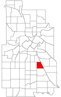
Midtown Phillips is a neighborhood within the Phillips community in Minneapolis. Its boundaries are East 24th Street to the north, Bloomington Avenue to the east, East Lake Street to the south, and Chicago Avenue to the west.
Midtown is a loosely defined region in south Minneapolis, Minnesota, United States. There are no hard-set boundaries to the midtown area, but it is generally agreed to include the area in the vicinity of Lake Street between Interstate 35W and Hiawatha Avenue. Lake Street is the border between the Phillips and Powderhorn communities of Minneapolis. Lake Street/Midtown LRT Station, with service on the METRO Blue Line, is located on the eastern edge of the area.

Robert Lilligren is an American politician and member of the Minnesota Democratic-Farmer-Labor Party. He was an elected member of the Minneapolis City Council. He was first elected in 2001, to represent the 8th Ward of the Minneapolis City Council. Following the defeat of Green Party member Dean Zimmermann, during the 2005 municipal elections, Lilligren represented the 6th Ward of the City of Minneapolis. When first elected to office, Lilligren was serving as a volunteer on eight different community boards and commissions including: vice-chair of Phillips West Neighborhood organization, the Midtown Greenway Coalition, the Hennepin County-appointed I-35W Project Advisory Committee, and as a board member for several affordable housing groups throughout South Minneapolis. He lost his re-election bid in 2013 to Abdi Warsame.
The Minneapolis Streetcar System is a proposed streetcar system for the city of Minneapolis, Minnesota. Extensive studies and plans for the new system were completed in 2007 and presented to the Minneapolis City Council in January 2008; on April 2, 2010, the Council voted to approve the plans and seek funding. On December 21, 2010 the Federal Transit Administration granted $900,000 to further study the Nicollet and Central Avenue corridors.

The Kenilworth Trail is a paved bicycle trail in Minneapolis, Minnesota, United States. It runs nearly 1.5 miles (2.4 km) and acts as a connector between the Cedar Lake Trail in the north and the Midtown Greenway in the south. Like the Cedar Lake Trail, most of the route is composed of a triple-divided cycleway/pedway with a pair of one-way paths for bicycles and another path for pedestrians. On some maps, a southern segment of the Kenilworth Trail is called the Burnham Trail. The trail corridor has been considered the most highly trafficked in the Minneapolis park system.

Little Sugar Creek Greenway is a linear park and stream restoration project in Mecklenburg County, North Carolina. When completed it will consist of twenty miles of trails and paved walkways running from Cordelia Park just north of uptown Charlotte, then south through midtown Charlotte, and continuing all the way to the South Carolina state line. The Little Sugar Creek Greenway will be a key part of the Carolina Thread Trail, a regionwide network of trails that will ultimately pass through 15 counties.
Midtown is a neighborhood in Wichita, Kansas, United States. A mixed commercial and residential area on the east bank of the Little Arkansas River, it is the oldest neighborhood in the city.
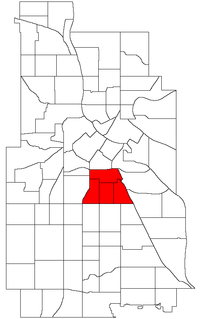
Powderhorn is a community in Minneapolis, which consists of eight different neighborhoods.
Corcoran is a neighborhood within the Powderhorn community in Minneapolis, Minnesota, United States. The neighborhood is bordered by Longfellow and Howe neighborhoods to the east, Phillips to the north, Powderhorn Park to the west and Standish to the south. Its official boundaries are East Lake Street to the north, Hiawatha Avenue to the east, East 36th Street to the south, and Cedar Avenue to the west.

Hiawatha LRT Trail is a 4.7-mile (7.6 km), multi-use path adjacent to a light-rail transit line in Minneapolis, Minnesota, United States, that is popular with bicycle commuters. Users travel along the Metro Blue Line and Hiawatha Avenue transit corridor, reaching downtown Minneapolis near an indoor sports stadium at the trail’s northern end, and reaching a bridge above Minnehaha Creek at the trail’s southern end. Hiawatha LRT Trail provides a vital link between several Minneapolis neighborhoods and the city’s downtown area.

Little Earth Trail is an approximately 1-mile (1.6 km), multi-use bicycle path in Minneapolis, Minnesota, United States, that links several neighborhoods, parks, businesses, and trails in the Phillips community. The trail begins at its northern end near the intersection of East Franklin Avenue and 16th Avenue South and eventually follows the west side of Hiawatha Avenue to the Midtown Greenway and Martin Olav Sabo Bridge. Named after the nearby Little Earth community, the shared-use pathway provides transportation and recreation opportunities, and is a frequent location of activism on social justice issues in Minneapolis.

Min Hi Line is a proposed linear park and shared-use path that would eventually re-purpose an active rail and agri-industrial corridor in the Longfellow community of Minneapolis, Minnesota, United States. Modeled after successful projects like the Atlanta Beltline and New York High Line, it would feature an approximately 3-mile (4.8 km), shared-use pathway that traverses housing, retail, commercial buildings, gardens, playgrounds, and public art installments. Two pilot projects completed in 2018 and 2019 connect the Min Hi Line corridor to trail systems at its northern and southern ends.
References
- ↑ Midtown Farmers Market. "Midtown Farmers Market website". Midtown Farmers Market. Retrieved 2010-06-09.
- ↑ Midtown Farmers Market. "Midtown Farmers Market website". Midtown Farmers Market. Retrieved 2010-06-09.
- ↑ Midtown Farmers Market. "Midtown Farmers Market website". Midtown Farmers Market. Retrieved 2010-06-09.
- ↑ Rosenblum, Gail (September 2, 2009). "Small potatoes, yes, but Midtown Market vies for No. 1". Star Tribune.
- ↑ Corcoran Neighborhood Organization (2010-06-09). "Preserving the Midtown Farmers Market". Corcoran Neighborhood Organization. Retrieved 2010-06-09.
- ↑ Midtown Farmers Market. "Midtown Farmers Market website". Midtown Farmers Market. Retrieved 2010-06-09.
- ↑ "Best of the Twin Cities: The Winners". City Pages. 2004-04-28. Retrieved 2009-02-08.
- ↑ Corcoran Neighborhood Organization (2010-06-09). "Preserving the Midtown Farmers Market". Corcoran Neighborhood Organization. Retrieved 2010-06-09.
- ↑ Corcoran Neighborhood Organization (2010-04-27). "Market will remain at its home of 7 seasons". The Neighborhood Advocate. Retrieved 2010-04-27.