Milford (CDP), New Hampshire

Last updated

Milford, New Hampshire
Milford Town Hall, Milford NH.jpg
Milford Town Hall
USA New Hampshire location map.svg
Red pog.svg
Milford
Usa edcp location map.svg
Red pog.svg
Milford
Coordinates: 42°50′8″N71°38′56″W / 42.83556°N 71.64889°W / 42.83556; -71.64889
Country United States
State New Hampshire
County Hillsborough
Town Milford
Area
[1]
  Total5.71 sq mi (14.79 km2)
  Land5.68 sq mi (14.72 km2)
  Water0.03 sq mi (0.07 km2)
Elevation
263 ft (80 m)
Population
 (2020)
  Total9,212
  Density1,621.26/sq mi (625.99/km2)
Time zone UTC-5 (Eastern (EST))
  Summer (DST) UTC-4 (EDT)
ZIP code
03055
Area code 603
FIPS code 33-47940
GNIS feature ID2378082

Milford is a census-designated place (CDP) and the main village in the town of Milford, Hillsborough County, New Hampshire, United States. The population of the CDP was 9,212 at the 2020 census, [2] out of 16,131 in the entire town.

Contents

Geography

The CDP occupies the center to northeastern part of the town of Milford, along both sides of the Souhegan River. It is bordered to the northeast by the town of Amherst, to the southeast by Ponemah Hill Road, and to the south by Emerson Road, Armory Road, and Osgood Pond. To the west the CDP extends to Whitten Road so as to include Brookview Drive and Brookview Court, and then follows Tucker Brook downstream to the Souhegan River. North of the river, the CDP border passes north of Riverlea Road and Jennison Road to return to the Amherst town line. [3]

New Hampshire Route 101, a limited-access bypass, runs through the south side of the CDP, leading northeast 19 miles (31 km) to Manchester and west 17 miles (27 km) to Peterborough. New Hampshire Route 13 passes through the center of the CDP (around the Milford Oval), leading north 17 miles (27 km) to Goffstown and south 24 miles (39 km) to Leominster, Massachusetts. New Hampshire Route 101A leads southeast from Milford 11 miles (18 km) to Nashua.

According to the U.S. Census Bureau, the Milford CDP has a total area of 5.7 square miles (14.8 km2), of which 0.03 square miles (0.07 km2), or 0.47%, are water. [4]

Demographics

Historical population
CensusPop.Note
1950 3,269
1960 3,91619.8%
1970 4,99727.6%
1980 6,26925.5%
1990 8,01527.9%
2000 8,2933.5%
2010 8,8356.5%
2020 9,2124.3%
U.S. Decennial Census [5]

As of the census of 2010, there were 8,835 people, 3,749 households, and 2,271 families residing in the CDP. There were 4,042 housing units, of which 293, or 7.2%, were vacant. The racial makeup of the CDP was 94.4% white, 1.4% African American, 0.3% Native American, 1.4% Asian, 0.01% Pacific Islander, 0.9% some other race, and 1.7% from two or more races. 2.5% of the population were Hispanic or Latino of any race. [6]

Of the 3,749 households in the CDP, 30.9% had children under the age of 18 living with them, 43.0% were headed by married couples living together, 12.1% had a female householder with no husband present, and 39.4% were non-families. 31.2% of all households were made up of individuals, and 12.1% were someone living alone who was 65 years of age or older. The average household size was 2.33, and the average family size was 2.91. [6]

22.2% of residents in the CDP were under the age of 18, 8.5% were from age 18 to 24, 28.1% were from 25 to 44, 27.0% were from 45 to 64, and 14.1% were 65 years of age or older. The median age was 39.1 years. For every 100 females, there were 91.3 males. For every 100 females age 18 and over, there were 89.2 males. [6]

For the period 2011-15, the estimated median annual income for a household was $49,226, and the median income for a family was $65,676. Male full-time workers had a median income of $47,981 versus $34,833 for females. The per capita income for the CDP was $29,020. 7.5% of the population and 4.5% of families were below the poverty line, along with 10.7% of people under the age of 18 and 3.4% of people 65 or older. [7]

Related Research Articles

<span class="mw-page-title-main">Pinardville, New Hampshire</span> Census-designated place in New Hampshire, United States

Pinardville is a census-designated place (CDP) in the town of Goffstown, Hillsborough County, New Hampshire, United States. It is a suburban neighborhood adjacent to the city of Manchester. The population was 5,034 at the 2020 census. Pinardville has existed since 1906.

<span class="mw-page-title-main">Winchester (CDP), New Hampshire</span> Census-designated place in New Hampshire, United States

Winchester is a census-designated place (CDP) and the main village in the town of Winchester in Cheshire County, New Hampshire, United States. The population of the CDP was 1,606 at the 2020 census, compared to 4,150 in the entire town.

Whitefield is a census-designated place (CDP) and the main village in the town of Whitefield in Coos County, New Hampshire, United States. The population of the CDP was 1,460 at the 2020 census, out of 2,490 people in the entire town of Whitefield.

<span class="mw-page-title-main">Bristol (CDP), New Hampshire</span> Census-designated place in New Hampshire, United States

Bristol is a census-designated place (CDP) and the main village in the town of Bristol in Grafton County, New Hampshire, United States. The population of the CDP was 1,911 at the 2020 census, out of 3,244 in the entire town.

Hanover is a census-designated place (CDP) and the main village in the town of Hanover in Grafton County, New Hampshire, United States. The population of the CDP was 9,078 at the 2020 census, out of 11,870 in the entire town. The CDP includes the campus of Dartmouth College.

Littleton is a census-designated place (CDP) and the main village in the town of Littleton in Grafton County, New Hampshire, United States. The population of the CDP was 4,467 at the 2020 census, out of 6,005 in the entire town.

<span class="mw-page-title-main">Antrim (CDP), New Hampshire</span> Census-designated place in New Hampshire, United States

Antrim is a census-designated place (CDP) and the main village in the town of Antrim in Hillsborough County, New Hampshire, United States. The population of the CDP was 1,395 at the 2020 census, out of 2,651 in the entire town.

<span class="mw-page-title-main">Greenville (CDP), New Hampshire</span> Census-designated place in New Hampshire, United States

Greenville is a census-designated place (CDP) and the main village in the town of Greenville in Hillsborough County, New Hampshire, United States. The population of the CDP was 1,074 at the 2020 census, out of 1,974 in the entire town.

<span class="mw-page-title-main">Peterborough (CDP), New Hampshire</span> Census-designated place in New Hampshire, United States

Peterborough is a census-designated place (CDP) and the main village in the town of Peterborough, Hillsborough County, New Hampshire, United States. The population of the CDP was 3,090 at the 2020 census, out of 6,418 in the entire town.

<span class="mw-page-title-main">Wilton (CDP), New Hampshire</span> Census-designated place in New Hampshire, United States

Wilton is a census-designated place (CDP) and the main village in the town of Wilton, Hillsborough County, New Hampshire, United States. The CDP extends east into the town of Milford as well. The population of the CDP was 1,324 at the 2020 census, up from 1,163 at the 2010 census.

<span class="mw-page-title-main">Exeter (CDP), New Hampshire</span> Census-designated place in New Hampshire, United States

Exeter is a census-designated place (CDP) and the main village in the town of Exeter, Rockingham County, New Hampshire, United States. The population of the CDP was 10,109 at the 2020 census, out of 16,049 in the entire town.

<span class="mw-page-title-main">Hampton (CDP), New Hampshire</span> Census-designated place in New Hampshire, United States

Hampton is a census-designated place (CDP) comprising the town center and surrounding developed areas of the town of Hampton, Rockingham County, New Hampshire, United States. The population of the CDP was 9,597 at the 2020 census, out of 16,214 in the entire town.

<span class="mw-page-title-main">Londonderry (CDP), New Hampshire</span> Census-designated place in New Hampshire, United States

Londonderry is a census-designated place (CDP) within the town of Londonderry in Rockingham County, New Hampshire, United States. The population of the CDP was 11,645 at the 2020 census, out of 25,826 in the entire town.

<span class="mw-page-title-main">Milford, New Hampshire</span> Town in New Hampshire, United States

Milford is a town in Hillsborough County, New Hampshire, United States, on the Souhegan River. The population was 16,131 at the 2020 census, up from 15,115 at the 2010 census. It is the retail and manufacturing center of a multi-town area known informally as the Souhegan Valley.

<span class="mw-page-title-main">Goffstown (CDP), New Hampshire</span> Census-designated place in New Hampshire, United States

Goffstown is a census-designated place (CDP) and the main village in the town of Goffstown in Hillsborough County, New Hampshire, United States. The population of the CDP was 3,366 at the 2020 census, out of 18,577 in the entire town.

<span class="mw-page-title-main">Amherst (CDP), New Hampshire</span> Census-designated place in New Hampshire, United States

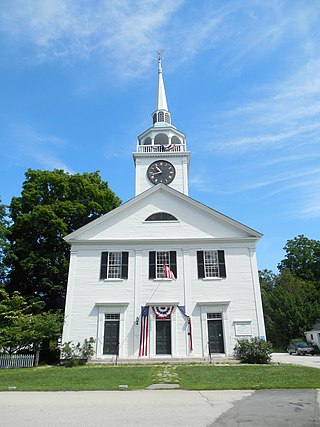
Amherst is a census-designated place (CDP) and the main village in the town of Amherst in Hillsborough County, New Hampshire, United States. The population of the CDP was 697 at the 2020 census, out of 11,753 in the entire town. The village center is listed on the National Register of Historic Places as the Amherst Village Historic District.

<span class="mw-page-title-main">Colebrook (CDP), New Hampshire</span> Census-designated place in New Hampshire, United States

Colebrook is a census-designated place (CDP) and the main village in the town of Colebrook, Coös County, New Hampshire, United States. The population of the CDP was 1,201 at the 2020 census, out of 2,084 in the entire town. The CDP population had dropped from 1,394 at the 2010 census.

<span class="mw-page-title-main">Hancock (CDP), New Hampshire</span> Census-designated place in New Hampshire, United States

Hancock is a census-designated place (CDP) and the main village in the town of Hancock in Hillsborough County, New Hampshire, United States. The population of the CDP was 213 at the 2020 census, out of 1,731 in the entire town.

Lincoln is a census-designated place (CDP) and the main village in the town of Lincoln in Grafton County, New Hampshire, United States. The population of the CDP was 969 at the 2020 census, out of 1,631 in the entire town.

<span class="mw-page-title-main">Troy (CDP), New Hampshire</span> Census-designated place in New Hampshire, United States

Troy is a census-designated place (CDP) and the main village in the town of Troy in Cheshire County, New Hampshire, United States. The population of the CDP was 1,108 at the 2020 census, compared to 2,130 in the entire town. The center of the CDP is the Troy Village Historic District.

References

  1. "ArcGIS REST Services Directory". United States Census Bureau. Retrieved September 20, 2022.
  2. "Milford CDP, New Hampshire: 2020 DEC Redistricting Data (PL 94-171)". U.S. Census Bureau. Retrieved December 10, 2021.
  3. "TIGERweb: Milford CDP, New Hampshire". Geography Division, U.S. Census Bureau. Retrieved January 25, 2021.
  4. "2021 U.S. Gazetteer Files – New Hampshire". United States Census Bureau. Retrieved December 10, 2021.
  5. "Census of Population and Housing". Census.gov. Retrieved June 4, 2016.
  6. 1 2 3 "Profile of General Population and Housing Characteristics: 2010 Census Summary File 1 (DP-1): Milford CDP, New Hampshire". U.S. Census Bureau, American Factfinder. Archived from the original on February 13, 2020. Retrieved September 15, 2017.
  7. "Selected Economic Characteristics: 2011-2015 American Community Survey 5-Year Estimates (DP03): Milford CDP, New Hampshire". U.S. Census Bureau, American Factfinder. Archived from the original on February 13, 2020. Retrieved September 15, 2017.