Morehouse, New York

Last updated

Morehouse, New York
Hamilton County New York incorporated and unincorporated areas Morehouse highlighted.svg
Location in Hamilton County and the state of New York
Coordinates: 43°26′N74°44′W / 43.433°N 74.733°W / 43.433; -74.733
Country United States
State New York
County Hamilton
Established1835
Government
  Type Town Council
   Town Supervisor Anthony Fernandez (R)
   Town Council
Members' List
Area
[1]
  Total194.77 sq mi (504.45 km2)
  Land191.06 sq mi (494.85 km2)
  Water3.71 sq mi (9.60 km2)
Elevation
2,287 ft (697 m)
Population
 (2020)
  Total92
  Density0.48/sq mi (0.19/km2)
Time zone UTC-5 (Eastern (EST))
  Summer (DST) UTC-4 (EDT)
FIPS code 36-041-48340
GNIS feature ID0979237
Website morehousenewyork.com

Morehouse is a town in Hamilton County, New York, United States. The population was 92 at the 2020 census. [2] The name is that of an early developer, Andrew K. Morehouse.

Contents

The town is in the Adirondack Park. It is in the southwestern corner of the county and is northeast of Utica.

History

Morehouse was formed from part of the town of Lake Pleasant in 1835. Morehouse ("Morehouseville") was created by land developer and entrepreneur Andrew King Morehouse (1805-1884); the post office there opened on April 9, 1834. (Morehouse owned 60,000 acres (240 km2) of wilderness in Hamilton, Herkimer and Saratoga counties, but ultimately ended up dying in a poorhouse.) Part of the town was later taken and added to the town of Long Lake. An additional part of Morehouse was taken for Long Lake in 1861. In 1901, the town of Inlet was formed from the northern end of Morehouse.

One of the most newsworthy events to occur in town was the crash landing of an American Airways Curtis Condor in December 1934 and daring rescue of the crew by locals on snowshoes in the southern end of town. [3]

Geography

According to the United States Census Bureau, the town has a total area of 194.7 square miles (504 km2), of which 191.1 square miles (495 km2) is land and 3.6 square miles (9.3 km2) (1.86%) is water.

The western and southern town lines of Morehouse are the border of Herkimer County.

The West Canada Creek flows out the western town line, and other tributaries of that stream flow through the town. The Moose River marks the northern town line.

New York State Route 8, an east–west highway in the southern part of the town, is the only significant road in Morehouse, passing through the hamlets of Morehouseville and Hoffmeister.

Demographics

Historical population
CensusPop.Note
1840 169
1850 24243.2%
1860 228−5.8%
1870 186−18.4%
1880 181−2.7%
1890 1820.6%
1900 31975.3%
1910 149−53.3%
1920 109−26.8%
1930 85−22.0%
1940 917.1%
1950 10414.3%
1960 65−37.5%
1970 11373.8%
1980 102−9.7%
1990 1063.9%
2000 15142.5%
2010 86−43.0%
2020 927.0%

As of the census [4] of 2020, there were 92 people and 21 households residing in the town. The population density was 0.48 people per square mile (0.19/km2). There were 280 housing units at an average density of 1.5 per square mile (0.6/km2). The racial makeup of the town was 95.65% White, 0.00% Native American, 4.35% from two or more races. Hispanic or Latino of any race were 0.00% of the population. The median age was 59.5 years.

The median income for a household in the town was $58,125.

Communities and locations in Morehouse

Communities

Geographical features

Related Research Articles

<span class="mw-page-title-main">Minerva, New York</span> Town in New York, United States

Minerva is a town in Essex County, New York, United States. The population was 773 at the 2020 census. The town is named after Minerva, the Roman goddess of wisdom. The town has a highly irregular polygonal shape. It is located in the southwestern corner of the county. By road, it is 40 miles (64 km) north-northwest of Queensbury, 85 miles (137 km) southwest of Burlington, Vermont, 88 miles (142 km) south of Plattsburgh, 93 miles (150 km) north of Albany, and 147 miles (237 km) south of Montreal, Quebec.

<span class="mw-page-title-main">Caroga, New York</span> Town in New York, United States

Caroga is a town in Fulton County, New York, United States. The population was 1,205 at the 2010 census. The town was named after a local creek.

Oppenheim is a town in Fulton County, New York, United States. The town is in the southwestern corner of the county and is east of Utica. The population was 1,924 at the 2010 census.

<span class="mw-page-title-main">Stratford, New York</span> Town in New York, United States

Stratford is a town in Fulton County, New York, United States. The population was 610 at the 2010 census. The town is in the northwestern corner of the county, northeast of the village of Dolgeville. It was named after Stratford, Connecticut.

<span class="mw-page-title-main">Arietta, New York</span> Town in New York, United States

Arietta is a town in Hamilton County, New York, United States. The population was 304 at the 2010 census. The town was named after the mother of one of the first settlers, Rensselaer Van Rennslaer.

<span class="mw-page-title-main">Benson, New York</span> Town in New York, United States

Benson is a town in Hamilton County, New York, United States. The population was 221 at the 2020 census. The town is on the southern border of Hamilton County and is northwest of Schenectady. The current Town Supervisor is John M. Stortecky.

<span class="mw-page-title-main">Indian Lake, New York</span> Town in New York, United States

Indian Lake is a town in Hamilton County, New York, United States. The population was 1,352 at the 2010 census. The name is from a lake of the same name that is largely inside the town. There are no permanent stop lights in the town. Law enforcement is provided by New York State Troopers and Hamilton County Sheriff's Office.

<span class="mw-page-title-main">Inlet, New York</span> Town in New York, United States

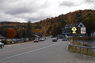
Inlet is a town in Hamilton County, New York, United States. The population was 355 at the 2020 census, up from 333 in 2010. The name is derived from its location at the eastern end (inlet) of Fourth Lake, part of the Fulton Chain of Lakes.

<span class="mw-page-title-main">Long Lake, New York</span> Town in New York, United States

Long Lake is a town in Hamilton County, New York, United States. The population was 791 at the 2020 census.

<span class="mw-page-title-main">Wells, New York</span> Town in New York, United States

Wells is a town in Hamilton County, New York, United States. The population was 674 at the 2010 census. The town is named after Joshua Wells, a land agent, who built the first mills in the area. It is in the Adirondack Park and on the eastern border of the county. It is northwest of Schenectady.

<span class="mw-page-title-main">Columbia, New York</span> Town in New York, United States

Columbia is a town in Herkimer County, New York, United States. As of the 2020 census, the town population was 1,569. The town is at the southern border of the county and is southeast of Utica.

<span class="mw-page-title-main">Manheim, New York</span> Town in New York, United States

Manheim is a town in Herkimer County, New York, United States. The population was 3,334 at the 2010 census. The town name is derived from Mannheim in Baden, Germany.

<span class="mw-page-title-main">Ohio, New York</span> Town in New York, United States

Ohio is a town in Herkimer County, New York, United States. The population was 1,002 at the 2010 census. The town is named after the state of Ohio. The town is in the northern part of the county and northeast of Utica. Part of Ohio is within the Adirondack Park.

<span class="mw-page-title-main">Russia, New York</span> Town in New York, United States

Russia is a town in Herkimer County, New York, United States. The population was 2,269 at the 2020 census, down from 2,587 in 2010. The town is located in the northwestern part of the county and is northeast of Utica.

<span class="mw-page-title-main">Salisbury, Herkimer County, New York</span> Town in New York, United States

Salisbury is a town in Herkimer County, New York, United States. The population was 1,958 at the 2010 census. The town is on the eastern edge of the county, north of the city of Little Falls. The northern part of the town is in the Adirondack Park.

<span class="mw-page-title-main">Webb, New York</span> Town in New York, United States

Webb is the northernmost town in Herkimer County, New York, United States. As of the 2010 census it had a population of 1,807.

<span class="mw-page-title-main">Winfield (town), New York</span> Town in New York, United States

Winfield is a town in Herkimer County, New York, United States. The population was 2,086 at the 2010 census. The town is named after General Winfield Scott and is in the southwestern corner of the county, south of Utica.

<span class="mw-page-title-main">Maryland, New York</span> Town in New York, United States

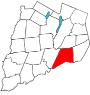
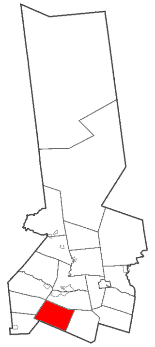
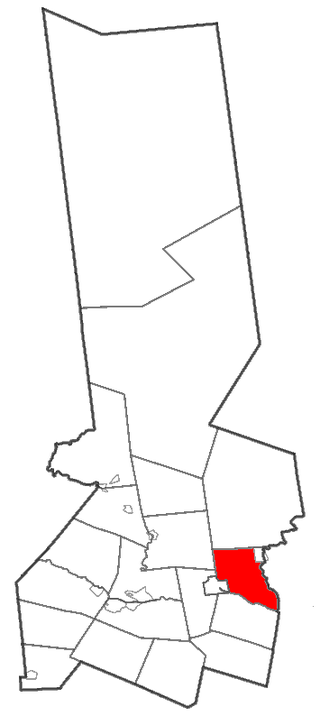
Maryland is a town in Otsego County, New York, United States. The population was 1,897 at the 2010 census. It was named for the U.S. state of the same name. The Town of Maryland is on the county's southern border. It is northeast of the City of Oneonta.

<span class="mw-page-title-main">Colton, New York</span> Town in New York, United States

Colton is a town in St. Lawrence County, New York, United States. The population was 1,451 at the 2010 census. The town, originally named "Matildaville", is named after early settler Jesse Colton Higley.

The West Canada Lake Wilderness Area is an Adirondack Park Forest Preserve management unit in the State of New York, USA.

References

  1. "2016 U.S. Gazetteer Files". United States Census Bureau. Retrieved July 5, 2017.
  2. "Geographic Identifiers: table/DECENNIALPL2020.P1?g=060XX00US3604148340: Morehouse town, Hamilton County, New York". US Census Bureau. U.S. Census Bureau. Archived from the original on January 17, 2024. Retrieved January 17, 2024.
  3. "Warbird Information Exchange • View topic - Curtiss Condor restoration". www.warbirdinformationexchange.org. Retrieved June 29, 2022.
  4. "U.S. Census website". United States Census Bureau . Retrieved January 18, 2024.