Mount Walker, Queensland

Last updated

Map all coordinates using: OpenStreetMap
Mount Walker
Queensland
Mount Walker Scenic Rim Region.jpg
Mount Walker viewed from Rosewood Warrill View Road, 2015
Australia Queensland location map.svg
Red pog.svg
Mount Walker
Coordinates 27°46′38″S152°33′01″E / 27.7772°S 152.5502°E / -27.7772; 152.5502 (Mount Walker (centre of locality))
Population129 (SAL 2021) [1]
Postcode(s) 4340
Area33.4 km2 (12.9 sq mi)
Time zone AEST (UTC+10:00)
Location
LGA(s) Scenic Rim Region
State electorate(s) Scenic Rim
Federal division(s) Wright
Suburbs around Mount Walker:
Lower Mount Walker Lower Mount Walker Mount Forbes
Mount Walker West Mount Walker Coleyville
Rosevale Rosevale Coleyville

Mount Walker is a rural locality in the Scenic Rim Region, Queensland, Australia. [2] In the 2021 census, Mount Walker had a population of 129 people. [3]

Contents

Geography

The locality is bounded to the west by the Bremer River. [4]

Mount Walker is in the east of the locality ( 27°47′17″S152°33′27″E / 27.7881°S 152.5575°E / -27.7881; 152.5575 (Mount Walker (mountain)) ), rising to 471 metres (1,545 ft) above sea level. [5] [6]

The land on the upper slopes of Mount Walker is undeveloped. Part of from that, the predominant land use is grazing on native vegetation with other areas of irrigated crop growing. [4]

History

Farm at Mount Walker, circa 1907 StateLibQld 1 236997 Farm at Mount Walker, ca. 1907.jpg
Farm at Mount Walker, circa 1907

The mountain was originally called Mount Forbes by John Oxley in honour of Sir Francis Forbes, the Chief Justice of New South Wales. However, it was later acquired the name Mount Walker. The origins of the name Walker are believed to be a shepherd of that name from the Franklyn Vale pastoral station. [7] The locality takes its name from the mountain. [2]

Mount Walker Congregational Church, circa 1896 Mount Walker Congregational Church, circa 1896.jpg
Mount Walker Congregational Church, circa 1896

Mount Walker German Baptist Church opened in 1872. [8] For a time it was the headquarters for the German Baptist churches, until circa 1879 when that responsibility shifted to Engelsburg (now Kalbar) Baptist Church. [9] [10]

Mount Walker State School opened on 15 April 1878. It closed in December 1967. [11] [12] It was at 1775 Rosewood Warrill View Road ( 27°46′50″S152°32′08″E / 27.7805°S 152.5355°E / -27.7805; 152.5355 (Mount Walker State School (former)) ) on a 25-acre (10 ha) site. [13] [14] [4]

Mount Walker Church of Christ opened in 1884 and celebrated its 125th anniversary in 2009. [15]

Mount Walker Congregational Church opened in 1896. [16] [17] It had closed by 1940. [18]

Mount Walker Post Office opened on 1 October 1916 (a receiving office had been open from 1874) and closed in 1957. [19]

Demographics

In the 2016 census, Mount Walker had a population of 134 people. The locality contained 50 households, in which 51.9% of the population were males and 48.1% of the population were females with a median age of 42, 4 years above the national average. The average weekly household income was $1,208, $230 below the national average. 5.3% of Mount Walker's population was either of Aboriginal or Torres Strait Islander descent. 76.3% of the population aged 15 or over was either registered or de facto married, while 23.7% of the population was not married. 34.6% of the population attended some form of a compulsory education. The most common nominated ancestries were Australian (40.1%), English (19.8%) and German (9.3%), while the most common country of birth was Australia (79.4%), and the most commonly spoken language at home was English (86.7%). The most common nominated religions were Catholic (19.4%), Not stated (18.0%) and No religion (15.1%). The most common occupation was a technician/trades worker (26.2%) and the majority/plurality of residents worked 40 or more hours per week (49.2%). [20]

In the 2021 census, Mount Walker had a population of 129 people. [3]

Education

There are no school in Mount Walker. The nearest government primary schools are Mutdapilly State School in Mutdapilly to the east and Warrill View State School in Warrill View to the south-east. The nearest government secondary school is Rosewood State High School in Rosewood to the north. [4]

Amenities

Church of Christ, Mount Walker, 2005 Church of Christ, Mount Walker, 2005.JPG
Church of Christ, Mount Walker, 2005
Mount Walker Public Cemetery, 2005 Mount Walker Public Cemetery, 2005.JPG
Mount Walker Public Cemetery, 2005

Mount Walker Church of Christ is located at 10 Hinrichsen Road, just off the Rosewood-Warrill View Road ( 27°46′22″S152°32′15″E / 27.7729°S 152.5374°E / -27.7729; 152.5374 (Mount Walker Church of Christ) ); weekly Sunday services are held at the church. [21]

Mount Walker General Cemetery is located at 1744–1752 Rosewood-Warrill View Road ( 27°46′44″S152°32′08″E / 27.7788°S 152.5356°E / -27.7788; 152.5356 (Mount Walker Public Cemetery) ). [22] [23] [24]

Related Research Articles

<span class="mw-page-title-main">Aratula</span> Town in Queensland, Australia

Aratula is a rural town and locality in the Scenic Rim Region, Queensland, Australia. In the 2016 census, the locality of Aratula had a population of 532 people.

<span class="mw-page-title-main">Shire of Boonah</span> Local government area in Queensland, Australia

The Shire of Boonah was a local government area in South East Queensland, Australia, about 80 kilometres (50 mi) southwest of Brisbane. The shire covered an area of 1,921.6 square kilometres (741.9 sq mi), and existed from 1880 until its merger with parts of the Shire of Beaudesert and City of Ipswich to form the Scenic Rim Region on 15 March 2008.

<span class="mw-page-title-main">Maroon, Queensland</span> Suburb of Scenic Rim Region, Queensland, Australia

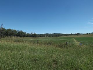
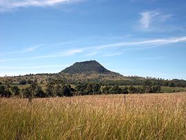
Maroon is a rural locality in the Scenic Rim Region, Queensland, Australia. In the 2016 census, Maroon had a population of 149 people.

<span class="mw-page-title-main">Rosevale, Queensland</span> Town in Queensland, Australia

Rosevale is a rural locality in the Scenic Rim Region, Queensland, Australia. In the 2016 census, Rosevale had a population of 208 people.

<span class="mw-page-title-main">Warrill View, Queensland</span> Town in Queensland, Australia

Warrill View is a rural town and locality in the Scenic Rim Region, Queensland, Australia. In the 2021 census, the locality of Warrill View had a population of 203 people.

<span class="mw-page-title-main">Mount Forbes, Queensland</span> Suburb of City of Ipswich, Queensland, Australia

Mount Forbes is a rural locality split between the City of Ipswich and the Scenic Rim Region, Queensland, Australia. In the 2016 census, Mount Forbes had a population of 263 people.

<span class="mw-page-title-main">Harrisville, Queensland</span> Town in Queensland, Australia

Harrisville, locally known as the town of churches, is a rural town and locality in the Scenic Rim Region, Queensland, Australia. In the 2016 census, the locality of Harrisville had a population of 613 people.

<span class="mw-page-title-main">Peak Crossing, Queensland</span> Suburb of City of Ipswich, Queensland, Australia

Peak Crossing is a rural locality split between the City of Ipswich and the Scenic Rim Region of Queensland, Australia. In the 2016 census, Peak Crossing had a population of 965 people.

<span class="mw-page-title-main">Munbilla, Queensland</span> Town in Queensland, Australia

Munbilla is a rural town and locality in the Scenic Rim Region, Queensland, Australia. In the 2016 census, the locality of Munbilla had a population of 100 people.

<span class="mw-page-title-main">Mutdapilly, Queensland</span> Suburb of City of Ipswich, Queensland, Australia

Mutdapilly is a rural locality in south-east Queensland, Australia. It is split between the local government areas of Scenic Rim Region and City of Ipswich. In the 2016 census, Mutdapilly had a population of 308 people.

<span class="mw-page-title-main">Coleyville, Queensland</span> Suburb of Scenic Rim Region, Queensland, Australia

Coleyville is a rural locality in the Scenic Rim Region, Queensland, Australia. In the 2021 census, Coleyville had a population of 192 people.

<span class="mw-page-title-main">Mount Walker West, Queensland</span> Suburb of Scenic Rim Region, Queensland, Australia

Mount Walker West is a locality split between the Scenic Rim Region and City of Ipswich local government areas of Queensland, Australia. In the 2021 census, Mount Walker West had a population of 31 people.

<span class="mw-page-title-main">Lower Mount Walker, Queensland</span> Suburb of City of Ipswich, Queensland, Australia

Lower Mount Walker is a locality split between the Scenic Rim Region and City of Ipswich local government areas of South East Queensland, Australia. In the 2021 census, Lower Mount Walker had a population of 192 people.

<span class="mw-page-title-main">Merryvale, Queensland</span> Suburb of Scenic Rim Region, Queensland, Australia

Merryvale is a rural locality in the Scenic Rim Region, Queensland, Australia. In the 2016 census, Merryvale had a population of 22 people.

<span class="mw-page-title-main">Frazerview, Queensland</span> Suburb of Scenic Rim Region, Queensland, Australia

Frazerview is a rural locality in the Scenic Rim Region, Queensland, Australia. In the 2016 census, Frazerview had a population of 34 people.

<span class="mw-page-title-main">Gleneagle, Queensland</span> Suburb of Scenic Rim Region, Queensland, Australia

Gleneagle is a rural locality in the Scenic Rim Region, Queensland, Australia. In the 2016 census, Gleneagle had a population of 1,877 people.

<span class="mw-page-title-main">Coulson, Queensland</span> Suburb of Scenic Rim Region, Queensland, Australia

Coulson is a rural locality in the Scenic Rim Region, Queensland, Australia. In the 2016 census, Coulson had a population of 195 people.

Kulgun is a locality in the Scenic Rim Region, Queensland, Australia. In the 2016 census, Kulgun had a population of 67 people.

<span class="mw-page-title-main">Moorang, Queensland</span> Suburb of Scenic Rim Region, Queensland, Australia

Moorang is a rural locality in the Scenic Rim Region, Queensland, Australia. In the 2016 census, Moorang had a population of 46 people.

Radford is a rural locality in the Scenic Rim Region, Queensland, Australia. In the 2016 census, Radford had a population of 41 people.

References

  1. Australian Bureau of Statistics (28 June 2022). "Mount Walker (Qld) (suburb and locality)". Australian Census 2021 QuickStats. Retrieved 28 June 2022.  OOjs UI icon edit-ltr-progressive.svg
  2. 1 2 "Mount Walker – locality in Scenic Rim Region (entry 45216)". Queensland Place Names. Queensland Government . Retrieved 29 December 2020.
  3. 1 2 Australian Bureau of Statistics (28 June 2022). "Mount Walker (SAL)". 2021 Census QuickStats. Retrieved 28 February 2023. OOjs UI icon edit-ltr-progressive.svg
  4. 1 2 3 4 "Queensland Globe". State of Queensland . Retrieved 5 February 2022.
  5. "Mountain peaks and capes - Queensland". Queensland Open Data. Queensland Government. 12 November 2020. Archived from the original on 25 November 2020. Retrieved 25 November 2020.
  6. "Mount Walker – mountain in Scenic Rim Region (entry 36227)". Queensland Place Names. Queensland Government . Retrieved 25 November 2020.
  7. "Mount Walker (mountain) (entry 36227)". Queensland Place Names. Queensland Government . Retrieved 15 September 2013.
  8. Blake, Thom. "Mount Walker Baptist Church". Queensland religious places database. Archived from the original on 5 February 2022. Retrieved 5 February 2022.
  9. "Baptists in Australia". Baptist World Alliance. 19 May 2016. Archived from the original on 19 May 2016. Retrieved 5 February 2022.
  10. "Baptist Association". Queensland Times, Ipswich Herald And General Advertiser . Vol. XXXVIII, no. 5648. Queensland, Australia. 23 September 1897. p. 2. Retrieved 5 February 2022 via National Library of Australia.
  11. "Opening and closing dates of Queensland Schools". Queensland Government . Retrieved 13 April 2015.
  12. "Agency ID 6387, Mount Walker State School". Queensland State Archives . Retrieved 13 April 2015.
  13. "Parish of Forbes" (Map). Queensland Government. 1965. Archived from the original on 5 February 2022. Retrieved 5 February 2021.
  14. "Flinders" (Map). 1927. Archived from the original on 29 May 2020. Retrieved 5 February 2022.
  15. "Mt Walker's 125th Church Anniversary Celebrations" (PDF). Networking: Magazine of Churches of Christ in Queensland. Church of Christ Queensland (19). Spring 2009. Archived (PDF) from the original on 4 March 2016. Retrieved 13 April 2015.
  16. "TENDERS INVITED". Queensland Times, Ipswich Herald and General Advertiser . Vol. XXXV, no. 5144. Queensland, Australia. 23 June 1894. p. 5. Retrieved 14 December 2023 via National Library of Australia.
  17. "Advertising". Queensland Times, Ipswich Herald and General Advertiser . Vol. XXXVI, no. 5200. Queensland, Australia. 3 November 1894. p. 1. Retrieved 14 December 2023 via National Library of Australia.
  18. "Mount Walker Congregational Church | Mount Walker". Queensland Religious Places Database. Retrieved 14 December 2023.
  19. Premier Postal History. "Post Office List". Premier Postal Auctions. Archived from the original on 15 May 2014. Retrieved 10 May 2014.
  20. Australian Bureau of Statistics (27 June 2017). "Mount Walker (SSC)". 2016 Census QuickStats. Retrieved 20 October 2018. OOjs UI icon edit-ltr-progressive.svg
  21. "Find us". Church of Christ Queensland. Archived from the original on 4 March 2016. Retrieved 13 April 2015.
  22. "Private Cemeteries within the Scenic Rim Region and Beyond". Scenic Rim Regional Council . Archived from the original on 17 May 2020. Retrieved 5 February 2022.
  23. "Mt Walker historic cemetery, Boonah Shire". Archived from the original on 23 September 2015. Retrieved 13 April 2015.
  24. "Cemetery Areas - Queensland". Queensland Open Data. Queensland Government. 12 November 2020. Archived from the original on 15 November 2020. Retrieved 12 November 2020.

Commons-logo.svg Media related to Mount Walker, Queensland at Wikimedia Commons