Mulanje

Last updated
Mulanje
Mulanje Mountain.JPG
Malawi adm location map.svg
Red pog.svg
Mulanje
Location in Malawi
Coordinates: 16°01′33″S35°30′29″E / 16.02583°S 35.50806°E / -16.02583; 35.50806
CountryFlag of Malawi.svg  Malawi
Region Southern Region
District Mulanje District
Population
 (2018 Census [1] )
  Total14,782
Time zone +2
Climate Cwa

Mulanje, formerly called Mlanje, is a town in the Southern Region of Malawi, close to the border with Mozambique, to the east. It is near the Mulanje Massif. [2]

Contents

Location

The town of Mulanje lies along the M-2 highway from Thyolo to the west to the Mozambican border to the east. It is approximately 69 kilometres (43 mi), by road, south-east of Blantyre, the commercial and financial capital of Malawi. [3] This is approximately 380 kilometres (236 mi), by road, southeast of Lilongwe, the largest city in Malawi and the country's capital. [4] The geographical coordinates of the town of Mulanje are: 16°01'33.0"S, 35°30'29.0"E (Latitude:-16.025833; Longitude:35.508056). [5]

Overview

Mulanje is a tourist attraction and serves as a staging base for climbers who want to scale Mount Mulanje or those who want to explore the countryside at its base. Residential and camping accommodation is available. [6]

Mulanje is also the headquarters of a conservation group, the Mulanje Mountain Conservation Trust. [2] The small town of Mulanje is the center of Malawi's tea growing industry. [7] The Lujeri Tea Estate, adjacent to the border with Mozambique, is the location of the 8.25 megawatts (11,063 hp) Ruo–Ndiza Hydroelectric Power Station, that is owned and operated by Mulanje Renewable Energy Plc, a private enterprise. [8]

Demographics

YearPopulation
19877,113
199812,548
200814,497
201814,782 [1]

Points of interest

The following points of interest in or near the town of Mulanje include the following: (a) the offices of Mulanje Town Council (b) the offices of Mulanje District Administration (c) Mulanje District Hospital [5] (d) a branch of National Bank of Malawi [9] (e) a branch of NBS Bank [10] and (f) the headquarters of Malawi-Mulanje Mountain Biodiversity Conservation Project. [11]

See also

Related Research Articles

<span class="mw-page-title-main">Geography of Malawi</span> Geographical features of Malawi

Malawi is a landlocked country in southeast Africa. It is wholly within the tropics; from about 9°30S at its northernmost point to about 17°S at the southernmost tip. The country occupies a thin strip of land between Zambia and Mozambique, extending southwards into Mozambique along the valley of the Shire River. In the north and north east it also shares a border with Tanzania. Malawi is connected by rail to the Mozambican ports of Nacala and Beira. It lies between latitudes 9° and 18°S, and longitudes 32° and 36°E.

<span class="mw-page-title-main">Zomba, Malawi</span> Place in Southern Region, Malawi

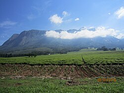
Zomba is a city in southern Malawi, in the Shire Highlands. It is the former capital city of Malawi.

<span class="mw-page-title-main">Blantyre</span> Place in Southern Region, Malawi

Blantyre is Malawi's centre of finance and commerce, and its second largest city, with an enumerated 800,264 inhabitants as of 2018. It is sometimes referred to as the commercial and industrial capital of Malawi as opposed to the political capital, Lilongwe. It is the capital of the country's Southern Region as well as the Blantyre District.

<span class="mw-page-title-main">Nkhotakota</span> Place in Central Region, Malawi

Nkhotakota (Un-kho-tah-kho-tuh) is a town and one of the districts in the Central Region of Malawi. It is on the shore of Lake Malawi and is one of the main ports on Lake Malawi. As of 2018, Nkhotakota had a population estimated at 28,350. The district had a population of 301.000.

Phalombe is a town in Malawi. It is the district capital of Phalombe District.

<span class="mw-page-title-main">A2 road (Zimbabwe)</span> Road in Zimbabwe

The A2 Highway is a primary road in Zimbabwe running from Harare to Nyamapanda at the border with Mozambique. The Mozambican side border post is called Cochemane. This is a busy entry point used by people travelling by road between South Africa, Malawi, Zimbabwe and Mozambique. It starts at intersection with Samora Machel Avenue; however Enterprise Road itself begins from the T-junction with Robert Mugabe Avenue, opposite the market in Eastlea, east of Simon Muzenda Street Road Port; a bus terminus for inter-regional buses.

<span class="mw-page-title-main">First Capital Bank Malawi Limited</span> Malawian commercial bank

First Capital Bank Malawi Plc, formerly known as First Merchant Bank Plc, is a commercial bank in Malawi. It is licensed by the Reserve Bank of Malawi, the central bank and national banking regulator. It is a subsidiary of FMB Capital Holdings.

NBS Bank Limited, commonly referred to as NBS Bank, is a commercial bank in Malawi. It is licensed as a commercial bank, by the Reserve Bank of Malawi, central bank and national banking regulator.

<span class="mw-page-title-main">CDH Investment Bank</span>

CDH Investment Bank (CDHIB), is an investment bank in Malawi. It is licensed by the Reserve Bank of Malawi, the central bank and national banking regulator.

Mwanza is a town in Malawi on the border with Mozambique. It is the administrative headquarters for Mwanza District.

The Khammwamba Thermal Power Station, also Khammwamba Power Station, is a proposed coal-fired power plant in Malawi, with planned installed capacity of 300 megawatts (400,000 hp).

New Finance Bank (NFB), whose complete name is New Finance Bank Malawi Limited is a commercial bank in Malawi. It is one of the commercial banks licensed by the Reserve Bank of Malawi, the central bank and national banking regulator.

The University of Malawi College of Medicine (UMCM), also Malawi College of Medicine in Blantyre, is a constituent college of the University of Malawi, the oldest and largest public university in the country. The college houses the Faculty of Medicine of the University, and is the only medical school in Malawi.

The Muloza–Chiringa Road is a road in the Southern Region of Malawi, connecting the towns of Muloza in Mulanje District, and Chiringa, in Phalombe District.

Chiringa is a town in Malawi.

The Ruo–Ndiza Hydroelectric Power Station is an operational 8.25 megawatts (11,063 hp) hydroelectric power plant in southeastern Malawi, at the border with Mozambique.

Mwami is a town in the Eastern Province of Zambia. The town lies at the international border with Malawi, adjacent to the Malawian city of Mchinji.

NICO Holdings plc is a diversified financial services group and is listed on the Malawi Stock Exchange.

References

  1. 1 2 "2018 Population and Housing Census Main Report" (PDF). Malawi National Statistical Office. Retrieved 25 December 2019.
  2. 1 2 Henry Wismayer (12 December 2013). "A trek across Malawi's Mount Mulanje, long rumored to have inspired J.R.R. Tolkien". The Washington Post . Washington, DC. Retrieved 9 May 2020.
  3. Google (9 May 2020). "Road Distance Between Blantyre And Mulanje" (Map). Google Maps . Google. Retrieved 9 May 2020.
  4. Google (9 May 2020). "Road Distance Between Lilongwe And Mulanje" (Map). Google Maps . Google. Retrieved 9 May 2020.
  5. 1 2 Google (9 May 2020). "Location of Mulanje Town, Mulanje District, Southern Region, Malawi" (Map). Google Maps . Google. Retrieved 9 May 2020.
  6. Journeys By Design (2020). "Bespoke Safaris In Mulanje, Malawi". Brighton, United Kingdom: Journeysbydesign.com. Retrieved 9 May 2020.
  7. Jane Pettigrew (1 February 2016). "Advances in Smallholder Tea Farming in Malawi". Stir-Tea-Coffee.com. Retrieved 9 May 2020.
  8. Elijah Phimbi (26 February 2019). "$16 Million Power Project On Course In Mulanje: To Supply Electricity To Escom From March". Nyasa Times . Blantyre. Retrieved 9 May 2020.
  9. Brabys (21 May 2018). "National Bank of Malawi: Mulanje Branch". Brabys.com. Retrieved 21 May 2018.
  10. AfricanAdvice.Com (21 May 2018). "NBS Bank (Mulanje Branch)". AfricanAdvice.Com. Retrieved 21 May 2018.
  11. Nathalie Weier Johnson (27 March 2001). "About Malawi-Mulanje Mt. Biodiversity Conservation Project" (PDF). Washington, DC: World Bank . Retrieved 21 May 2018.