
Interstate 82 (I-82) is an Interstate Highway in the Pacific Northwest region of the United States that travels through parts of Washington and Oregon. It runs 144 miles (232 km) from its northwestern terminus at I-90 in Ellensburg, Washington, to its southeastern terminus at I-84 in Hermiston, Oregon. The highway passes through Yakima and the Tri-Cities, and is also part of the link between Seattle and Salt Lake City, Utah. I-82 travels concurrently with U.S. Route 97 (US 97) between Ellensburg and Union Gap; US 12 from Yakima to the Tri-Cities; and US 395 from Kennewick to Umatilla, Oregon.
E-ZPass is an electronic toll collection system used on toll roads, toll bridges, and toll tunnels in the Eastern United States, Midwestern United States, and Southern United States. The E-ZPass Interagency Group (IAG) consists of member agencies in several states, which use the same technology and allow travelers to use the same transponder on toll roads throughout the network.

U.S. Route 97 (US 97) is a major north–south route of the United States Numbered Highway System in the Pacific Northwest region. It runs for approximately 670 miles (1,078 km) through the states of California, Oregon, and Washington, primarily serving interior areas on the east side of the Cascade Mountains. The highway terminates to the south at a junction with Interstate 5 (I-5) in Weed, California, and to the north at the Canadian border near Osoyoos, British Columbia, where it becomes British Columbia Highway 97. Major cities on the US 97 corridor include Klamath Falls, Bend, and Redmond in Oregon; and Yakima, Ellensburg, and Wenatchee in Washington. A portion of the highway in California and Oregon is part of the Volcanic Legacy Scenic Byway.
SunPass is an electronic toll collection system within the state of Florida, United States. It was created in 1999 by the Florida Department of Transportation's (FDOT's) Office of Toll Operations, operating now as a division of Florida's Turnpike Enterprise (FTE). The system utilizes windshield-mounted RFID transponders manufactured by TransCore and lane equipment designed by companies including TransCore, SAIC, and Raytheon.
U.S. Route 199 (US 199) is a U.S. Highway in the states of California and Oregon. The highway was established in 1926 as a spur of US 99, which has since been replaced by Interstate 5 (I-5). US 199 stretches 80 miles (130 km) from US 101 near Crescent City, California northeast to I-5 in Grants Pass, Oregon. The highway is the northern portion of the Redwood Highway. In Oregon, US 199 is officially known as Redwood Highway No. 25. The majority of the road in California is the Smith River Scenic Byway, a National Forest Scenic Byway. The first roadway, a plank road, from Crescent City was established in May 1858, and before the US 199 designation was applied to the highway, the roadway was designated Highway 25 and Route 1.

The Amtrak Cascades is a passenger train corridor in the Pacific Northwest, operated by Amtrak in partnership with the U.S. states of Washington and Oregon. It is named after the Cascade mountain range that the route parallels. The 467-mile (752 km) corridor runs from Vancouver, British Columbia, through Seattle, Washington, and Portland, Oregon, to Eugene, Oregon.

U.S. Route 730 (US 730) is an east–west United States Numbered Highway, of which all but 6.08 miles of its 41.78 miles are within the state of Oregon. The highway starts in rural Morrow County in Eastern Oregon at an interchange with Interstate 84 (I-84) and US 30, located east of the city of Boardman. US 730 travels east along the Columbia River as a continuation of Columbia River Highway No. 2 into Umatilla County, intersecting I-82 and US 395 in the city of Umatilla. US 730 and US 395 form a short concurrency within the city before the highways part, and US 730 continues northeast into Washington. The highway travels through rural Walla Walla County and ends at an intersection with US 12 south of Wallula.

Open road tolling (ORT), also called all-electronic tolling, cashless tolling, or free-flow tolling, is the collection of tolls on toll roads without the use of toll booths. An electronic toll collection system is usually used instead. The major advantage to ORT is that users are able to drive through the toll plaza at highway speeds without having to slow down to pay the toll. In some installations, ORT may also reduce congestion at the plazas by allowing more vehicles per hour/per lane.

The Methow River is a tributary of the Columbia River in northern Washington in the United States. The river's 1,890-square-mile (4,900 km2) watershed drains the eastern North Cascades, with a population of about 5,000 people. The Methow's watershed is characterized by relatively pristine habitats, as much of the river basin is located in national forests and wildernesses. Many tributaries drain the large Pasayten Wilderness. An earlier economy based on agriculture is giving way to one based on recreation and tourism.

Oregon Route 11 is an Oregon state highway that runs between the city of Pendleton in eastern Oregon, to the Washington border south of Walla Walla, Washington. OR 11 traverses the Oregon–Washington Highway No. 8 of the Oregon state highway system, even though there are numerous other highways crossing the Oregon–Washington border. The route shares a concurrency with U.S. Route 30 along the Pendleton Highway No. 67. It is one of several Oregon state highways to terminate at one of Oregon's borders.

A weigh station is a checkpoint along a highway to inspect vehicular weights and safety compliance criteria. Usually, trucks and commercial vehicles are subject to the inspection.
Good to Go, stylized as GoodToGo!, is the electronic toll collection program managed by the Washington State Department of Transportation on all current toll and future projects in the U.S. state of Washington. Regular Good to Go customers may set up an account from which tolls are automically deducted. Vehicles that are not linked to an account are photographed and a toll bill is sent to the registered owner by U.S. mail.
PrePass is an intelligent transportation system (ITS) that electronically verifies the safety, credentials, and weight of commercial vehicles as they approach participating state highway weigh stations. Because they comply electronically, commercial carriers enrolled in PrePass are authorized to bypass these facilities rather than pull in for manual inspection.

Interstate 84 (I-84) in the U.S. state of Oregon is a major Interstate Highway that traverses the state from west to east. It is concurrent with U.S. Route 30 (US 30) for most of its length and runs 376 miles (605 km) from an interchange with I-5 in Portland to the Idaho state line near Ontario. The highway roughly follows the Columbia River and historic Oregon Trail in northeastern Oregon, and is designated as part of Columbia River Highway No. 2 and all of the Old Oregon Trail Highway No. 6; the entire length is also designated as the Vietnam Veterans Memorial Highway. I-84 intersects several of the state's main north–south roads, including US 97, US 197, I-82, and US 395.
Rail transportation is an important element of the transportation network in the U.S. state of Oregon. Rail transportation has existed in Oregon in some form since 1855, and the state was a pioneer in development of electric railway systems. While the automobile has displaced many uses of rail in the state, rail remains a key means of moving passengers and freight, both within the state and to points beyond its borders.
U.S. Route 97 in the U.S. state of Washington is a 322-mile (518 km) route which traverses from the Oregon state line at the northern end of the Sam Hill Memorial Bridge in Maryhill, north to the Canada–US border in Okanogan County near Oroville. The highway serves major cities such as Goldendale, Yakima, Ellensburg and Wenatchee before continuing towards the Alaska Highway at the Yukon border as British Columbia Highway 97. Along the length of the roadway, US 97 is concurrent with State Route 14 in Maryhill, Interstate 82 (I-82) and US 12 between Union Gap and Ellensburg, I-90 briefly in Ellensburg, US 2 between Peshastin and rural Douglas County and SR 20 near Omak. An alternate route connects the highway with Chelan.
Cornelius Pass Road is an arterial road over Cornelius Pass in the Tualatin Mountains west of Portland, Oregon, United States, also extending several miles to the south. Running north–south, the road stretches between U.S. Route 30 (US 30) on the north and Kinnaman Street, just south of Oregon Route 8 (OR 8), on the south. The road passes through Washington and Multnomah counties, crossing the Tualatin Mountains at Cornelius Pass, 581 feet (177 m) above sea level. TriMet's MAX Light Rail line travels over the road on a bridge. The section between US 30 in Burlington and U.S. Route 26 in Hillsboro is Oregon Route 127 , known in the Oregon state highway system as Cornelius Pass Highway No. 127.
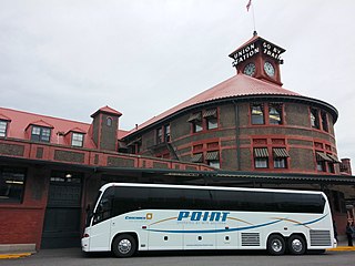
The POINT Intercity Bus Service is a four-route, intercity bus service of the Oregon Department of Transportation (ODOT). The service is administered by ODOT's Public Transportation Division as part of its intercity grant program. The POINT service exists to connect towns and rural communities with major transportation hubs and urban centers. ODOT accomplishes this by filling gaps in Oregon's long distance transit network where no public services exist and which would otherwise be unprofitable for private companies.
