Nansemond County, Virginia

Last updated
1903 Map depicting Nansemond County (1646-1972) and other "lost counties" of Virginia. Lost Counties of Virginia on the mouth of the James River.jpg
1903 Map depicting Nansemond County (1646–1972) and other "lost counties" of Virginia.

Nansemond is an extinct jurisdiction that was located south of the James River in Virginia Colony and in the Commonwealth of Virginia (after statehood) in the United States, from 1646 until 1974. It was known as Nansemond County until 1972. From 1972 to 1974, a period of eighteen months, it was the independent city of Nansemond. It is now part of the independent city of Suffolk.

Contents

English colonists named it for the Nansemond, a tribe of Native Americans who had long been living along the Nansemond River, a tributary of what the English later named as the James River. They encountered the English colonists after they began arriving in 1607 at Jamestown. Although disrupted by being forced off their land and through armed confrontation with colonists, the Nansemond Indian Nation continues to be based in Virginia and was granted state (1985) and federal recognition (2018).

History

17th century

Under the Virginia Company of London, in 1619, the area which became Nansemond County was included in Elizabeth Cittie [ sic ], one of four large "boroughs", or "incorporations". In 1624, the Virginia Company lost its proprietary charter, and Virginia became a royal colony.

In 1634, the King of England directed the formation of eight shires (or counties) in the colony. One of these was Elizabeth River Shire, which included land area on both sides of Hampton Roads, as had the earlier Elizabeth Cittie. Two years later, New Norfolk County was formed in 1636 from Elizabeth River Shire. It included all the area in South Hampton Roads that is now incorporated in the five independent cities located there in modern times. The following year, in 1637, New Norfolk County was divided into Upper Norfolk County and Lower Norfolk County.

Upper Norfolk County was officially redesignated the County of Nansimum by the House of Burgesses in March 1646; by the October session, this was also being spelled as Nansimund. The English named it for the indigenous Nansemond people whom they encountered in the area along the Nansemond River. Among the several Algonquian-speaking coastal peoples in the Tidewater, the Nansemond continue in the 21st century as a federally recognized tribe.

18th century

In the 1720s, John Constant settled along the Nansemond River (in what is now Suffolk) and built a home, wharf, and warehouse. This site became known as "Constant's Warehouse." [1]

Tobacco was the commodity crop in the Virginia colony and there was strong demand for it in England and Europe. Under the Tobacco Inspection Act of 1730, three of the 40 tobacco inspection warehouses were chartered in Nansemond County, under two inspectors, as follows:

At Waynwright's Landing, Isle of Wight; and Laurence's, in Nansemond County, under one inspection.

At the widow Constance's [sic], at Sleepy-Hole Point, in Nansemond County, under one inspection. [2]

In 1742, the Virginia House of Burgesses chartered a new town at Constant's Wharf and renamed it as Suffolk. [3]

In 1750, the county seat of Nansemond County was moved from Jarnigan's or Cohoon's Bridge to Suffolk. This new town was founded in 1742 at Constance's Warehouse at Sleepy Hole Point on the Nansemond River. It was named for the English hometown of Royal Governor William Gooch. [4]

19th century

Suffolk became an incorporated town in 1808 and an independent city in 1910. Even after Suffolk became politically independent of Nansemond County, it remained the seat of Nansemond County. Suffolk and Nansemond County also shared a court system and several other constitutional officers.

20th century

Presidential Elections Results [5]
Year Republican Democratic Third Parties
1972 57.9%5,76739.4% 3,9292.7% 270
1968 20.9% 2,10141.6%4,17437.5% 3,758
1964 34.9% 2,59064.8%4,8040.3% 21
1960 25.3% 1,34674.1%3,9440.6% 33
1956 40.2% 1,75357.2%2,4922.6% 115
1952 32.9% 1,16866.4%2,3600.7% 25
1948 14.9% 41376.3%2,1158.8% 245
1944 20.1% 35179.9%1,398
1940 8.4% 12991.6%1,4080.1% 1
1936 10.6% 17589.4%1,4780.1% 1
1932 13.4% 19686.2%1,2640.4% 6
1928 46.8% 64953.2%737
1924 15.2% 9982.7%5392.1% 14
1920 26.1% 24374.0%690
1916 9.6% 7090.5%663
1912 8.0% 5381.6%54410.5% 70

As part of a wave of political consolidations in southeastern Virginia between 1952 and 1976, the unincorporated areas of Nansemond County merged with the outlying incorporated towns of Holland and Whaleyville to form the independent city of Nansemond. Two years later Nansemond merged with Suffolk to form the present-day independent city of Suffolk. [6] The new municipality encompassed a total of 430 square miles (1,100 km2), making it the largest city in Hampton Roads and in all of Virginia in land area and the 11th largest in land area in the United States. With a life of 18 months, Nansemond was the shortest-lived independent city of any in Virginia.

Related Research Articles

Colony of Virginia Former British colony in North America (1606–1776)

The Colony of Virginia, chartered in 1606 and settled in 1607, was the first enduring English colony in North America, following failed proprietary attempts at settlement on Newfoundland by Sir Humphrey Gilbert in 1583, and the subsequent farther south Roanoke Island by Sir Walter Raleigh in the late 1580s.

Hampton Roads Body of water and metropolitan area in the U.S. states of Virginia and North Carolina

Hampton Roads is the name of both a body of water that serves as a wide channel for the James, Nansemond and Elizabeth rivers between Old Point Comfort and Sewell's Point where the Chesapeake Bay flows into the Atlantic Ocean, and the surrounding metropolitan region located in the southeastern Virginia and northeastern North Carolina portions of the Tidewater region.

Suffolk, Virginia Independent city in Virginia, United States

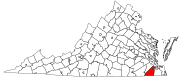
Suffolk is an independent city in the Commonwealth of Virginia, and as such has no county. As of the 2010 census, the population was 84,585. It is the largest city in Virginia by boundary land area as well as the 14th largest in the country.

South Hampton Roads Region in southeast Virginia

South Hampton Roads is a region located in the extreme southeastern portion of Virginia's Tidewater region in the United States with a total population of 1,191,937. It is part of the Virginia Beach-Norfolk-Newport News, VA-NC MSA, which itself has a population of 1,724,876.

Phoebus, Virginia United States historic place

Phoebus is a formerly incorporated town located in Elizabeth City County on the Virginia Peninsula in eastern Virginia. Upon incorporation in 1900, it was named in honor of local businessman Harrison Phoebus (1840–1886), who is credited with convincing the Chesapeake and Ohio Railway (C&O) to extend its tracks to the town from Newport News.

Elizabeth City Shire was one of eight shires created in colonial Virginia in 1634. The shire and the Elizabeth River were named for Elizabeth of Bohemia, daughter of King James I.

History of Suffolk, Virginia

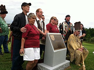
The area around Suffolk, Virginia, which is now an independent city in the Hampton Roads region in the southeastern part of the state, was originally inhabited by Native Americans. At the time of European contact, the Nansemond people lived along the river later known by the same name. The area was first explored by Jamestown colonists led by explorer John Smith soon after the settlements founding in 1607, seeking means to survive the inhospitable environment at Jamestown Island.

Norfolk County, Virginia

Norfolk County was a county of the South Hampton Roads in eastern Virginia in the United States that was created in 1691. After the American Civil War, for a period of about 100 years, portions of Norfolk County were lost and the territory of the county reduced as they were annexed by the independent and growing cities of Norfolk, Portsmouth and South Norfolk.

New Norfolk County is a long-extinct county which was located in colonial Virginia from 1636 until 1637.

Upper Norfolk County is an extinct county which was located in colonial Virginia from 1637 until 1646.

Princess Anne County, Virginia

County of Princess Anne is a former county in the British Colony of Virginia and the Commonwealth of Virginia in the United States, first incorporated in 1691. The county was merged into the city of Virginia Beach on January 1, 1963, ceasing to exist.

Kecoughtan was the name of the settlement now known as Hampton, Virginia, in the seventeenth century. In the early twentieth century, it was also the name of a town developed nearby which was annexed into the City of Newport News in 1927.

History of Virginia Beach, Virginia

The history of Virginia Beach, Virginia, goes back to the Native Americans who lived in the area for thousands of years before the English colonists landed at Cape Henry in April 1607 and established their first permanent settlement at Jamestown a few weeks later. The Colonial Virginia period extended until 1776 and the American Revolution, and the area has been part of the Commonwealth of Virginia ever since.

Byrd Road Act

The Byrd Road Act was an Act of Assembly passed in February 1932 by the Virginia General Assembly. Named for former Governor Harry F. Byrd, the legislation was originally presented as measure to relieve the financial pressures of the Great Depression upon the counties, as the state offered to take over responsibility and control of most county roads, creating the Virginia Secondary Roads System.

Whaleyville is a neighborhood of Suffolk, Virginia, United States. It was formerly an incorporated town located in southern Nansemond County, Virginia. Whaleyville is located midway between the former county seat at downtown Suffolk and the North Carolina border along U.S. Route 13.

History of Norfolk, Virginia

The history of Norfolk, Virginia as a modern settlement begins in 1636. The city formally was incorporated in 1736. The city was burned by orders of the outgoing Virginia governor Lord Dunmore in 1776 during the second year of the American Revolutionary War (1775–1783), although it was soon rebuilt.

History of Hampton Roads

The history of Hampton Roads dates to 1607, when Jamestown was founded. Two wars have taken place in addition to many other historical events.

In the United States, an independent city is a city that is not in the territory of any county or counties and is considered a primary administrative division of its state. Independent cities are classified by the United States Census Bureau as "county equivalents" and may also have similar governmental powers to a consolidated city-county. However, in the case of a consolidated city-county, a city and a county were merged into a unified jurisdiction in which the county at least nominally exists to this day, whereas an independent city was legally separated from any county or merged with a county that simultaneously ceased to exist even in name.

Tobacco Inspection Act

The Tobacco Inspection Act of 1730 was a 1730 English law designed to improve the quality of tobacco exported from Colonial Virginia. Proposed by Virginia Lieutenant Governor Sir William Gooch, the law was far-reaching in impact in part because it gave warehouses the power to destroy substandard crops and issue bills of exchange that served as currency. The law centralized the inspection of tobacco at 40 locations described in the law.

References

  1. "Early History of Suffolk K-251 | Marker History". www.markerhistory.com. Retrieved Apr 26, 2020.
  2. https://www.gutenberg.org/files/27117/27117-8.txt
  3. "What's in a name? | Constant's Wharf in Suffolk | HamptonRoads.com | PilotOnline.com". Archived from the original on 2012-01-24.
  4. VA Guide, XRoads, University of Virginia
  5. "Dave Leip's Atlas of U.S. Presidential Elections". uselectionatlas.org. Retrieved Apr 26, 2020.
  6. "Virginia: Consolidated Chronology of State and County Boundaries" https://digital.newberry.org/ahcb/documents/VA_Consolidated_Chronology.htm Archived 2009-07-27 at the Wayback Machine

Coordinates: 36°44′22″N76°36′34″W / 36.739323°N 76.609379°W / 36.739323; -76.609379