Naseby

Last updated

Naseby
Naseby village - geograph.org.uk - 175023.jpg
Northamptonshire UK location map (2021).svg
Red pog.svg
Naseby
Location within Northamptonshire
Population687 (2011)
OS grid reference SP689781
Civil parish
  • Naseby
Unitary authority
Ceremonial county
Region
Country England
Sovereign state United Kingdom
Post town NORTHAMPTON
Postcode district NN6
Dialling code 01604
Police Northamptonshire
Fire Northamptonshire
Ambulance East Midlands
UK Parliament
List of places
UK
England
Northamptonshire
52°23′49″N0°59′18″W / 52.39692°N 0.98847°W / 52.39692; -0.98847

Naseby is a village in West Northamptonshire, England. The population of the civil parish at the 2011 Census was 687. [1]

Contents

The village is 14 mi (23 km) north of Northampton, 13.3 mi (21.4 km) northeast of Daventry, and 7 mi (11 km) south of Market Harborough.

Geography

The village sits in a commanding position on one of the highest parts of the Northamptonshire Uplands, close to the county border with Leicestershire.

History

Early history

The original settlement probably owes its existence to its geography; the village lay in a strong defensive position. In the 6th century a Saxon named Hnaef established the settlement with the name of Hnaefes-Burgh ("fortified place of Hnaef"). Evidence for these origins came in the form of a 19th-century discovery of an Anglo-Saxon trefoil-headed brooch which is now in the collection of the British Museum.

Domesday Book to the Black Death

The Old Market Cross The Old Market Cross, now relocated.JPG
The Old Market Cross

In 1086 Naseby appeared in the Domesday Book, by which time Hnaefes-Burgh had evolved into Navesberie. In later records the village had been known as Navesby and Nathesby, eventually becoming Naseby. It was believed that the name derived from the Old English naefela, meaning navel, because it was thought to be the navel of England.[ citation needed ] In 1203, King John granted Naseby its market charter and the village became a flourishing market town for many years.

During this period the village grew. In 1349, the Black Death, which wiped out a third of the population of England, attacked the village and greatly reduced its population, with parts becoming abandoned altogether. Extensive earthworks in the fields adjacent to parts of the village show the outlines of lost lanes and the outlines of buildings and enclosures which existed before the Black Death.

Battle of Naseby

The Battle of Naseby took place on 14 June 1645, during the English Civil War. In the area called Broad Moor a small distance north of the village, the Royalist forces, commanded by King Charles I, battled the Roundhead army commanded by Thomas Fairfax, 3rd Lord Fairfax of Cameron. The battle resulted in a decisive Royalist defeat.

A naval warship during the Commonwealth period was named the Naseby in honour of the battle; after the Restoration the ship was renamed HMS Royal Charles.

18th century

During the 18th century, Naseby continued as an agricultural community and during this time several fine Georgian buildings were constructed in the parish, including Manor Farm (built 1720), Shuckburgh House (1773), and the old Vicarage (1785). One of the most significant buildings is Naseby House, built in 1818 for the Fitzgeralds, Lords of the Manor. In the 20th century the hall hosted the Duke of York, later King George VI, with the Duchess of York, Elizabeth Bowes-Lyon (the Queen Mother) and a very young future Queen Elizabeth. Naseby Hall, altered by E F Law in 1859 was badly damaged by fire in 1948, and was rebuilt from the ground up using the old materials. [2]

Rev John Mastin was vicar of Naseby from 1783 until his death in 1829. He was the author of “The History and Antiquities of Naseby, in the County of Northampton”, which was the earliest published history of the parish. He also left a manuscript account of his life. The texts of both these works are included in a 2004 publication by the Northamptonshire Record Society. [3]

Nineteenth century

All Saints church had a peak of baptisms in June 1837 Spire, All Saints, Naseby.JPG
All Saints church had a peak of baptisms in June 1837

In 1822 the Enclosure commissioners allocated the open land around the village to two landowners, who duly fenced off their newly acquired fields. This action deprived many of the villagers of their traditional plots of land that surrounded the village, that had for years allowed them to grow crops and graze their cattle and sheep. This action did not adversely affect the community as much as it did in other villages; one reason may have been that the village had other trades. A survey of the time lists 26 different occupations and trades in the village.

1837 baptisms

The local friendly society attracted non-conformists from the end of the eighteenth century and in 1825, a Methodist chapel was erected. [4] The population continued to grow: thus between 1831 and 1841 it increased from 707 to 898 (including 48 visitors to the annual feast). [4] In 1837, following the passing of the Births and Deaths Registration Act 1836 there was a peak in the number of baptisms recorded in the Naseby parish register, relating to All Saints church. Whereas during the previous ten years the number per annum had varied between 7 and 24, in 1837 there were a total of 91 baptisms which amounted to 10.7% of the population given in the 1841 census. 50 of these occurred in the week before 1 July when civil registration was made mandatory. Most of those baptised were over the age of one, mostly children with the oldest age recorded being 26. One view is the prevalence of baptisms in this year is that non-conformists wished to ensure their children and young adults were recorded before the introduction of civil registration. [4]

Victorian building boom

One of the two remaining cob and thatched cottages in the village Cob Cottage Naseby 20,04,2007.JPG
One of the two remaining cob and thatched cottages in the village

Until around 1870, most buildings (except for the church, chapel, school, and the three houses from the Georgian period) were made of mud walls and cob with thatched roofs. During the 1870s Lord Clifden had most of the cottages demolished and replaced with new red-brick cottages, some of which were semi-detached, to house his estate workers. This gave Naseby its well-known Victorian appearance. All these Victorian houses still survive to this day, along with two remaining 17th-century cob and thatched cottages.

Churches

The two churches in Naseby are:

River sources

The source of the River Avon in the grounds of Manor Farm Naseby Source of the River Avon 20,04,2007 (14).JPG
The source of the River Avon in the grounds of Manor Farm

Naseby and the plateau of land towards Sibbertoft form a watershed and contain the sources of four rivers flowing west, south and east.

In the front garden of Manor Farm at the junction of Church Street, Newlands and Welford Road is a cone-shaped monument which sits in a depression. This is the source of the River Avon, Warwickshire.

The northern tributary of the River Nene (Brampton Arm) arises by the Thornby road to the west of the village (the main Source being at Arbury Hill (SP 542 581) near Staverton, Northamptonshire).

The source of the River Ise can be found close to Sibbertoft Road to the north of Naseby.

The source of the River Welland can be found in fields close to Welland Rise, Sibbertoft village, three miles to the north.

Notable buildings

The Historic England website contains details of a total of ten listed buildings in the parish of Naseby, all of which are Grade II apart from All Saints' Church, which is Grade II*. [6] They are:

Details of some of these and other notable buildings in the village appear below.

War memorial Naseby 20,04,2007 (20).JPG
War memorial

Within the village at the junction of Church Street and Gynwell, close to the Methodist Chapel (1825) there is the shaft of the old whipping post dating to 1203. In the Middle Ages this stood opposite the church in what was the marketplace and is now the village street called Newlands.

Also to be found in Newlands are examples of the Victorian cottages from around 1870, which continue down the right-hand side of High Street; further down the street to the right is one of the two surviving cob-thatched cottages. It was built around 1630 and is now called Cromwell Cottage. Next door to the cottage in School Lane is the village school, built in 1843.

Further down School Lane are more Victorian cottages. At the end of School Lane with its intersection with Church Lane is the village war memorial. This memorial, built in 1918 to commemorate World War I, is a smaller copy of one of Edwin Henry Landseer's four lions at Nelson's Column in London's Trafalgar Square. On the opposite side of Church Street from the memorial is the Old Vicarage, built around 1785. The two beech trees at the entrance were planted in 1792. Next to the vicarage is Shuckburgh House which dates from around 1773. The other surviving cob thatched cottage can be found at the southern end of High Street.

Transport

Naseby is 2.4 mi (3.9 km) from Junction 2 of the A14 road, giving it access to the national road system. For rail travel, the Midland Main Line can be accessed at the railway station in Market Harborough. There is a bus service between Market Harborough and Northampton that stops in Naseby, but it is very infrequent.

Related Research Articles

<span class="mw-page-title-main">Market Harborough</span> Human settlement in England

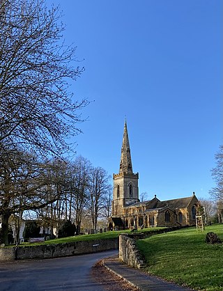
Market Harborough is a market town in the Harborough district of Leicestershire, England, close to the border with Northamptonshire. The town's population was 25,143 in 2020. It is the administrative headquarters of the larger Harborough District.

<span class="mw-page-title-main">Harborough District</span> Non-metropolitan district in England

Harborough is a local government district of Leicestershire, England, named after its main town, Market Harborough. Covering 230 square miles (600 km2), the district is by far the largest of the eight district authorities in Leicestershire and covers almost a quarter of the county. The district also covers the town of Lutterworth and villages of Broughton Astley and Ullesthorpe.

<span class="mw-page-title-main">East Farndon</span> Human settlement in England

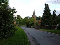
East Farndon is a small linear village and civil parish about one mile south of Market Harborough in West Northamptonshire, England. The village is close to the border with Leicestershire, and has a Leicestershire post code and telephone dialling code. At the time of the 2001 census, the parish's population was 258 people, increasing to 307 at the 2011 census.

<span class="mw-page-title-main">Lytchett Matravers</span> Human settlement in England

Lytchett Matravers is a large village and civil parish in Dorset, England. The 2011 census recorded the parish as having 1,439 households and a population of 3,424.

<span class="mw-page-title-main">Welford, Northamptonshire</span> Human settlement in England

Welford is a village and civil parish in the West Northamptonshire unitary authority area of Northamptonshire, England, just south of the River Avon and the border with Leicestershire. At the 2011 Census, the population of the parish was 1,043.

<span class="mw-page-title-main">Arthingworth</span> Human settlement in England

Arthingworth is a civil parish and village in the West Northamptonshire area of the county of Northamptonshire, England. The population of the civil parish at the 2011 census was 238.

<span class="mw-page-title-main">Boughton, Northamptonshire</span> Village in Northamptonshire, England

Boughton is a village and civil parish in West Northamptonshire, England. It is situated approximately 4 miles (6 km) from Northampton town centre along the A508 road between Northampton and Market Harborough.

<span class="mw-page-title-main">Brixworth</span> Village in Northamptonshire, England

Brixworth is a large village and civil parish in West Northamptonshire, England. The 2001 census recorded a parish population of 5,162, increasing to 5,228 at the 2011 census. The village's All Saints' Church is of Anglo-Saxon origin.

<span class="mw-page-title-main">Sibbertoft</span> Human settlement in England

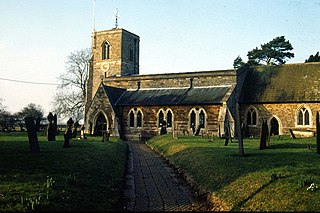
Sibbertoft is a village and civil parish in West Northamptonshire in England. At the time of the 2001 census, the parish's population was 343 people, increasing to 462 at the 2011 Census.

Haselbech is a village and civil parish in West Northamptonshire in England. At the time of the 2001 census, the parish had a population of 87 people. The population remained less than 100 at the 2011 Census and was included in the civil parish of Kelmarsh.

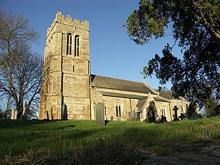
Great Oxendon is a linear village and civil parish in West Northamptonshire in England. At the time of the 2001 census, the parish's population was 307 people, increasing to 331 at the 2011 Census.

<span class="mw-page-title-main">Clipston, Northamptonshire</span> Human settlement in England

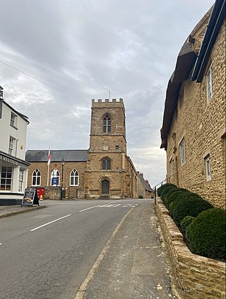
Clipston is a village and civil parish that is administered as part of West Northamptonshire in England. The population of the civil parish at the 2011 census was 643. The town of Market Harborough is much nearer, about 4 miles (6.4 km) north-east and so the village may be regarded as an economic satellite of that town rather than Daventry. At the time of the 2001 census, the parish had a population of 613 people.

<span class="mw-page-title-main">Kingsthorpe</span> Suburb in Northampton, England

Kingsthorpe is a suburb and civil parish of Northampton, England. It is situated to the north of Northampton town centre and is served by the A508 and A5199 roads which join at Kingsthorpe's centre. The 2011 Census recorded the population of the district council ward as 4,477.

<span class="mw-page-title-main">Gretton, Northamptonshire</span> Human settlement in England

Gretton is a village and civil parish in North Northamptonshire. It is in Rockingham Forest and overlooks the valley of the River Welland and the neighbouring county of Rutland. At the time of the 2001 census, the parish had a population of 1,240 people, increasing to 1,285 at the 2011 census.

<span class="mw-page-title-main">Southwick, Northamptonshire</span> Human settlement in England

Southwick is a small village and civil parish in Northamptonshire, England. It is approximately 3 miles (4.8 km) north of the town of Oundle and is set in a valley of the River Nene. The village lies in the North Northamptonshire. Before local government changes in 2021 it fell within the non-metropolitan district of East Northamptonshire, which lay within the East Midlands region. At the time of the 2001 census, the parish's population was 180 people, increasing marginally to 181 at the 2011 Census.

<span class="mw-page-title-main">Drayton, Leicestershire</span> Human settlement in England

Drayton is a small village and civil parish in the Harborough district of south-east Leicestershire, bordering Northamptonshire and Rutland. It is situated 6.7 miles (11 km) northeast of Market Harborough and 5 miles (7.5 km) southwest of Uppingham on the north side of the Welland valley. Nearby villages are Bringhurst, Great Easton and Nevill Holt. The church of St James in Drayton is one of the smallest churches in England.

Nortoft was once a distinct hamlet between the Northamptonshire village of Guilsborough and the main road connecting Leicester and Northampton in the English Midlands.

<span class="mw-page-title-main">Edmund Francis Law</span> British architect

Edmund Francis Law, usually referred to as 'E. F. Law', FRIBA was an English architect during the 19th century, notable for a large number of projects, particularly restorations, in the counties of Northamptonshire, Leicestershire and Rutland.

<span class="mw-page-title-main">All Saints' Church, Naseby</span> Church

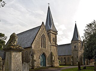
All Saints' Church is an Anglican Church and the parish church of Naseby in Northamptonshire, England. It is a Grade II* listed building and stands at the southern corner of Church Street and Newlands.

<span class="mw-page-title-main">Cromwell Cottage, Naseby</span>

Cromwell Cottage is a Grade II listed building that stands on a site on the west side of the High Street, just north of its junction with School Lane, in Naseby, Northamptonshire, England.

References

  1. "Civil Parish population 2011". Neighbourhood Statistics. Office for National Statistics. Retrieved 7 July 2016.
  2. Pevsner, Nikolaus; Cherry, Bridget (revision) (1961). The Buildings of England – Northamptonshire. London and New Haven: Yale University Press. p. 309. ISBN   978-0-300-09632-3.
  3. Vialls, Christine; Collins, Kay (2004). A Georgian Country Parson: The Rev. John Mastin of Naseby. Northamptonshire Record Society.
  4. 1 2 3 Howcutt, Francis (1989). "Naseby – The Great Baptism Round-up, 1837". Footprints. Northamptonshire Family History Society.
  5. "Naseby Methodist Church". Methodist Church, Harborough Methodist Circuit. Retrieved 4 October 2015.
  6. "Historic England – The List" . Retrieved 17 September 2015.