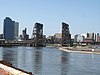
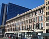
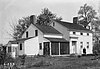
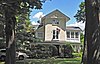
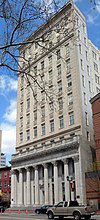
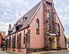
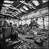
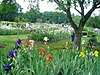
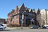
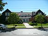
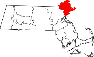
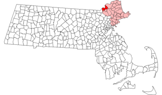
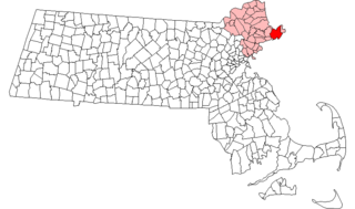
[4] Name on the Register [5] Image Date listed [6] Location City or town Description 1 Ahavas Sholom Ahavas Sholom December 13, 2000 (# 00001530 145 Broadway 40°45′19″N 74°10′12″W / 40.755278°N 74.17°W / 40.755278; -74.17 (Ahavas Sholom ) Newark Now site of Jewish Museum of New Jersey 2 Ambrose-Ward Mansion Ambrose-Ward Mansion September 20, 1982 (# 82003272 132 S. Harrison St. 40°45′51″N 74°13′20″W / 40.764167°N 74.222222°W / 40.764167; -74.222222 (Ambrose-Ward Mansion ) East Orange 3 Ampere Station Ampere Station June 22, 1984 (# 84002628 Ampere Plaza and Whitney Place 40°45′55″N 74°11′40″W / 40.765278°N 74.194444°W / 40.765278; -74.194444 (Ampere Station ) East Orange The station was closed in 1991 and demolished shortly after. Part of the Operating Passenger Railroad Stations TR . 4 The Anchorage The Anchorage July 1, 1988 (# 86003061 155 Wildwood Avenue 40°50′13″N 74°12′15″W / 40.836944°N 74.204167°W / 40.836944; -74.204167 (The Anchorage ) Montclair part of the Montclair Multiple Resource Area (MRA) 5 Anderson Park Anderson Park December 11, 2009 (# 09001073 SE corner of Bellevue and North Mountain Ave. 40°50′30″N 74°12′38″W / 40.841578°N 74.210464°W / 40.841578; -74.210464 (Anderson Park ) Montclair First park in first county parks system in country. 6 John Ballantine House John Ballantine House October 2, 1973 (# 73001093 43 Washington St. 40°50′00″N 74°10′16″W / 40.833333°N 74.171111°W / 40.833333; -74.171111 (John Ballantine House ) Newark Now part of Newark Museum 7 Joseph Bardsley House Joseph Bardsley House July 1, 1988 (# 86003059 345 Park St. 40°50′11″N 74°12′09″W / 40.836389°N 74.2025°W / 40.836389; -74.2025 (Joseph Bardsley House ) Montclair part of the Montclair MRA 8 Belleville Avenue Congregational Church Belleville Avenue Congregational Church August 13, 1986 (# 86001505 151 Broadway 40°45′19″N 74°10′12″W / 40.755278°N 74.17°W / 40.755278; -74.17 (Belleville Avenue Congregational Church ) Newark 9 Bethany Baptist Church Bethany Baptist Church May 10, 1989 (# 88000466 117 W. Market St. 40°44′25″N 74°11′01″W / 40.740278°N 74.183611°W / 40.740278; -74.183611 (Bethany Baptist Church ) Newark Photo shows the replacement church. The original has been demolished 10 Bloomfield Green Historic District Bloomfield Green Historic District April 20, 1978 (# 78001757 Bounded by Belleville Ave., Montgomery, Spruce, State, Liberty, and Franklin Sts. 40°47′48″N 74°11′44″W / 40.796667°N 74.195556°W / 40.796667; -74.195556 (Bloomfield Green Historic District ) Bloomfield 11 Bloomfield Station Bloomfield Station June 22, 1984 (# 84002631 Washington St. and Glenwood Ave. 40°47′33″N 74°12′03″W / 40.7925°N 74.200833°W / 40.7925; -74.200833 (Bloomfield Station ) Bloomfield part of the Operating Passenger Railroad Stations TR 12 Bradner`s Pharmacy Bradner`s Pharmacy July 1, 1988 (# 86003010 33 Watchung Plaza 40°49′48″N 74°12′21″W / 40.83°N 74.205833°W / 40.83; -74.205833 (Bradner`s Pharmacy ) Montclair part of the Montclair MRA 13 Branch Brook Park Branch Brook Park January 12, 1981 (# 81000392 Roughly bounded by Belleville Park, Washington and Clifton Aves., 6th and Orange Sts. 40°46′05″N 74°10′32″W / 40.768056°N 74.175556°W / 40.768056; -74.175556 (Branch Brook Park ) Newark and Belleville 14 Brick Church Station Brick Church Station June 22, 1984 (# 84002636 Brick Church Plaza 40°45′56″N 74°13′10″W / 40.765556°N 74.219444°W / 40.765556; -74.219444 (Brick Church Station ) East Orange part of the Operating Passenger Railroad Stations TR 15 Caldwell Presbyterian Church Manse Caldwell Presbyterian Church Manse November 16, 1977 (# 77000861 207 Bloomfield Avenue 40°50′15″N 74°16′22″W / 40.8375°N 74.272778°W / 40.8375; -74.272778 (Caldwell Presbyterian Church Manse ) Caldwell Birthplace of Grover Cleveland 16 Canfield-Morgan House Canfield-Morgan House November 7, 1995 (# 95001265 899-903 Pompton Ave. (NJ 23) 40°51′48″N 74°13′51″W / 40.863333°N 74.230833°W / 40.863333; -74.230833 (Canfield-Morgan House ) Cedar Grove 17 Carnegie Library Carnegie Library July 1, 1988 (# 86003074 Church St. at Valley Rd. 40°48′55″N 74°13′15″W / 40.815278°N 74.220833°W / 40.815278; -74.220833 (Carnegie Library ) Montclair part of the Montclair MRA 18 Casa Deldra Casa Deldra July 1, 1988 (# 86003062 35 Afterglow Way 40°49′18″N 74°13′42″W / 40.821667°N 74.228333°W / 40.821667; -74.228333 (Casa Deldra ) Montclair part of the Montclair MRA 19 Catedral Evangelica Reformada Catedral Evangelica Reformada October 26, 1972 (# 72000773 27 Lincoln Park and Halsey St. 40°43′38″N 74°10′43″W / 40.727222°N 74.178611°W / 40.727222; -74.178611 (Catedral Evangelica Reformada ) Newark 20 Cathedral of the Sacred Heart Cathedral of the Sacred Heart December 22, 1976 (# 76001151 89 Ridge St. 40°45′18″N 74°10′43″W / 40.755°N 74.178611°W / 40.755; -74.178611 (Cathedral of the Sacred Heart ) Newark 21 Central Avenue Commercial Historic District Central Avenue Commercial Historic District August 26, 1983 (# 83001600 560-654 Central Ave. 40°45′42″N 74°13′29″W / 40.761667°N 74.224722°W / 40.761667; -74.224722 (Central Avenue Commercial Historic District ) East Orange 22 Central Presbyterian Church Central Presbyterian Church November 14, 1986 (# 86003051 46 Park St. 40°49′04″N 74°13′04″W / 40.817778°N 74.217778°W / 40.817778; -74.217778 (Central Presbyterian Church ) Montclair part of the Montclair MRA 23 J. M. Chapman House J. M. Chapman House July 1, 1988 (# 86002975 10 Rockledge 40°49′22″N 74°13′38″W / 40.822778°N 74.227222°W / 40.822778; -74.227222 (J. M. Chapman House ) Montclair part of the Montclair MRA 24 Church Street School Church Street School August 25, 1995 (# 95001042 65 Church St., Nutley Township 40°49′07″N 74°09′49″W / 40.818747°N 74.163583°W / 40.818747; -74.163583 (Church Street School ) Nutley 25 William Clark House William Clark House November 10, 1977 (# 77000863 346 Mount Prospect Ave. 40°45′50″N 74°10′20″W / 40.763889°N 74.172222°W / 40.763889; -74.172222 (William Clark House ) Newark 26 Cliffside Hose Company No. 4 Cliffside Hose Company No. 4 July 1, 1988 (# 86003077 588 Valley Rd. 40°50′24″N 74°12′34″W / 40.84°N 74.209444°W / 40.84; -74.209444 (Cliffside Hose Company No. 4 ) Montclair part of the Montclair MRA 27 Collins House Collins House July 3, 2017 (# 100001264 108 Baldwin St. 40°48′26″N 74°11′29″W / 40.807178°N 74.191295°W / 40.807178; -74.191295 (Collins House ) Bloomfield Township 28 Community Hospital Community Hospital March 22, 2004 (# 04000224 130 W. Kinney Street 40°43′50″N 74°10′58″W / 40.73042°N 74.18264°W / 40.73042; -74.18264 (Community Hospital ) Newark Formerly Kenney Memorial Hospital, now New Salem Baptist Church 29 Congregational Church Congregational Church July 1, 1988 (# 86003050 42 S. Fullerton Ave. 40°48′45″N 74°13′11″W / 40.8125°N 74.219722°W / 40.8125; -74.219722 (Congregational Church ) Montclair part of the Montclair MRA 30 Israel Crane House Israel Crane House March 14, 1973 (# 73001091 110 Orange Road 40°48′41″N 74°13′26″W / 40.811389°N 74.223889°W / 40.811389; -74.223889 (Israel Crane House ) Montclair 31 Day Street Public School Day Street Public School August 28, 2012 (# 12000568 29 N. Day St. 40°46′23″N 74°13′44″W / 40.773124°N 74.228978°W / 40.773124; -74.228978 (Day Street Public School ) Orange 32 Dock Bridge Dock Bridge October 3, 1980 (# 80002484 Spans Passaic River 40°44′09″N 74°09′43″W / 40.735833°N 74.161944°W / 40.735833; -74.161944 (Dock Bridge ) Newark 33 East Orange Station East Orange Station June 22, 1984 (# 84002638 65 City Hall Plaza 40°45′40″N 74°12′40″W / 40.761111°N 74.211111°W / 40.761111; -74.211111 (East Orange Station ) East Orange part of the Operating Passenger Railroad Stations TR 34 East Orange VA Hospital East Orange VA Hospital September 4, 2018 (# 100002831 385 Tremont Avenue 40°45′16″N 74°14′09″W / 40.7544°N 74.2359°W / 40.7544; -74.2359 (East Orange VA Hospital ) East Orange Known as East Orange VA Medical Center , part of United States Third Generation Veterans Hospitals MPS 35 Eastward Eastward July 1, 1988 (# 86002980 50 Lloyd Rd. 40°49′07″N 74°13′45″W / 40.818611°N 74.229167°W / 40.818611; -74.229167 (Eastward ) Montclair part of the Montclair MRA 36 Edison National Historic Site Edison National Historic Site October 15, 1966 (# 66000052 Main St. between Alden and Lakeside Sts. 40°47′13″N 74°14′16″W / 40.78694°N 74.23778°W / 40.78694; -74.23778 (Edison National Historic Site ) West Orange 37 Edison Storage Battery Company Building Edison Storage Battery Company Building February 28, 1996 (# 96000055 177 Main St. 40°46′57″N 74°14′07″W / 40.7825°N 74.235278°W / 40.7825; -74.235278 (Edison Storage Battery Company Building ) West Orange 38 Thomas Edison National Historical Park Thomas Edison National Historical Park April 17, 2023 (# 100008826 211 Main St. and 12 Honeysuckle Ave. 40°47′03″N 74°14′03″W / 40.7841°N 74.2341°W / 40.7841; -74.2341 (Thomas Edison National Historical Park ) West Orange 39 Egbert Farm Egbert Farm July 1, 1988 (# 86002996 128 N. Mountain Ave. 40°49′39″N 74°13′08″W / 40.8275°N 74.218889°W / 40.8275; -74.218889 (Egbert Farm ) Montclair part of the Montclair MRA 40 Eighteenth Avenue School Eighteenth Avenue School April 14, 2015 (# 15000151 229-243 18th Ave. 40°43′45″N 74°11′31″W / 40.7292°N 74.1919°W / 40.7292; -74.1919 (Eighteenth Avenue School ) Newark 41 Enclosure Historic District Enclosure Historic District December 31, 1974 (# 74001160 Enclosure and Calico Lane 40°49′11″N 74°09′16″W / 40.819722°N 74.154444°W / 40.819722; -74.154444 (Enclosure Historic District ) Nutley 42 Essex Club Essex Club February 22, 1991 (# 91000110 52 Park Place 40°44′20″N 74°10′07″W / 40.7389°N 74.1687°W / 40.7389; -74.1687 (Essex Club ) Newark 43 Essex County Courthouse Essex County Courthouse June 26, 1975 (# 75001135 470 High Street 40°44′13″N 74°10′45″W / 40.736944°N 74.179167°W / 40.736944; -74.179167 (Essex County Courthouse ) Newark 44 Essex County Jail Essex County Jail September 3, 1991 (# 91001366 21 Wilsey St. 40°44′40″N 74°10′58″W / 40.744444°N 74.182778°W / 40.744444; -74.182778 (Essex County Jail ) Newark 45 Essex County Park Commission Administration Building Essex County Park Commission Administration Building November 11, 1977 (# 77000864 115 Clifton Ave. 40°45′12″N 74°10′41″W / 40.753333°N 74.178056°W / 40.753333; -74.178056 (Essex County Park Commission Administration Building ) Newark 46 The Everett Court Apartments The Everett Court Apartments June 28, 2021 (# 100006672 76-80 Court St. 40°43′56″N 74°10′43″W / 40.7322°N 74.1787°W / 40.7322; -74.1787 (The Everett Court Apartments ) Newark 47 Evergreen Cemetery Evergreen Cemetery July 9, 1991 (# 91000882 1137 N. Broad St. 40°41′32″N 74°12′39″W / 40.692222°N 74.210833°W / 40.692222; -74.210833 (Evergreen Cemetery ) Newark 48 Fairfield Dutch Reformed Church Fairfield Dutch Reformed Church October 7, 1975 (# 75001134 Fairfield Rd. 40°53′04″N 74°16′57″W / 40.884444°N 74.2825°W / 40.884444; -74.2825 (Fairfield Dutch Reformed Church ) Fairfield 49 Feigenspan Mansion Feigenspan Mansion October 5, 1977 (# 77000865 710 High St. 40°43′41″N 74°10′58″W / 40.728056°N 74.182778°W / 40.728056; -74.182778 (Feigenspan Mansion ) Newark 50 Henry Fenn House Henry Fenn House July 1, 1988 (# 86002988 208 N. Mountain Ave. 40°49′59″N 74°13′02″W / 40.833056°N 74.217222°W / 40.833056; -74.217222 (Henry Fenn House ) Montclair part of the Montclair MRA 51 First Baptist Peddie Memorial Church First Baptist Peddie Memorial Church October 30, 1972 (# 72000774 Broad and Fulton Sts. 40°44′29″N 74°10′09″W / 40.741389°N 74.169167°W / 40.741389; -74.169167 (First Baptist Peddie Memorial Church ) Newark 52 First Methodist Episcopal Church First Methodist Episcopal Church July 1, 1988 (# 86003048 24 N. Fullerton Ave. 40°48′55″N 74°13′06″W / 40.815278°N 74.218333°W / 40.815278; -74.218333 (First Methodist Episcopal Church ) Montclair part of the Montclair MRA 53 First National State Bank Building First National State Bank Building August 10, 1977 (# 77000866 810 Broad St. 40°44′04″N 74°10′22″W / 40.734444°N 74.172778°W / 40.734444; -74.172778 (First National State Bank Building ) Newark 54 Forest Hill Historic District Forest Hill Historic District August 3, 1990 (# 90001193 Roughly bounded by Verona Ave., Mt. Prospect Ave., 2nd Ave., and Branch Brook Park 40°46′22″N 74°10′14″W / 40.772778°N 74.170556°W / 40.772778; -74.170556 (Forest Hill Historic District ) Newark 55 Four Corners Historic District Four Corners Historic District September 8, 2000 (# 00001061 Roughly bounded by Raymond Blvd., Mulberry St., Hill St. and Washington St. 40°44′06″N 74°10′26″W / 40.735°N 74.173889°W / 40.735; -74.173889 (Four Corners Historic District ) Newark 56 Free Public Library, Upper Montclair Branch Free Public Library, Upper Montclair Branch July 1, 1988 (# 86003076 185 Bellevue Avenue, Upper Montclair 40°50′29″N 74°12′19″W / 40.841389°N 74.205278°W / 40.841389; -74.205278 (Free Public Library, Upper Montclair Branch ) Montclair part of the Montclair MRA 57 Glen Ridge Historic District Glen Ridge Historic District August 9, 1982 (# 82004784 Roughly bounded by Bay St., Essex and Midland Aves., Adams Pl., Spencer Rd., and Franklin Pl.November 14, 1988 , refnum 88002155): North side roughly along Ridgewood and Forest Ave. from Bay to Gray St., south side along Hawthorne, Carteret, and Midland Ave.July 9, 2013 , refnum 13000480): Ridgewood, Sommer, Hawthorne, Victor, Forest, Oakwood, Watchung, Prescott & Sunset Aves., Brooklawn & Stonehouse Rds. 40°47′52″N 74°12′19″W / 40.797778°N 74.205278°W / 40.797778; -74.205278 (Glen Ridge Historic District ) Glen Ridge 58 Glencoe Glencoe October 1, 1991 (# 91001481 698 Martin Luther King Blvd. 40°43′42″N 74°10′56″W / 40.728333°N 74.182222°W / 40.728333; -74.182222 (Glencoe ) Newark 59 Frank Goodwillie House Frank Goodwillie House July 1, 1988 (# 86003058 17 Wayside Pl. 40°48′16″N 74°13′51″W / 40.804444°N 74.230833°W / 40.804444; -74.230833 (Frank Goodwillie House ) Montclair part of the Montclair MRA 60 Grace Church Grace Church November 2, 1972 (# 72000776 Broad and Walnut Sts. 40°43′50″N 74°10′28″W / 40.730556°N 74.174444°W / 40.730556; -74.174444 (Grace Church ) Newark 61 Griffith Building Griffith Building May 24, 1984 (# 84002641 605-607 Broad Street 40°44′27″N 74°10′11″W / 40.740833°N 74.169722°W / 40.740833; -74.169722 (Griffith Building ) Newark 62 Hahne and Company Hahne and Company August 30, 1994 (# 94001005 609 Broad Street 40°44′25″N 74°10′14″W / 40.740278°N 74.170556°W / 40.740278; -74.170556 (Hahne and Company ) Newark 63 Samuel Orton Harrison House Samuel Orton Harrison House June 30, 1980 (# 80002488 153 Orton Rd. 40°49′50″N 74°18′15″W / 40.830556°N 74.304167°W / 40.830556; -74.304167 (Samuel Orton Harrison House ) West Caldwell 64 Haskell`s Bloomfield Villa Haskell`s Bloomfield Villa July 1, 1988 (# 86003002 84 Llewellyn Rd. 40°48′16″N 74°13′35″W / 40.804444°N 74.226389°W / 40.804444; -74.226389 (Haskell`s Bloomfield Villa ) Montclair part of the Montclair MRA 65 Home Office Building Home Office Building June 17, 1982 (# 82003273 8-12 Park Pl. 40°44′25″N 74°10′07″W / 40.740278°N 74.168611°W / 40.740278; -74.168611 (Home Office Building ) Newark 66 House at 147 Park Street House at 147 Park Street July 1, 1988 (# 86003064 147 Park St. 40°49′23″N 74°12′40″W / 40.823056°N 74.211111°W / 40.823056; -74.211111 (House at 147 Park Street ) Montclair part of the Montclair MRA 67 House at 18 Brunswick Road House at 18 Brunswick Road July 1, 1988 (# 86003035 18 Brunswick Rd. 40°49′33″N 74°12′51″W / 40.825833°N 74.214167°W / 40.825833; -74.214167 (House at 18 Brunswick Road ) Montclair part of the Montclair MRA 68 House at 21 Stonebridge Road House at 21 Stonebridge Road July 1, 1988 (# 86003073 21 Stonebridge Rd. 40°48′04″N 74°13′41″W / 40.801111°N 74.228056°W / 40.801111; -74.228056 (House at 21 Stonebridge Road ) Montclair part of the Montclair MRA 69 House at 52 Wayside Place House at 52 Wayside Place July 1, 1988 (# 86003041 52 Wayside Pl. 40°48′05″N 74°13′52″W / 40.801389°N 74.231111°W / 40.801389; -74.231111 (House at 52 Wayside Place ) Montclair part of the Montclair MRA 70 House at 53 Lloyd Road House at 53 Lloyd Road July 1, 1988 (# 86002973 53 Lloyd Rd. 40°49′03″N 74°13′45″W / 40.8175°N 74.229167°W / 40.8175; -74.229167 (House at 53 Lloyd Road ) Montclair part of the Montclair MRA 71 House at 67 Warren Place House at 67 Warren Place July 1, 1988 (# 86003004 67 Warren Pl. 40°48′20″N 74°13′36″W / 40.805556°N 74.226667°W / 40.805556; -74.226667 (House at 67 Warren Place ) Montclair part of the Montclair MRA 72 House at 68 Eagle Rock Way House at 68 Eagle Rock Way July 1, 1988 (# 86003009 68 Eagle Rock Way 40°50′28″N 74°12′33″W / 40.841111°N 74.209167°W / 40.841111; -74.209167 (House at 68 Eagle Rock Way ) Montclair part of the Montclair MRA 73 House at 7 South Mountain Terrace House at 7 South Mountain Terrace November 15, 1986 (# 86003235 7 S. Mountain Terr. 40°48′37″N 74°13′51″W / 40.810278°N 74.230833°W / 40.810278; -74.230833 (House at 7 South Mountain Terrace ) Montclair part of the Montclair MRA 74 House at 80 Lloyd Road House at 80 Lloyd Road July 1, 1988 (# 86003003 80 Lloyd Rd. 40°48′57″N 74°13′50″W / 40.815833°N 74.230556°W / 40.815833; -74.230556 (House at 80 Lloyd Road ) Montclair part of the Montclair MRA 75 House at 97 Warren Place House at 97 Warren Place July 1, 1988 (# 86003070 97 Warren Pl. 40°48′39″N 74°13′44″W / 40.810833°N 74.228889°W / 40.810833; -74.228889 (House at 97 Warren Place ) Montclair part of the Montclair MRA 76 House of Prayer Episcopal Church and Rectory House of Prayer Episcopal Church and Rectory October 30, 1972 (# 72000777 Broad and State Sts. 40°44′53″N 74°10′17″W / 40.748056°N 74.171389°W / 40.748056; -74.171389 (House of Prayer Episcopal Church and Rectory ) Newark 77 The House that Lives The House that Lives July 1, 1988 (# 86002976 83 Watchung Ave. 40°49′52″N 74°12′34″W / 40.831111°N 74.209444°W / 40.831111; -74.209444 (The House that Lives ) Montclair part of the Montclair MRA 78 Indian and the Puritan Indian and the Puritan October 28, 1994 (# 94001256 Opposite 5 Washington Street 40°44′38″N 74°10′13″W / 40.743889°N 74.170278°W / 40.743889; -74.170278 (Indian and the Puritan Newark part of the Public Sculpture in Newark, New Jersey Multiple Property Submission 79 Interstate Hosiery Mills, Inc. Mill Building Interstate Hosiery Mills, Inc. Mill Building December 30, 2009 (# 09001176 110 N. Fulton St. 40°47′16″N 74°12′27″W / 40.787803°N 74.207631°W / 40.787803; -74.207631 (Interstate Hosiery Mills, Inc. Mill Building ) Bloomfield 80 Jacobus House Jacobus House April 1, 1975 (# 75001133 178 Grove Ave. 40°51′03″N 74°14′06″W / 40.850833°N 74.235°W / 40.850833; -74.235 (Jacobus House ) Cedar Grove 81 James Street Commons Historic District James Street Commons Historic District January 9, 1978 (# 78001758 Roughly bounded by Halsey, Warren, Boyden, Bleeker, Orange, and Broad Streets 40°44′36″N 74°10′25″W / 40.743333°N 74.173611°W / 40.743333; -74.173611 (James Street Commons Historic District ) Newark Boundary increase approved September 22, 1983 82 Eugene V. Kelly Carriage House Eugene V. Kelly Carriage House November 10, 1975 (# 75001136 S. Orange Ave., Seton Hall University campus 40°44′40″N 74°14′38″W / 40.744444°N 74.243889°W / 40.744444; -74.243889 (Eugene V. Kelly Carriage House ) South Orange Historic building from 1887, with 5 acres, now on Seton Hall University campus 83 Kingsland Manor Kingsland Manor March 24, 1978 (# 78001762 3 Kingsland Street 40°49′35″N 74°08′35″W / 40.826389°N 74.143056°W / 40.826389; -74.143056 (Kingsland Manor ) Nutley 84 Krueger Mansion Krueger Mansion November 9, 1972 (# 72000778 601 High St. 40°43′57″N 74°10′54″W / 40.7325°N 74.181667°W / 40.7325; -74.181667 (Krueger Mansion ) Newark 85 Lincoln Park Historic District Lincoln Park Historic District January 5, 1984 (# 84002646 Lincoln Park, Clinton Avenue, and Spruce and Broad Streets 40°43′35″N 74°10′46″W / 40.726389°N 74.179444°W / 40.726389; -74.179444 (Lincoln Park Historic District ) Newark 86 Llewellyn Park Historic District Llewellyn Park Historic District February 28, 1986 (# 86000423 Roughly bounded by Eagle Rock Ave., Main St., Pleasant Ave., and NJ 280 40°47′37″N 74°14′25″W / 40.793611°N 74.240278°W / 40.793611; -74.240278 (Llewellyn Park Historic District ) West Orange 87 Maple Avenue School Maple Avenue School February 6, 2020 (# 100004957 33 Maple Ave. 40°42′31″N 74°12′55″W / 40.7086°N 74.2152°W / 40.7086; -74.2152 (Maple Avenue School ) Newark 88 Maplewood Memorial Park Maplewood Memorial Park August 3, 2015 (# 15000489 Bounded by Oakland & Dunnell Rds., Valley & Baker Sts. 40°43′51″N 74°16′23″W / 40.73079°N 74.27297°W / 40.73079; -74.27297 (Maplewood Memorial Park ) Maplewood 89 Maplewood Municipal Building Maplewood Municipal Building October 1, 2014 (# 14000810 574 Valley St. 40°43′48″N 74°16′18″W / 40.7301°N 74.2716°W / 40.7301; -74.2716 (Maplewood Municipal Building ) Maplewood 90 Maplewood Village Historic District Maplewood Village Historic District April 25, 2022 (# 100007649 Maplewood Ave., Durand Rd., Baker St., Highland, Inwood and Lenox Pls. 40°43′49″N 74°16′42″W / 40.7304°N 74.2784°W / 40.7304; -74.2784 (Maplewood Village Historic District ) Maplewood 91 Marlboro Park Historic District Marlboro Park Historic District July 22, 1988 (# 86002967 Roughly along Fairfield St., Waterbury Rd., Montclair Ave., and Watchung Ave. between N. Fullerton and Grove Sts. 40°49′46″N 74°12′09″W / 40.829444°N 74.2025°W / 40.829444; -74.2025 (Marlboro Park Historic District ) Montclair part of the Montclair MRA 92 Marsellis House Marsellis House July 1, 1988 (# 86003031 190 Cooper Ave. 40°50′19″N 74°12′21″W / 40.838611°N 74.205833°W / 40.838611; -74.205833 (Marsellis House ) Montclair part of the Montclair MRA 93 Military Park Commons Historic District Military Park Commons Historic District June 18, 2004 (# 04000649 Roughly bounded by Washington Place, McCarter Highway, E. Park Street and Raymond Boulevard 40°44′19″N 74°10′09″W / 40.738631°N 74.169286°W / 40.738631; -74.169286 (Military Park Commons Historic District ) Newark 94 Miller Street Historic District Miller Street Historic District July 1, 1988 (# 86002971 Miller and Fulton Sts. between Elmwood Ave., Elm, and New Sts. 40°48′26″N 74°12′53″W / 40.807222°N 74.214722°W / 40.807222; -74.214722 (Miller Street Historic District ) Montclair part of the Montclair MRA 95 George A. Miller House George A. Miller House July 1, 1988 (# 86002979 275 Claremont Ave. 40°49′13″N 74°13′11″W / 40.820278°N 74.219722°W / 40.820278; -74.219722 (George A. Miller House ) Montclair part of the Montclair MRA 96 Montclair Art Museum Montclair Art Museum November 14, 1986 (# 86002984 3 S. Mountain Ave. 40°49′07″N 74°13′27″W / 40.818611°N 74.224167°W / 40.818611; -74.224167 (Montclair Art Museum ) Montclair part of the Montclair MRA 97 Montclair Railroad Station Montclair Railroad Station January 8, 1973 (# 73001092 Lackawanna Plaza 40°48′41″N 74°12′48″W / 40.811389°N 74.213333°W / 40.811389; -74.213333 (Montclair Railroad Station ) Montclair 98 Montrose Park Historic District Montrose Park Historic District August 29, 1997 (# 97000978 Roughly bounded by S. Orange, Sanford, and Heywood Aves., and Holland Rd. 40°44′57″N 74°14′52″W / 40.749167°N 74.247778°W / 40.749167; -74.247778 (Montrose Park Historic District ) South Orange 99 Morris Canal Morris Canal October 1, 1974 (# 74002228 Irregular line beginning at Phillipsburg and ending at Jersey City 40°41′08″N 75°09′49″W / 40.685556°N 75.163611°W / 40.685556; -75.163611 (Morris Canal ) Not Applicable 100 Mount Pleasant Cemetery Mount Pleasant Cemetery October 28, 1988 (# 87000836 375 Broadway 40°45′50″N 74°09′51″W / 40.763889°N 74.164167°W / 40.763889; -74.164167 (Mount Pleasant Cemetery ) Newark 101 Mountain Avenue Station Mountain Avenue Station June 22, 1984 (# 84002654 451 Upper Mountain Avenue, Upper Montclair 40°50′57″N 74°12′21″W / 40.849167°N 74.205833°W / 40.849167; -74.205833 (Mountain Avenue Station ) Montclair part of the Operating Passenger Railroad Stations TR 102 Mountain District Mountain District July 22, 1988 (# 86002970 Roughly bounded by Highland, Bradford, Upper Mountain, and Claremont Aves. 40°49′52″N 74°13′10″W / 40.831111°N 74.219444°W / 40.831111; -74.219444 (Mountain District ) Montclair part of the Montclair MRA 103 Mountain Station Mountain Station September 29, 1984 (# 84002656 449 Vose Ave. 40°45′17″N 74°15′13″W / 40.754722°N 74.253611°W / 40.754722; -74.253611 (Mountain Station ) South Orange part of the Operating Passenger Railroad Stations TR 104 Mulford House Mulford House July 1, 1988 (# 86003038 207 Union St. 40°48′42″N 74°13′50″W / 40.811667°N 74.230556°W / 40.811667; -74.230556 (Mulford House ) Montclair part of the Montclair MRA 105 Murphy Varnish Works Murphy Varnish Works March 9, 1979 (# 79001484 McWhorter, Vesey, and Chestnut Sts. 40°43′28″N 74°10′14″W / 40.724444°N 74.170556°W / 40.724444; -74.170556 (Murphy Varnish Works ) Newark 106 Mutual Benefit Life Insurance Company Mutual Benefit Life Insurance Company November 17, 1983 (# 83004031 300 Broadway and 2nd St. 40°45′40″N 74°10′10″W / 40.761111°N 74.169444°W / 40.761111; -74.169444 (Mutual Benefit Life Insurance Company ) Newark 107 New Jersey Bell Headquarters Building New Jersey Bell Headquarters Building September 21, 2005 (# 05001054 540 Broad St. 40°44′42″N 74°10′08″W / 40.745°N 74.168889°W / 40.745; -74.168889 (New Jersey Bell Headquarters Building ) Newark 108 New Point Baptist Church New Point Baptist Church November 2, 1972 (# 72000779 17 E. Kinney St. 40°43′41″N 74°10′32″W / 40.728056°N 74.175556°W / 40.728056; -74.175556 (New Point Baptist Church ) Newark 109 Newark Broad Street Station Newark Broad Street Station June 22, 1984 (# 84002662 Broad and University Streets 40°44′50″N 74°10′20″W / 40.747222°N 74.172222°W / 40.747222; -74.172222 (Newark Broad Street Station ) Newark part of the Operating Passenger Railroad Stations TR 110 Newark City Hall Newark City Hall February 17, 1978 (# 78001759 920 Broad St. 40°43′54″N 74°10′27″W / 40.731667°N 74.174167°W / 40.731667; -74.174167 (Newark City Hall ) Newark 111 Newark Female Charitable Society Newark Female Charitable Society September 12, 1979 (# 79001485 305 Halsey St., 41-43 Hill St. 40°43′56″N 74°10′36″W / 40.732222°N 74.176667°W / 40.732222; -74.176667 (Newark Female Charitable Society ) Newark 112 Newark Metropolitan Airport Buildings Newark Metropolitan Airport Buildings December 12, 1980 (# 80002485 U.S. 22 40°42′23″N 74°09′45″W / 40.706389°N 74.1625°W / 40.706389; -74.1625 (Newark Metropolitan Airport Buildings ) Newark 113 Newark Orphan Asylum Newark Orphan Asylum June 19, 1973 (# 73001094 High and Bleeker Sts., Newark College of Engineering 40°44′36″N 74°15′37″W / 40.743333°N 74.260278°W / 40.743333; -74.260278 (Newark Orphan Asylum ) Newark 114 North Broad Street Historic District North Broad Street Historic District July 23, 1996 (# 96000813 136-148 Broad St. 40°45′27″N 74°10′08″W / 40.7575°N 74.168889°W / 40.7575; -74.168889 (North Broad Street Historic District ) Newark 115 North Reformed Church North Reformed Church October 5, 1972 (# 72000780 510 Broad St. 40°44′39″N 74°10′10″W / 40.744167°N 74.169444°W / 40.744167; -74.169444 (North Reformed Church ) Newark 116 Oakes Estate Oakes Estate August 6, 1981 (# 81000390 240 Belleville Ave. 40°47′56″N 74°11′27″W / 40.798889°N 74.190833°W / 40.798889; -74.190833 (Oakes Estate ) Bloomfield 117 Old First Presbyterian Church Old First Presbyterian Church November 2, 1972 (# 72000781 820 Broad St. 40°44′03″N 74°10′22″W / 40.734167°N 74.172778°W / 40.734167; -74.172778 (Old First Presbyterian Church ) Newark 118 Orange Free Public Library Orange Free Public Library September 28, 1981 (# 81000393 348 Main St. 40°46′21″N 74°13′56″W / 40.7725°N 74.232222°W / 40.7725; -74.232222 (Orange Free Public Library ) Orange 119 Orange Memorial Hospital Historic District Orange Memorial Hospital Historic District November 17, 2015 (# 15000797 180 S. Essex Ave. 40°46′05″N 74°14′02″W / 40.768157°N 74.233936°W / 40.768157; -74.233936 (Orange Memorial Hospital Historic District ) Orange 120 Orange Station Orange Station June 22, 1984 (# 84002665 73 Lincoln Avenue 40°46′18″N 74°14′02″W / 40.771667°N 74.233889°W / 40.771667; -74.233889 (Orange Station ) Orange part of the Operating Passenger Railroad Stations TR 121 Pan American C.M.A. Church Pan American C.M.A. Church July 31, 1972 (# 72000782 76 Prospect St. 40°43′48″N 74°09′47″W / 40.73°N 74.163056°W / 40.73; -74.163056 (Pan American C.M.A. Church ) Newark 122 Passaic Machine Works-Watts, Campbell & Company Passaic Machine Works-Watts, Campbell & Company August 13, 1986 (# 86001503 1270 McCarter Hwy. 40°45′02″N 74°10′04″W / 40.750556°N 74.167778°W / 40.750556; -74.167778 (Passaic Machine Works-Watts, Campbell & Company ) Newark 123 Pennsylvania Station Pennsylvania Station December 20, 1978 (# 78001760 Raymond Plaza West 40°44′03″N 74°09′53″W / 40.734167°N 74.164722°W / 40.734167; -74.164722 (Pennsylvania Station ) Newark 124 Pine Street Historic District Pine Street Historic District March 16, 2000 (# 00000175 Roughly bounded by Glenridge Ave., the NJ TRANSIT Boonton Line, Pine and Baldwin Sts. 40°48′35″N 74°12′28″W / 40.809722°N 74.207778°W / 40.809722; -74.207778 (Pine Street Historic District ) Montclair 125 Post Office Building, Upper Montclair Post Office Building, Upper Montclair July 1, 1988 (# 86003012 242-244 Bellevue Avenue, Upper Montclair 40°50′28″N 74°12′33″W / 40.841111°N 74.209167°W / 40.841111; -74.209167 (Post Office Building, Upper Montclair ) Montclair part of the Montclair MRA 126 Presby Memorial Iris Gardens Horticultural Center Presby Memorial Iris Gardens Horticultural Center September 17, 1980 (# 80002483 474 Upper Mountain Ave. 40°51′05″N 74°12′23″W / 40.851389°N 74.206389°W / 40.851389; -74.206389 (Presby Memorial Iris Gardens Horticultural Center ) Montclair 127 Protestant Foster Home Protestant Foster Home February 13, 1986 (# 86000211 272-284 Broadway 40°45′37″N 74°10′11″W / 40.760278°N 74.169722°W / 40.760278; -74.169722 (Protestant Foster Home ) Newark 128 Queen of Angels Church Queen of Angels Church October 26, 1972 (# 72000783 Belmont Ave. at Morton St. 40°43′00″N 74°11′22″W / 40.716667°N 74.189444°W / 40.716667; -74.189444 (Queen of Angels Church ) Newark 129 M. F. Reading House M. F. Reading House July 1, 1988 (# 86003006 87 Midland Ave. 40°49′10″N 74°13′01″W / 40.819444°N 74.216944°W / 40.819444; -74.216944 (M. F. Reading House ) Montclair part of the Montclair MRA 130 Red Gables Red Gables July 1, 1988 (# 86002992 99 S. Fullerton Ave. 40°48′29″N 74°13′08″W / 40.808056°N 74.218889°W / 40.808056; -74.218889 (Red Gables ) Montclair part of the Montclair MRA 131 Reformed Dutch Church of Second River Reformed Dutch Church of Second River December 21, 1978 (# 78001756 171 Main St. 40°47′12″N 74°08′58″W / 40.786667°N 74.149444°W / 40.786667; -74.149444 (Reformed Dutch Church of Second River ) Belleville 132 Riverbank Park Riverbank Park April 16, 1998 (# 98000351 Roughly bounded by Van Buren, Market, and Somme Sts., and Passaic R. 40°43′55″N 74°09′09″W / 40.731944°N 74.1525°W / 40.731944; -74.1525 (Riverbank Park ) Newark 133 Route 1 Extension Route 1 Extension August 12, 2005 (# 05000880 US 1 and 9 milepoint: 51.25-54.55, NJ 139 milepoint 0-1.45 40°44′09″N 74°05′30″W / 40.73583°N 74.09167°W / 40.73583; -74.09167 (Route 1 Extension ) Newark Includes Pulaski Skyway . Also listed in Hudson County section. 134 Salaam Temple Salaam Temple October 5, 1977 (# 77000867 1020 Broad St. 40°43′40″N 74°10′35″W / 40.727778°N 74.176389°W / 40.727778; -74.176389 (Salaam Temple ) Newark Later became Newark Symphony Hall 135 Charles S. Shultz House Charles S. Shultz House July 22, 1979 (# 79001482 30 N. Mountain Ave. 40°49′17″N 74°13′24″W / 40.821389°N 74.223333°W / 40.821389; -74.223333 (Charles S. Shultz House ) Montclair 136 Seated Lincoln Seated Lincoln March 30, 1995 (# 95000303 Junction of Springfield and Market Streets, Essex County Courthouse 40°44′13″N 74°10′40″W / 40.736944°N 74.177778°W / 40.736944; -74.177778 (Seated Lincoln Newark part of the Public Sculpture in Newark, New Jersey Multiple Property Submission 137 Second Reformed Dutch Church Second Reformed Dutch Church March 7, 1979 (# 79001486 178-184 Edison Pl. 40°43′57″N 74°09′51″W / 40.7325°N 74.164167°W / 40.7325; -74.164167 (Second Reformed Dutch Church ) Newark 138 Short Hills Park Historic District Short Hills Park Historic District September 18, 1980 (# 80002482 Off NJ 24 40°43′53″N 74°19′38″W / 40.731389°N 74.327222°W / 40.731389; -74.327222 (Short Hills Park Historic District ) Millburn 139 S. C. Smith House S. C. Smith House July 1, 1988 (# 86002978 40 Northview Ave. 40°50′23″N 74°12′25″W / 40.839722°N 74.206944°W / 40.839722; -74.206944 (S. C. Smith House ) Montclair part of the Montclair MRA 140 South Orange Fire Department South Orange Fire Department March 19, 1998 (# 98000255 Junction of First and Sloan Sts. 40°44′43″N 74°15′39″W / 40.745278°N 74.260833°W / 40.745278; -74.260833 (South Orange Fire Department ) South Orange Village 141 South Orange Station South Orange Station June 22, 1984 (# 84002669 19 Sloan St. 40°44′45″N 74°15′39″W / 40.745833°N 74.260833°W / 40.745833; -74.260833 (South Orange Station ) South Orange part of the Operating Passenger Railroad Stations TR 142 South Orange Village Hall South Orange Village Hall May 28, 1976 (# 76001152 S. Orange Ave. and Scotland Rd. 40°44′46″N 74°15′30″W / 40.746111°N 74.258333°W / 40.746111; -74.258333 (South Orange Village Hall ) South Orange 143 South Park Calvary United Presbyterian Church South Park Calvary United Presbyterian Church December 5, 1972 (# 72000784 1035 Broad Street 40°43′34″N 74°10′31″W / 40.726111°N 74.175278°W / 40.726111; -74.175278 (South Park Calvary United Presbyterian Church ) Newark 144 St. Barnabas' Episcopal Church St. Barnabas' Episcopal Church October 18, 1972 (# 72000785 W. Market St. and Sussex and Roseville Aves. 40°45′04″N 74°11′38″W / 40.751111°N 74.193889°W / 40.751111; -74.193889 (St. Barnabas' Episcopal Church ) Newark 145 St. Casimir's Roman Catholic Church St. Casimir's Roman Catholic Church July 9, 1997 (# 97000773 164 Nichols St. 40°43′24″N 74°09′32″W / 40.723333°N 74.158889°W / 40.723333; -74.158889 (St. Casimir's Roman Catholic Church ) Newark 146 St. Columba's Church St. Columba's Church October 30, 1972 (# 72000786 Pennsylvania Ave. and Brunswick St. 40°43′28″N 74°10′49″W / 40.724444°N 74.180278°W / 40.724444; -74.180278 (St. Columba's Church ) Newark 147 St. James' A. M. E. Church St. James' A. M. E. Church October 18, 1972 (# 72000787 High and Court Sts. 40°43′57″N 74°10′52″W / 40.7325°N 74.181111°W / 40.7325; -74.181111 (St. James' A. M. E. Church ) Newark 148 St. John's Church St. John's Church October 30, 1972 (# 72000789 22-26 Mulberry St. 40°44′17″N 74°09′58″W / 40.738056°N 74.166111°W / 40.738056; -74.166111 (St. John's Church ) Newark 149 St. Joseph's Roman Catholic Church Rectory and School St. Joseph's Roman Catholic Church Rectory and School December 8, 1980 (# 80002486 W. Market St. 40°44′35″N 74°11′11″W / 40.743056°N 74.186389°W / 40.743056; -74.186389 (St. Joseph's Roman Catholic Church Rectory and School ) Newark 150 St. Lucy's Church St. Lucy's Church December 31, 1998 (# 98001570 19-26 Ruggiero Plaza 40°45′01″N 74°10′36″W / 40.750278°N 74.176667°W / 40.750278; -74.176667 (St. Lucy's Church ) Newark 151 St. Luke's Church St. Luke's Church July 1, 1988 (# 86003045 69 S. Fullerton Ave. 40°48′36″N 74°13′06″W / 40.81°N 74.218333°W / 40.81; -74.218333 (St. Luke's Church ) Montclair part of the Montclair MRA 152 St. Mark's Episcopal Church St. Mark's Episcopal Church September 22, 1977 (# 77000868 13 Main St. 40°46′37″N 74°14′21″W / 40.776944°N 74.239167°W / 40.776944; -74.239167 (St. Mark's Episcopal Church ) West Orange 153 St. Mary's Abbey Church St. Mary's Abbey Church November 3, 1972 (# 72000790 High and William Sts. 40°44′09″N 74°17′13″W / 40.735833°N 74.286944°W / 40.735833; -74.286944 (St. Mary's Abbey Church ) Newark 154 St. Patrick's Pro Cathedral St. Patrick's Pro Cathedral November 3, 1972 (# 72000791 Washington St. and Central Ave. 40°44′31″N 74°10′21″W / 40.741944°N 74.1725°W / 40.741944; -74.1725 (St. Patrick's Pro Cathedral ) Newark 155 St. Rocco's Roman Catholic Church St. Rocco's Roman Catholic Church September 29, 1980 (# 80002487 212-216 Hunterdon St. 40°44′15″N 74°11′35″W / 40.7375°N 74.193056°W / 40.7375; -74.193056 (St. Rocco's Roman Catholic Church ) Newark 156 St. Stephan's Church St. Stephan's Church October 5, 1972 (# 72000792 Ferry St. and Wilson Ave. 40°43′40″N 74°09′20″W / 40.727778°N 74.155556°W / 40.727778; -74.155556 (St. Stephan's Church ) Newark 157 Stanley Theater Stanley Theater August 28, 1986 (# 86001957 985 S. Orange Ave. 40°44′48″N 74°13′46″W / 40.746667°N 74.229444°W / 40.746667; -74.229444 (Stanley Theater ) Newark 158 State Street Public School State Street Public School August 3, 1990 (# 90001201 15 State St. 40°44′56″N 74°10′18″W / 40.748889°N 74.171667°W / 40.748889; -74.171667 (State Street Public School ) Newark 159 Stone Eagles Stone Eagles July 1, 1988 (# 86003005 60 Undercliff Road 40°48′27″N 74°14′02″W / 40.8075°N 74.233889°W / 40.8075; -74.233889 (Stone Eagles ) Montclair part of the Montclair MRA 160 Stone House by the Stone House Brook Stone House by the Stone House Brook November 22, 1991 (# 87001333 219 S. Orange Ave. 40°44′42″N 74°15′13″W / 40.745°N 74.253611°W / 40.745; -74.253611 (Stone House by the Stone House Brook ) South Orange Built prior to 1680; expanded into a Queen Anne Victorian in 1877 by William Brewer, Jr. 161 Sydenham House Sydenham House July 29, 1970 (# 70000384 Old Road to Bloomfield, at Heller Pkwy. 40°46′36″N 74°10′21″W / 40.776667°N 74.1725°W / 40.776667; -74.1725 (Sydenham House ) Newark 162 Symington House Symington House March 2, 1979 (# 79001487 2 Park Place 40°44′26″N 74°10′07″W / 40.740556°N 74.168611°W / 40.740556; -74.168611 (Symington House ) Newark 163 Temple B'Nai Abraham Temple B'Nai Abraham April 26, 2007 (# 07000358 621 Clinton Ave. 40°43′23″N 74°12′25″W / 40.723056°N 74.206944°W / 40.723056; -74.206944 (Temple B'Nai Abraham ) Newark 164 Trinity Cathedral Trinity Cathedral November 3, 1972 (# 72000793 Broad and Rector Sts. 40°44′25″N 74°10′09″W / 40.740278°N 74.169167°W / 40.740278; -74.169167 (Trinity Cathedral ) Newark 165 Upper Montclair Station Upper Montclair Station June 22, 1984 (# 84002673 275 Bellevue Avenue, Upper Montclair 40°50′31″N 74°12′35″W / 40.841944°N 74.209722°W / 40.841944; -74.209722 (Upper Montclair Station ) Montclair part of the Operating Passenger Railroad Stations TR 166 Van Ness House Van Ness House July 29, 1977 (# 77000862 236 Little Falls Road 40°52′59″N 74°15′35″W / 40.883056°N 74.259722°W / 40.883056; -74.259722 (Van Ness House ) Fairfield 167 Van Reyper-Bond House Van Reyper-Bond House January 22, 1979 (# 79001483 848 Valley Rd. 40°51′23″N 74°12′00″W / 40.856389°N 74.2°W / 40.856389; -74.2 (Van Reyper-Bond House ) Montclair 168 Von Schmid House Von Schmid House July 1, 1988 (# 86002974 580 Park St. 40°51′07″N 74°11′49″W / 40.851944°N 74.196944°W / 40.851944; -74.196944 (Von Schmid House ) Montclair part of the Montclair MRA 169 Vreeland Homestead Vreeland Homestead October 14, 1994 (# 94001217 216 Chestnut Street 40°49′09″N 74°10′12″W / 40.819167°N 74.17°W / 40.819167; -74.17 (Vreeland Homestead ) Nutley 170 Ward-Force House and Condit Family Cook House Ward-Force House and Condit Family Cook House December 29, 1981 (# 81000391 366 S. Livingston Ave. 40°46′54″N 74°19′00″W / 40.781667°N 74.316667°W / 40.781667; -74.316667 (Ward-Force House and Condit Family Cook House ) Livingston 171 Wars of America Wars of America October 28, 1994 (# 94001257 Military Park , 614-706 Broad St. 40°44′20″N 74°10′11″W / 40.7388°N 74.1697°W / 40.7388; -74.1697 (Wars of America ) Newark part of the Public Sculpture in Newark, New Jersey Multiple Property Submission 172 Watchung Avenue Station Watchung Avenue Station June 22, 1984 (# 84002674 Park St. 40°49′46″N 74°12′25″W / 40.829444°N 74.206944°W / 40.829444; -74.206944 (Watchung Avenue Station ) Montclair part of the Operating Passenger Railroad Stations TR 173 Weequahic High School Upload image April 11, 2024 (# 100010170 279 Chancellor Avenue 40°42′33″N 74°13′13″W / 40.7092°N 74.2203°W / 40.7092; -74.2203 (Weequahic High School ) Newark 174 Weequahic Park Historic District Weequahic Park Historic District February 12, 2003 (# 03000013 Roughly bounded by Meeker Ave., Dayton St., the Union County border and Maple Ave. 40°42′06″N 74°12′19″W / 40.701667°N 74.205278°W / 40.701667; -74.205278 (Weequahic Park Historic District ) Newark 175 Wickcliffe Presbyterian Church Wickcliffe Presbyterian Church May 22, 1978 (# 78001761 111 13th Ave. 40°44′19″N 74°11′05″W / 40.738611°N 74.184722°W / 40.738611; -74.184722 (Wickcliffe Presbyterian Church ) Newark 176 Allyn Wight House Allyn Wight House July 1, 1988 (# 86003007 75 Gates Ave. 40°48′25″N 74°13′08″W / 40.806944°N 74.218889°W / 40.806944; -74.218889 (Allyn Wight House ) Montclair part of the Montclair MRA 177 Williams-Harrison House Williams-Harrison House March 13, 1979 (# 79001488 126 Eagle Rock Ave. 40°49′14″N 74°17′24″W / 40.820556°N 74.29°W / 40.820556; -74.29 (Williams-Harrison House ) Roseland 178 Woman's Club of Upper Montclair Woman's Club of Upper Montclair September 4, 2012 (# 12000594 200 Cooper Avenue, Upper Montclair 40°50′21″N 74°12′24″W / 40.839171°N 74.206595°W / 40.839171; -74.206595 (Woman's Club of Upper Montclair ) Montclair part of the Clubhouses of New Jersey Women's Clubs MPS