The humpback whale is a species of baleen whale. It is one of the larger rorqual species, with adults ranging in length from 12–16 m (39–52 ft) and weighing around 25–30 t. The humpback has a distinctive body shape, with long pectoral fins and a knobbly head. It is known for breaching and other distinctive surface behaviors, making it popular with whale watchers. Males produce a complex song lasting 10 to 20 minutes, which they repeat for hours at a time. All the males in a group will produce the same song, which is different each season. Its purpose is not clear, though it may help induce estrus in females.

Cetacean surfacing behaviour or breaching is a group of behaviours demonstrated by the Cetacea infraorder when they come to the water's surface to breathe. Time intervals between surfacing can vary depending on the species, surfacing style or the purpose of the dive; some species have been known to dive for up to 85 minutes at a time when hunting, and dives in excess of three hours have been observed in Cuvier's beaked whale under extreme circumstances.

The Lucayan Archipelago, also known as the Bahama Archipelago, is an island group comprising the Commonwealth of The Bahamas and the British Overseas Territory of the Turks and Caicos Islands. The archipelago is in the western North Atlantic Ocean, north of Cuba and the other Antilles, and east and southeast of Florida.

The Saya de Malha Bank is the largest submerged ocean bank in the world, a part of the vast undersea Mascarene Plateau.

Foxe Basin is a shallow oceanic basin north of Hudson Bay, in Nunavut, Canada, located between Baffin Island and the Melville Peninsula. For most of the year, it is blocked by sea ice and drift ice made up of multiple ice floes.

The Mona Passage is a strait that separates the islands of Hispaniola and Puerto Rico. The Mona Passage connects the Atlantic Ocean to the Caribbean Sea, and is an important shipping route between the Atlantic and the Panama Canal.

Cordell Bank National Marine Sanctuary is a marine sanctuary located off the coast of California. It protects an area of 1,286 sq mi (3,331 km2) of marine wildlife. The administrative center of the sanctuary is on an offshore granite outcrop 4.5 sq mi (12 km2) by 9.5 sq mi (25 km2), located on the continental shelf off of California. The outcrop is, at its closest, 6 mi (10 km) from the sanctuary itself.

Providenciales is an island in the northwest Caicos Islands, part of the Turks and Caicos Islands, a British Overseas Territory. The island has an area of 98 km2 (38 sq mi) and a 2012 Census population of 23,769. Providenciales is the largest island in population, the third largest in area, and is home to a large majority of the population of the Turks and Caicos Islands. Providenciales was ranked the best beach destination in the world by TripAdvisor in 2011.
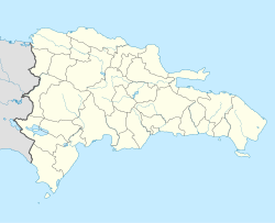
Silver Bank is a submerged bank in the Atlantic Ocean north of the Dominican Republic and southeast of the territory of Turks and Caicos Islands. It covers an area of 1,680 square kilometres. It is separated from Mouchoir Bank in the west by Silver Bank Passage, and from Navidad Bank in the east by Navidad Bank Passage.

South Caicos is the seventh-largest island in the Turks and Caicos archipelago, with a land area of 21.2 square kilometres. South Caicos is known for excellent fishing, both deep-sea and bone fishing, and scuba diving. South Caicos was formerly a salt exporter, the island still hosts a network of salt pans as a reminder of the industry. Today, the island's main income is derived from small-scale commercial fishing.

The Bahama Banks are the submerged carbonate platforms that make up much of the Bahama Archipelago. The term is usually applied in referring to either the Great Bahama Bank around Andros Island, or the Little Bahama Bank of Grand Bahama Island and Great Abaco, which are the largest of the platforms, and the Cay Sal Bank north of Cuba. The islands of these banks are politically part of the Bahamas. Other banks are the three banks of the Turks and Caicos Islands, namely the Caicos Bank of the Caicos Islands, the bank of the Turks Islands, and wholly submerged Mouchoir Bank. Further southeast are the equally wholly submerged Silver Bank and Navidad Bank north of the Dominican Republic.
Mouchoir Bank, in Spanish also called Banco de Pañuelo Blanco, is a submerged bank disputed by the Turks and Caicos Islands and the Dominican Republic, claimed by both as part of their EEZ.
Stellwagen Bank National Marine Sanctuary is an 842-square-mile (638-square-nautical-mile) federally protected marine sanctuary located at the mouth of Massachusetts Bay, between Cape Cod and Cape Ann. It is known as an excellent whale watching site, and is home to many other species of marine life.

Salt Cay is the second largest of the Turks Islands, one of the two island groups forming of the British territory of the Turks and Caicos Islands in the Caribbean. Its area is 6.74 square kilometres. The size of the district, which also includes some unpopulated islands like Cotton Cay nearby, is 9.1 square kilometres. The population is 186, all in the district capital Balfour Town, established in 1673, on the west coast.

West Caicos is an island in the Turks and Caicos Islands southwest of Providenciales. West Caicos has an area of 11 square miles (28 km2), and has been uninhabited for over a century.
The Caribbean bioregion is a biogeographic region that includes the islands of the Caribbean Sea and nearby Atlantic islands, which share a fauna, flora and mycobiota distinct from surrounding bioregions.
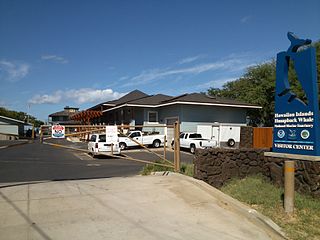
The Hawaiian Islands Humpback Whale National Marine Sanctuary is one of the world's most important whale habitats, hosting thousands of humpbacks each winter.

A bait ball, or baitball, occurs when small fish swarm in a tightly packed spherical formation about a common centre. It is a last-ditch defensive measure adopted by small schooling fish when they are threatened by predators. Small schooling fish are eaten by many types of predators, and for this reason they are called bait fish or forage fish.

The Sea of Abaco, located in The Bahamas, is an approximately 100 kilometres long saltwater lagoon separating Great Abaco Island from a chain of barrier islands known as the Abaco Cays. Depths in the Sea of Abaco are generally a few metres, and shallow reefs and shoals can pose a serious hazard to navigation. Despite these hazards, the sea is popular with boaters and is sometimes referred to as a ‘marine highway’, offering a sheltered passage through the Abaco Islands. The majority of the largest settlements and towns in the Abaco Islands are located along the shores of the sea.
Idelisa Bonnelly de Calventi is a Dominican marine biologist who is considered the "mother of marine conservation in the Caribbean". She was the founder of the study of biology in the Dominican Republic, as well as the founder of the Institute of Marine Biology and the Dominican Foundation for Marine Research. She was instrumental in the creation of the first Humpback Whale Sanctuary of the North Atlantic and has won numerous awards, including induction into the UNEP's Global 500 Roll of Honour, Unesco's Marie Curie Medal and the Order of Merit of Duarte, Sánchez and Mella. The BBC has called her one of the most important women scientists in Latin America.