
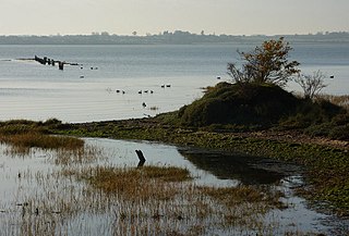
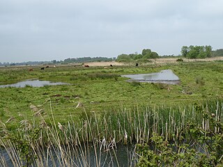
Breydon Water is a 514.4-hectare (1,271-acre) biological Site of Special Scientific Interest at Great Yarmouth, Norfolk. It is a Local Nature Reserve, a Ramsar site and a Special Protection Area. It is part of the Berney Marshes and Breydon Water nature reserve, which is managed by the Royal Society for the Protection of Birds (RSPB).

The Wildfowl & Wetlands Trust (WWT) is an international wildfowl and wetland conservation charity in the United Kingdom.

Ouse Washes is a linear 2,513.6-hectare (6,211-acre) biological Site of Special Scientific Interest stretching from near St Ives in Cambridgeshire to Downham Market in Norfolk. It is also a Ramsar internationally important wetland site, a Special Protection Area for birds, a Special Area of Conservation and a Nature Conservation Review site, Grade I. An area of 186 hectares between March and Ely is managed by the Wildlife Trust for Bedfordshire, Cambridgeshire and Northamptonshire and another area near Chatteris is managed by the Royal Society for the Protection of Birds. The Wildfowl & Wetlands Trust manages another area near Welney.
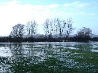
Walmore Common is a 57.78-hectare (142.8-acre) nature reserve on the flood-plain of the River Severn, west of the city of Gloucester in England and north of the village of Chaxhill. It was notified as a biological Site of Special Scientific Interest in 1966. The site is listed in the 'Forest of Dean Local Plan Review' as a Key Wildlife Site (KWS).

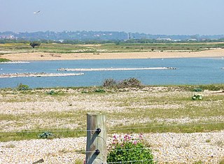
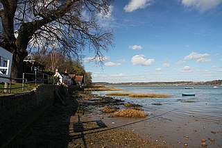
Deben Estuary is a 981.1-hectare (2,424-acre) biological Site of Special Scientific Interest (SSSI) covering the River Deben and its banks 12 kilometres from its mouth north of Felixstowe to Woodbridge in Suffolk. It is a Ramsar internationally important wetland site and a Special Protection Area under the European Union Directive on the Conservation of Wild Birds. It is also in the Suffolk Coast and Heaths Area of Outstanding Natural Beauty. It partly overlaps two geological SSSIs, Ferry Cliff, Sutton and Ramsholt Cliff.
Dungeness, Romney Marsh and Rye Bay is a 10,172.9-hectare (25,138-acre) biological and geological Site of Special Scientific Interest which stretches from New Romney in Kent to Winchelsea in East Sussex. An area of 5,129.5 hectares is a Special Protection Area, an area of 3,141.1 hectares is a Special Area of Conservation, and an area of 6,377.6 hectares is a Ramsar Site, a wetland site designated of international importance under the Ramsar Convention. Part of the site is in the High Weald Area of Outstanding Natural Beauty, parts are Geological Conservation Review sites, part is a Local Nature Reserve, and part is a Royal Society for the Protection of Birds nature reserve, and part is a National Nature Reserve.
Castle Marshes is a 71 hectare nature reserve west of Lowestoft in Suffolk. It is managed by the Suffolk Wildlife Trust. It is part of the Barnby Broad and Marshes Site of Special Scientific Interest the Broadland Ramsar internationally important wetland site, the Broadland Special Protection Area under the European Union Directive on the Conservation of Wild Birds, and The Broads Special Area of Conservation.

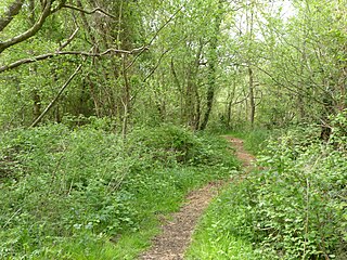
Summer Leys is a local nature reserve at Wollaston in the Upper Nene Valley, in Northamptonshire, England. It is owned by the Wildlife Trust for Bedfordshire, Cambridgeshire and Northamptonshire.
Benfleet and Southend Marshes is an 8.1-square-mile (21 km2) Site of Special Scientific Interest (SSSI) in Essex. It consists of mudflats, salt marshes, scrub and wild grassland, and includes the Southend-on-Sea foreshore. It has been so recognised for its biological value, rather than geological. A definition five percent larger forms the Benfleet and Southend Marshes Ramsar site and Special Protection Area. In the centre-west, more than ten percent of the Site is the Leigh National Nature Reserve (NNR), which has been appraised in detail in A Nature Conservation Review as a site of national importance. The SSSI and NNR include the eastern half of Two Tree Island, in Leigh on Sea which is managed by the Essex Wildlife Trust. A narrow majority of the Site is the Southend on Sea Foreshore Local Nature Reserve.
Stour Estuary is a 2,523 hectare biological and geological Site of Special Scientific Interest which stretches from Manningtree to Harwich in Essex and Suffolk. It is also an internationally important wetland Ramsar site, a Special Protection Area and a Nature Conservation Review site. It is part of the Suffolk Coast and Heaths Area of Outstanding Natural Beauty, and there are Geological Conservation Review sites in Wrabness, Stutton, and Harwich Part of the site is managed by the Royal Society for the Protection of Birds, and a small area is Wrabness Nature Reserve, a Local Nature Reserve managed by the Essex Wildlife Trust.
Chippenham Fen and Snailwell Poor's Fen is a 155.9-hectare (385-acre) biological Site of Special Scientific Interest south-east of Fordham in Cambridgeshire, England. It is a Nature Conservation Review site, Grade I, a Ramsar wetland site and a Special Area of Conservation. It is managed by Natural England.

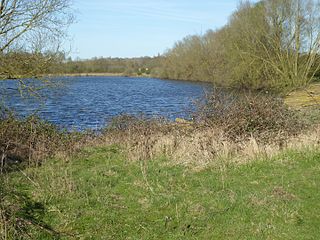
Upper Nene Valley Gravel Pits is a 1,382.4 hectare biological Site of Special Scientific Interest in a chain of flooded gravel pits along 35 kilometres of the valley of the River Nene between Northampton and Thorpe Waterville in Northamptonshire. It is a Ramsar wetland site of international importance, a Special Protection Area under the European Communities Birds Directive and part of the Nene Valley Nature Improvement Area. It is also part of the River Nene Regional Park. Two areas are managed by the Wildlife Trust for Bedfordshire, Cambridgeshire and Northamptonshire, Summer Leys and Titchmarsh Nature Reserve.

Ditchford Lakes and Meadows is a 31.1-hectare (77-acre) nature reserve Northamptonshire. It is managed by the Wildlife Trust for Bedfordshire, Cambridgeshire and Northamptonshire. It is part of the Upper Nene Valley Gravel Pits Site of Special Scientific Interest, Ramsar wetland site of international importance, and Special Protection Area under the European Communities Birds Directive.
Higham Ferrers Pits is a 10 hectare nature reserve Northamptonshire. It is managed by the Wildlife Trust for Bedfordshire, Cambridgeshire and Northamptonshire. It is part of the Upper Nene Valley Gravel Pits Site of Special Scientific Interest, Ramsar internationally important wetland site and Special Protection Area under the EC Birds Directive.
Wilson's Pits is a 32 hectare nature reserve west of Higham Ferrers in Northamptonshire. It is managed by the Wildlife Trust for Bedfordshire, Cambridgeshire and Northamptonshire. It is part of the Upper Nene Valley Gravel Pits Site of Special Scientific Interest, Ramsar internationally important wetland site and Special Protection Area under the EC Birds Directive.

Kinewell Lake is a 35.4 hectare Local Nature Reserve west of Ringstead in Northamptonshire, England. It is owned by Ringstead Parish Council and managed by Kinewell Lake Trust. The site is part of the Upper Nene Valley Gravel Pits Site of Special Scientific Interest, Ramsar wetland site of international importance, and Special Protection Area under the European Communities Birds Directive.

Sprat's Water and Marshes, Carlton Colville is a 57.1-hectare (141-acre) biological Site of Special Scientific Interest on the western outskirts of Lowestoft in Suffolk, England. It is part of the Broadland Ramsar internationally important wetland site, and Special Protection Area under the European Union Directive on the Conservation of Wild Birds, and part of The Broads Special Area of Conservation. The northern part of the site is Carlton Marshes, which is part of Carlton and Oulton Marshes, a nature reserve managed by the Suffolk Wildlife Trust.
Carlton and Oulton Marshes is a 151 hectare nature reserve in Lowestoft in Suffolk. It is managed by the Suffolk Wildlife Trust. Carlton Marshes is part of the Sprat's Water and Marshes, Carlton Colville Site of Special Scientific Interest, the Broadland Ramsar internationally important wetland site, the Broadland Special Protection Area under the European Union Directive on the Conservation of Wild Birds, and The Broads Special Area of Conservation.
North Cove is a 15.5-hectare (38-acre) nature reserve between Beccles and Lowestoft in Suffolk. It is managed by the owner and Beccles Bird Society, is part of the Barnby Broad and Marshes Site of Special Scientific Interest the Broadland Ramsar internationally important wetland site, the Broadland Special Protection Area under the European Union Directive on the Conservation of Wild Birds, and The Broads Special Area of Conservation.
Orwell Estuary is a 1,335.7 hectare biological Site of Special Scientific Interest which stretches along the River Orwell and its banks between Felixstowe and Ipswich in Suffolk. It is part of the Stour and Orwell Estuaries Ramsar site internationally important wetland site and Special Protection Area under the European Union Directive on the Conservation of Wild Birds. It is also in the Suffolk Coast and Heaths Area of Outstanding Natural Beauty.
