Nepeuskun, Wisconsin

Last updated

Nepeuskun, Wisconsin
TownOfNepeuskunWisconsinWelcomeSign.JPG
Entering Nepeuskun heading south on Cty E
WIMap-doton-Nepeuskun.png
Location of Nepeuskun, Wisconsin
Coordinates: 43°56′41″N88°49′37″W / 43.94472°N 88.82694°W / 43.94472; -88.82694
Country Flag of the United States.svg  United States
State Flag of Wisconsin.svg  Wisconsin
County Winnebago
Area
  Total36.2 sq mi (93.7 km2)
  Land31.7 sq mi (82.0 km2)
  Water4.5 sq mi (11.7 km2)
Elevation
[1]
830 ft (253 m)
Population
 (2010)
  Total710
  Density23/sq mi (8.7/km2)
Time zone UTC-6 (Central (CST))
  Summer (DST) UTC-5 (CDT)
Area code 920
FIPS code 55-56100 [2]
GNIS feature ID1583793 [1]
Website www.townofnepeuskun.org

Nepeuskun, sometimes called Nepeuskin is a town in Winnebago County, Wisconsin, United States. The population was 710 at the 2010 census. [3] The unincorporated communities of Koro and Rush Lake are located in the town.

Contents

Geography

According to the United States Census Bureau, the town has a total area of 36.2 square miles (93.7 km2), of which 31.7 square miles (82.0 km2) is land and 4.5 square miles (11.7 km2), or 12.50%, is water. [3]

Demographics

Town hall Nepeuskun Wisconsin town hall.jpg
Town hall

As of the census [2] of 2000, there were 689 people, 254 households, and 198 families residing in the town. The population density was 21.6 people per square mile (8.3/km2). There were 275 housing units at an average density of 8.6 per square mile (3.3/km2). The racial makeup of the town was 98.98% White, 0.15% African American, 0.58% from other races, and 0.29% from two or more races. Hispanic or Latino of any race were 0.87% of the population.

There were 254 households, out of which 36.2% had children under the age of 18 living with them, 71.7% were married couples living together, 2.4% had a female householder with no husband present, and 22.0% were non-families. 17.3% of all households were made up of individuals, and 9.1% had someone living alone who was 65 years of age or older. The average household size was 2.71 and the average family size was 3.08.

In the town, the population was spread out, with 27.0% under the age of 18, 7.0% from 18 to 24, 28.6% from 25 to 44, 23.4% from 45 to 64, and 14.1% who were 65 years of age or older. The median age was 38 years. For every 100 females, there were 104.5 males. For every 100 females age 18 and over, there were 105.3 males.

The median income for a household in the town was $47,344, and the median income for a family was $51,500. Males had a median income of $36,719 versus $20,714 for females. The per capita income for the town was $19,390. About 1.9% of families and 2.9% of the population were below the poverty line, including 1.9% of those under age 18 and 5.6% of those age 65 or over.

Education

Nepeuskun residents receive primary education from three school districts, [4] Berlin Area School District, School District of Omro, and Ripon Area School District.

Recreation

  1. East Landing is a gravel boat landing located off County Road M.
  2. North Access is a gravel boat landing located off Osborne Road.

Related Research Articles

<span class="mw-page-title-main">Pecatonica, Illinois</span> Village in Illinois, United States

Pecatonica is a village in Winnebago County, Illinois, United States. It is part of the Rockford, Illinois Metropolitan Statistical Area. The population was 2,195 at the 2010 census, up from 1,997 in 2000.

<span class="mw-page-title-main">Strongs Prairie, Wisconsin</span> Town in Wisconsin, United States

The Town of Strongs Prairie is located in Adams County in the U.S. state of Wisconsin. The population was 1,150 at the 2010 census. The unincorporated communities of Arkdale, Dellwood, and Strongs Prairie are located within the town.

<span class="mw-page-title-main">Portage, Wisconsin</span> City in Wisconsin, United States

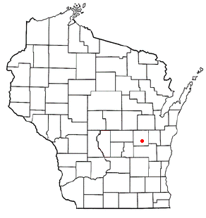
Portage is a city in and the county seat of Columbia County, Wisconsin, United States. The population was 10,581 at the 2020 census, making it the largest city in Columbia County. The city is part of the Madison Metropolitan Statistical Area.

<span class="mw-page-title-main">Brice Prairie, Wisconsin</span> Census-designated place in Wisconsin, United States

Brice Prairie is a census-designated place (CDP) in La Crosse County, Wisconsin, United States. The population was 1,887 at the 2010 census. Brice Prairie is located in the Town of Onalaska.

<span class="mw-page-title-main">Shiocton, Wisconsin</span> Village in Wisconsin, United States

Shiocton is a village in Outagamie County, Wisconsin, United States. The population was 921 at the 2010 census. It is wholly surrounded by the Town of Bovina.

<span class="mw-page-title-main">Algoma, Winnebago County, Wisconsin</span> Town in Wisconsin, United States

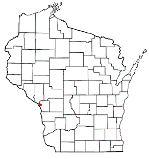
Algoma is a town in Winnebago County, Wisconsin, United States. The population was 6,822 at the 2010 census. The unincorporated communities of Highland Shore, Leonards Point, Melrose Park, and Oakwood are located in the town.

<span class="mw-page-title-main">Black Wolf, Wisconsin</span> Town in Wisconsin, United States

Black Wolf is a town in Winnebago County, Wisconsin, United States. The population was 2,429 at the 2020 census. The unincorporated communities of Black Wolf, Black Wolf Point, Little Point, Paukotuk, and Point Comfort are located in the town.

<span class="mw-page-title-main">Menasha (town), Wisconsin</span> Town in Wisconsin, United States

Menasha was a town in Winnebago County, Wisconsin, United States, west of the Fox River across from the city of Menasha, Wisconsin. The population was 18,498 at the 2010 census, making it the second most populous town in the state of Wisconsin at the time of its dissolution. The unincorporated community of Waverly Beach was located partially in the town. In an April 2016 referendum, the portion of the town west of Little Lake Butte des Morts voted to become the village of Fox Crossing. The remaining portions of the town were annexed to Fox Crossing on September 22, 2016, effectively ending the existence of the town.

<span class="mw-page-title-main">Poygan, Wisconsin</span> Town in Wisconsin, United States

Poygan is a town in Winnebago County, Wisconsin, United States. The population was 1,301 at the 2010 census.

<span class="mw-page-title-main">Utica, Winnebago County, Wisconsin</span> Town in Wisconsin, United States

Utica is a town in Winnebago County, Wisconsin, United States. The population was 1,299 at the 2010 census. The unincorporated communities of Elo, Fisk, and Pickett are located in the town.

<span class="mw-page-title-main">Vinland, Wisconsin</span> Town in Wisconsin, United States

Vinland is a town in Winnebago County, Wisconsin, United States. The population was 1,765 at the 2010 census. The unincorporated community of Allenville is located in the town.

<span class="mw-page-title-main">Winchester, Winnebago County, Wisconsin</span> Town in Wisconsin, United States

Winchester is a town in Winnebago County, Wisconsin, United States. The population was 1,763 at the 2010 census. The census-designated place of Winchester and the unincorporated communities of Clarks Point, Indian Shores, Lasleys Point, and Piacenza are located in the town.

<span class="mw-page-title-main">Forest City, Iowa</span> City in Iowa, United States

Forest City is a city in Hancock and Winnebago counties in the U.S. state of Iowa, and the county seat of Winnebago County. The population was 4,285 in the 2020 census, a decline from the 4,362 population in 2000.

<span class="mw-page-title-main">Menasha, Wisconsin</span> City in Wisconsin, United States

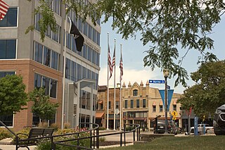
Menasha is a city in Calumet and Winnebago counties in the U.S. state of Wisconsin. The population was 18,268 at the 2020 census. Of this, 15,144 were in Winnebago County, and 2,209 were in Calumet County. The city is located mostly in Winnebago County; only a small portion is in the Town of Harrison in Calumet County. Doty Island is located partially in Menasha. The city's name comes from the Winnebago word meaning "thorn" or "island". In the Menominee language, it is known as Menāēhsaeh, meaning "little island".

<span class="mw-page-title-main">Stockbridge (town), Wisconsin</span> Town in Wisconsin, United States

Stockbridge is a town in Calumet County, Wisconsin. The population was 1,456 at the time of the 2010 census. The village of Stockbridge, and the unincorporated communities of Kloten, Quinney, and Saint Catherines Bay are located within the town.

<span class="mw-page-title-main">Wonewoc, Wisconsin</span> Village in Wisconsin, United States

Wonewoc is a village along the Baraboo River in Juneau County, Wisconsin. The population was 816 at the time of the 2010 census.

<span class="mw-page-title-main">Neenah (town), Wisconsin</span> Town in Wisconsin, United States

Neenah is a town in Winnebago County, Wisconsin, United States. The population was 3,237 at the 2010 census. The City of Neenah is adjacent to the town, but is politically independent. The unincorporated communities of Adella Beach, Ricker Bay, Snells, and Sunrise Bay are located in the town.

Winneconne is a town in Winnebago County, Wisconsin, United States. The population was 2,350 at the 2010 census. The Village of Winneconne is located within the town, on both sides of the Wolf River. The unincorporated community of Butte des Morts, named for a French and Native American trading war, is also located in the town. The town's water resources of rivers and lakes makes it a center of hunting and fishing, including winter ice fishing.

<span class="mw-page-title-main">Oshkosh (town), Wisconsin</span> Town in Wisconsin, United States

Oshkosh is a town in Winnebago County, Wisconsin, United States. The population was 2,475 at the 2010 census. It is a northern suburb of the larger City of Oshkosh which it is located adjacent to and partially within. The unincorporated communities of Nichols Shore Acres, Plummer Point, Shangri La Point, and Winnebago are located within the town.

Mascoutin Valley State Trail is a rail trail in northeastern Wisconsin. The trail is used for walking, bicycling, horseback riding, and snowmobiling during the winter months. The trail can also be used for cross-country skiing and snowshoeing but the trail is not groomed and must be shared with snowmobiles. Numerous miles of snowmobile trails connect to the Mascoutin Valley State Trail.

References

  1. 1 2 "US Board on Geographic Names". United States Geological Survey. October 25, 2007. Retrieved January 31, 2008.
  2. 1 2 "U.S. Census website". United States Census Bureau . Retrieved January 31, 2008.
  3. 1 2 "Geographic Identifiers: 2010 Demographic Profile Data (G001): Nepeuskun town, Winnebago County, Wisconsin". U.S. Census Bureau, American Factfinder. Archived from the original on February 12, 2020. Retrieved January 31, 2013.
  4. "Jurisdictional Boundaries Map Of Nepeuskun" (PDF). Archived from the original (PDF) on July 28, 2011. Retrieved February 4, 2011.
  5. Koro Railroad Prairie State Natural Area. Wisconsin Department of Natural Resources.
  6. Mascoutin Valley State Trail | Winnebago County
  7. WDNR - Rush Lake Project
  8. The Anti-Horse Thief Association Town of Nepeuskun