Rand McNally is an American technology and publishing company that provides mapping, software and hardware for consumer electronics, commercial transportation and education markets. The company is headquartered in Chicago, with a distribution center in Richmond, Kentucky.
Peytonsburg is an unincorporated community in Cumberland County, Kentucky, United States.
Stacy Fork is an unincorporated community in Morgan County, Kentucky, United States. It lies along Route 191 south of the city of West Liberty, the county seat of Morgan County. Its elevation is 823 feet (251 m).
Pailo is an unincorporated community in Bledsoe County, Tennessee. It lies along U.S. Route 127 southwest of the city of Pikeville, the county seat of Bledsoe County.
Lusk is an unincorporated community in Bledsoe County, Tennessee. It lies along U.S. Route 127 southwest of the city of Pikeville, the county seat of Bledsoe County.

Lees Station is an unincorporated community in Bledsoe County, Tennessee. It lies along U.S. Route 127 southwest of the city of Pikeville, the county seat of Bledsoe County. Its elevation is 853 feet (260 m), and it is at 35°33′27″N85°15′3″W. The various forms of its names led the Board on Geographic Names officially to designate it Lees in 1916. In 1969, the official name was changed to Lees Station.
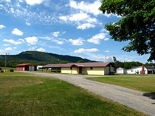
Summer City is an unincorporated community that sits on the border of Bledsoe County, and Rhea County, Tennessee, United States. It lies between the cities of Pikeville and Dayton, at the intersection of Tennessee State Route 30 and Tennessee State Route 443.
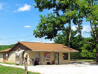
Dill is an unincorporated community in Bledsoe County, Tennessee. It lies west of the city of Pikeville, the county seat of Bledsoe County. Its elevation is 1,742 feet (531 m).
Mount Crest is an unincorporated community in Bledsoe County, Tennessee. It lies along State Route 30 northwest of the city of Pikeville, the county seat of Bledsoe County.
Cold Spring is an unincorporated community in Bledsoe County, Tennessee. It lies along U.S. Route 127 northeast of the city of Pikeville, the county seat of Bledsoe County. Its elevation is 876 feet (267 m).
Melvine is an unincorporated community in Bledsoe County, Tennessee. It lies near U.S. Route 127 northeast of the city of Pikeville, the county seat of Bledsoe County.

Gordonsburg is an unincorporated community in northeastern Lewis County, Tennessee. It lies at the intersection of U.S. Route 412 with the Natchez Trace Parkway, east of the city of Hohenwald, the county seat of Lewis County. Its elevation is 610 feet (186 m).
Kimmins is an unincorporated community in northern Lewis County, Tennessee. It lies along local roads north of the city of Hohenwald, the county seat of Lewis County. Its elevation is 951 feet (290 m).

U.S. Route 70 enters the state of Tennessee from Arkansas via the Memphis & Arkansas Bridge in Memphis, and runs west to east across 21 counties in all three Grand Divisions of Tennessee, with a total length of 478.48 miles (770.04 km), to end at the North Carolina state line in eastern Cocke County. Along the route, US 70 is accompanied with various U.S. and state highways, including those in three of the state's four major cities.

U.S. Route 62 (US 62) in Kentucky runs for a total of 391.207 miles (629.587 km) across 20 counties in western, north-central, and northeastern Kentucky. It enters the state by crossing the Ohio River near Wickliffe, then begins heading eastward at Bardwell, and traversing several cities and towns across the state up to Maysville, where it crosses the Ohio River a second time to enter the state of Ohio.

U.S. Route 79 in Tennessee enters the state from Arkansas via the Memphis & Arkansas Bridge in Memphis, and runs northeast through western and the northwestern portions of middle Tennessee, and leaving the state into Kentucky northeast of Clarksville. Along the route, US 79 is accompanied with several concurrencies, including hidden designations, throughout its alignment in Tennessee.
Time in Tennessee, as in all U.S. states, is regulated by the United States Department of Transportation.
The roads in Nashville, Tennessee include Interstates 24, 65 and 40, with interchanges near the city center. There are nine U.S. highways serving the city. Two beltways surround Nashville.

State Route 140 is a west-east state highway located entirely in Henry County in northwest Tennessee.

State Route 443 is a 12.2-mile-long (19.6 km) east–west state highway in East Tennessee, connecting SR 30 with the communities of New Harmony and Ogden along with other rural areas, which is primarily farmland.


