New London, Minnesota

Last updated

New London
Welcome to New London, Minnesota - City on the Pond (34584176574).jpg
Kandiyohi County Minnesota Incorporated and Unincorporated areas New London Highlighted.svg
Location of New London, Minnesota
Coordinates: 45°17′50″N94°56′53″W / 45.29722°N 94.94806°W / 45.29722; -94.94806
CountryUnited States
State Minnesota
County Kandiyohi
Founded1865
Incorporated April 8, 1889
Government
   Mayor John Dahl
Area
[1]
  Total1.35 sq mi (3.51 km2)
  Land1.29 sq mi (3.35 km2)
  Water0.06 sq mi (0.16 km2)
Elevation
[2]
1,221 ft (382 m)
Population
 (2020) [3]
  Total1,252
  Estimate 
(2022) [4]
1,282
  Density968.29/sq mi (373.84/km2)
Time zone UTC-6 (Central (CST))
  Summer (DST) UTC-5 (CDT)
ZIP code
56273
Area code 320
FIPS code 27-45682 [5]
GNIS feature ID2395203 [2]
Website newlondonmn.net

New London is a city in Kandiyohi County, Minnesota, United States along the Middle Fork of the Crow River. The population was 1,252 at the 2020 census. [3] Sibley State Park is nearby. It was named after New London, Wisconsin, by Louis Larson because of the similarity he saw with his previous home there. [6] It was incorporated on April 8, 1889. The city was the county seat of Monongalia County from 1866 to 1870 when Monongalia merged with Kandiyohi County. [6]

Contents

Geography

According to the United States Census Bureau, the city has an area of 1.24 square miles (3.21 km2), of which 1.19 square miles (3.08 km2) is land and 0.05 square miles (0.13 km2) is water. [7]

Minnesota State Highways 9 and 23 are two of the main routes in the city, and U.S. Route 71 is nearby.

Climate

Climate data for New London, Minnesota, 1991–2020 normals, extremes 18932009
MonthJanFebMarAprMayJunJulAugSepOctNovDecYear
Record high °F (°C)60
(16)
58
(14)
83
(28)
95
(35)
107
(42)
108
(42)
110
(43)
102
(39)
106
(41)
90
(32)
78
(26)
62
(17)
110
(43)
Mean daily maximum °F (°C)20.3
(−6.5)
25.2
(−3.8)
38.0
(3.3)
54.1
(12.3)
68.3
(20.2)
77.5
(25.3)
81.6
(27.6)
79.7
(26.5)
72.1
(22.3)
56.5
(13.6)
39.4
(4.1)
25.0
(−3.9)
53.1
(11.8)
Daily mean °F (°C)10.9
(−11.7)
14.9
(−9.5)
27.7
(−2.4)
42.7
(5.9)
56.9
(13.8)
67.1
(19.5)
71.5
(21.9)
69.5
(20.8)
61.0
(16.1)
45.9
(7.7)
30.9
(−0.6)
16.8
(−8.4)
43.0
(6.1)
Mean daily minimum °F (°C)1.4
(−17.0)
4.7
(−15.2)
17.4
(−8.1)
31.3
(−0.4)
45.5
(7.5)
56.7
(13.7)
61.3
(16.3)
59.3
(15.2)
49.9
(9.9)
35.3
(1.8)
22.4
(−5.3)
8.5
(−13.1)
32.8
(0.4)
Record low °F (°C)−42
(−41)
−40
(−40)
−34
(−37)
−2
(−19)
16
(−9)
28
(−2)
41
(5)
35
(2)
21
(−6)
6
(−14)
−23
(−31)
−35
(−37)
−42
(−41)
Average precipitation inches (mm)0.87
(22)
0.97
(25)
1.84
(47)
3.05
(77)
3.53
(90)
4.89
(124)
4.15
(105)
3.53
(90)
3.47
(88)
2.60
(66)
1.58
(40)
0.90
(23)
31.38
(797)
Average snowfall inches (cm)10.3
(26)
9.1
(23)
8.4
(21)
4.7
(12)
0.0
(0.0)
0.0
(0.0)
0.0
(0.0)
0.0
(0.0)
0.0
(0.0)
0.8
(2.0)
9.0
(23)
7.9
(20)
50.2
(127)
Average precipitation days (≥ 0.01 in)5.34.66.27.29.710.78.98.18.67.14.95.086.3
Average snowy days (≥ 0.1 in)5.74.03.61.30.00.00.00.00.00.62.94.822.9
Source 1: NOAA [8]
Source 2: XMACIS2 [9]

Demographics

Historical population
CensusPop.Note
1880 55
1890 211283.6%
1900 36372.0%
1910 41815.2%
1920 52726.1%
1930 483−8.3%
1940 57819.7%
1950 72625.6%
1960 721−0.7%
1970 7362.1%
1980 81210.3%
1990 97119.6%
2000 1,0669.8%
2010 1,25117.4%
2020 1,2520.1%
2022 (est.)1,282 [4] 2.4%
U.S. Decennial Census [10]
2020 Census [3]

2010 census

As of the census of 2010, there were 1,251 people, 521 households, and 318 families living in the city. The population density was 1,051.3 inhabitants per square mile (405.9/km2). There were 566 housing units at an average density of 475.6 per square mile (183.6/km2). The racial makeup of the city was 98.7% White, 0.2% Native American, 0.1% Asian, 0.9% from other races, and 0.2% from two or more races. Hispanic or Latino of any race were 2.7% of the population.

There were 521 households, of which 31.7% had children under the age of 18 living with them, 47.0% were married couples living together, 11.7% had a female householder with no husband present, 2.3% had a male householder with no wife present, and 39.0% were non-families. 34.7% of all households were made up of individuals, and 21.7% had someone living alone who was 65 years of age or older. The average household size was 2.28 and the average family size was 2.97.

The median age in the city was 40.5 years. 25.5% of residents were under the age of 18; 6.8% were between the ages of 18 and 24; 23.4% were from 25 to 44; 19.6% were from 45 to 64; and 24.6% were 65 years of age or older. The gender makeup of the city was 45.9% male and 54.1% female.

2000 census

As of the census of 2000, there were 1,066 people, 415 households, and 261 families living in the city. The population density was 1,103.4 inhabitants per square mile (426.0/km2). There were 439 housing units at an average density of 454.4 per square mile (175.4/km2). The racial makeup of the city was 97.75% White, 0.47% Native American, 0.09% Asian, 0.66% from other races, and 1.03% from two or more races. Hispanic or Latino of any race were 1.50% of the population.

There were 415 households, out of which 32.3% had children under the age of 18 living with them, 49.4% were married couples living together, 11.3% had a female householder with no husband present, and 37.1% were non-families. 33.7% of all households were made up of individuals, and 17.1% had someone living alone who was 65 years of age or older. The average household size was 2.31 and the average family size was 2.95.

In the city, the population was spread out, with 24.3% under the age of 18, 6.4% from 18 to 24, 25.1% from 25 to 44, 17.1% from 45 to 64, and 27.1% who were 65 years of age or older. The median age was 40 years. For every 100 females, there were 76.2 males. For every 100 females age 18 and over, there were 71.7 males.

The median income for a household in the city was $34,018, and the median income for a family was $42,500. Males had a median income of $28,636 versus $21,786 for females. The per capita income for the city was $16,216. About 6.1% of families and 6.8% of the population were below the poverty line, including 4.7% of those under age 18 and 11.6% of those age 65 or over.

Car races

This city is known as the starting point for the New London to New Brighton Antique Car Run, a 120-mile endurance tour for vehicles from 1908 and earlier, or any 1 or 2 cylinder vehicles up to 1915. [11] This event has been held in early to mid-August since 1987. The run goes to New Brighton, Minnesota, and is a reference to the London to Brighton Veteran Car Run from London to Brighton in the United Kingdom.

Porch Fest

New London has hosted an annual one day event called Porch Fest in honor of its late Mayor Bill Gossman a musician and Potter who envisioned the idea of a music festival where groups of musicians played on front porches around New London but passed away before seeing his vision become reality. Porch Fest is usually held the first Saturday in June.

Related Research Articles

<span class="mw-page-title-main">Kandiyohi County, Minnesota</span> County in Minnesota, United States

Kandiyohi County is a county in the U.S. state of Minnesota. As of the 2020 census, its population is 43,732. As of November 20, 1871, its county seat is Willmar.

Arctander Township is a township in Kandiyohi County, Minnesota, United States. The population was 401 at the 2000 census.

<span class="mw-page-title-main">Atwater, Minnesota</span> City in Minnesota, United States

Atwater is a city in Kandiyohi County, Minnesota, United States. The population was 1,124 at the 2020 census.

Burbank Township is a township in Kandiyohi County, Minnesota, United States. The population was 510 at the 2000 census.

Fahlun Township is a township in Kandiyohi County, Minnesota, United States. The population was 412 at the 2000 census.

Harrison Township is a township in Kandiyohi County, Minnesota, United States. The population was 665 at the 2000 census.

<span class="mw-page-title-main">Kandiyohi, Minnesota</span> City in Minnesota, United States

Kandiyohi is a city in Kandiyohi County, Minnesota, United States. The population was 491 at the 2010 census.

Kandiyohi Township is a township in Kandiyohi County, Minnesota, United States. The population was 600 at the 2000 census.

Lake Elizabeth Township is a township in Kandiyohi County, Minnesota, United States. The population was 277 at the 2000 census.

<span class="mw-page-title-main">Lake Lillian, Minnesota</span> City in Minnesota, United States

Lake Lillian is a city in Kandiyohi County, Minnesota, United States. The population was 238 at the 2010 census.

New London Township is a township in Kandiyohi County, Minnesota, United States. The population was 3,057 at the 2000 census.

<span class="mw-page-title-main">Pennock, Minnesota</span> City in Minnesota, United States

Pennock is a city in Kandiyohi County, Minnesota, United States. The population was 508 at the 2010 census.

<span class="mw-page-title-main">Prinsburg, Minnesota</span> City in Minnesota, United States

Prinsburg is a city in Kandiyohi County, Minnesota, United States. The population was 497 at the 2010 census.

<span class="mw-page-title-main">Raymond, Minnesota</span> City in Minnesota, United States

Raymond is a city in southwest Kandiyohi County, Minnesota, United States. The population was 764 at the 2010 census.

<span class="mw-page-title-main">Regal, Minnesota</span> City in Minnesota, United States

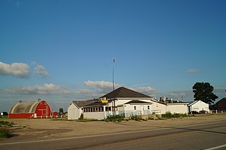
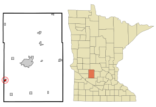
Regal is a city in northeast Kandiyohi County, Minnesota, United States, along the North Fork of the Crow River. The population was 34 at the 2010 census.

Roseville Township is a township in Kandiyohi County, Minnesota, United States. The population was 570 at the 2000 census.

<span class="mw-page-title-main">Spicer, Minnesota</span> City in Minnesota, United States

Spicer is a city in Kandiyohi County, Minnesota, United States situated on Green Lake. The population was 1,167 at the 2010 census. Sibley State Park and many surrounding lakes are nearby.

<span class="mw-page-title-main">Sunburg, Minnesota</span> City in Minnesota, United States

Sunburg is a city in Kandiyohi County, Minnesota, United States. The population was 94 at the 2020 census.

Whitefield Township is a township in Kandiyohi County, Minnesota, United States. The population was 571 at the 2000 census.

Brighton Township is a township in Nicollet County, Minnesota, United States. The population was 169 at the 2000 census.

References

  1. "2020 U.S. Gazetteer Files". United States Census Bureau. Retrieved July 24, 2022.
  2. 1 2 U.S. Geological Survey Geographic Names Information System: New London, Minnesota
  3. 1 2 3 "Explore Census Data". United States Census Bureau . Retrieved November 22, 2023.
  4. 1 2 "City and Town Population Totals: 2020-2022". United States Census Bureau. November 22, 2023. Retrieved November 22, 2023.
  5. "American FactFinder". United States Census Bureau. Archived from the original on February 12, 2020. Retrieved January 31, 2008.
  6. 1 2 Warren Upham (2001). Minnesota Place Names: A Geographical Encyclopedia. Minnesota Historical Society Press. pp. 84–. ISBN   978-0-87351-396-8.
  7. "US Gazetteer files 2010". United States Census Bureau. Archived from the original on January 25, 2012. Retrieved November 13, 2012.
  8. "U.S. Climate Normals Quick Access – Station: New London, MN". National Oceanic and Atmospheric Administration. Retrieved May 12, 2023.
  9. "xmACIS2". National Oceanic and Atmospheric Administration. Retrieved May 12, 2023.
  10. United States Census Bureau. "Census of Population and Housing" . Retrieved June 4, 2015.
  11. For more information, please see the Antique Car Run's official website. New London to New Brighton Antique Car Run