Newtown, Victoria

Last updated

Newtown
Geelong,  Victoria
Newtown, Victoria
Population10,445 (2021 census) [1]
Postcode(s) 3220
LGA(s) City of Greater Geelong
State electorate(s) Geelong
Federal division(s) Corio
Suburbs around Newtown:
Fyansford and Herne Hill Manifold Heights and Geelong West Geelong CBD
Highton Newtown South Geelong
Highton Belmont Belmont

Newtown is an inner western suburb of Geelong, Victoria, Australia. At the 2021 census, Newtown had a population of 10,445. [1] It is a primarily residential area occupying one of the highest points of urban Geelong. It has always been a desirable place of residence and is the location of many of Geelong's oldest and most valuable properties.

Contents

The locality of Chilwell is part of Newtown, and together Newtown and Chilwell were a municipality from 1858 to 1993 after which they were amalgamated with other municipalities to form the City of Greater Geelong in 1993.

History

Queens Park, on the Barwon River, 1866. QueensPark Geelong1866.jpg
Queens Park, on the Barwon River, 1866.

Chilwell Post Office opened here on 1 April 1912 (closing in 1993). Bareena Post Office opened in 1911 in the area and remains open. [2]

The Geelong Highland Gathering is an annual Highland Games held at Queens Park and first began in the 1850s.

Heritage listed sites

Newtown contains a number of heritage listed sites, including:

Sport and recreation

Queens Park is also the home ground for the Newtown and Chilwell Cricket Club, the most successful team in the Geelong Cricket Association in terms of senior premierships won. The club uses both Stinton Oval (turf) and Shaw Oval (hard wicket). The Queens Park Sporting Complex is currently being refurbished by the City of Greater Geelong and will greatly improve both playing and social facilities for the club. Famous cricketers who have played for Newtown include Lindsay Hassett, Aaron Finch and Ian Redpath. Bob Merriman, the former Chairman of Cricket Australia, began his administrative career at Newtown and Chilwell Cricket Club.

The suburb is also home to the Geelong Amateur Football Club who also use Stinton Oval during the winter months. They play in the Bellarine Football League.

The suburb in conjunction with neighbouring area Chilwell has an Australian Rules football team competing in the Geelong Football League, as also does Saint Josephs. [19]

Parks and open space

Queens Park, in a valley beside the Barwon River, is home to the picturesque 18 hole Queens Park Golf Course, located between Fyansford, Highton and Newtown. Newtown has several other important parks, including Balyang Sanctuary, Chilwell Gardens, Windmill Reserve, Fyans Park, Zillah Crawcour Park and Frier Reserve.

Education

Sacred Heart College on Retreat Road Sacred Heart College Geelong main gates.jpg
Sacred Heart College on Retreat Road

Newtown is home to three major private secondary schools: Sacred Heart College (an all-girls school), St. Josephs College (an all-boys school) and The Geelong College (co-educational).

Notable people

Related Research Articles

<span class="mw-page-title-main">City of Greater Geelong</span> Local government area in Victoria, Australia

The City of Greater Geelong is a local government area in the Barwon South West region of Victoria, Australia, located in the western part of the state. It covers an area of 1,248 square kilometres (482 sq mi) and, had a population of 271,057 as of the 2021 Australian census. It is primarily urban with the vast majority of its population living in the Greater Geelong urban area, while other significant settlements within the LGA include Anakie, Balliang, Barwon Heads, Batesford, Ceres, Clifton Springs, Drysdale, Lara, Ocean Grove, Portarlington and St Leonards. It was formed in 1993 from the amalgamation of the Rural City of Bellarine, Shire of Corio, City of Geelong, City of Geelong West, City of Newtown, City of South Barwon, and parts of Shire of Barrabool and Shire of Bannockburn.

<span class="mw-page-title-main">Barwon River (Victoria)</span> Perennial river in Victoria, Australia

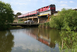
The Barwon River is a perennial river of the Corangamite catchment, located in The Otways and the Bellarine Peninsula regions of the Australian state of Victoria.

<span class="mw-page-title-main">Fyansford, Victoria</span> Suburb of Geelong, Victoria, Australia

Fyansford is a township on the western edge of Geelong, Victoria, Australia, named after Captain Foster Fyans who came to Geelong as a Police magistrate in October, 1837. It is located at the junction of the Barwon and Moorabool rivers. At the 2016 census, Fyansford had a population of 196.

<span class="mw-page-title-main">Breakwater, Victoria</span> Suburb of Geelong, Victoria, Australia

Breakwater is a residential and industrial suburb of Geelong, Victoria, Australia, located on the Barwon River, 4 km south-south-east of the Geelong central business district. At the 2016 census Breakwater had a population of 1,014. Breakwater is home to the Geelong Racing Club, Geelong Racecourse and the Geelong Showgrounds.

<span class="mw-page-title-main">Geelong West, Victoria</span> Suburb of Geelong, Victoria, Australia

Geelong West is a commercial and residential suburb of Geelong, Victoria, Australia. When Geelong was founded, the area was known as Kildare but its name was changed to Geelong West in 1875. The main street is Pakington Street. At the 2016 census, Geelong West had a population of 6,966.

St. Albans Park is a residential suburb of Geelong, Victoria, 6 km southeast from Geelong's city centre. It is bounded by Boundary Road (West), Coppards Road (East), Townsend Road (North) and the Barwon River (South). The suburbs that surround it are Whittington, Breakwater, Moolap and Marshall. The suburb extends around the St. Albans Homestead and stud, a historic house and accompanying stables. At the 2021 census, St. Albans Park had a population of 4,942.

<span class="mw-page-title-main">Highton, Victoria</span> Suburb of Geelong, Victoria, Australia

Highton is a residential suburb of Geelong, Victoria, Australia. With views across Geelong, Corio Bay and the surrounding region, Highton is located along the banks of the Barwon River and across the rolling Barrabool Hills. The Barwon River straddles Highton to the north and east, while it is bordered by the hilly Ceres and Wandana Heights to the west, the former Kardinia Creek separates the suburb from Belmont to the south-east, and the Princes Highway and Pigdons Road to the south separate the suburb from Waurn Ponds.

<span class="mw-page-title-main">Barwon Heads, Victoria</span> Suburb of Geelong, Victoria, Australia

Barwon Heads is a coastal township on the Bellarine Peninsula, near Geelong, Victoria, Australia. It is situated on the west bank of the mouth of the Barwon River below Lake Connewarre, while it is bounded to the west by farmland, golf courses and the saline ephemeral wetland of Murtnaghurt Lagoon. At the 2016 census, Barwon Heads had a population of 3,875.

<span class="mw-page-title-main">Bannockburn, Victoria</span> Town in Victoria, Australia

Bannockburn is a town near Geelong, Victoria, Australia, 88 km southwest of Melbourne. It is located in Golden Plains Shire. In the 2021 census, Bannockburn had a population of 6,470.

<span class="mw-page-title-main">Winchelsea, Victoria</span> Town in Victoria, Australia

Winchelsea is a town in Victoria, Australia. The town is located in the Surf Coast Shire local government area, the suburb or locality of Winchelsea is predominantly within Surf Coast Shire with a small section within the Colac Otway Shire. Winchelsea is located on the Barwon River 115 km south-west of Melbourne and close to Geelong.

<span class="mw-page-title-main">Meredith, Victoria</span> Town in Victoria, Australia

Meredith is a town in Victoria, Australia, located on the Midland Highway between Ballarat and Geelong, in the local government area of the Golden Plains Shire. At the 2016 census, Meredith had a population of 788.

<span class="mw-page-title-main">Geelong College</span> School in Newtown, Victoria, Australia

The Geelong College is an Australian independent and co-educational, Christian day and boarding school located in Newtown, an inner-western suburb of Geelong, Victoria.

<span class="mw-page-title-main">Geelong Gas Company</span>

The Geelong Gas Company was a private company set up to produce and distribute town gas in the city of Geelong. From a gasworks in North Geelong it converted coal into town gas for use in homes and industry. The company was founded in 1858 and existed until 1971 when Geelong was converted to natural gas and the company was bought out by the Gas and Fuel Corporation of Victoria.

<span class="mw-page-title-main">City of Geelong West</span> Local government area in Victoria, Australia

The City of Geelong West was a local government area about 5 kilometres (3 mi) west of the regional city of Geelong, Victoria, Australia. The city covered an area of 5.26 square kilometres (2.0 sq mi), and existed from 1875 until 1993.

<span class="mw-page-title-main">City of Newtown</span> Local government area in Victoria, Australia

The City of Newtown was a local government area about 3 kilometres (1.9 mi) west of the regional city of Geelong, Victoria, Australia. The city covered an area of 6.22 square kilometres (2.4 sq mi), and existed from 1858 until 1993.

<span class="mw-page-title-main">South Barwon Football Club</span>

South Barwon Football & Netball Club, nicknamed the Swans, is an Australian rules football and netball club based in the southern suburb of Belmont, Victoria. The South Barwon teams currently compete in the Geelong Football Netball League, the major regional league in the region.

<span class="mw-page-title-main">Geelong Football Netball League</span>

The Geelong Football Netball League is an Australian rules football and netball league in Victoria, Australia. It is widely regarded as the highest standard Australian rules football league in regional Victoria, with several former AFL players now playing for a variety of clubs.

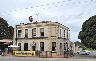
Edward Prowse was an architect working in the Geelong region of Victoria, Australia in the late nineteenth century. He was responsible for many early Geelong buildings, including hotels, mansions and churches.

Barrabool is a rural locality in the Surf Coast Shire, Victoria, Australia. In the 2016 census, Barrabool had a population of 235 people.

Barwon Football Club was a 19th-century Australian rules football club based in South Geelong, Victoria, and for a brief period during the mid-1870s, was provincial Victoria's strongest football club.

References

  1. 1 2 Australian Bureau of Statistics (28 June 2022). "Newtown (Greater Geelong - Vic.)". 2021 Census QuickStats. Retrieved 5 April 2024. OOjs UI icon edit-ltr-progressive.svg
  2. Phoenix Auctions History, Post Office List , retrieved 5 April 2021
  3. "Baptist Church (H0427)". Victorian Heritage Register . Heritage Victoria . Retrieved 4 July 2014.
  4. "Armytage House (H0405)". Victorian Heritage Register . Heritage Victoria . Retrieved 4 July 2014.
  5. "Barwon Bank (H0425)". Victorian Heritage Register . Heritage Victoria . Retrieved 4 July 2014.
  6. "Barwon Grange (H1102)". Victorian Heritage Register . Heritage Victoria . Retrieved 4 July 2014.
  7. "Claremont (H1127)". Victorian Heritage Register . Heritage Victoria . Retrieved 4 July 2014.
  8. "Former Baptist Church (H0426)". Victorian Heritage Register . Heritage Victoria . Retrieved 4 July 2014.
  9. "Geelong College (H0883)". Victorian Heritage Register . Heritage Victoria . Retrieved 4 July 2014.
  10. "Eythorne (H1130)". Victorian Heritage Register . Heritage Victoria . Retrieved 4 July 2014.
  11. "Keyham (H1128)". Victorian Heritage Register . Heritage Victoria . Retrieved 4 July 2014.
  12. "Miharo (H1137)". Victorian Heritage Register . Heritage Victoria . Retrieved 4 July 2014.
  13. "Milton (H1164)". Victorian Heritage Register . Heritage Victoria . Retrieved 4 July 2014.
  14. "Noble Street Uniting Church, Hall and Kindergarten (H1158)". Victorian Heritage Register . Heritage Victoria . Retrieved 4 July 2014.
  15. "Rannoch House (H1165)". Victorian Heritage Register . Heritage Victoria . Retrieved 4 July 2014.
  16. "Sacred Heart Convent and College (H0555)". Victorian Heritage Register . Heritage Victoria . Retrieved 4 July 2014.
  17. "St Leonards (H1174)". Victorian Heritage Register . Heritage Victoria . Retrieved 4 July 2014.
  18. "The Heights (H0429)". Victorian Heritage Register . Heritage Victoria . Retrieved 4 July 2014.
  19. Full Points Footy, Newtown and Chilwell, archived from the original on 7 January 2009, retrieved 25 July 2008

38°09′00″S144°19′59″E / 38.15°S 144.333°E / -38.15; 144.333