
Palau was initially settled around 1000 BC.
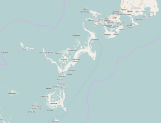
The Republic of Palau consists of eight principal islands and more than 250 smaller ones lying roughly 500 miles southeast of the Philippines, in Oceania. The islands of Palau constitute the westernmost part of the Caroline Islands chain. The country includes the World War II battleground of Peleliu and world-famous rock islands. The total land area is 459 km2 (177 sq mi). It has the 42nd largest Exclusive Economic Zone of 603,978 km2 (233,197 sq mi).

Koror is the state comprising the main commercial centre of the Republic of Palau. It consists of several islands, the most prominent being Koror Island. It is Palau’s most populous state.

Airai, located on the southern coast of Babeldaob island, is the second-most populous state of Palau. It contains the country's chief airport, Roman Tmetuchl International Airport, and is connected by the Koror–Babeldaob Bridge to nearby Koror Island.

Peleliu is an island in the island nation of Palau. Peleliu, along with two small islands to its northeast, forms one of the sixteen states of Palau. The island is notable as the location of the Battle of Peleliu in World War II.
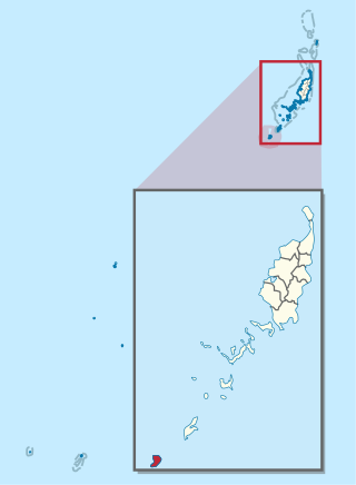
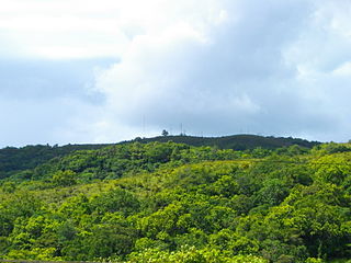
Angaur, or Ngeaur in Palauan, is an island and state in the island nation of Palau.

Babeldaob is the largest island in the island nation of the Republic of Palau. It is in the western Caroline Islands, and the second largest island in the Micronesia region of Oceania. Palau's capital, Ngerulmud, is located on Babeldaob, in Melekeok State.

Aimeliik is an administrative division of the island country of Palau. It is one of the Republic of Palau's 16 states. It has an area of 52 km2 and a population of 334. The state capital is the village of Mongami. The four other villages are Medorm, Imul, Elechui and Ngmechiangel.

Ngchesar also known as Oldiais is one of the sixteen states of the nation of Palau in Oceania.

Ngaraard is the eighth state of the Republic of Palau, and was originally named Kerradel.

Kayangel (Ngcheangel) is the northernmost state of Palau 86 km (53 mi) north of Koror. The land area is about 1.4 km2 (0.54 sq mi). The population is 54. There is one hamlet in the state - Orukei which is also its capital.
{{Infobox settlement | name = Ngiwal | native_name = | native_name_lang = | settlement_type = State | image_skyline = Cooooooooool - panoramio.jpg | image_alt = | image_caption = | image_flag = Flag of Ngiwal State.png | flag_alt = Flag of Ngiwal | image_seal = | seal_alt = | image_shield = | shield_alt = | nickname = | motto = | image_map = Ngiwal in Palau.svg | map_alt = | map_caption = Location of Ngiwal in Palau | pushpin_map = | pushpin_label_position = | pushpin_map_alt = | pushpin_map_caption = | coordinates = | coor_pinpoint = | coordinates_footnotes = | subdivision_type = Country | subdivision_name = Palau | subdivision_type1 = | subdivision_name1 = | subdivision_type2 = | subdivision_name2 = | subdivision_type3 = | subdivision_name3 = | established_title = | established_date = | founder = | seat_type = Capital | seat = [[Ngercheluuk] | government_footnotes = | leader_party = | leader_title = | leader_name = | unit_pref = Metric | area_footnotes = | area_urban_footnotes = | area_rural_footnotes = | area_metro_footnotes = | area_magnitude = | area_note = | area_water_percent = | area_rank = | area_blank1_title = | area_blank2_title = | area_total_km2 = 26 | area_land_km2 = | area_water_km2 = | area_urban_km2 = | area_rural_km2 = | area_metro_km2 = | area_blank1_km2 = | area_blank2_km2 = | area_total_ha = | area_land_ha = | area_water_ha = | area_urban_ha = | area_rural_ha = | area_metro_ha = | area_blank1_ha = | area_blank2_ha = | length_km = | width_km = | dimensions_footnotes = | elevation_footnotes = | elevation_m = | population_footnotes = | population_total = 282 | population_as_of = 2015 Census | population_density_km2 = auto | population_demonym = | population_note = | population_blank1_title = Official languages | population_blank1 = Palauan
English | timezone1 = | utc_offset1 = | timezone1_DST = | utc_offset1_DST = | postal_code_type = | postal_code = | area_code_type = | area_code = | iso_code = PW-228 | website = | footnotes = }} Ngiwal is one of the sixteen states of Palau. It has a population of 282 and an area of 26 km2

Ngardmau is one of Palau's sixteen states and is located on the west side of Babeldaob between the states of Ngaraard and Ngeremlengui.

Ngatpang is one of Palau's sixteen states. It comprises an area of around 47 square kilometers in the west of Palau's largest island, Babeldaob, facing onto Ngeremeduu Bay. It has a population of 282, making it Palau's 9th largest state in population.
Ngeremlengui is one of Palau's sixteen states. It has a population of 349, and is just west of the capital in Melekeok state. Among the 16 states of Palau, it’s the one with the lowest density but the one with the most neighbor states. It’s also the seventh most populous state.
Ngebuked is a village on the west coast of Ngaraard State, Palau, where the Chief of Ngaraard, Maderangebuked is from. It has many stone pathways, ruins and graves scattered all over the surrounding hamlet. Its ruins consist of multi-leveled platforms where clans and families lived. At the center of the ancient site is the Bai ra Ngeruau, a large high platform where a bai, or men's meeting house, stood. The village even has a man-made channel from the sea for easy fishing and transportation access in ancient times.
Chol (Choll) is a village at the northern end of Ngaraard State in Palau. This village consists of a large, long, beach that runs along its entire east coast. The village has a series of ancient paths and platforms, similar to the rest of the villages in Ngaraard. There is also a large man-made channel that connects the village to the sea on the western coast. At the center of the village, along the compact road, there is a small marketplace with benches where one can purchase some village refreshments.

Melekeok is a state of the Republic of Palau located on the central east coast of Babeldaob Island. The seat of government of the country, Ngerulmud, is located in the state. The state consists of long beaches, hills, steep ridges, rivers, and the largest and only natural freshwater lake in Palau and Micronesia, Lake Ngardok.
Ollei is a small fishing village in the Pacific island nation of Palau. It has a population of slightly over 100 GeoNames.org people and is located in the State of Ngarchelong, near the northern tip of the Babeldaob island. The village is built along a single road which connects it the rest of the island. Facing west from the village is a large boating dock, which juts out about one fifth of a mile into the ocean Google. The nearest populated village is that of Mengellang, the capital of the state.

The Ministry of Education is a government agency of Palau, headquartered in Koror City.


