North Central Rockies forests

Last updated
North Central Rockies forests
SummitLake.JPG
North Central Rockies forests map.svg
Ecology
Realm Nearctic
Biome Temperate coniferous forests
Borders
Bird species219 [1]
Mammal species79 [1]
Geography
Area245,700 km2 (94,900 sq mi)
Countries
States/Provinces
Rivers Columbia River
Climate typeHighly variable
Conservation
Conservation status Vulnerable [2]
Habitat loss2.1976 [1] %
Protected39.72 [1] %

The North Central Rockies forests is a temperate coniferous forest ecoregion of Canada and the United States. This region overlaps in large part with the North American inland temperate rainforest and gets more rain on average than the South Central Rockies forests and is notable for containing the only inland populations of many species from the Pacific coast. [3] [4]

Contents

Setting

This ecoregion is located in the Rocky Mountain regions of southeastern British Columbia, southwestern Alberta, northwestern Montana, northern Idaho, and northeastern Washington. [5] The climate here is varied. Areas west of the Continental Divide experience greater precipitation and the moderating effects of the Pacific Ocean, while areas east of the Divide experience a drier, more continental climate. In the Canadian portion of the ecoregion, mean annual temperatures range from 3.5 °C (38.3 °F) in the east to 5.5 °C (41.9 °F) west, summer mean temperatures range from 12.5 °C (54.5 °F) to 14.5 °C (58.1 °F), and average winter temperatures range from −3.5 °C (25.7 °F) to −6.5 °C (20.3 °F). Valleys experience warm, wet summers and mildly cold, snowy winters, while subalpine zones experience cool, wet summers with the possibility of frosts, and very cold, snowy winters. Precipitation is moderate to high, with valleys usually receiving between 500 millimetres (20 in) and 800 millimetres (31 in), and high elevations receiving well over 1,000 millimetres (39 in).

Flora

This ecoregion is predominantly coniferous forest. Lower elevation forests are dominated by Western hemlock ( Tsuga heterophylla ), Western red cedar ( Thuja plicata ) and Subalpine fir ( Abies lasiocarpa ), with medium-smaller and mixed populations of Lodgepole pine (Pinus contorta), Rocky mountain douglas-fir ( Pseudotsuga menziesii var. glauca ), Ponderosa pine ( Pinus ponderosa ), Western white pine ( Pinus monticola ), Mountain hemlock ( Tsuga mertensiana ) and Western larch ( Larix occidentalis ). Subalpine zones are dominated by Engelmann spruce ( Picea engelmanni ), Subalpine fir (Abies lasiocarpa), and, in areas affected by fire, Lodgepole pine (Pinus contorta). This ecoregion also contains meadows, foothill grasslands, riverside woodlands, and tree line/alpine zone communities. [2]

Fauna

Mammals of the North Central Rockies forests include the gray wolf (Canis lupus), grizzly bear (Ursus arctos horriblus), wolverine (Gulo gulo), woodland caribou (Rangifer tarandus caribou), black bear ( Ursus americanus cinnamomum ), mountain goat (Oreamnos americanus), mule deer (Odocoileus hemonius), white-tailed deer (Odocoileus virginianus), Rocky Mountain elk ( Cervus canadensis nelson ), moose (Alces alces), coyote (Canis latrans), cougar (Puma concolor), bobcat (Lynx rufus), fisher (Martes pennanti), red fox (Vulpes vulpes), groundhog (Marmota monax) and American marten (Martes americana). [2]

Conservation status and protected areas

Though large portions of this ecoregion are intact and protected, its conservation status is listed as "vulnerable". The main threats to this ecoregion's integrity are resource extraction and development, increasing human activity, logging, mining, livestock grazing and the introduction of exotic species. Protected areas in this ecoregion include Glacier National Park in northwestern Montana, Yoho and Kootenay National Parks in southeastern British Columbia, Waterton Lakes National Park in far southwestern Alberta and the Selway-Bitterroot Wilderness in northeastern Idaho.

See also

Related Research Articles

<span class="mw-page-title-main">British Columbia mainland coastal forests</span> Temperate coniferous forest ecoregion in British Columbia, Canada and Washington, United States

British Columbia mainland coastal forests is a temperate coniferous forest ecoregion the Pacific coast of North America, as defined by the World Wildlife Fund (WWF) categorization system.

<span class="mw-page-title-main">New England–Acadian forests</span> Temperate broadleaf and mixed forest ecoregion of Canada and the United States

The New England-Acadian forests are a temperate broadleaf and mixed forest ecoregion in North America that includes a variety of habitats on the hills, mountains and plateaus of New England and New York State in the Northeastern United States, and Quebec and the Maritime Provinces of Eastern Canada.

<i>Krummholz</i> Type of stunted, deformed vegetation encountered in subarctic and subalpine tree line landscapes

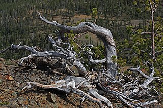
Krummholz — also called knieholz — is a type of stunted, deformed vegetation encountered in the subarctic and subalpine tree line landscapes, shaped by continual exposure to fierce, freezing winds. Under these conditions, trees can only survive where they are sheltered by rock formations or snow cover. As the lower portion of these trees continues to grow, the coverage becomes extremely dense near the ground. In Newfoundland and Labrador, the formation is known as tuckamore. Krummholz trees are also found on beaches such as the Oregon coast, where trees can become much taller than their subalpine cousins.

<span class="mw-page-title-main">Rocky Mountain ponderosa pine forest</span>

The Rocky Mountain ponderosa pine forest is a forest plant community at an elevation of 2,000–2,700 metres (6,600–8,900 ft) in the U.S. state of Colorado, depending on soil moisture. It is an important temperate coniferous forest ecoregion, including some endemic wildlife and grass species that are only found in this ponderosa pine habitat.

<span class="mw-page-title-main">Klamath Mountains (ecoregion)</span> Temperate coniferous forests ecoregion in northern California and southwestern Oregon

The Klamath Mountains ecoregion of Oregon and California lies inland and north of the Coast Range ecoregion, extending from the Umpqua River in the north to the Sacramento Valley in the south. It encompasses the highly dissected ridges, foothills, and valleys of the Klamath and Siskiyou Mountains. It corresponds to the Level III ecoregion designated by the Environmental Protection Agency and to the Klamath-Siskiyou forests ecoregion designated by the World Wide Fund for Nature.

<i>Protoboarmia porcelaria</i> Species of moth

Protoboarmia porcelaria, the porcelain gray or dash-lined looper, is a Geometrid species of moth found throughout North America, except in the far north. The species was first described by Achille Guenée in 1857.

<span class="mw-page-title-main">Cascade Mountains leeward forests</span> Temperate coniferous forest ecoregion in British Columbia, Canada and Washington, United States

The Cascade Mountains leeward forests are a temperate coniferous forest ecoregion of North America, as defined by the World Wildlife Fund (WWF) categorization system.

<span class="mw-page-title-main">Eastern forest–boreal transition</span> Temperate broadleaf and mixed forest ecoregion in Canada and the United States

The eastern forest–boreal transition is a temperate broadleaf and mixed forests ecoregion of North America, mostly in eastern Canada. It is a transitional zone or region between the predominantly coniferous Boreal Forest and the mostly deciduous broadleaf forest region further south.

<span class="mw-page-title-main">Eastern Great Lakes lowland forests</span> Temperate broadleaf and mixed forest ecoregion of Canada and the United States

The Eastern Great Lakes lowland forests is a temperate broadleaf and mixed forest ecoregion of North America, as defined by the World Wildlife Fund. It lies mostly in south and eastern Ontario and Quebec in Canada, and Upstate New York and Vermont in the United States.

<span class="mw-page-title-main">Gulf of St. Lawrence lowland forests</span> Temperate broadleaf and mixed forest ecoregion of Canada and the United States

The Gulf of St. Lawrence lowland forests are a temperate broadleaf and mixed forest ecoregion of Eastern Canada, as defined by the World Wildlife Fund (WWF) categorization system.

<span class="mw-page-title-main">Alberta Mountain forests</span> Temperate coniferous forests ecoregion of Alberta and British Columbia, Canada

The Alberta Mountain forests are a temperate coniferous forests ecoregion of Western Canada, as defined by the World Wildlife Fund (WWF) categorization system.

<span class="mw-page-title-main">Alberta–British Columbia foothills forests</span> Temperate coniferous forests ecoregion of Alberta and British Columbia, Canada

The Alberta–British Columbia foothills forests are a temperate coniferous forests ecoregion of Western Canada, as defined by the World Wildlife Fund (WWF) categorization system. This ecoregion borders Canada's taiga and contains a mix of subarctic forest and temperate forest species as a result. This makes the region an ecotone region, or a region that acts as a buffer between two other biomes.

<span class="mw-page-title-main">Yukon Interior dry forests</span> Taiga ecoregion of British Columbia and Yukon, Canada

The Yukon Interior dry forests is a taiga ecoregion of Canada.

<span class="mw-page-title-main">Muskwa–Slave Lake forests</span> Taiga ecoregion of northwestern Canada

The Muskwa-Slave Lake forests ecoregion covers Canadian taiga in northwestern Alberta, northeastern British Columbia and a large portion of the southwestern Northwest Territories around the Mackenzie River valley and the Great Slave Lake.

<span class="mw-page-title-main">South Central Rockies forests</span> Temperate coniferous forests ecoregion of the United States

The South Central Rockies forests is a temperate coniferous forest ecoregion of the United States located mainly in Wyoming, Idaho, and Montana. It has a considerably drier climate than the North Central Rockies forest.

<span class="mw-page-title-main">Colorado Rockies forests</span> Temperate coniferous forests ecoregion of the United States

The Colorado Rockies forests is a temperate coniferous forest ecoregion of the United States.

<span class="mw-page-title-main">Wasatch and Uinta montane forests</span> Temperate coniferous forests ecoregion of the United States

The Wasatch and Uinta montane forest is a temperate coniferous forest ecoregion in the Wasatch Range and Uinta Mountains of the western Rocky Mountains system, in the Western United States.

<span class="mw-page-title-main">North American inland temperate rainforest</span>

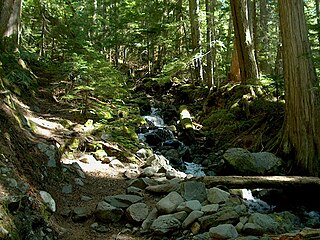
The North American inland temperate rainforest is a 7 million hectare disjunct temperate rainforest spreading over parts of British Columbia in Canada as well as Washington, Idaho and Montana on the US side. Its patches are located on the windward slopes of the Rocky Mountains and the Columbia Mountains, extending roughly over 1000km from 54° North to 45° North. It is one of the largest inland temperate rainforests in the world.

<span class="mw-page-title-main">Ogilvie–MacKenzie alpine tundra</span> Tundra ecoregion of Canada and the United States

The Ogilvie–MacKenzie alpine tundra ecoregion covers the mountainous middle of the Yukon Territory in Canada, with extensions into the Northwest Territories. The vegetation is alpine and subalpine open forest of stunted spruce, fir and pine. The area is rugged but sections appear to have been unglaciated in the late Pleistocene and there are therefore relic species in the region. The area is remote and supports large, sustainable predator-prey systems.

References

  1. 1 2 3 4 "Atlas of Global Conservation". The Nature Conservancy. Archived from the original on 2012-03-05. Retrieved 2017-05-08.
  2. 1 2 3 "North Central Rockies forests". Terrestrial Ecoregions. World Wildlife Fund.
  3. "Inland Temperate Rainforest – Friends of the Clearwater".
  4. "The Interior Cedar-Hemlock Forest of North America".
  5. Ricketts, Taylor H; et al. (1999). Terrestrial ecoregions of North America : a conservation assessment. Washington, DC: Island Press. pp. 8–9. ISBN   9781559637220.

Coordinates: 49°N115°W / 49°N 115°W / 49; -115