North Vernon, Indiana | |
---|---|
Coordinates: 39°0′18″N85°37′40″W / 39.00500°N 85.62778°W | |
Country | United States |
State | Indiana |
County | Jennings |
Townships | Center, Vernon |
Government | |
• Mayor | Shawn Gerkin (Democratic Party) |
Area | |
• Total | 7.68 sq mi (19.90 km2) |
• Land | 7.67 sq mi (19.88 km2) |
• Water | 0.01 sq mi (0.03 km2) 0.15% |
Elevation | 719 ft (219 m) |
Population (2020) | |
• Total | 6,608 |
• Density | 861.09/sq mi (332.46/km2) |
Time zone | UTC-5 (EST) |
• Summer (DST) | UTC-4 (EDT) |
ZIP code | 47265 |
Area code | 812 |
FIPS code | 18-55116 [2] |
GNIS feature ID | 0440310 [3] |
Website | northvernon-in |
North Vernon is a city in Jennings County, Indiana, United States. The population was 6,608 as of the 2020 census.
North Vernon was originally called Tripton, sometimes referred to as “The Gem of the Midwest” and under the latter name was platted in 1854. [4]
Annadale, North Vernon Downtown Historic District, State Street Historic District, and Walnut Street Historic District are listed on the National Register of Historic Places. [5]
According to the 2010 census, North Vernon has a total area of 6.63 square miles (17.17 km2), of which 6.62 square miles (17.15 km2) (or 99.85%) is land and 0.01 square miles (0.03 km2) (or 0.15%) is water. [6]
The climate in this area is characterized by hot, humid summers and typically cold mid-west winters.
Census | Pop. | Note | %± |
---|---|---|---|
1860 | 778 | — | |
1870 | 1,758 | 126.0% | |
1880 | 1,842 | 4.8% | |
1890 | 2,012 | 9.2% | |
1900 | 2,823 | 40.3% | |
1910 | 2,915 | 3.3% | |
1920 | 3,084 | 5.8% | |
1930 | 2,989 | −3.1% | |
1940 | 3,112 | 4.1% | |
1950 | 3,488 | 12.1% | |
1960 | 4,307 | 23.5% | |
1970 | 4,582 | 6.4% | |
1980 | 5,768 | 25.9% | |
1990 | 5,311 | −7.9% | |
2000 | 6,515 | 22.7% | |
2010 | 6,728 | 3.3% | |
2020 | 6,608 | −1.8% | |
U.S. Decennial Census [7] |
As of the census [8] of 2010, there were 6,728 people, 2,656 households, and 1,667 families living in the city. The population density was 1,016.3 inhabitants per square mile (392.4/km2). There were 2,948 housing units at an average density of 445.3 per square mile (171.9/km2). The racial makeup of the city was 95.0% White, 1.5% African American, 0.2% Native American, 0.4% Asian, 1.2% from other races, and 1.7% from two or more races. Hispanic or Latino of any race were 2.4% of the population.
There were 2,656 households, of which 35.8% had children under the age of 18 living with them, 39.9% were married couples living together, 17.0% had a female householder with no husband present, 5.9% had a male householder with no wife present, and 37.2% were non-families. 31.1% of all households were made up of individuals, and 12.4% had someone living alone who was 65 years of age or older. The average household size was 2.43 and the average family size was 3.01.
The median age in the city was 35.6 years. 26.5% of residents were under the age of 18; 9.7% were between the ages of 18 and 24; 26.3% were from 25 to 44; 23.4% were from 45 to 64; and 14.1% were 65 years of age or older. The gender makeup of the city was 47.8% male and 52.2% female.
As of the census [2] of 2000, there were 6,515 people, 2,665 households, and 1,684 families living in the city. The population density was 1,484.4 inhabitants per square mile (573.1/km2). There were 2,892 housing units at an average density of 658.9 per square mile (254.4/km2). The racial makeup of the city was 96.47% White, 1.49% African American, 0.20% Native American, 0.40% Asian, 0.28% from other races, and 1.17% from two or more races. Hispanic or Latino of any race were 1.04% of the population.
There were 2,665 households, out of which 33.1% had children under the age of 18 living with them, 44.9% were married couples living together, 13.6% had a female householder with no husband present, and 36.8% were non-families. 32.0% of all households were made up of individuals, and 13.8% had someone living alone who was 65 years of age or older. The average household size was 2.39 and the average family size was 3.01.
In the city, the population was spread out, with 27.5% under the age of 18, 10.1% from 18 to 24, 28.1% from 25 to 44, 19.3% from 45 to 64, and 15.0% who were 65 years of age or older. The median age was 34 years. For every 100 females, there were 84.9 males. For every 100 females age 18 and over, there were 82.4 males.
The median income for a household in the city was $34,244, and the median income for a family was $41,020. Males had a median income of $31,173 versus $21,137 for females. The per capita income for the city was $16,836. About 7.6% of families and 11.8% of the population were below the poverty line, including 15.5% of those under age 18 and 14.8% of those age 65 or over.
The town has a lending library, the Jennings County Public Library. [9]
Sumiton is a city in Jefferson and Walker counties in the State of Alabama. It incorporated in 1952. At the 2010 census the population was 2,520, down from 2,665 in 2000.
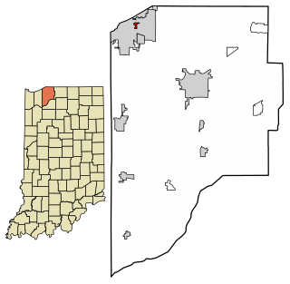
Alton is a town in Boone Township, Crawford County, Indiana, United States. The population was 29 at the 2020 census.
Milltown is a town in Blue River and Spencer townships in Harrison County and Whiskey Run Township in Crawford County, Indiana. The population was 818 at the time of the 2010 census.
Greendale is a city in Dearborn County, Indiana, United States. The population was 4,520 at the 2010 census.
Hidden Valley is a private residential community in Dearborn County, Indiana, United States. For statistical purposes it is a census-designated place (CDP), with a population of 5,387 at the 2010 census, up from 4,417 at the 2000 census.
Owensville is the third largest town and the smallest of the five larger communities in Gibson County, Indiana, United States. The population was 1,338 in 2020.
Fortville is a town in Vernon Township, Hancock County, Indiana, United States. The population was 4,784 at the 2020 census.
McCordsville is a town in Vernon Township, Hancock County, Indiana, United States. The town is a fast-growing suburb of Indianapolis with an estimated population of 8,592 in 2020.
Redkey is a town in Richland Township, Jay County, Indiana, United States. The population was 1,353 at the 2010 census.
Dupont is a town in Lancaster Township, Jefferson County, Indiana, United States. The population was 339 at the 2010 census.
Vernon is a town within Vernon Township and the county seat of Jennings County, Indiana, United States. With a population of 318 in the 2010 census, it is the smallest town with that designation in the state of Indiana, lying just south of the much larger North Vernon. It is also the smallest county seat in Indiana. It is nearly surrounded by the Muscatatuck River. Vernon is the only Indiana town with an elected mayor and an elected town marshal. As of 2023, Marshall Zamora is the mayor and Britt Burgmeier is the marshal.
Pottawattamie Park is a town in Michigan Township, LaPorte County, Indiana, United States. The population was 235 at the 2010 census. It is included in the Michigan City, Indiana-La Porte, Indiana Metropolitan Statistical Area.
Parker City is a town in Monroe Township, Randolph County, in the U.S. state of Indiana. The population was 1,419 at the 2010 census.
Jennings is a city in Decatur County, Kansas, United States. As of the 2020 census, the population of the city was 81.
Mount Vernon is a town in Kennebec County, Maine, United States. The population was 1,721 at the 2020 census. Mount Vernon is included in the Augusta, Maine micropolitan New England City and Town Area. A popular recreation spot in central Maine, the northern area of Mount Vernon is part of the Belgrade Lakes Region, while the southern area is part of the Winthrop Lakes Region.
Jennings is a city in St. Louis County, Missouri, United States. Per the 2020 census, the population was 12,895.
Walker is a city in Vernon County, Missouri, United States. The population was 199 at the 2020 census.
Mount Vernon is a city in and the county seat of Lawrence County, Missouri, United States. The population was 4,575 as of the 2010 census. It was estimated to be 4,960 by the City of Mount Vernon on July 1, 2020.
Uplands Park is a village in St. Louis County, Missouri, United States. The population was 445 at the 2010 census. The village is one of many small majority black communities located in the Natural Bridge corridor of mid-St. Louis County, characterized by small homes on small lots.
Mount Vernon is a city in Grant County, Oregon, United States. Its post office was established in 1877 and named after a black stallion that belonged to settler David W. Jenkins. The stallion's stable, a small stone building, is still standing in a field on the north side of U.S. Highway 26 about 2.2 miles (3.5 km) east of the main intersection in town. In 1915 the ranching community had a population of 60 and a hotel at a hot springs resort approximately 2 miles (3.2 km) north. The population had grown to 451 by the 1950 census. There are a few motels and restaurants in Mount Vernon. The population was 527 at the 2010 census.